


Pinehurst, Massachusetts
Pinehurst is a community of 6,845 people in Middlesex County, Massachusetts.
Why visit Pinehurst
Townapedia lists 26 museums and landmarks, 25 parks and trails, 13 places to eat, 2 places to stay and 2 attractions in and around town.
Highlights include Crosbys Hill, Wood Hill, Abraham Jaquith House and Bacon-Gleason-Blodgett Homestead.
July is the warmest month, with average highs of 84°F; January lows average 18°F, and about 59 inches of snow fall in a normal year.
Weather in Pinehurst
Forecast from the National Weather Service. Full forecast
About Pinehurst
Pinehurst is an unincorporated village and census-designated place (CDP) in the town of Billerica, Middlesex County, Massachusetts, United States. The population was 7,368 at the 2020 census. It is in the southeastern part of town along Massachusetts Route 3A.
From the Wikipedia article Pinehurst, Massachusetts (this version), under CC BY-SA 4.0.
Things to do2

Museums and landmarks26

Abraham Jaquith House
Monument and historic site · National Register of Historic Places · 2.6 mi
Building in Massachusetts, United States

Bacon-Gleason-Blodgett Homestead
Monument and historic site · National Register of Historic Places · 2.4 mi
Building in Massachusetts, United States

Bedford Center Historic District
Monument and historic site · National Register of Historic Places · 3.7 mi
Historic district in Bedford, MA

Bedford Veterans Affairs Medical Center
Monument and historic site · National Register of Historic Places · 2.7 mi
Hospital in Massachusetts, United States
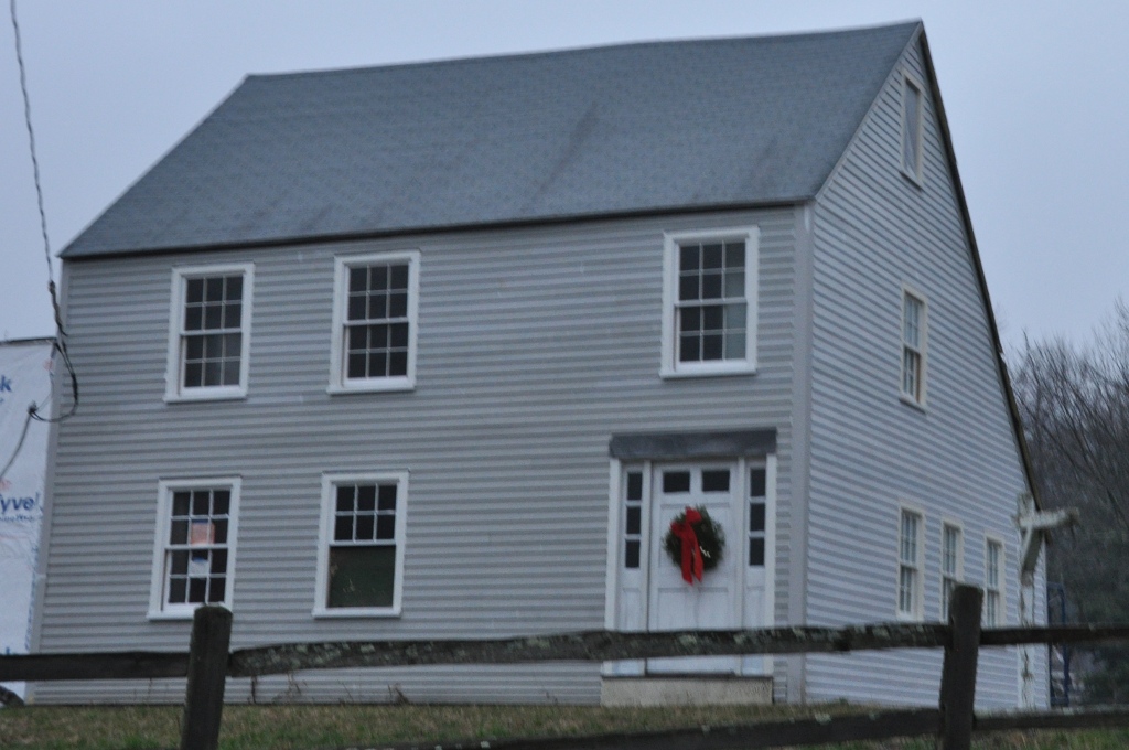
Butters-Avery House
Monument and historic site · National Register of Historic Places · 2.9 mi
Historic house in Massachusetts, United States

Center School
Monument and historic site · National Register of Historic Places · 2.8 mi
Historic school building in Burlington, Massachusetts

Christopher Page House
Monument and historic site · National Register of Historic Places · 2.9 mi
Building in Massachusetts, United States

Church Street Historic District
Monument and historic site · National Register of Historic Places · 3.6 mi
Historic district in Massachusetts, United States

David Lane House
Monument and historic site · National Register of Historic Places · 3.4 mi
Building in Massachusetts, United States

Deacon Samuel Hill House
Monument and historic site · National Register of Historic Places · 3.6 mi
Building in Massachusetts, United States

Dutton-Holden Homestead
Monument and historic site · National Register of Historic Places · 2.7 mi
Building in Massachusetts, United States

Farley-Hutchinson-Kimball House
Monument and historic site · National Register of Historic Places · 2.7 mi
Bedford, Massachusetts, listed on the NRHP in Middlesex County
14 more on the map.
Parks, trails and playgrounds25





13 more on the map.
Restaurants and cafes13

Mexica Burrito Grill
Restaurant · Mexican · 0.8 mi
647 Boston Road, Billerica
Mo-Sa 11:00-22:00; Su 11:00-21:00

The Bagel Bar
Restaurant · Donut
834 Boston Road
Tu-Fr 06:00-18:00; Sa-Su 08:00-15:00

Ninety Nine Restaurant & Pub
Diner · American · 1.2 mi
160 Lexington Road, Billerica

McDonald's
Fast food · Burger · 0.6 mi
718 Boston Road, Billerica
Mo-Th 05:00-23:00; Fr-Sa 05:00-24:00; Su 05:00-23:00
1 more on the map.
Where to stay2
Churches and places of worship5
Meeting House of the Second Parish in Woburn
Church · National Register of Historic Places · 2.7 mi
Shopping3
Gas and EV charging2
Schools, colleges and libraries46
Healthcare1
Map of Pinehurst
125 places. The map loads OpenStreetMap tiles when you open it.
Climate by month
Monthly table
| Month | High | Low | Rain | Snow |
|---|---|---|---|---|
| Jan | 36°F | 18°F | 3.8 in | 16.1 in |
| Feb | 39°F | 19°F | 3.4 in | 12.5 in |
| Mar | 47°F | 27°F | 4.8 in | 12.9 in |
| Apr | 59°F | 36°F | 3.9 in | 2.3 in |
| May | 70°F | 46°F | 3.8 in | 0.0 in |
| Jun | 78°F | 55°F | 4.1 in | 0.0 in |
| Jul | 84°F | 61°F | 3.8 in | 0.0 in |
| Aug | 82°F | 60°F | 3.9 in | 0.0 in |
| Sep | 74°F | 52°F | 3.7 in | 0.0 in |
| Oct | 62°F | 40°F | 4.8 in | 0.1 in |
| Nov | 51°F | 31°F | 4.1 in | 1.9 in |
| Dec | 41°F | 23°F | 4.8 in | 13.2 in |
U.S. Climate Normals 1991-2020 for Bedford Hcn (4 mi away), NOAA NCEI.
People and cost of living
American Community Survey 5-year estimates, 2020-2024, U.S. Census Bureau. Estimates have margins of error, larger for small towns.
Disaster history
Middlesex County has had 26 federal disaster declarations since 2000, most often for severe storms.
- 2023-09-15: Hurricane Lee (Hurricane)
- 2020-03-27: Covid-19 Pandemic (Biological)
- 2020-03-13: Covid-19 (Biological)
- 2018-07-19: Severe Winter Storm And Snowstorm (Snowstorm)
- 2015-04-13: Severe Winter Storm, Snowstorm, And Flooding (Severe Storm)
- 2013-04-19: Severe Winter Storm, Snowstorm, And Flooding (Severe Storm)
OpenFEMA disaster declarations summaries.
Getting there and nearby towns
Laurence G. Hanscom Field (BED) is the nearest airport with scheduled flights listed in OpenStreetMap, 6 miles away.
- Burlington 3 mi southeast, about 4 min by car
- Wilmington 4 mi northeast, about 7 min by car
- Woburn 5 mi southeast, about 8 min by car
- Lexington 6 mi south, about 10 min by car
- Hanscom AFB 6 mi southwest, about 9 min by car
- Reading 7 mi east, about 10 min by car
- Winchester 7 mi southeast, about 12 min by car
- Stoneham 8 mi southeast, about 13 min by car
- Lowell 9 mi northwest, about 14 min by car
- Arlington 9 mi southeast, about 14 min by car
Drive times are estimates from straight-line distance, not routes.
Local news
Headlines from INDB, the NEMICO news database.
Reviews, tips and questions
Loading what members have shared...
Sources and licences
- NCES EDGE (Public domain): public schools
- NOAA NCEI U.S. Climate Normals 1991-2020 (Public domain): climate by month
- OpenFEMA (Public domain): disaster declarations
- OpenStreetMap contributors (ODbL 1.0): places, airports, map data
- U.S. Census Bureau (Public domain): population, income, housing, education, commute
- Wikidata (CC0 1.0): elevation, founding date, time zone, website, landmarks and historic places
- Wikimedia Commons (see each image): photos
- Wikipedia (CC BY-SA 4.0): overview and history text
Photo credits
- Church of Saint Mary, Pinehurst MA, John Phelan, CC BY 3.0
- Cyril D Locke Middle School, Pinehurst MA, John Phelan, CC BY-SA 4.0
- Job Lane House August 2003, Anon user ( talk ), CC BY-SA 3.0
- Woburn Second Parish Meeting House, Burlington MA, John Phelan, CC BY 3.0
- Bacon-Gleason-Blodgett Homestead, Bedford MA, John Phelan, CC BY 3.0
- Congregational Church, Wilmington MA, John Phelan, CC BY 3.0
- David Lane House, Bedford MA, John Phelan, CC BY 3.0
- Unitarian Meeting House (exterior) Bedford, Massachusetts, Daderot at en.wikipedia, CC BY-SA 3.0
- Dutton-Holden Homestead, Billerica MA, John Phelan, CC BY 3.0
- WilmingtonMA WestSchoolhouse, User:Magicpiano, CC BY-SA 4.0
- Capt Jonathan Wilson House, Bedford MA, John Phelan, CC BY 4.0
- West School, Burlington MA, John Phelan, CC BY 3.0
- WilmingtonMA ButtersAveryHouse, User:Magicpiano, CC BY-SA 4.0
- Shawsheen Cemetery, October 2013, Bedford MA, John Phelan, CC BY-SA 3.0
- Edgar and Emily Folkins House, Wilmington MA, John Phelan, CC BY 3.0
- Building 2, VA Medical Center, Bedford MA, John Phelan, CC BY-SA 3.0
- BillericaMA DudleyRoadHD, User:Magicpiano, CC BY-SA 4.0
- Old Burlington Road Bridge over Vine Brook, Bedford MA, John Phelan, CC BY-SA 4.0
- Nathaniel Page House, Bedford MA, John Phelan, CC BY 3.0
- Center School, Burlington MA, John Phelan, CC BY 3.0
- Sabbath Day House, May 2012, Billerica MA, John Phelan, CC BY-SA 3.0
- BedfordMA FarleyHutchinsonKimballHouse, User:Magicpiano, CC BY-SA 4.0
- Christopher Page House, Bedford MA, John Phelan, CC BY 3.0
- Howe School, Billerica MA, John Phelan, CC BY 3.0
- BillericaMA DeaconSamuelHillHouse, User:Magicpiano, CC BY-SA 4.0
- Francis Wyman House, Burlington MA, John Phelan, CC BY 3.0
- Chargepoint DC fast charging station in Billerica, MA June 2026 2, 4300streetcar, CC BY 4.0
- Chargepoint DC fast charging station in Billerica, MA June 2026 1, 4300streetcar, CC BY 4.0
- MBTA route 351 bus at RSA offices, May 2020, Beantowndude316 from USA, CC BY 2.0
- MBTA route 351 bus on Oak Park Drive, May 2020, Beantowndude316 from USA, CC BY 2.0
- MBTA route 351 bus and EMD Serono construction, May 2020, Beantowndude316 from USA, CC BY 2.0
- Post Office, Nutting Lake MA, John Phelan, CC BY 4.0
- Little Free Library, Wilmington Rd, Burlington MA, John Phelan, CC BY-SA 4.0
- Humbolt Norway Maple 2023, Davidjanoschek, CC BY-SA 4.0
- Open Face Cut Red maple, Davidjanoschek, CC BY-SA 4.0
- Little Free Library, Burlington MA, John Phelan, CC BY-SA 4.0


Page built October 30, 2026. Spotted a mistake? Tell us or suggest a place.