
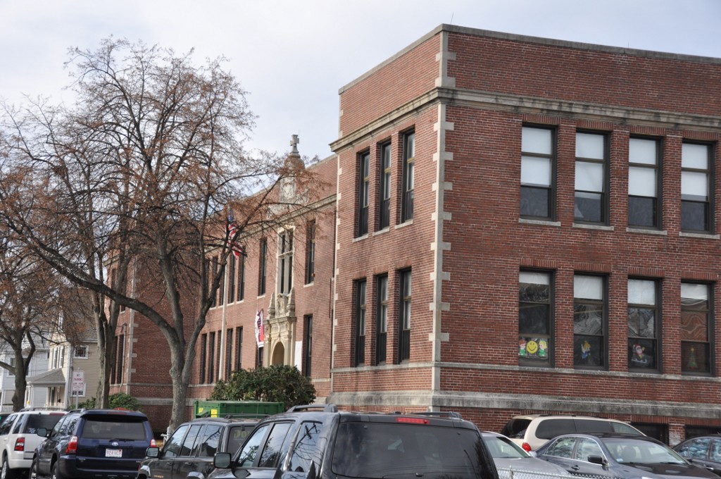


Reading, Massachusetts
Reading is a community of 25,612 people in Middlesex County, Massachusetts.
Why visit Reading
Townapedia lists 94 museums and landmarks, 82 parks and trails, 124 places to eat, 8 places to stay and 7 attractions in and around town.
Highlights include IMAX, Bear Hill, Lakeside Cemetery Chapel and Temple Israel Cemetery.
July is the warmest month, with average highs of 84°F; January lows average 18°F, and about 64 inches of snow fall in a normal year.
Weather in Reading
Forecast from the National Weather Service. Full forecast
Things to do7



Museums and landmarks94
Lakeside Cemetery Chapel
Monument and historic site · National Register of Historic Places · 2.1 mi
Historic chapel in Wakefield, Massachusetts
541 North Avenue
Temple Israel Cemetery
Monument and historic site · National Register of Historic Places · 2.2 mi
Cemetery in Wakefield, Massachusetts
Yale Avenue Historic District
Monument and historic site · National Register of Historic Places · 2.7 mi
Historic district in Massachusetts, United States

1790 House
Monument and historic site · National Register of Historic Places · 3.5 mi
Building in Massachusetts, United States
Almshouse
Monument and historic site · National Register of Historic Places · 3.1 mi
Poorhouse in Stoneham, Massachusetts
Baldwin House
Monument and historic site · National Register of Historic Places · 3.5 mi
Listed on the NRHP in Middlesex County

Beacon Street Tomb
Monument and historic site · National Register of Historic Places · 2.2 mi
Receiving vault in Wakefield, Massachusetts, United States
Benjamin Thompson House-Count Rumford Birthplace
Monument and historic site · National Register of Historic Places · 4.4 mi
Historic house in Massachusetts, United States


Boutell-Hathorn House
Monument and historic site · National Register of Historic Places · 2.9 mi
Building in Massachusetts, United States
Buck's Corner Historic District
Monument and historic site · National Register of Historic Places · 2.5 mi
Historic district in Massachusetts, United States
Building at 38–48 Richardson Avenue
Monument and historic site · National Register of Historic Places · 2.8 mi
Row houses in Wakefield, Massachusetts, United States
Buildings at 35–37 Richardson Avenue
Monument and historic site · National Register of Historic Places · 2.8 mi
Rowhouses in Wakefield, Massachusetts, United States
82 more on the map.
Parks, trails and playgrounds82





70 more on the map.
Restaurants and cafes124

110 Grill
Diner · American · 2.6 mi
373 Washington Street, Woburn
Mo-Th,Su 11:30-21:00; Fr-Sa 11:30-22:00

AJ's Kitchen
Restaurant · Pizza · 2.5 mi
162 Lowell Street, Wilmington
Mo 10:30-20:00; Tu-Sa 10:30-21:00
Bagel World
Restaurant · Breakfast, Sandwich · 1.2 mi
323 Main Street, Reading
Mo-Fr 06:00-15:30; Sa 06:00-15:00; Su 06:00-14:00
Bellino's Trattoria
Restaurant · Italian · 1.6 mi
146 Lowell Street, Wakefield
Tu-Th, Su 04:00-21:00; Fr-Sa 04:00-22:00
Cal's Brick Oven Pizza Company
Restaurant · Pizza · 1.9 mi
122 Main Street, Reading
Tu-Th,Su 11:00-20:00; Fr-Sa 11:00-21:00
Cal's Creamery
Restaurant · Ice Cream · 1.9 mi
122 Main Street, Reading
Tu-Th 14:00-20:30; Fr-Sa 12:00-21:00; Su 12:00-20:30

Carols Cafe
Cafe · Sandwich, American, Breakfast · 2.7 mi
39 Tuttle Street, Wakefield
Mo-Su 06:00-14:00
Charm Thai Bistro
Restaurant · Thai · 2.9 mi
412 Main Street, Wakefield
Mo 11:30-21:30; We-Th 11:30-21:30; Fr-Sa 11:30-22:15; Su 16:00-21:30
Chili's
Restaurant · Tex-Mex · 1.3 mi
70 Walkers Brook Drive, Reading
Mo-Th 11:00-23:00; Fr-Sa 11:00-24:00; Su 11:00-22:00
112 more on the map.
Where to stay8
Churches and places of worship20
Wakefield-Lynnfield United Methodist Church
Church · Methodist · 2.5 mi
273 Vernon Street, Wakefield
Shopping26
Gas and EV charging22
Schools, colleges and libraries60
Saint Joseph School
School · National Register of Historic Places · 2.7 mi
15 Gould Street, Wakefield
Healthcare7
Map of Reading
250 places. The map loads OpenStreetMap tiles when you open it.
Climate by month
Monthly table
| Month | High | Low | Rain | Snow |
|---|---|---|---|---|
| Jan | 38°F | 18°F | 3.9 in | 17.2 in |
| Feb | 40°F | 20°F | 3.6 in | 16.2 in |
| Mar | 48°F | 27°F | 4.9 in | 13.3 in |
| Apr | 60°F | 36°F | 4.3 in | 2.2 in |
| May | 70°F | 47°F | 3.8 in | 0.0 in |
| Jun | 78°F | 56°F | 4.2 in | 0.0 in |
| Jul | 84°F | 63°F | 4.0 in | 0.0 in |
| Aug | 82°F | 61°F | 3.5 in | 0.0 in |
| Sep | 75°F | 53°F | 3.9 in | 0.0 in |
| Oct | 64°F | 42°F | 4.8 in | 0.1 in |
| Nov | 53°F | 32°F | 4.0 in | 1.7 in |
| Dec | 43°F | 24°F | 5.0 in | 12.8 in |
U.S. Climate Normals 1991-2020 for Reading Hcn (1 mi away), NOAA NCEI.
People and cost of living
American Community Survey 5-year estimates, 2020-2024, U.S. Census Bureau. Estimates have margins of error, larger for small towns.
Disaster history
Middlesex County has had 26 federal disaster declarations since 2000, most often for severe storms.
- 2023-09-15: Hurricane Lee (Hurricane)
- 2020-03-27: Covid-19 Pandemic (Biological)
- 2020-03-13: Covid-19 (Biological)
- 2018-07-19: Severe Winter Storm And Snowstorm (Snowstorm)
- 2015-04-13: Severe Winter Storm, Snowstorm, And Flooding (Severe Storm)
- 2013-04-19: Severe Winter Storm, Snowstorm, And Flooding (Severe Storm)
OpenFEMA disaster declarations summaries.
Getting there and nearby towns
Laurence G. Hanscom Field (BED) is the nearest airport with scheduled flights listed in OpenStreetMap, 11 miles away.
- Lynnfield 3 mi east, about 5 min by car
- Burlington 5 mi southwest, about 9 min by car
- Melrose 6 mi southeast, about 10 min by car
- Peabody 7 mi east, about 11 min by car
- Malden 8 mi south, about 12 min by car
- Medford 8 mi south, about 12 min by car
- Lynn 8 mi southeast, about 14 min by car
- Danvers 8 mi east, about 13 min by car
- Arlington 9 mi south, about 14 min by car
- Lexington 9 mi southwest, about 14 min by car
Drive times are estimates from straight-line distance, not routes.
Local news
Headlines from INDB, the NEMICO news database.
Reviews, tips and questions
Loading what members have shared...
Sources and licences
- NCES EDGE (Public domain): public schools
- NOAA NCEI U.S. Climate Normals 1991-2020 (Public domain): climate by month
- OpenFEMA (Public domain): disaster declarations
- OpenStreetMap contributors (ODbL 1.0): places, airports, map data
- U.S. Census Bureau (Public domain): population, income, housing, education, commute
- Wikidata (CC0 1.0): landmarks and historic places
- Wikimedia Commons (see each image): photos
Photo credits
- WakefieldMA StJosephsSchool, User:Magicpiano, CC BY-SA 4.0
- WakefieldMA TempleIsraelCemetery, User:Magicpiano, CC BY-SA 4.0
- WakefieldMA YaleAvenueHD, User:Magicpiano, CC BY-SA 4.0
- WakefieldMA LakesideCemeteryChapel, User:Magicpiano, CC BY-SA 4.0
- WakefieldMA CaptainGoodwinJamesCustisHouse, User:Magicpiano, CC BY-SA 4.0
- WakefieldMA 39ConverseStreet, User:Magicpiano, CC BY-SA 4.0
- Main Post Office, Wakefield MA, John Phelan, CC BY 3.0
- WilmingtonMA BoutellHathornHouse, User:Magicpiano, CC BY-SA 4.0
- WakefieldMA SamuelGouldHouse, User:Magicpiano, CC BY-SA 4.0
- WakefieldMA 5BennettStreet, User:Magicpiano, CC BY-SA 4.0
- House at 8 Park Street, Wakefield MA, John Phelan, CC BY 3.0
- US Post Office, Woburn MA, John Phelan, CC BY 3.0
- House at 95 Chestnut Street, Wakefield MA, John Phelan, CC BY 3.0
- John Bickford House, North Reading MA, John Phelan, CC BY 3.0
- WakefieldMA BeaconStreetTomb, User:Magicpiano, CC BY-SA 4.0
- WakefieldMA 88ProspectStreet, User:Magicpiano, CC BY-SA 4.0
- House at 25 Avon Street, Wakefield MA, John Phelan, CC BY 3.0
- Nathaniel Cowdry House, Wakefield MA, John Phelan, CC BY 3.0


Page built October 30, 2026. Spotted a mistake? Tell us or suggest a place.