
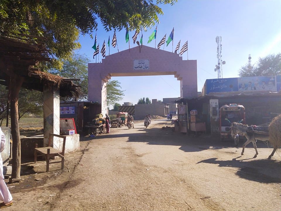

Mian Sahib, Pakistan
میاں صاحب (قصبہ)
Mian Sahib is a town of 25,000 people in Sindh, Pakistan.
Why visit Mian Sahib
Townapedia lists 3 museums and landmarks and 1 place to eat in and around town.
Weather in Mian Sahib
Forecast from MET Norway (CC BY 4.0). Full forecast
About Mian Sahib
Mian Sahib (Sindhi: ميان صاحب), Mian Jo Goth (Sindhi: ميان جو گوٺ) is the town of Shikarpur District in the Sindh Province of Pakistan, is a union council. It is located at 28°9'17"N 68°38'32"E at an altitude of 59 metres (196 feet). Mian Sahib, is a historical village of Shikarpur District, although Mian Sahib is now a relatively small city, it borders with the nearest town Mubarakpur, Jacobabad town of Jacobabad District and it's also the largest town of the tehsil Khanpur, Sindh Of Shikarpur District.
From the Wikipedia article Mian Sahib (this version), under CC BY-SA 4.0.
Museums and landmarks3

Restaurants and cafes1

Mahar Hotel
Restaurant · Chicken, Tea, Stentils, Kebab, Barbecue, Salad, Grill · 0.7 km
Churches and places of worship5

History
The origins of Mian Sahib are obscure, and historical records accurately detailing its founding are divided into several mythologies. According to some accounts, the city was founded by Saint Mian Taj Muhammad Mahar, who while on a preaching and spreading his mentors teaching expedition, was charmed by the surrounding area, and ordered the construction of the settlement and land cultivation of Mian Sahib, alternatively known "Mian Jo Goth", which was named in his honour. The name "Mian jo Goth", a contracted version of the Mian Taj's name, eventually gained favour, though the older name the "Pat" had been used up until at least the 1820s.
From the History section of Mian Sahib on Wikipedia, under CC BY-SA 4.0.
Map of Mian Sahib
9 places. The map loads OpenStreetMap tiles when you open it.
Getting there and nearby towns
Dr. Safdar Sarki Airport (JAG) is the nearest airport with scheduled flights listed in OpenStreetMap, 23 km away.
- Nao Mian Sahib 0 km west, about 1 min by car
- Thul 16 km northeast, about 16 min by car
- Shikarpur 22 km south, about 22 min by car
- Jacobabad 25 km northwest, about 25 min by car
- Rustam 26 km southeast, about 26 min by car
- Garhiyasin 30 km southwest, about 30 min by car
- Lakhi 34 km south, about 34 min by car
- Chak 38 km southeast, about 38 min by car
- Sukkur 54 km southeast, about 54 min by car
- Rohri 57 km southeast, about 57 min by car
Drive times are estimates from straight-line distance, not routes.
Local news
Headlines from INDB.
Reviews, tips and questions
Loading what members have shared...
Sources and licences
- GeoNames (CC BY 4.0): population, coordinates, regions and time zone
- OpenStreetMap contributors (ODbL 1.0): places, airports, map data
- Wikidata (CC0 1.0): elevation, founding date, time zone, website
- Wikimedia Commons (see each image): photos
- Wikipedia (CC BY-SA 4.0): overview and history text
Photo credits
- Entrance Gate Of Mian Sahib, Mubashiir Channa, CC BY-SA 4.0
Page built November 3, 2026. Spotted a mistake? Tell us or suggest a place.