


Pompton Lakes, New Jersey
Pompton Lakes is a borough of 11,047 people in Passaic County, New Jersey, founded in 1682.
Why visit Pompton Lakes
Townapedia lists 51 museums and landmarks, 39 parks and trails, 70 places to eat, 2 places to stay and 4 attractions in and around town.
Highlights include Federal Hill, Packanack Mountain, Ackerman-Boyd House and Butler.
July is the warmest month, with average highs of 84°F; January lows average 20°F.
Weather in Pompton Lakes
Forecast from the National Weather Service. Full forecast
About Pompton Lakes
Pompton Lakes is a borough in Passaic County, in the U.S. state of New Jersey. As of the 2020 United States census, the borough's population was 11,127, an increase of 30 (+0.3%) from the 2010 census count of 11,097, which in turn reflected an increase of 457 (+4.3%) from the 10,640 counted in the 2000 census.
From the Wikipedia article Pompton Lakes, New Jersey (this version), under CC BY-SA 4.0.
Things to do4


StageWorks at Studio 237
Cinema and theater · Catholic
237 Paterson-Hamburg Turnpike, Pompton Lakes
Museums and landmarks51

Ackerman-Boyd House
Monument and historic site · National Register of Historic Places · 2.6 mi
United States historic place

Butler
Monument and historic site · National Register of Historic Places · 2.9 mi
NYS&W station

Demarest House
Monument and historic site · National Register of Historic Places · 2.2 mi
Historic house in Oakland, New Jersey, USA

Demarest-Hopper House
Monument and historic site · National Register of Historic Places · 2.1 mi
Historic house in Bergen County, New Jersey

Jacobus Demarest House
Monument and historic site · National Register of Historic Places · 2.3 mi
Historic house in Oakland, New Jersey

Martin Berry House
Monument and historic site · National Register of Historic Places · 2.3 mi
Historic house in Morris County, New Jersey

Mead-Van Duyne House
Monument and historic site · National Register of Historic Places · 2.8 mi
Historic house in Passaic County, New Jersey

Pompton Plains
Monument and historic site · National Register of Historic Places · 2.2 mi
Railway station in Pequannock Township, the United States of America
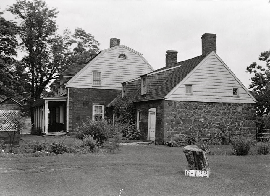
Schuyler-Colfax House
Monument and historic site · National Register of Historic Places · 1.1 mi
Historic house in New Jersey, United States

Storms House
Monument and historic site · National Register of Historic Places · 2.7 mi
Historic house in Franklin Lakes, New Jersey

Van Allen House
Monument and historic site · National Register of Historic Places · 3.2 mi
Historic house in New Jersey, United States


Van Houten-Ackerman House
Monument and historic site · National Register of Historic Places · 2.3 mi
United States historic house in New Jersey
39 more on the map.
Parks, trails and playgrounds39

Pompton Aquatic Park
Park · 1.6 mi
Park in New Jersey, United States of America
Friendship Park
Park · 2.5 mi
Park in New Jersey, United States of America


Pompton Valley Rail Trail - River Drive Trailhead
Hiking and trails · 1.6 mi
River Drive, Pequannock Township
27 more on the map.
Restaurants and cafes70



Axton's by Chef Anton Testino
Restaurant · Italian · 0.5 mi
437 Ringwood Avenue, Pompton Lakes

Black Bull Steakhouse & Seafood
Restaurant · Steak House · 1.3 mi
88 Newark-Pompton Turnpike, Riverdale
58 more on the map.
History
Dutch settlers began to settle in the area that is now Pompton Lakes in the 1680s, purchasing farmland from the local Lenape Native Americans.
The presence of iron ore and the availability of hydropower were initial catalysts for the early development of the Pompton area. An ironworks was constructed in the early 1700s on the Ramapo River at the site of the current Pompton Lake dam, which produced munitions for the French and Indian War, the Revolutionary War, and the War of 1812.
Pompton was situated along the main north–south route during the Revolutionary War, and as such the Continental Army passed through often. Casparus Schuyler, a member of the prominent Schuyler family, owned a tavern in the town that became known as the Yellow Tavern or the Yellow Cottage, and the various army encampments in the area supplied much of the business.
From the History section of Pompton Lakes, New Jersey on Wikipedia, under CC BY-SA 4.0.
Where to stay2
Churches and places of worship9
Kingdom Hall of Jehovah's Witnesses
Church · Jehovahs Witness · 1.3 mi
146 Willow Avenue, Pompton Lakes
Pompton Reformed Church
Church · Reformed · 0.5 mi
59 Paterson-Hamburg Turnpike, Pompton Lakes
St Mary's Roman Catholic Church
Church · Catholic
17 Pompton Avenue, Pompton Lakes
The Journey Within (Spiritualists' National Union Church)
Place of worship · 0.8 mi
Shopping21
Gas and EV charging9
Schools, colleges and libraries49
Franklin Avenue Middle School
School · 4.5 mi
755 Franklin Avenue, Franklin Lakes
Healthcare8
Orthopedic Surgery-Sports Center
Clinic and pharmacy · 1.8 mi
2035 Paterson-Hamburg Turnpike, Wayne
Riverview Pharmacy
Clinic and pharmacy · 1.0 mi
2405 Paterson-Hamburg Turnpike, Wayne
Shoppers Pharmacy
Clinic and pharmacy · 0.7 mi
750 Paterson-Hamburg Turnpike, Pompton Lakes
TruYou Dental Wayne
Clinic and pharmacy · 1.8 mi
2035 Paterson-Hamburg Turnpike, Wayne
ValuRx Pharmacy
Clinic and pharmacy · 1.8 mi
2075 Paterson-Hamburg Turnpike, Wayne
Map of Pompton Lakes
250 places. The map loads OpenStreetMap tiles when you open it.
Climate by month
Monthly table
| Month | High | Low | Rain |
|---|---|---|---|
| Jan | 38°F | 20°F | 3.4 in |
| Feb | 40°F | 20°F | 2.7 in |
| Mar | 48°F | 29°F | 3.9 in |
| Apr | 60°F | 39°F | 4.2 in |
| May | 71°F | 50°F | 3.6 in |
| Jun | 79°F | 58°F | 5.1 in |
| Jul | 84°F | 64°F | 4.7 in |
| Aug | 83°F | 63°F | 4.6 in |
| Sep | 76°F | 56°F | 4.0 in |
| Oct | 64°F | 43°F | 4.4 in |
| Nov | 53°F | 35°F | 3.8 in |
| Dec | 43°F | 27°F | 4.0 in |
U.S. Climate Normals 1991-2020 for Wanaque Raymond Dam (3 mi away), NOAA NCEI.
People and cost of living
American Community Survey 5-year estimates, 2020-2024, U.S. Census Bureau. Estimates have margins of error, larger for small towns.
Disaster history
Passaic County has had 20 federal disaster declarations since 2000, most often for hurricanes.
- 2021-09-05: Remnants Of Hurricane Ida (Hurricane)
- 2021-09-02: Remnants Of Hurricane Ida (Hurricane)
- 2020-03-25: Covid-19 Pandemic (Biological)
- 2020-03-13: Covid-19 (Biological)
- 2018-06-08: Severe Winter Storm And Snowstorm (Severe Storm)
- 2012-10-30: Hurricane Sandy (Hurricane)
OpenFEMA disaster declarations summaries.
Getting there and nearby towns
Essex County Airport (CDW) is the nearest airport with scheduled flights listed in OpenStreetMap, 9 miles away.
- Oakland 3 mi northeast, about 5 min by car
- Franklin Lakes 4 mi east, about 7 min by car
- Kinnelon 5 mi west, about 9 min by car
- Lincoln Park 6 mi south, about 9 min by car
- Paterson 9 mi southeast, about 14 min by car
- Glen Rock 9 mi east, about 14 min by car
- Lake Hiawatha 10 mi southwest, about 16 min by car
- Oak Ridge 12 mi west, about 19 min by car
- Hillsdale 13 mi east, about 20 min by car
- Maywood 14 mi southeast, about 22 min by car
Drive times are estimates from straight-line distance, not routes.
Local news
Headlines from INDB, the NEMICO news database.
Reviews, tips and questions
Loading what members have shared...
Sources and licences
- NCES EDGE (Public domain): public schools
- NOAA NCEI U.S. Climate Normals 1991-2020 (Public domain): climate by month
- OpenFEMA (Public domain): disaster declarations
- OpenStreetMap contributors (ODbL 1.0): places, airports, map data
- U.S. Census Bureau (Public domain): population, income, housing, education, commute
- Wikidata (CC0 1.0): elevation, founding date, time zone, website, landmarks and historic places
- Wikimedia Commons (see each image): photos
- Wikipedia (CC BY-SA 4.0): overview and history text
Photo credits
- Pompton Lake in Pompton Lakes NJ island, Tomwsulcer, CC0
- Pompton Lakes, NJ Municipal Building, Nov. 2025, Mr. Matté (if there is an issue with this image, contact me using this image's Commons talk page , my Commons user talk page , or my English Wikipedia user talk page ; I'll know about it a lot faster), CC BY-SA 4.0
- 2018-07-25 17 06 45 View north along Passaic County Route 511 Alternate (Ringwood Avenue) just north of Passaic County Route 689 (Paterson-Hamburg Turnpike) in Pompton Lakes, Passaic County, New..., Famartin, CC BY-SA 4.0
- 2018-07-25 17 25 15 View south along Passaic County Route 511 Alternate (Paterson-Hamburg Turnpike) between Ringwood Avenue and Spruce Road in Pompton Lakes, Passaic County, New Jersey, Famartin, CC BY-SA 4.0
- 2018-07-25 17 02 01 View north along Passaic County Route 511 Alternate (Paterson-Hamburg Turnpike) between Garden Road and Spruce Road in Pompton Lakes, Passaic County, New Jersey, Famartin, CC BY-SA 4.0
- 2024-10-22 09 38 58 Autumn view north along Interstate 287 between Exit 53 and Exit 54 in Pompton Lakes, Passaic County, New Jersey, Famartin, CC BY-SA 4.0
- 2018-07-25 17 20 41 View south along Passaic County Route 511 Alternate (Ringwood Avenue) at Carr Street in Pompton Lakes, Passaic County, New Jersey, Famartin, CC BY-SA 4.0
- 2018-07-25 14 54 03 View north along Interstate 287 between Exit 53 and Exit 55 in Pompton Lakes, Passaic County, New Jersey, Famartin, CC BY-SA 4.0
- 2018-07-25 15 05 07 View south along Interstate 287 between Exit 55 and Exit 53 in Pompton Lakes, Passaic County, New Jersey, Famartin, CC BY-SA 4.0
- 2020-07-08 14 01 08 View north along Interstate 287 at Exit 55 (Passaic County Route 511, Passaic County Route 511 Alternate, Wanaque, Pompton Lakes) in Wanaque, Passaic County, New Jersey, Famartin, CC BY-SA 4.0
- 2020-07-13 08 04 07 View south along Interstate 287 at Exit 53 (Morris County Route 694, Morris County Route 511 Alternate, Bloomingdale, Pompton Lakes) in Riverdale, Morris County, New Jersey, Famartin, CC BY-SA 4.0
- ACKERMAN-BOYD HOUSE, FRANKLIN LAKES, BERGEN COUNTY, NJ, JERRYE & ROY KLOTZ MD, CC BY-SA 4.0
- MARTIN BERRY HOUSE, POMPTON PLAINS, MORRIS COUNTY, Jerrye & Roy Klotz, MD, CC BY-SA 3.0
- HENDRICK VAN ALLEN HOUSE, OAKLAND, BERGEN COUNTY, NJ, JERRYE & ROY KLOTZ M.D., CC BY-SA 4.0
- VanRiper-Hopper House, Lithium6ion, Public domain
- STORMS HOUSE, FRANKLIN LAKES, BERGEN COUNTY, NJ, JERRYE & ROY KLOTZ MD, CC BY-SA 4.0
- Schuyler-Colfax House, Nathaniel R. Ewan, Public domain
- Pompton Plains Station - September 2014, Adam Moss, CC BY-SA 2.0
- DEMAREST-HOPPER HOUSE, OAKLAND, BERGEN COUNTY, NJ, JERRYE & ROY KLOTZ M.D., CC BY-SA 4.0
- Butler station - August 2011, Adam Moss, CC BY-SA 2.0
- Demarest House, Oakland, Bergen County, NJ, JERRYE & ROY KLOTZ M.D., CC BY-SA 4.0
- JACOBUS S. DEMAREST HOUSE, OAKLAND, BERGEN COUNTY, NJ, JERRYE & ROY KLOTZ M.D., CC BY-SA 4.0
- VAN HOUTON-ACKERMAN HOUSE, FRANKLIN LAKES, BERGEN COUNTY, NJ, JERRYE & ROY KLOTZ MD, CC BY-SA 4.0
- VAN WINKLE-FOX HOUSE, OAKLAND, BERGEN COUNTY, NJ, JERRYE & ROY KLOTZ M.D., CC BY-SA 4.0
- REACTION MOTORS ROCKET TEST FACILITY, FRANKLIN LAKES, BERGEN COUNTY, NY, JERRYE & ROY KLOTZ MD, CC BY-SA 4.0
- 2018-07-28 15 17 32 View south along Morris County Route 511 Alternate (Hamburg Turnpike) just south of Morris Avenue and Post Lane in Riverdale, Morris County, New Jersey, Famartin, CC BY-SA 4.0
- ISS002-E-6278 - View of New York, Earth Science and Remote Sensing Unit , Lyndon B. Johnson Space Center, Public domain
- ISS023-E-18521 - View of Earth, Earth Science and Remote Sensing Unit , Lyndon B. Johnson Space Center, Public domain
- ISS040-E-33240 - View of Earth, Earth Science and Remote Sensing Unit , Lyndon B. Johnson Space Center, Public domain
- ISS040-E-33239 - View of Earth, Earth Science and Remote Sensing Unit , Lyndon B. Johnson Space Center, Public domain
- ISS040-E-33243 - View of Earth, Earth Science and Remote Sensing Unit , Lyndon B. Johnson Space Center, Public domain
- ISS045-E-13941 - View of Earth, Earth Science and Remote Sensing Unit , Lyndon B. Johnson Space Center, Public domain
- ISS040-E-33242 - View of Earth, Earth Science and Remote Sensing Unit , Lyndon B. Johnson Space Center, Public domain
- ISS040-E-33241 - View of Earth, Earth Science and Remote Sensing Unit , Lyndon B. Johnson Space Center, Public domain
- ISS042-E-135444 - View of Earth, Earth Science and Remote Sensing Unit , Lyndon B. Johnson Space Center, Public domain
- ISS029-E-39119 - View of Earth, Earth Science and Remote Sensing Unit , Lyndon B. Johnson Space Center, Public domain
- 2018-07-25 10 32 39 View north along U.S. Route 202 (Terhune Drive) at Circle Avenue in Wayne Township, Passaic County, New Jersey, Famartin, CC BY-SA 4.0
- 2018-07-25 10 41 15 View south along U.S. Route 202 (Terhune Drive) at Passaic County Route 689 (Hamburg Turnpike) in Wayne Township, Passaic County, New Jersey, Famartin, CC BY-SA 4.0
- Dowel bar retrofit on I-287 in New Jersey, Z22, CC BY-SA 3.0
- 2018-07-25 14 51 59 View north along Interstate 287 between Exit 53 and Exit 55 in Bloomingdale, Passaic County, New Jersey, Famartin, CC BY-SA 4.0


Page built October 30, 2026. Spotted a mistake? Tell us or suggest a place.