


Port Chester, New York
Port Chester is a village of 31,102 people in Westchester County, New York, founded in 1660.
Why visit Port Chester
Townapedia lists 36 museums and landmarks, 16 parks and trails, 29 places to eat, 1 place to stay and 8 attractions in and around town.
Highlights include Capitol Theatre, Great Captain Island Light, Bush-Lyon Homestead and Glenville School.
July is the warmest month, with average highs of 83°F; January lows average 22°F.
Weather in Port Chester
Forecast from the National Weather Service. Full forecast
About Port Chester
Port Chester is a village in the U.S. state of New York and the largest part of the town of Rye in Westchester County by population. As of the 2020 census, Port Chester had a population of 31,693. Port Chester is part of the New York City metropolitan statistical area. Located in southeast Westchester County, Port Chester borders Connecticut and the town of Greenwich to the east.
From the Wikipedia article Port Chester, New York (this version), under CC BY-SA 4.0.
Things to do8

Capitol Theatre
Cinema and theater · National Register of Historic Places
Theater and music venue in Port Chester, New York, United States

Great Captain Island Light
Lighthouse · National Register of Historic Places · 2.7 mi
Lighthouse built 1868 in Connecticut, United States
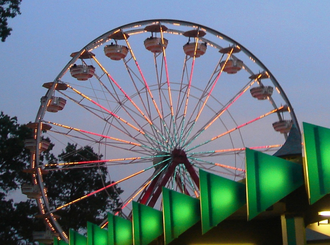
Playland
Monument and historic site · National Register of Historic Places · 2.7 mi
Amusement park in Rye, New York

State University of New York at Purchase
School · 3.5 mi
Public college in Purchase, New York, United States


Museums and landmarks36

Bush-Lyon Homestead
Monument and historic site · National Register of Historic Places · 0.6 mi
Port Chester, New York, NRHP-listed

Glenville School
Monument and historic site · National Register of Historic Places · 2.2 mi
Listed on the National Register of Historic Places
33 Riversville Rd., Greenwich

Bird Homestead
Monument and historic site · National Register of Historic Places · 3.2 mi
Historic house in New York, United States

Byram School
Monument and historic site · National Register of Historic Places · 0.9 mi
Former school building in Greenwich, Connecticut, USA

Fourth Ward Historic District
Monument and historic site · National Register of Historic Places · 2.9 mi
Historic district in Connecticut, United States

French Farm
Monument and historic site · National Register of Historic Places · 3.6 mi
Historic building in the USA

Glenville Historic District
Monument and historic site · National Register of Historic Places · 2.3 mi
Historic district in Connecticut, United States

Greenwich Avenue Historic District
Monument and historic site · National Register of Historic Places · 2.6 mi
Human settlement in Connecticut, United States of America

Greenwich Town Hall
Monument and historic site · National Register of Historic Places · 2.6 mi
Rathaus in Connecticut, United States of America

Greenwich Y.M.C.A.
Monument and historic site · National Register of Historic Places · 2.9 mi
Building in Connecticut, United States

Indian Harbor Yacht Club
Monument and historic site · National Register of Historic Places · 2.4 mi
American yacht club


Life Savers Building
Monument and historic site · National Register of Historic Places · 0.4 mi
Building in New York, United States
24 more on the map.
Parks, trails and playgrounds16

Columbus Park
Park · 0.8 mi
A Big Friendly Family Park
Columbus Park, Port Chester



4 more on the map.
Restaurants and cafes29

Antique Garage - Rye
Restaurant · Mediterranean · 1.6 mi
100 Purchase Street
Mo-Th 12:00-22:00; Fr 12:00-23:00; Sa 11:00-23:00; Su 11:00-22:00

Sunshine Coffee Roasters
Cafe · Coffee Shop · 1.6 mi
12 Purdy Avenue
Mo-Fr 06:00-16:00; Sa-Su 07:00-16:00
Toños Mexican Restaurant
Restaurant · Mexican · 0.4 mi
8 South Main Street, Port Chester
17 more on the map.
History
In 1660, three settlers from Greenwidge (now Greenwich, Connecticut)—Thomas Studwell, John Coe, and Peter Disbrow—arranged to buy Manursing Island and the land near the Byram River from the Native Americans. This First Purchase on Peningo Neck comprised the lower part of the present town of Rye, on the east side of Blind Brook. Over the next decade, additional purchases filled in the shoreline from Rye to Greenwich, made via land agreements with the Native Americans in the area.
These Native Americans' tribal affiliation has been debated. They may have been small, independent families or tribes, or subgroups of larger tribes in the area. What is documented is the names of the natives who signed land agreements. Their names were written by the English, using their semi-skilled interpretation of the phonetics. In spite of the English phonetic variations, the land records still existent were clearly signed by the same people:
Shawanórõckquot, a.k.a. Shanarockwell, aka Shanarocke (and other variations)
Cockinsecawa, a.k.a. Cokinseco, Cockenseco (and other variations)
From the History section of Port Chester, New York on Wikipedia, under CC BY-SA 4.0.
Where to stay1
Churches and places of worship34
Little Bethel African Methodist Episcopal Church
Church · National Register of Historic Places · 2.7 mi
Methodist Episcopal Church
Church · National Register of Historic Places · 2.9 mi
St. Peter's Episcopal Church
Church · National Register of Historic Places
Shopping9
Gas and EV charging2
Schools, colleges and libraries49
Healthcare4
Map of Port Chester
188 places. The map loads OpenStreetMap tiles when you open it.
Climate by month
Monthly table
| Month | High | Low | Rain |
|---|---|---|---|
| Jan | 37°F | 22°F | 3.2 in |
| Feb | 40°F | 24°F | 2.5 in |
| Mar | 48°F | 30°F | 4.1 in |
| Apr | 59°F | 40°F | 4.2 in |
| May | 69°F | 50°F | 3.9 in |
| Jun | 78°F | 59°F | 4.2 in |
| Jul | 83°F | 65°F | 4.1 in |
| Aug | 81°F | 64°F | 4.4 in |
| Sep | 74°F | 57°F | 4.9 in |
| Oct | 63°F | 46°F | 4.3 in |
| Nov | 52°F | 36°F | 3.6 in |
| Dec | 42°F | 28°F | 4.2 in |
U.S. Climate Normals 1991-2020 for Westchester Co Ap (5 mi away), NOAA NCEI.
People and cost of living
American Community Survey 5-year estimates, 2020-2024, U.S. Census Bureau. Estimates have margins of error, larger for small towns.
Disaster history
Westchester County has had 21 federal disaster declarations since 2000, most often for hurricanes.
- 2024-01-30: Severe Storm And Flooding (Flood)
- 2021-09-05: Remnants Of Hurricane Ida (Hurricane)
- 2021-09-02: Remnants Of Hurricane Ida (Hurricane)
- 2021-08-22: Hurricane Henri (Hurricane)
- 2020-10-02: Tropical Storm Isaias (Hurricane)
- 2020-03-20: Covid-19 Pandemic (Biological)
OpenFEMA disaster declarations summaries.
Getting there and nearby towns
Westchester County Airport (HPN) is the nearest airport with scheduled flights listed in OpenStreetMap, 5 miles away.
- Greenwich 3 mi northeast, about 4 min by car
- Harrison 3 mi northwest, about 5 min by car
- Mamaroneck 6 mi southwest, about 9 min by car
- Stamford 8 mi northeast, about 13 min by car
- New Rochelle 8 mi southwest, about 13 min by car
- Eastchester 8 mi southwest, about 13 min by car
- Glen Cove 8 mi south, about 13 min by car
- Mount Vernon 11 mi southwest, about 17 min by car
- Yonkers 11 mi west, about 18 min by car
- Dobbs Ferry 11 mi west, about 17 min by car
Drive times are estimates from straight-line distance, not routes.
Local news
Headlines from INDB, the NEMICO news database.
Reviews, tips and questions
Loading what members have shared...
Sources and licences
- NCES EDGE (Public domain): public schools
- NOAA NCEI U.S. Climate Normals 1991-2020 (Public domain): climate by month
- OpenFEMA (Public domain): disaster declarations
- OpenStreetMap contributors (ODbL 1.0): places, airports, map data
- U.S. Census Bureau (Public domain): population, income, housing, education, commute
- Wikidata (CC0 1.0): elevation, founding date, time zone, website, landmarks and historic places
- Wikimedia Commons (see each image): photos
- Wikipedia (CC BY-SA 4.0): overview and history text
Photo credits
- US Route 1 through Port Chester, Doug Kerr, CC BY-SA 2.0
- NY 120A sb at Pearl Street, Port Chester, May 2025, Mr. Matté (if there is an issue with this image, contact me using this image's Commons talk page , my Commons user talk page , or my English Wikipedia user talk page ; I'll know about it a lot faster), CC BY-SA 4.0
- Summerfield Park, Port Chester, NY, May 2025, Mr. Matté (if there is an issue with this image, contact me using this image's Commons talk page , my Commons user talk page , or my English Wikipedia user talk page ; I'll know about it a lot faster), CC BY-SA 4.0
- NY 120A nb at Pearl Street, Port Chester, June 2025, Mr. Matté (if there is an issue with this image, contact me using this image's Commons talk page , my Commons user talk page , or my English Wikipedia user talk page ; I'll know about it a lot faster), CC BY-SA 4.0
- Port Chester station postcard, Unknown author Unknown author, Public domain
- Capitol Theater, Port Chester, NY, Doctrsquirt, CC BY-SA 4.0
- Port Chester station from passing train (1), July 2019, Pi.1415926535, CC BY-SA 4.0
- Metro-North railroad car passing the Port Chester station on its way to Grand Central, Port Chester, New York (USA) (53619429661), Charles from Port Chester, New York, CC BY 2.0
- Port Chester station 1923 postcard, Unknown author Unknown author, Public domain
- MTA Metro-North Railroad adds elevator to Port Chester station (26039059488), Metropolitan Transportation Authority of the State of New York from United States of America, CC BY 2.0
- MTA Metro-North Railroad adds elevator to Port Chester station (39013175605), Metropolitan Transportation Authority of the State of New York from United States of America, CC BY 2.0
- MTA Metro-North Railroad adds elevator to Port Chester station (39912048871), Metropolitan Transportation Authority of the State of New York from United States of America, CC BY 2.0
- MTA Metro-North Railroad adds elevator to Port Chester station (26039059398), Metropolitan Transportation Authority of the State of New York from United States of America, CC BY 2.0
- Postcard of train at Port Chester station, Unknown author Unknown author, Public domain
- PortChesterNY BushLyonHomestead, User:Magicpiano, CC BY-SA 4.0
- West Greenwich Civic Center, Daniel Case, CC BY-SA 3.0
- Methodist Episcopal Church, Joshua Koerner, CC BY-SA 3.0
- PortChesterNY StPetersChurch, User:Magicpiano, CC BY-SA 4.0
- Bird Homestead Rye NY DSCN2013, Barry Eagel, CC BY-SA 4.0
- Byram School Buildling, Joshua Koerner, CC BY-SA 3.0
- Indian Harbor Yacht Club Today, Southern at en.wikipedia, Public domain
- PortChesterNY LifesaversBuilding, User:Magicpiano, CC BY-SA 4.0
- New Mill and Depot Building, Hawthorne Woolen Mill, Greenwich, CT, Daniel Case, CC BY-SA 3.0
- US Post Office-Rye NY Oct 06, Jimmy Emerson from Dalton GA, CC BY-SA 2.0
- GreenwichYMCA, Jerry Dougherty, CC BY 2.5
- GreenwichCT LittleBethelAMEChurch, Magicpiano, CC BY-SA 3.0
- PostcardGreenwichCTGreenwichAve1910, Unknown author Unknown author, Public domain
- Playland Gondola Wheel, ChangChienFu at English Wikipedia, Public domain
- Putnam and Mellor Engine and Hose Company Firehouse, day., Joshua Koerner, CC BY-SA 3.0
- Widow Haviland's Tavern Jul 10, Doug Kerr from Upstate New York, CC BY-SA 2.0
- GreenwichCT FrenchFarm, Magicpiano, CC BY-SA 3.0
- William E Ward House, Rye Brook, NY-Greenwich, CT, Daniel Case, CC BY-SA 3.0
- Second Congregational Church, Greenwich, Connecticut, Doug Kerr from Albany, NY, United States, CC BY-SA 2.0
- PortChesterNY PostOffice, User:Magicpiano, CC BY-SA 4.0
- GreenwichCT FourthWardHD 4, Magicpiano, CC BY-SA 3.0
- Knapp House Rye NY DSCN2033, Barry Eagel, CC BY-SA 4.0
- U.S. Post Office Harrison NY Jul 10, Doug Kerr from Upstate New York, CC BY-SA 2.0
- RyeNY AfricanCemetery BellFamilyPlot, Magicpiano, CC BY-SA 4.0
- GREENWICHFORMERTOWNHALL, Jerry Dougherty, CC BY 2.5
- PutnamCottageKnappsTavernGreenwichCT08312008, Noroton, Public domain


Page built October 30, 2026. Spotted a mistake? Tell us or suggest a place.