
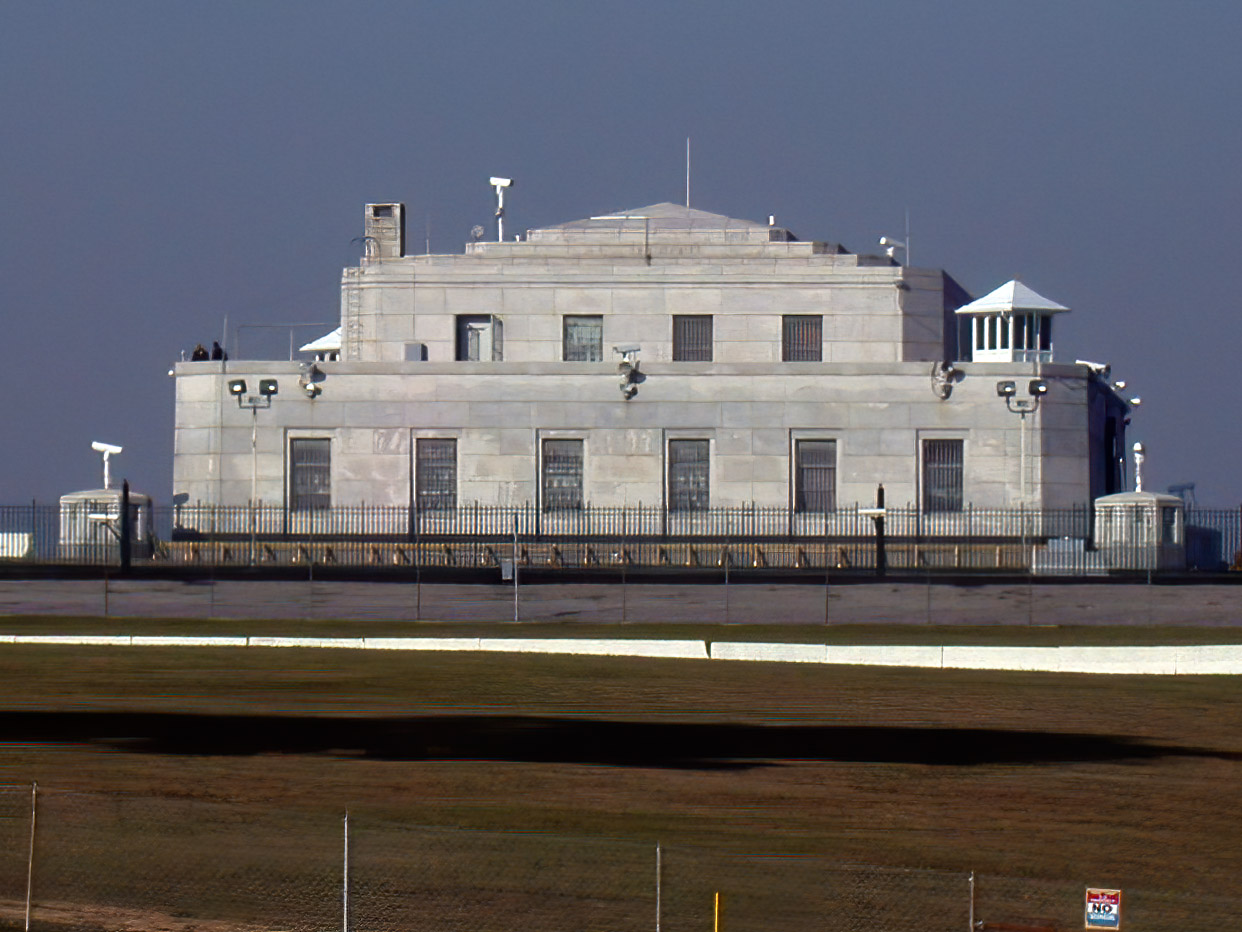

Radcliff, Kentucky
Radcliff is a city of 22,864 people in Hardin County, Kentucky, founded in 1919.
Why visit Radcliff
Townapedia lists 1 museum or landmark, 2 parks and trails, 61 places to eat and 8 places to stay in and around town.
Highlights include United States Bullion Depository and Duvall Park.
July is the warmest month, with average highs of 86°F; January lows average 24°F.
Weather in Radcliff
Forecast from the National Weather Service. Full forecast
About Radcliff
Radcliff is a city in Hardin County, Kentucky, in the United States. The population was around 23,042 as of the 2020 Census, up from 21,692 from the 2010 census.
From the Wikipedia article Radcliff, Kentucky (this version), under CC BY-SA 4.0.
Museums and landmarks1
United States Bullion Depository
Monument and historic site · National Register of Historic Places · 4.6 mi
Building used for gold storage
Parks, trails and playgrounds2

Restaurants and cafes61

Apostoli Coffee
Cafe · Coffee Shop · 0.8 mi
158 West Vine Street, Radcliff
Mo-Fr 06:00-18:00; Sa-Su 08:00-18:00


Asian Express
Restaurant · Asian · 1.8 mi
525 North Dixie Boulevard, Radcliff
Mo off; Tu-Th 11:00-21:30; Fr-Sa 11:00-22:00; Su 11:30-21:30

Chocolate Lab and Desserts
Ice cream · Crepe, Waffle, Gelato · 1.5 mi
200 North Dixie Boulevard, Radcliff
Mo-Sa 10:00-22:00; Su 11:00-22:00
Colton's Steak House & Grill
Restaurant · Steak House · 1.9 mi
3050 South Dixie Boulevard, Radcliff
Mo-Th 11:00-21:00; Fr-Sa 11:00-22:00; Su 11:00-21:00
Crab Party
Restaurant · Seafood · 1.5 mi
161 East Lincoln Trail Boulevard, Radcliff
Fr-Sa 11:00-22:00; Su-Th 11:00-21:30
Craft House Pizza–Radcliff
Restaurant · Pizza · 1.5 mi
153 East Lincoln Trail Boulevard, Radcliff
Su-Th 11:00-22:00; Fr-Sa 11:00-23:00
El Camino's Mexican Restaurant
Restaurant · Mexican · 1.5 mi
179 East Lincoln Trail Boulevard, Radcliff
Mo-Th 11:00-21:00; Fr-Sa 11:00-21:30; Su 11:00-20:30
El Molino Mexican Restaurant
Restaurant · Mexican · 1.1 mi
440 South Dixie Boulevard, Radcliff
Mo-Th 11:00-21:30; Fr-Sa 11:00-22:00; Su 11:00-21:00
Huddle House
Diner · American · 2.0 mi
3060 South Dixie Boulevard, Radcliff
Mo-Th 06:00-22:00; Fr-Sa 06:00-24:00; Su 06:00-22:00
Kickin' Pizza
Restaurant · Pizza · 1.4 mi
125 West Lincoln Trail Boulevard, Radcliff
Mo off; Tu-Th 10:00-21:00; Fr-Sa 10:00-22:00; Su 11:00-19:00
La Unica Mexican Restaurant
Restaurant · Mexican · 2.2 mi
2021 Walmart Way, Radcliff
Mo-Th 11:00-21:30; Fr-Sa 11:00-22:00; Su 11:00-21:00
49 more on the map.
Where to stay8

Gateway Villa Motel
Motel and hotel · 2.6 mi
1404 Dixie Highway North, Radcliff
History
Incorporated in 1956, Radcliff was first settled in 1919, when Horace McCullum subdivided lots along Wilson Avenue and sold them at auction to the highest bidder. McCullum named the new community after Major William Radcliffe, head of the Quartermaster Corps at the newly established Camp Henry Knox. After selling the general store he had opened in the new town, McCullum no longer played a role in its development.
The next significant step in Radcliff's history took place during the 1930s when Fort Knox expanded and dislocated the towns of Stithton and New Stithton, causing various residents and businesses of those communities to move to Radcliff. During World War II, thousands of soldiers trained at Fort Knox and spent their leisure hours at the USO in Radcliff.
From the History section of Radcliff, Kentucky on Wikipedia, under CC BY-SA 4.0.
Churches and places of worship31
Shopping13
Hardin County Fence & Hardware
Hardware store · 2.3 mi
1079 Dixie Highway North, Radcliff
Gas and EV charging11
Schools, colleges and libraries17
Lincoln Trail Behavioral Health Systems
School · 2.5 mi
3909 S. Wilson Road, Radcliff
Rineyville Elementary School
School · 5.5 mi
275 Rineyville School Rd, Rineyville
Healthcare8
Walmart Pharmacy
Clinic and pharmacy · 1.8 mi
102 Gateway Crossing Boulevard, Radcliff
Baptist Health Urgent Care Radcliff
Clinic and pharmacy · 0.9 mi
1360 Rogersville Road, Radcliff
Map of Radcliff
152 places. The map loads OpenStreetMap tiles when you open it.
Climate by month
Monthly table
| Month | High | Low | Rain | Snow |
|---|---|---|---|---|
| Jan | 42°F | 24°F | 4.0 in | 2.0 in |
| Feb | 47°F | 27°F | 3.9 in | 1.6 in |
| Mar | 56°F | 34°F | 5.1 in | 0.1 in |
| Apr | 67°F | 44°F | 5.1 in | 0.0 in |
| May | 75°F | 54°F | 5.8 in | 0.0 in |
| Jun | 83°F | 62°F | 4.7 in | 0.0 in |
| Jul | 86°F | 66°F | 5.4 in | 0.0 in |
| Aug | 85°F | 64°F | 4.1 in | 0.0 in |
| Sep | 80°F | 57°F | 3.5 in | 0.0 in |
| Oct | 69°F | 45°F | 4.1 in | 0.0 in |
| Nov | 56°F | 34°F | 3.7 in | 0.0 in |
| Dec | 46°F | 28°F | 4.9 in | 0.8 in |
U.S. Climate Normals 1991-2020 for Elizabethtown Wp Cs (10 mi away), NOAA NCEI.
People and cost of living
American Community Survey 5-year estimates, 2020-2024, U.S. Census Bureau. Estimates have margins of error, larger for small towns.
Disaster history
Hardin County has had 19 federal disaster declarations since 2000, most often for severe storms.
- 2026-09-01: Severe Storms, Straight-Line Winds, Flooding, Landslides, And Mudslides (Severe Storm)
- 2026-01-24: Severe Winter Storm (Winter Storm)
- 2025-04-24: Severe Storms, Straight-Line Winds, Tornadoes, Flooding, Landslides, And Mudslides (Severe Storm)
- 2025-04-03: Severe Storms, Straight-Line Winds, Tornadoes, And Flooding (Severe Storm)
- 2025-02-16: Severe Storms, Straight-Line Winds, Flooding, And Landslides (Severe Storm)
- 2023-04-10: Severe Storms, Straight-Line Winds, Tornadoes, Flooding, Landslides, And Mudslides (Severe Storm)
OpenFEMA disaster declarations summaries.
Getting there and nearby towns
Godman Army Airfield (FTK) is the nearest airport with scheduled flights listed in OpenStreetMap, 6 miles away.
- Elizabethtown 9 mi south, about 14 min by car
- Mount Washington 26 mi northeast, about 42 min by car
- Bardstown 26 mi east, about 42 min by car
- Louisville/Jefferson County 29 mi northeast, about 46 min by car
- Jeffersontown 33 mi northeast, about 54 min by car
- New Albany 35 mi north, about 56 min by car
- Clarksville 36 mi north, about 58 min by car
- Lyndon 36 mi northeast, about 58 min by car
- Jeffersonville 38 mi north, about 1 h by car
- Sellersburg 41 mi north, about 1 h by car
Drive times are estimates from straight-line distance, not routes.
Local news
Headlines from INDB, the NEMICO news database.
Reviews, tips and questions
Loading what members have shared...
Sources and licences
- NCES EDGE (Public domain): public schools
- NOAA NCEI U.S. Climate Normals 1991-2020 (Public domain): climate by month
- OpenFEMA (Public domain): disaster declarations
- OpenStreetMap contributors (ODbL 1.0): places, airports, map data
- U.S. Census Bureau (Public domain): population, income, housing, education, commute
- Wikidata (CC0 1.0): elevation, founding date, time zone, website, landmarks and historic places
- Wikimedia Commons (see each image): photos
- Wikipedia (CC BY-SA 4.0): overview and history text
Photo credits
- U.S. Bullion Depository-adjust2, Work permit Original author= Cliff, CC BY-SA 4.0
Page built October 30, 2026. Spotted a mistake? Tell us or suggest a place.