


Ramblewood, New Jersey
Ramblewood is a community of 6,611 people in Burlington County, New Jersey.
Why visit Ramblewood
Townapedia lists 13 museums and landmarks, 14 parks and trails, 55 places to eat, 31 places to stay and 2 attractions in and around town.
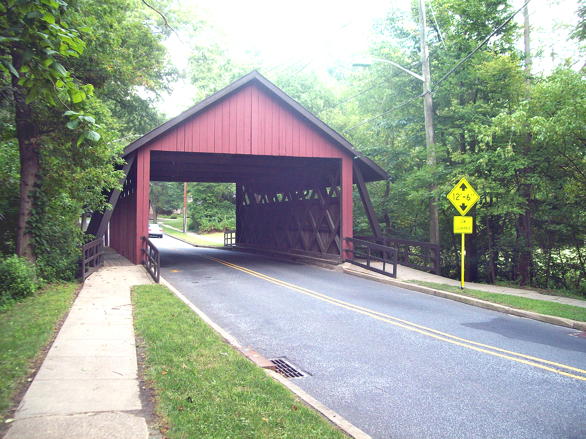
Highlights include Scarborough Bridge, Regal Moorsetown Mall Stadium 12 & RPX, Barclay Farm House and Breidenhart.
July is the warmest month, with average highs of 88°F; January lows average 26°F.
Weather in Ramblewood
Forecast from the National Weather Service. Full forecast
About Ramblewood
Ramblewood is an unincorporated community and census-designated place (CDP) located within Mount Laurel in Burlington County, in the U.S. state of New Jersey. As of the 2020 census, Ramblewood had a population of 6,655.
From the Wikipedia article Ramblewood, New Jersey (this version), under CC BY-SA 4.0.
Things to do2

Museums and landmarks13

Barclay Farm House
Monument and historic site · National Register of Historic Places · 3.0 mi
House in Cherry Hill, New Jersey

Breidenhart
Monument and historic site · National Register of Historic Places · 2.7 mi
Historic house in Moorestown, New Jersey

Cropwell Friends Meeting House
Monument and historic site · National Register of Historic Places · 2.8 mi
Historic Quaker meeting house Cropwell

Evesham Friends Meeting House
Monument and historic site · National Register of Historic Places · 3.2 mi
Historic Quaker meeting house in Burlington County, New Jersey

Gatehouse at Colestown Cemetery
Monument and historic site · National Register of Historic Places · 2.0 mi
Cemetery gatehouse in Cherry Hill, New Jersey

John Inskeep Homestead
Monument and historic site · National Register of Historic Places · 3.1 mi
Historic house in Burlington County, New Jersey

Moorestown Friends School and Meetinghouse
Monument and historic site · National Register of Historic Places · 2.4 mi
Historic Quaker school and meetinghouse

Paulsdale
Monument and historic site · National Register of Historic Places · 2.1 mi
Historic house in Mount Laurel, New Jersey

Samuel Coles House
Monument and historic site · National Register of Historic Places · 1.9 mi
Historic house in New Jersey, United States

Smith Mansion
Monument and historic site · National Register of Historic Places · 2.1 mi
Historic house in Burlington County, New Jersey

Stokes-Evans House
Monument and historic site · National Register of Historic Places · 3.4 mi
Building in New Jersey, United States


Thomas Hollinshead House
Monument and historic site · National Register of Historic Places · 2.0 mi
Historic house in Burlington County, New Jersey
1 more on the map.
Parks, trails and playgrounds14



2 more on the map.
Restaurants and cafes55


Rai Rai Ramen
Restaurant · Ramen · 1.6 mi
1200 South Church Street
Su-Th 11:00-21:00; Fr-Sa 11:00-22:00

King's Palace Chinese Restaurant
Restaurant · Chinese · 1.9 mi
896 State Route 73, Marlton
43 more on the map.
Where to stay31
Holiday Inn Express & Suites Philadelphia - Mt. Laurel
Motel and hotel · 1.2 mi
6000 Crawford Place, Mount Laurel
Homewood Suites by Hilton Philadelphia/Mt.Laurel
Motel and hotel · 0.6 mi
1422 Nixon Drive, Mount Laurel
La Quinta Inn & Suites Mt. Laurel - Philadelphia
Motel and hotel · 0.4 mi
5000 Clover Road, Mount Laurel
Churches and places of worship7
Our Lady of Good Counsel Church (Moorestown, New Jersey)
Church · 2.1 mi
Shopping15
Gas and EV charging12
Schools, colleges and libraries51
A. Russell Knight Elementary School
School · 3.8 mi
140 Old Carriage Rd., Cherry Hill
Burlington County Alternative High School
School · 3.9 mi
1020 Briggs Road, Mt. Laurel
Clara Barton Elementary School
School · 3.3 mi
223 Rhode Island Ave., Cherry Hill
Healthcare2
South Jersey Health and Wellness Center
Clinic and pharmacy · 2.0 mi
1919 Greentree Road, Cherry Hill
Map of Ramblewood
202 places. The map loads OpenStreetMap tiles when you open it.
Climate by month
Monthly table
| Month | High | Low | Rain |
|---|---|---|---|
| Jan | 43°F | 26°F | 3.9 in |
| Feb | 46°F | 27°F | 2.7 in |
| Mar | 54°F | 34°F | 4.6 in |
| Apr | 66°F | 43°F | 3.7 in |
| May | 75°F | 52°F | 3.6 in |
| Jun | 84°F | 62°F | 4.4 in |
| Jul | 88°F | 67°F | 5.4 in |
| Aug | 85°F | 64°F | 4.6 in |
| Sep | 80°F | 59°F | 4.2 in |
| Oct | 68°F | 47°F | 4.1 in |
| Nov | 56°F | 37°F | 3.5 in |
| Dec | 47°F | 31°F | 4.5 in |
U.S. Climate Normals 1991-2020 for Moorestown Hcn (2 mi away), NOAA NCEI.
People and cost of living
American Community Survey 5-year estimates, 2020-2024, U.S. Census Bureau. Estimates have margins of error, larger for small towns.
Disaster history
Burlington County has had 23 federal disaster declarations since 2000, most often for hurricanes.
- 2021-09-05: Remnants Of Hurricane Ida (Hurricane)
- 2021-09-02: Remnants Of Hurricane Ida (Hurricane)
- 2020-12-11: Tropical Storm Isaias (Hurricane)
- 2020-03-25: Covid-19 Pandemic (Biological)
- 2020-03-13: Covid-19 (Biological)
- 2018-06-08: Severe Winter Storm And Snowstorm (Severe Storm)
OpenFEMA disaster declarations summaries.
Getting there and nearby towns
South Jersey Regional Airport (LLY) is the nearest airport with scheduled flights listed in OpenStreetMap, 6 miles away.
- Kingston Estates 2 mi southwest, about 4 min by car
- Greentree 2 mi south, about 4 min by car
- Moorestown-Lenola 2 mi north, about 4 min by car
- Marlton 2 mi southeast, about 4 min by car
- Cherry Hill Mall 3 mi west, about 5 min by car
- Ellisburg 3 mi west, about 5 min by car
- Barclay 3 mi southwest, about 5 min by car
- Springdale 4 mi south, about 6 min by car
- Golden Triangle 5 mi west, about 7 min by car
- Haddonfield 5 mi southwest, about 8 min by car
Drive times are estimates from straight-line distance, not routes.
Local news
Headlines from INDB, the NEMICO news database.
Reviews, tips and questions
Loading what members have shared...
Sources and licences
- NCES EDGE (Public domain): public schools
- NOAA NCEI U.S. Climate Normals 1991-2020 (Public domain): climate by month
- OpenFEMA (Public domain): disaster declarations
- OpenStreetMap contributors (ODbL 1.0): places, airports, map data
- U.S. Census Bureau (Public domain): population, income, housing, education, commute
- Wikidata (CC0 1.0): elevation, founding date, time zone, website, landmarks and historic places
- Wikimedia Commons (see each image): photos
- Wikipedia (CC BY-SA 4.0): overview and history text
Photo credits
- 2020-09-07 13 45 13 View south along New Jersey State Route 73 at Burlington County Route 616 (Church Road) and Ramblewood Parkway in Mount Laurel Township, Burlington County, New Jersey, Famartin, CC BY-SA 4.0
- John Inskeep Homestead (3), Apc106, CC BY-SA 3.0
- Smith Mansion (5), Apc106, CC BY-SA 3.0
- CROPWELL FRIENDS MEETING HOUSE - MARLTON - NJ, Jerrye and Roy Klotz MD, CC BY-SA 3.0
- GATEHOUSE AT COLESTOWN CEMETERY, CAMDEN COUNTY, Jerrye & Roy Klotz, MD, CC BY-SA 3.0
- BARCLAY FARM HOUSE, JERRYE & ROY KLOTZ MD, CC BY-SA 3.0
- Evesham Friends Meeting House (5), Apc106, CC BY-SA 3.0
- COLES HOUSE, JERRYE & ROY KLOTZ MD, CC BY-SA 3.0
- Stokes- Evans House, Apc106, CC BY-SA 3.0
- THOMAS HOLLINSHEAD HOUSE, MARLTON, BURLINGTON COUNTY, JERRYE AND ROY KLOTZ MD, CC BY-SA 3.0
- All are welcome, John, CC BY 2.0
- Breidenhart (5), Apc106, CC BY-SA 3.0
- Our Lady of Good Counsel Church, Moorestown, NJ, Dec. 2024, Mr. Matté (if there is an issue with this image, contact me using this image's Commons talk page , my Commons user talk page , or my English Wikipedia user talk page ; I'll know about it a lot faster), CC BY-SA 4.0
- Barclaycoveredbridge, User:JSF0864, CC BY 2.0
- 2021-05-21 17 20 56 View north along New Jersey State Route 700 (New Jersey Turnpike) from the overpass for the ramps to New Jersey State Route 73 in Mount Laurel Township, Burlington County, New..., Famartin, CC BY-SA 4.0
- 2021-05-21 17 20 28 View south along New Jersey State Route 700 (New Jersey Turnpike) from the overpass for the ramps to New Jersey State Route 73 in Mount Laurel Township, Burlington County, New..., Famartin, CC BY-SA 4.0
- 2020-07-12 10 17 47 View south along New Jersey State Route 700 (New Jersey Turnpike) at Exit 4 (New Jersey State Route 73, Mount Laurel, Camden) in Mount Laurel Township, Burlington County, New..., Famartin, CC BY-SA 4.0
- 2021-05-21 15 27 12 View along the ramps connecting New Jersey State Route 73 to New Jersey State Route 700 (New Jersey Turnpike) in Mount Laurel Township, Burlington County, New Jersey, Famartin, CC BY-SA 4.0
- 2020-07-16 18 25 06 View along the ramp connecting New Jersey State Route 73 and the New Jersey Turnpike in Mount Laurel Township, Burlington County, New Jersey, Famartin, CC BY-SA 4.0
- 2018-05-21 18 05 11 View north along New Jersey State Route 700 (New Jersey Turnpike) just south of Exit 4 in Mount Laurel Township, Burlington County, New Jersey, Famartin, CC BY-SA 4.0
- 2020-07-07 14 07 00 View north along New Jersey State Route 700 (New Jersey Turnpike) at Exit 4 (New Jersey State Route 73, Mount Laurel, Camden) in Mount Laurel Township, Burlington County, New..., Famartin, CC BY-SA 4.0
- 2021-05-21 15 22 56 View along the ramps connecting New Jersey State Route 700 (New Jersey Turnpike) to New Jersey State Route 73 in Mount Laurel Township, Burlington County, New Jersey, Famartin, CC BY-SA 4.0
- Mount Laurel greyhound sta jeh, Jim.henderson, CC BY-SA 4.0
- 2018-05-21 17 46 41 View south along New Jersey State Route 700 (New Jersey Turnpike) just north of Exit 4 in Mount Laurel Township, Burlington County, New Jersey, Famartin, CC BY-SA 4.0
- 2020-07-12 10 16 47 View south along New Jersey State Route 700 (New Jersey Turnpike) just north of Exit 4 (New Jersey State Route 73, Mount Laurel, Camden) in Mount Laurel Township, Burlington..., Famartin, CC BY-SA 4.0
- Moorestown Mall, New Jersey (2896434104), Ken Lund from Reno, Nevada, USA, CC BY-SA 2.0
- NJ TPK NB from NJ 73 overpass, Dough4872, CC BY-SA 4.0
- 2020-09-07 11 23 04 View north along New Jersey State Route 73 at the exit for the New Jersey Turnpike in Mount Laurel Township, Burlington County, New Jersey, Famartin, CC BY-SA 4.0
- 2021-05-21 17 12 59 View south along New Jersey State Route 700 (New Jersey Turnpike) from the overpass for New Jersey State Route 73 (Marlton Pike) in Mount Laurel Township, Burlington County, New..., Famartin, CC BY-SA 4.0
- 2021-05-21 17 18 41 View north along New Jersey State Route 700 (New Jersey Turnpike) from the overpass for New Jersey State Route 73 (Marlton Pike) in Mount Laurel Township, Burlington County, New..., Famartin, CC BY-SA 4.0
- 2020-09-07 13 42 37 View south along New Jersey State Route 73 at the exit for the New Jersey Turnpike in Mount Laurel Township, Burlington County, New Jersey, Famartin, CC BY-SA 4.0
- 2020-09-07 13 38 53 View south along New Jersey State Route 73 at the exit for Burlington County Route 673 (Fellowship Road) in Mount Laurel Township, Burlington County, New Jersey, Famartin, CC BY-SA 4.0
- Tommy and Molly, Uncommon-27, CC BY-SA 4.0
- 2021-06-24 15 29 28 View south along Interstate 295 from the overpass for Burlington County Route 673 (Fellowship Road) in Mount Laurel Township, Burlington County, New Jersey, Famartin, CC BY-SA 4.0
- 2021-06-24 15 31 30 View north along Interstate 295 from the overpass for Burlington County Route 673 (Fellowship Road) in Mount Laurel Township, Burlington County, New Jersey, Famartin, CC BY-SA 4.0
- 2020-07-15 08 35 39 View south along Interstate 295 at Exit 36B (TO New Jersey State Route 73 NORTH, Tacony Bridge) in Mount Laurel Township, Burlington County, New Jersey, Famartin, CC BY-SA 4.0
- 2018-05-25 08 10 57 View north along Interstate 295 just north of Exit 36 in Mount Laurel Township, Burlington County, New Jersey, Famartin, CC BY-SA 4.0
- 2021-05-21 17 06 41 View north along New Jersey State Route 700 (New Jersey Turnpike) from the overpass for Burlington County Route 616 (Church Road) in Mount Laurel Township, Burlington County, New..., Famartin, CC BY-SA 4.0
- 2021-05-21 17 04 50 View south along New Jersey State Route 700 (New Jersey Turnpike) from the overpass for Burlington County Route 616 (Church Road) in Mount Laurel Township, Burlington County, New..., Famartin, CC BY-SA 4.0
- 2018-05-23 15 14 04 View north along New Jersey State Route 73 at Burlington County Route 616 (Church Road) in Mount Laurel Township, Burlington County, New Jersey, Famartin, CC BY-SA 4.0


Page built October 30, 2026. Spotted a mistake? Tell us or suggest a place.