




Riverside, New York
Riverside is a community of 4,038 people in Suffolk County, New York.
Why visit Riverside
Townapedia lists 7 museums and landmarks, 10 parks and trails, 21 places to eat, 4 places to stay and 3 attractions in and around town.
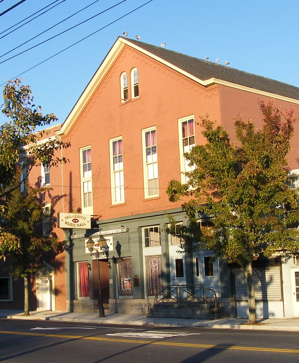
Highlights include Vail-Leavitt Music Hall, Big Duck, Big Duck Ranch and Long Island Aquarium and Exhibition Center.
July is the warmest month, with average highs of 83°F; January lows average 22°F.
Weather in Riverside
Forecast from the National Weather Service. Full forecast
About Riverside
Riverside is a hamlet and census-designated place (CDP) in Suffolk County, New York, United States. The population was 2,911 at the 2010 census.
From the Wikipedia article Riverside, Suffolk County, New York (this version), under CC BY-SA 4.0.
Things to do3
Vail-Leavitt Music Hall
Cinema and theater · National Register of Historic Places · 0.9 mi
Theater and former movie theater in Riverhead, New York, United States

Museums and landmarks7

Big Duck
Monument and historic site · National Register of Historic Places · 2.6 mi
Historic commercial building in New York, United States

Big Duck Ranch
Monument and historic site · National Register of Historic Places · 2.6 mi
Building in New York, United States

James Benjamin Homestead
Monument and historic site · National Register of Historic Places · 2.8 mi
Flanders, NY, listed on the NRHP in New York

Suffolk County Historical Society Building
Monument and historic site · National Register of Historic Places · 1.2 mi
Building in New York, United States

United States Post Office
Monument and historic site · National Register of Historic Places · 1.0 mi
Government building in Riverhead, New York

Suffolk County Historical Society Museum
Museum · 0.9 mi
300 West Main Street, Riverhead
Parks, trails and playgrounds10


Long Island Aquarium and Exhibition Center
Sports field and stadium · 1.2 mi
Aquarium in Riverhead, New York, United States
431 East Main Street, Riverhead
Mo-Su 10:00-18:00



Restaurants and cafes21

Jerry & The Mermaid
Restaurant · 1.3 mi
469 East Main Street, Riverhead
Mo-Su 11:00-22:00

Bagel Lovers Cafe
Restaurant · Coffee Shop · 1.3 mi
673 Osborne Avenue, Riverhead
Funcho's Fajita Grill
Restaurant · Mexican · 1.1 mi
1156 West Main Street, Riverhead

Maple Tree BBQ Smokehouse
Diner · American · 0.9 mi
816 West Main Street, Riverhead
Rocco's Pizza & Pasta
Restaurant · Pizza, Pasta · 1.7 mi
1285 Old Country Road, Riverhead
The Original Brickhouse
Restaurant · Pizza · 1.0 mi
1111 West Main Street, Riverhead

9 more on the map.
Where to stay4
Churches and places of worship15
Goodwill AME Zion Church
Church · Methodist · 0.9 mi
110 Flanders Road, Riverhead
Riverhead United Methodist Church
Church · United Methodist · 1.1 mi
204 East Main Street, Riverhead
Seventh-Day Adventist Church Riverhead
Church · Seventh Day Adventist · 1.2 mi
538 Griffing Avenue, Riverhead
St. Isadore Roman Catholic Church
Church · Roman Catholic · 1.1 mi
622 Pulaski Street, Riverhead
St. John the Baptist Ukrainian Catholic Church
Church · Ukrainian Greek Catholic · 1.4 mi
820 Pondview Road, Riverhead
St. John the Evangelist Roman Catholic Church
Church · Roman Catholic · 1.3 mi
546 St. John's Place, Riverhead
Temple Israel of Riverhead
Place of worship · Conservative · 1.4 mi
490 Northville Turnpike, Riverhead
Shopping9
Gas and EV charging4
Schools, colleges and libraries18
Healthcare8
Dr. Bernadette Pupilla
Clinic and pharmacy · 1.8 mi
1149 Old Country Road, Riverhead
East End Allergy & Asthma Care
Clinic and pharmacy · 1.7 mi
1149 Old Country Road, Riverhead
Maria L.S. Alcasid-Escano Adult & Pediatric Allergy
Clinic and pharmacy · 1.7 mi
982 Roanoke Avenue, Riverhead
MDVIP - Lilly Steel, MD
Clinic and pharmacy · 1.5 mi
25B Cranberry Street, Riverhead
North Fork Endocrinology
Clinic and pharmacy · 1.8 mi
1149 Old Country Road, Riverhead
Northwell Health Cardiology Office
Clinic and pharmacy · 1.6 mi
951 Roanoke Avenue, Riverhead
Suffolk Vascular Associates
Clinic and pharmacy · 1.8 mi
1149 Old Country Road, Riverhead
Sunrise Hypnosis Care, Inc.
Clinic and pharmacy · 1.7 mi
1149 Old Country Road, Riverhead
Map of Riverside
99 places. The map loads OpenStreetMap tiles when you open it.
Climate by month
Monthly table
| Month | High | Low | Rain |
|---|---|---|---|
| Jan | 38°F | 22°F | 3.8 in |
| Feb | 40°F | 23°F | 2.7 in |
| Mar | 47°F | 29°F | 5.0 in |
| Apr | 57°F | 38°F | 4.2 in |
| May | 68°F | 47°F | 3.7 in |
| Jun | 77°F | 56°F | 4.0 in |
| Jul | 83°F | 63°F | 3.3 in |
| Aug | 81°F | 62°F | 3.8 in |
| Sep | 75°F | 55°F | 4.3 in |
| Oct | 64°F | 44°F | 4.7 in |
| Nov | 53°F | 35°F | 3.9 in |
| Dec | 43°F | 27°F | 5.1 in |
U.S. Climate Normals 1991-2020 for Baiting Hollow (4 mi away), NOAA NCEI.
People and cost of living
American Community Survey 5-year estimates, 2020-2024, U.S. Census Bureau. Estimates have margins of error, larger for small towns.
Disaster history
Suffolk County has had 25 federal disaster declarations since 2000, most often for hurricanes.
- 2024-10-21: Severe Storm And Flooding (Severe Storm)
- 2024-08-25: Severe Storm And Flooding (Severe Storm)
- 2023-03-15: Severe Winter Storm And Snowstorm (Snowstorm)
- 2021-09-05: Remnants Of Hurricane Ida (Hurricane)
- 2021-09-02: Remnants Of Hurricane Ida (Hurricane)
- 2021-08-22: Hurricane Henri (Hurricane)
OpenFEMA disaster declarations summaries.
Getting there and nearby towns
Francis S. Gabreski Airport (FOK) is the nearest airport with scheduled flights listed in OpenStreetMap, 5 miles away.
- Riverhead 3 mi north, about 5 min by car
- Flanders 4 mi east, about 6 min by car
- Aquebogue 4 mi northeast, about 7 min by car
- Calverton 5 mi west, about 9 min by car
- Northville 5 mi northeast, about 9 min by car
- Baiting Hollow 6 mi northwest, about 9 min by car
- Eastport 6 mi southwest, about 9 min by car
- Jamesport 6 mi northeast, about 10 min by car
- Manorville 7 mi southwest, about 11 min by car
- East Quogue 7 mi southeast, about 11 min by car
Drive times are estimates from straight-line distance, not routes.
Local news
Headlines from INDB, the NEMICO news database.
Reviews, tips and questions
Loading what members have shared...
Sources and licences
- NCES EDGE (Public domain): public schools
- NOAA NCEI U.S. Climate Normals 1991-2020 (Public domain): climate by month
- OpenFEMA (Public domain): disaster declarations
- OpenStreetMap contributors (ODbL 1.0): places, airports, map data
- U.S. Census Bureau (Public domain): population, income, housing, education, commute
- Wikidata (CC0 1.0): landmarks and historic places
- Wikimedia Commons (see each image): photos
- Wikipedia (CC BY-SA 4.0): overview and history text
Photo credits
- Riverhead-post-office, Americasroof, CC BY-SA 3.0
- Suffolk-historic, Americasroof, CC BY-SA 3.0
- Big Duck 2018 04, Photograph by Mike Peel ( www.mikepeel.net )., CC BY-SA 4.0
- Vail-leavitt, Americasroof, CC BY-SA 3.0
- Big Duck 2018 05, Photograph by Mike Peel ( www.mikepeel.net )., Public domain
- James Benjamin Homestead; Flanders, New York-2, DanTD, CC BY-SA 4.0
- Long Island Aquarium 2018 106, Photograph by Mike Peel ( www.mikepeel.net )., CC BY-SA 4.0
Page built October 30, 2026. Spotted a mistake? Tell us or suggest a place.