




Al’burikent, Russia
Альбурикент
Al’burikent is a town of 10,591 people in Dagestan, Russia.
Why visit Al’burikent
Townapedia lists 12 museums and landmarks, 5 parks and trails, 167 places to eat, 21 places to stay and 9 attractions in and around town.
Highlights include Church of Saint Vladimir in MakhachkaӀa, Dagestan State Medical University, Dagestan Museum of Fine Arts and Парк имени Ленинского Комсомола.
Weather in Al’burikent
Forecast from MET Norway (CC BY 4.0). Full forecast
About Al’burikent
Alburikent (Russian: Альбурике́нт; Kumyk: Албёригент, Albörigent) is an urban locality (an urban-type settlement) under the administrative jurisdiction of Sovetsky City District of the City of Makhachkala in the Republic of Dagestan, Russia. As of the 2010 Census, its population was 12,413.
From the Wikipedia article Alburikent (this version), under CC BY-SA 4.0.
Things to do9
Church of Saint Vladimir in MakhachkaӀa
Monument and historic site · 3.0 km
Church of the Holy Equal-to-the-Apostles Prince Vladimir of Makhachkala

Dagestan State Medical University
School · 3.0 km
Russian medical school in Dagestan
Dagestan State Pedagogical University
School · 3.1 km
Education organization in Makhachkala, Russia

Dagestan State University
School · 2.3 km
Public university in Makhachkala, Republic of Dagestan, Russia
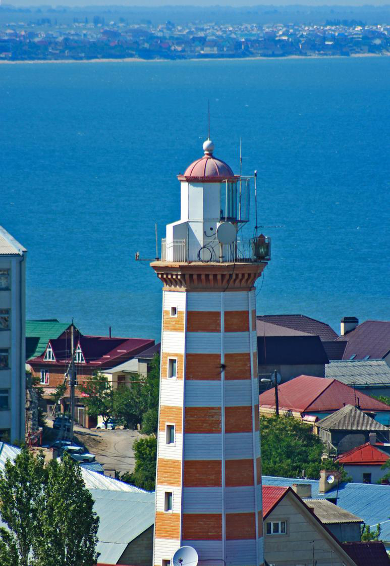
Makhachkala Lighthouse
Monument and historic site · 2.6 km
Lighthouse in Dagestan

Makhachkala Synagogue
Monument and historic site · 3.5 km
Center for the spiritual life of the Jews of Makhachkala

National Museum of the Republic of Dagestan
Monument and historic site · 3.4 km
Building in Russia

Парамакс
Cinema and theater · 2.4 km
64 проспект Имама Шамиля, Махачкала
Mo-Su 08:00-00:00
Museums and landmarks12



Parks, trails and playgrounds5



Караоке клуб
Sports field and stadium · 2.4 km
57 улица Магомедтагирова, Махачкала

Restaurants and cafes167

Bootlegger
Bar and pub · Regional, Bavarian, Chicken, Local, Coffee Shop, Friture · 1.8 km
6Б улица Аскерханова
Mo-Su 17:00-02:00

visage.concept
Cafe · Coffee Shop, Ice Cream · 2.3 km
12 улица Коркмасова, Махачкала
Mo-Su 10:00-22:00
Hinkal Brorhers
Cafe · Regional, Local · 2.5 km
29 улица Коркмасова
Mo-Su 10:00-23:00

Ресторан на Лермонтова
Restaurant · 2.1 km
6 улица Лермонтова, Махачкала
Mo-Su 10:00-24:00
Сказка востока
Cafe · International · 2.5 km
38 улица Магомеда Гаджиева, Махачкала
10:00-22:00
155 more on the map.
History
Urban-type settlement status was granted to Alburikent in 1992.
From the History section of Alburikent on Wikipedia, under CC BY-SA 4.0.
Where to stay21
Отель Альгамбра (Alhambra)
Motel and hotel · 1.0 km
1Ж улица Абдулхакима Исмаилова, Махачкала
Churches and places of worship7
Orthodox cathedral of the Dormition of Our Lady in Makhachkala
Church · 3.0 km
Shopping66
Gas and EV charging17
Schools, colleges and libraries45
ДГУ. Факультеты: филологический, иностранных языков
School · 2.3 km
улица Магомеда Гаджиева
Институт повышения квалификации педагогических кадров
School · 1.3 km
159 улица Магомедтагирова, Махачкала
Healthcare79
Map of Al’burikent
250 places. The map loads OpenStreetMap tiles when you open it.
Getting there and nearby towns
Makhachkala Uytash Airport (MCX) is the nearest airport with scheduled flights listed in OpenStreetMap, 23 km away.
- Makhachkala 2 km east, about 2 min by car
- Kyakhulay 1 km southeast, about 1 min by car
- Tarki 4 km southeast, about 4 min by car
- Semender 6 km west, about 6 min by car
- Leninkent 10 km west, about 10 min by car
- Kaspiysk 17 km southeast, about 17 min by car
- Buynaksk 33 km southwest, about 33 min by car
- Kizilyurt 55 km northwest, about 55 min by car
- Izberbash 56 km southeast, about 56 min by car
- Khasavyurt 78 km northwest, about 1 h 15 min by car
Drive times are estimates from straight-line distance, not routes.
Local news
Headlines from INDB.
Reviews, tips and questions
Loading what members have shared...
Sources and licences
- GeoNames (CC BY 4.0): population, coordinates, regions and time zone
- OpenStreetMap contributors (ODbL 1.0): places, airports, map data
- Wikidata (CC0 1.0): elevation, founding date, time zone, website, landmarks and historic places
- Wikimedia Commons (see each image): photos
- Wikipedia (CC BY-SA 4.0): overview and history text
Photo credits
- Храм Святого Князя Владимира в Махачкале, Пресс-служба Главы и Правительства РД, CC BY 3.0
- Улица Ярагского, 57, Shamil Magomedov, CC BY-SA 4.0
- Makhachkala lighthouse, Шамиль Магомедов, CC0
- Makhachkala Synagogue, Alandislands, CC BY-SA 4.0
- Baryatinsky-Vanetsov House in Makhachkala (March 2026) - 0 3, Vyacheslav Bukharov, CC BY-SA 4.0
- Art museum in Makhachkala (March 2026), Vyacheslav Bukharov, CC BY-SA 4.0
- Makhachkala 20180917 131925, Bogdanov-62, CC BY-SA 4.0
- ДГУ, Шамиль Магомедов, CC BY-SA 2.0
- ЖумгІа мажгит, МахІачхъала, Шамиль Магомедов, CC BY-SA 2.0
- Парк культуры и отдыха Ленинского Комсомола (Махачкала), Artemon228, CC BY-SA 4.0
- ДагГосМедАкадемия, Alandislands, CC BY-SA 3.0
- Dagestan - 2024-05-01 - 21, Dinamik, CC BY-SA 4.0
- Канал имени Октябрьской Революции, Z0m90001, CC BY-SA 4.0
- Большой брат возвращается - panoramio, Alkhimov Maxim, CC BY 3.0
- Dagestan - 2024-05-01 - 20, Dinamik, CC BY-SA 4.0
- Русский, Magomedova Kariyat, CC BY-SA 3.0
- Двдвбв, Magomedova Kariyat, CC BY-SA 3.0
- Разрушеннная бывшая фабрика, Magomedova Kariyat, CC BY-SA 3.0
- Лулвовоов, Magomedova Kariyat, CC BY-SA 3.0
- Здание Махачкалинской тюрьмы, Magomedova Kariyat, CC BY-SA 3.0
- Тюрьма высока, Magomedova Kariyat, CC BY-SA 3.0
- Orthodox cathedral of the Dormition of Our Lady in Makhachkala (2), Magomedova Kariyat, CC BY-SA 3.0
- Как, Magomedova Kariyat, CC BY-SA 3.0
- Фабрика, Magomedova Kariyat, CC BY-SA 3.0
- Вдвдлбвбв, Magomedova Kariyat, CC BY-SA 3.0
- Школа под номером пьять, Magomedova Kariyat, CC BY-SA 3.0
- Загружается, Magomedova Kariyat, CC BY-SA 3.0
- Маяк Дагестанский, Magomedova Kariyat, CC BY-SA 3.0
- Ылвооаов, Magomedova Kariyat, CC BY-SA 3.0
- Сулейман, Magomedova Kariyat, CC BY-SA 3.0
- Долго, Magomedova Kariyat, CC BY-SA 3.0
- Равроррр, Magomedova Kariyat, CC BY-SA 3.0
- И все такое, Magomedova Kariyat, CC BY-SA 3.0
- Гьарай, Magomedova Kariyat, CC BY-SA 3.0
- Двлвлвлв, Magomedova Kariyat, CC BY-SA 3.0
- Заголовок маяка, Magomedova Kariyat, CC BY-SA 3.0
- Памятник лучший, Magomedova Kariyat, CC BY-SA 3.0
- Двлвлв, Magomedova Kariyat, CC BY-SA 3.0
- Могила Сулеймана Стальского, Плешков, CC BY-SA 3.0
- Кдулвлвл, Magomedova Kariyat, CC BY-SA 3.0


Page built November 4, 2026. Spotted a mistake? Tell us or suggest a place.