
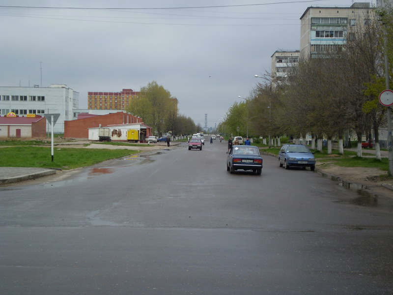


Desnogorsk, Russia
Десногорск
Desnogorsk is a town of 32,451 people in Smolensk Oblast, Russia, founded in 1974.
Why visit Desnogorsk
Townapedia lists 13 museums and landmarks, 4 parks and trails, 31 places to eat, 1 place to stay and 3 attractions in and around town.
Weather in Desnogorsk
Forecast from MET Norway (CC BY 4.0). Full forecast
About Desnogorsk
Desnogorsk (Russian: Десного́рск) is a town in Smolensk Oblast, Russia, located on the right bank of the Desna River 153 kilometers (95 mi) southeast of Smolensk. Population: 29,677 (2010 census); 32,070 (2002 census); 32,302 (1989 Soviet census). Desnogorsk is located on the banks of the Desna River and is surrounded by Roslavlsky District.
From the Wikipedia article Desnogorsk (this version), under CC BY-SA 4.0.
Things to do3


Museums and landmarks13

Дом творчества
Museum · 1.1 km
Mo-Th 08:00-13:00,14:00-17:15; Fr 08:00-13:00,14:00-16:00

1 more on the map.
Parks, trails and playgrounds4




Restaurants and cafes31


Рыжий лев
Bar and pub
213
Mo-Fr 00:00-02:00,11:00-24:00; Sa-Su 00:00-04:00,11:00-24:00
Аквамарин
Cafe
Su,Mo 19:00-01:00; Tu,We off; Th 19:00-02:00; Fr 19:00-05:00; Sa...


19 more on the map.
History
It was founded as a settlement around the Smolensk Nuclear Power Plant in 1974 (construction started in 1972). It belonged to Roslavlsky District. It was granted town status in 1989 and simultaneously declared to be the town of oblast significance.
From the History section of Desnogorsk on Wikipedia, under CC BY-SA 4.0.
Where to stay1
Churches and places of worship4
Подворие Спасо-Преображенского мужского монастыря г.Рославля в честь Святителя Стефана Великопермского.
Place of worship
Shopping28
Gas and EV charging2
Schools, colleges and libraries7
Healthcare23
Map of Desnogorsk
116 places. The map loads OpenStreetMap tiles when you open it.
Getting there and nearby towns
Smolensk South Tikhvinka Airport (LNX) is the nearest airport with scheduled flights listed in OpenStreetMap, 103 km away.
- Yekimovichi 4 km south, about 4 min by car
- Roslavl’ 35 km southwest, about 35 min by car
- Oster 35 km southwest, about 35 min by car
- Stodolishche 41 km west, about 41 min by car
- Rognedino 43 km southeast, about 43 min by car
- Yel’nya 48 km north, about 48 min by car
- Kirov 67 km east, about 1 h by car
- Zhukovka 75 km southeast, about 1 h 15 min by car
- Lyudinovo 83 km east, about 1 h 30 min by car
- Dorogobuzh 85 km north, about 1 h 30 min by car
Drive times are estimates from straight-line distance, not routes.
Local news
Headlines from INDB.
Reviews, tips and questions
Loading what members have shared...
Sources and licences
- GeoNames (CC BY 4.0): population, coordinates, regions and time zone
- OpenStreetMap contributors (ODbL 1.0): places, airports, map data
- Wikidata (CC0 1.0): elevation, founding date, time zone, website
- Wikimedia Commons (see each image): photos
- Wikipedia (CC BY-SA 4.0): overview and history text
Photo credits
- Desnogorsk (Десногорск) broadway (Бродвей) - panoramio, Николай Торгов, CC BY-SA 3.0
- Памятник семье - panoramio, Николай Торгов, CC BY-SA 3.0
- Набережная - panoramio (85), Николай Торгов, CC BY-SA 3.0
- Курган славы - panoramio, Николай Торгов, CC BY-SA 3.0
- Сброс - panoramio, Николай Торгов, CC BY-SA 3.0
- Водосброс - panoramio, Николай Торгов, CC BY-SA 3.0
- Десна - panoramio - Николай Торгов (2), Николай Торгов, CC BY-SA 3.0
- Охладители - panoramio, Николай Торгов, CC BY-SA 3.0
- Охладители - panoramio - Николай Торгов, Николай Торгов, CC BY-SA 3.0
- Присмара - panoramio, Николай Торгов, CC BY-SA 3.0


Page built November 4, 2026. Spotted a mistake? Tell us or suggest a place.