

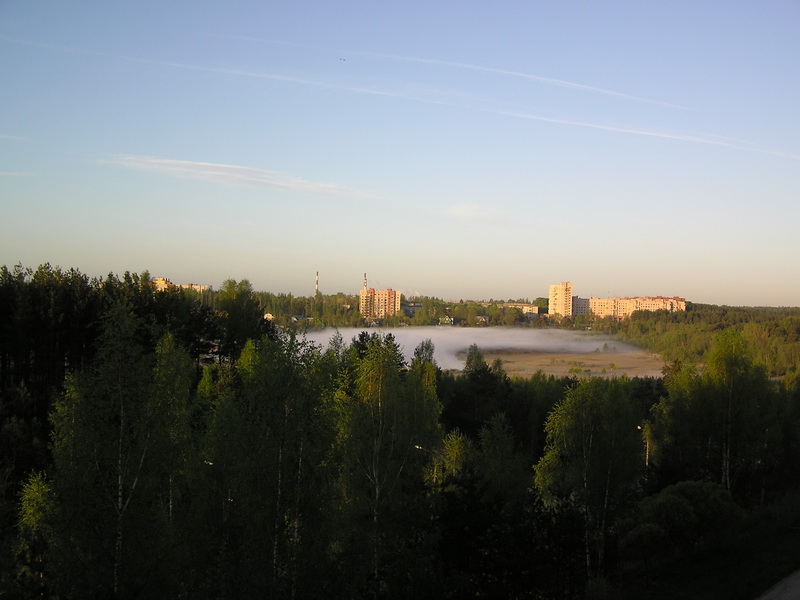


Kuz’molovskiy, Russia
Кузьмоловский
Kuz’molovskiy is a town of 12,794 people in Leningradskaya Oblast', Russia.
Why visit Kuz’molovskiy
Townapedia lists 3 museums and landmarks, 2 parks and trails, 13 places to eat, 2 places to stay and 1 attraction in and around town.
Weather in Kuz’molovskiy
Forecast from MET Norway (CC BY 4.0). Full forecast
About Kuz’molovskiy
Kuzmolovsky (Russian: Ку́зьмоловский) is an urban locality (an urban-type settlement) in Vsevolozhsky District of Leningrad Oblast, Russia, located north of the city of Saint Petersburg. Municipally it is incorporated as Kuzmolovskoye Urban Settlement, one of the eight urban settlements in the district. Population: 9,689 (2010 census); 9,725 (2002 census); 10,435 (1989 Soviet census).
From the Wikipedia article Kuzmolovsky (this version), under CC BY-SA 4.0.
Things to do1

Museums and landmarks3

Памятник сотрудникам ГИПХ, погибшим в годы ВОВ
Monument and historic site · 1.6 km
Parks, trails and playgrounds2


Restaurants and cafes13







1 more on the map.
History
The village of Kuzmolovo was founded in the 19th century. After 1939, it belonged to Pargolovsky District of Leningrad Oblast. On April 3, 1954 Pargolovsky District was abolished, and Kuzmolovo was transferred to Vsevolozhsky District. Intensive construction started in 1953, when the chemical plant was built, and housing was needed for the workers. On April 21, 1961 Kuzmolovo was granted urban-type settlement status and renamed Kuzmolovsky.
From the History section of Kuzmolovsky on Wikipedia, under CC BY-SA 4.0.
Where to stay2
Churches and places of worship1
Shopping9
Gas and EV charging2
Schools, colleges and libraries6
Healthcare6
Map of Kuz’molovskiy
45 places. The map loads OpenStreetMap tiles when you open it.
Getting there and nearby towns
Pulkovo Airport (LED) is the nearest airport with scheduled flights listed in OpenStreetMap, 37 km away.
- Vsevolozhsk 15 km southeast, about 15 min by car
- Sertolovo 16 km west, about 16 min by car
- Saint Petersburg 21 km southwest, about 21 min by car
- Shlissel’burg 35 km southeast, about 35 min by car
- Kolpino 40 km south, about 40 min by car
- Otradnoye 41 km southeast, about 41 min by car
- Nikol’skoye 48 km south, about 48 min by car
- Tosno 67 km south, about 1 h by car
- Vyritsa 78 km south, about 1 h 15 min by car
- Siverskiy 87 km south, about 1 h 30 min by car
Drive times are estimates from straight-line distance, not routes.
Local news
Headlines from INDB.
Reviews, tips and questions
Loading what members have shared...
Sources and licences
- GeoNames (CC BY 4.0): population, coordinates, regions and time zone
- OpenStreetMap contributors (ODbL 1.0): places, airports, map data
- Wikidata (CC0 1.0): elevation, founding date, time zone, website
- Wikimedia Commons (see each image): photos
- Wikipedia (CC BY-SA 4.0): overview and history text
Photo credits
- Кузьмоловский, Scaut2002, CC BY-SA 4.0
- Раннее летнее утро - panoramio, Const-Ant, CC BY 3.0
- Кузьмолово - panoramio, tjrn, CC BY 3.0
- Дер. Варкалово, Scaut2002, CC BY-SA 4.0
- Кузьмолово, Scaut2002, CC BY-SA 4.0
- Водв - panoramio, alzium, CC BY-SA 3.0
Page built November 4, 2026. Spotted a mistake? Tell us or suggest a place.