
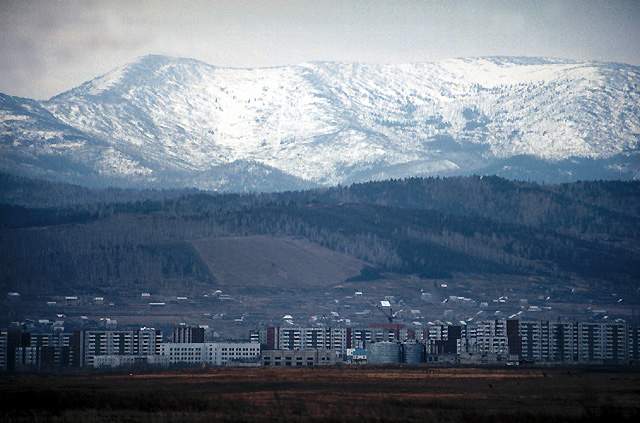


Sayanogorsk, Russia
Саяногорск
Sayanogorsk is a town of 49,939 people in Khakasiya Republic, Russia, founded in 1830.
Why visit Sayanogorsk
Townapedia lists 9 museums and landmarks, 5 parks and trails, 10 places to eat, 3 places to stay and 1 attraction in and around town.
Weather in Sayanogorsk
Forecast from MET Norway (CC BY 4.0). Full forecast
About Sayanogorsk
Sayanogorsk (Russian: Саяногорск; Khakas: Наа Сойан Тура, romanized: Nâ Soyan Tura) is a town in the Republic of Khakassia, Russia, located on the left bank of the Yenisei River, 80 kilometers (50 mi) south of Abakan, the capital of the republic. Population: 49,887 (2010 census); 50,255 (2002 census); 50,188 (1989 Soviet census).
From the Wikipedia article Sayanogorsk (this version), under CC BY-SA 4.0.
Things to do1

Museums and landmarks9


Parks, trails and playgrounds5


Restaurants and cafes10





History
Sayanogorsk was founded on November 6, 1975, in connection with the construction of the Sayan-Shushenskaya Hydroelectric Power Plant on the Yenisei River and the Sayan Aluminum Plant in the town; the latter opened ten years later.
From the History section of Sayanogorsk on Wikipedia, under CC BY-SA 4.0.
Where to stay3
Churches and places of worship1
Троицкая церковь
Church · Russian Orthodox · 2.1 km
30 Советская улица, Саяногорск
Shopping24
Gas and EV charging2
Schools, colleges and libraries8
Map of Sayanogorsk
63 places. The map loads OpenStreetMap tiles when you open it.
Getting there and nearby towns
Abakan Airport (ABA) is the nearest airport with scheduled flights listed in OpenStreetMap, 71 km away.
- Mayna 12 km southeast, about 12 min by car
- Cherëmushki 27 km south, about 27 min by car
- Beya 33 km west, about 33 min by car
- Il’ichevo 35 km northeast, about 35 min by car
- Shushenskoye 43 km northeast, about 43 min by car
- Belyy Yar 55 km north, about 55 min by car
- Askiz 59 km west, about 59 min by car
- Abakan 68 km north, about 1 h 15 min by car
- Minusinsk 70 km north, about 1 h 15 min by car
- Ust’-Abakan 82 km north, about 1 h 15 min by car
Drive times are estimates from straight-line distance, not routes.
Local news
Headlines from INDB.
Reviews, tips and questions
Loading what members have shared...
Sources and licences
- GeoNames (CC BY 4.0): population, coordinates, regions and time zone
- OpenStreetMap contributors (ODbL 1.0): places, airports, map data
- Wikidata (CC0 1.0): elevation, founding date, time zone, website
- Wikimedia Commons (see each image): photos
- Wikipedia (CC BY-SA 4.0): overview and history text
Photo credits
- SAYANOGORSK VUE GEN VILLE, Ksam, CC BY-SA 3.0
- Жук-носорог, Даша Килина, CC BY-SA 4.0
- ДПСаА3-0001 М62-1811 Саяногорск 1, Сергей Болашенко, CC BY-SA 3.0
- ДПСаА3-0001 М62-1811 Саяногорск 3, Сергей Болашенко, CC BY-SA 3.0
- ДПСаА3-0001 М62-1811 Саяногорск 2, Сергей Болашенко, CC BY-SA 3.0
- Станция Саяногорск платформа, Сергейй Болашенко, CC BY-SA 3.0
- Станция Саяногорск пути, Сергей Болашенко, CC BY-SA 3.0
- Станция Саяногорск, Сергей Болашенко, CC BY-SA 3.0
- ДПСаА3-0001 М62-1857 Саяногорск 1, Сергей Болашенко, CC BY-SA 3.0
- ДПСаА3-0001 М62-1857 Саяногорск 2, Сергей Болашенко, CC BY-SA 3.0
- ДПСаА3-0001 М62-1857 Саяногорск, Сергей Болашенко, CC BY-SA 3.0
- Поганки, Даша Килина, CC BY-SA 4.0


Page built November 4, 2026. Spotted a mistake? Tell us or suggest a place.