


Why visit Salem
Townapedia lists 9 museums and landmarks, 13 parks and trails, 26 places to eat, 18 places to stay and 11 attractions in and around town.
Highlights include ARRS MULTIPLEX, Government Museum, Salem and Kurumbapatti Zoological Park.
Weather in Salem
Forecast from MET Norway (CC BY 4.0). Full forecast
About Salem
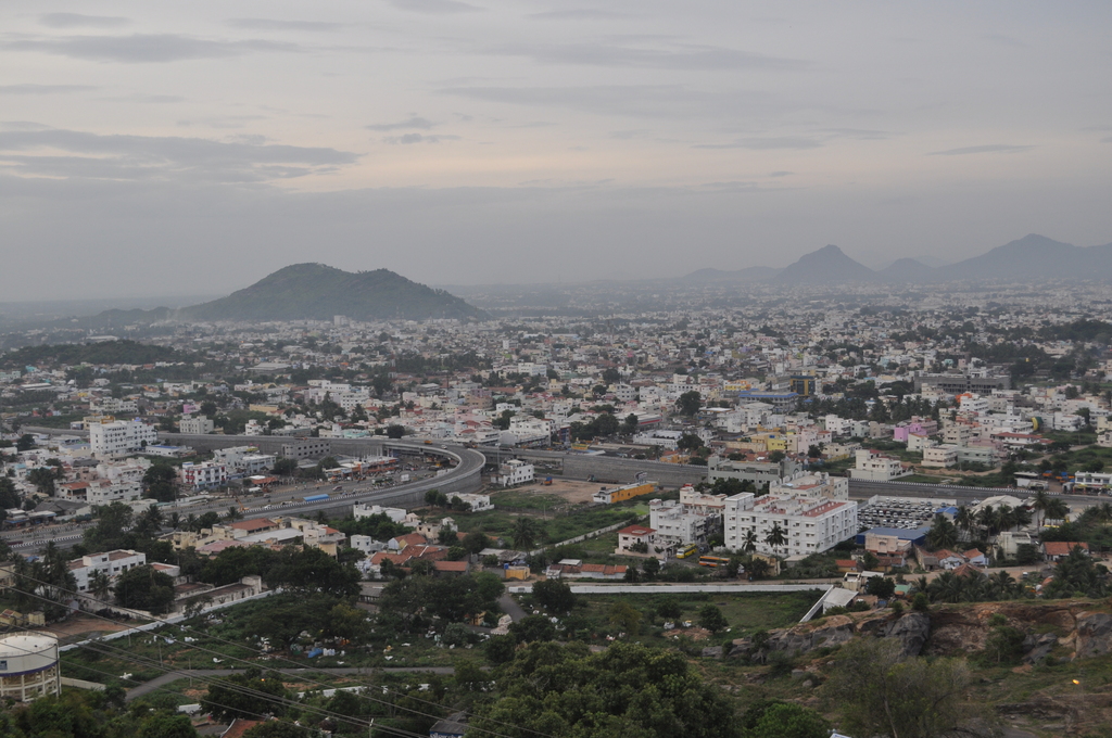
Salem (pronounced [seːlam] ) is a city in the Indian state of Tamil Nadu. It is located on the banks of the Thirumanimutharu River and surrounded by the Eastern Ghats. It is the fifth largest city in the state as per the 2011 census. It is the administrative capital of Salem District and is administered by the Salem Municipal Corporation which was established in 1994.
From the Wikipedia article Salem, Tamil Nadu (this version), under CC BY-SA 4.0.
Travel tips from other travellers: Salem on Wikivoyage (CC BY-SA 4.0).
Photos of Salem


Things to do11



Museums and landmarks9


My Office
Monument and historic site · 2.0 km
259 Suramangalam Road
Parks, trails and playgrounds13




1 more on the map.
Restaurants and cafes26



14 more on the map.
History
The region was part of the Chera Empire during Sangam period between c. 1st and the 4th centuries CE. The city might have had trade connections with the Roman Empire in the 1st century CE, evident from the Roman coins bearing the seal of Emperor Tiberius (37–68 CE) found in the region. In the 2nd century CE, the region came under the rule of the Pandyas. In the 4th century CE, the Pallavas rose to power in the region, and it was the center of conflict between the Pallavas and the Pandyas over the 8th and 9th centuries CE. In the 10th century, the region was captured by the Cholas. After the decline of the Chola Empire in the 12th century CE, the region was under the rule of the Hoysalas and the Later Pandyas in the 12th–13th centuries CE.
Read more of the history
The region came under the Vijayanagara Empire in the 14th century CE. It was later governed by Poligars, military chieftains under the Vijayanagara and the later Nayak rule. In the latter part of the 18th century, the region came under the Kingdom of Mysore, following a series of wars with the Madurai Nayak dynasty. After the defeat of Tipu Sultan in the Anglo-Mysore Wars, the British East India Company annexed the region to the Madras Presidency. The Salem district was established in 4 April 1792 and consisted of the present-day districts of Salem, Namakkal, Dharmapuri, and Krishnagiri. The region played a prominent role in the Second Poligar War (1801), when it was the area of operations of Dheeran Chinnamalai. After Indian independence in 1947, it became part of the Madras Province, which later became Tamil Nadu.
From the History section of Salem, Tamil Nadu on Wikipedia, under CC BY-SA 4.0.
More about Salem
Geography
Salem is located in Western Tamil Nadu, between the Kalrayan and Pachaimalai Hills of the Eastern Ghats. The Thirumanimutharu River flows through the city. The river originates in the Shevaroy Hills, and joins the Kaveri later. The terrain is rocky and undulating with isolated hillocks. Red soil is predominant though black soil is found in isolated pockets.
Salem has a tropical climate with a high humidity. The summer extends from March to May, with maximum temperatures in April. The temperature starts to drop in mid June, with the onset of the monsoon. The region receives almost equal rainfall from both southwest and northeast monsoon. November to February are the cooler months, with the temperature dropping to an average minimum of 19.2 °C (66.6 °F) in December.
Economy
As of 2020, Salem had a GDP of US$10.354 (equivalent to $12.88 in 2025) billion. The town is a major textile centre, with more than 75,000 handlooms and spinning mills in the region. The region is popular for its silk textiles. Salem Fabric and Salem silk are recognised as Geographical indications in India. Cassava cultivation in prominent in the region, and there are more than 650 industrial units which are engaged in the extraction of sago from the cassava plants. In 1981, the Salem Starch and Sago Manufacturers Service Industrial Co-operative Society was established to promote the industry and nearly 80 percent of the national demand for sago and starch is met by the region. Salem is popular for its mangoes, with several cultivars grown in the region.
Arts and culture
As per the religious census, Hinduism was the dominant religion with 89.79% adherents, with Islam (7.48%) and Christianity (2.36%) being the major minority religions. There are several Hindu temples in the city. The Kottai Mariamman Temple (ta), dedicated to the goddess Mariamman, has an annual five-day festival during the Tamil month of Aadi (mid-July to mid-August). The Sukhavaneswarar Temple (ta) is dedicated to Shiva, which was named after sage Sukha, and is mentioned in the hymns of Arunagirinathar. The Alagirinathar Temple is dedicated to Vishnu. Jamia Masjid is the oldest mosque in the city and lies on the southern bank of the Thirumanimutharu River. It was reportedly built in the late 19th century. The Christ Church is located on Fort Road and was consecrated in 1875. Lechler Memorial Church, the oldest church in the city, was built in 1856 by a German missionary in Fort Salem.
Education
Schools consist of government run, government aided, and private schools.
Indian Institute of Handloom Technology was established by the Ministry of Textiles in 1960.
Mohan Kumaramangalam Medical College was established in 1986.
There are two universities in the city. The Vinayaka Mission established its first college in 1987, and was later declared as deemed to be university. The Periyar University was established in 1997.
From the Wikipedia article Salem, Tamil Nadu, under CC BY-SA 4.0.
Notable people from Salem
 Thangarasu NatarajanIndian cricketerPhoto: Dee03, CC BY-SA 4.0
 B. N. Krishnamurti SharmaSanskrit writerPhoto: Sudhindra Bhavani, Public domain
 Uday kumarKannada Cine actor and producer (1933–1985)Photo: Uday Gurucharan, CC0
 Salem Ramaswami MudaliarIndian lawyer (1852-1892)Photo: Govinda Parameswaran Pillai, Public domain
 SathishIndian actorPhoto: Editor 2018, CC BY-SA 4.0
 Ardhanareeswara VarmaIndian Freedom Fighter from TamilnaduPhoto: Santhoshshanmugam19, CC BY-SA 4.0
 S. RamakrishnanIndian activistPhoto: Anandtmc, CC BY-SA 3.0
- T. V. RajeswarIndian politician
- Subramanian Arun PrasadIndian chess player
- K Prithika Yashiniprominent transgender Indian historical figure
- Mallika BadrinathIndian writer
- A. P. BalachandranIndian Physicist
Born in Salem, according to Wikidata (CC0). Each name links to its Wikipedia article.
Where to stay18
Hotel Sri Balakrishna
Motel and hotel · 2.5 km
opp: govt transport (ATC) Bus depot
Churches and places of worship29
Bishop House (RC)
Church · Roman Catholic · 1.3 km
2 Court Road, Maravaneri, Salem
Infant Jesus Cathedral
Church · Roman Catholic · 1.7 km
Salem - Omalur Road, Salem
Our Lady of Good Health Chruch
Church · Roman Catholic · 5.7 km
Ammapet bypass road, Salem
Our Lady of Good Health Church
Church · Roman Catholic · 5.7 km
Ammapet Bypass Road, Salem
Shopping14
Gas and EV charging29
Sowdambiga Fuels
Gas station · 3.0 km
3/53-1 Varanasi - Kanniyakumari Road (Old NH7), Salem
Schools, colleges and libraries75
Holy Cross Matriculation Higher Secondary School
School · 5.3 km
Salem - Ulundurpet Road, Kamarajar Nagar Colony
Diamond Rays Matric HR Sec School
School · 4.1 km
46/1 Mkb Agency, Kondalampatty Byepass Road, Kondalampatti, salem
Holy Angels Matric Higher Secondary School
School · 3.9 km
Pudhur Post,alem M Corp., Alagapuram, Periya Pudur, salem
Jay Matriculation Higher Secondary School
School · 3.8 km
Veeranam Main Road, Salem
Healthcare208
Map of Salem
250 places. The map loads OpenStreetMap tiles when you open it.
Getting there and nearby towns
Salem Airport (SXV) is the nearest airport with scheduled flights listed in OpenStreetMap, 17 km away.
- Erumāpālaiyam 3 km southeast, about 3 min by car
- Sedaikavundanūr 3 km southeast, about 3 min by car
- Kondalampatti 4 km southwest, about 4 min by car
- Kannānkurichchi 5 km northeast, about 5 min by car
- Dāsināyakkanpatti 5 km south, about 5 min by car
- Yercaud 15 km northeast, about 15 min by car
- Rasipuram 22 km south, about 22 min by car
- Erode 58 km southwest, about 58 min by car
- Brāhmana Periya Agrahāram 58 km southwest, about 58 min by car
- Sūrampatti 61 km southwest, about 1 h by car
Drive times are estimates from straight-line distance, not routes.
Towns near Salem


Keep exploring
Local news
Headlines from INDB.
Reviews, tips and questions
Loading what members have shared...
Sources and licences
- GeoNames (CC BY 4.0): population, coordinates, regions and time zone
- OpenStreetMap contributors (ODbL 1.0): places, airports, map data
- Wikidata (CC0 1.0): elevation, founding date, time zone, website, landmarks and historic places
- Wikimedia Commons (see each image): photos
- Wikipedia (CC BY-SA 4.0): overview and history text
Photo credits
- Salem Seelanaickenpati, Arulmuru182002, Public domain
- KOTTAI UPSTREET MASJID AHLE SUNNAT- WAL- JAMATH- (Hanafi), SALEM - panoramio (8), RAJUKHAN SR RAJESH, CC BY-SA 3.0
- KOTTAI UPSTREET MASJID AHLE SUNNAT- WAL- JAMATH- (Hanafi), SALEM - panoramio, RAJUKHAN SR RAJESH, CC BY-SA 3.0
- KOTTAI UPSTREET MASJID AHLE SUNNAT- WAL- JAMATH- (Hanafi), SALEM - panoramio (1), RAJUKHAN SR RAJESH, CC BY-SA 3.0
- KOTTAI UPSTREET MASJID AHLE SUNNAT- WAL- JAMATH- (Hanafi), SALEM - panoramio (6), RAJUKHAN SR RAJESH, CC BY-SA 3.0
- KOTTAI UPSTREET MASJID AHLE SUNNAT- WAL- JAMATH- (Hanafi), SALEM - panoramio (7), RAJUKHAN SR RAJESH, CC BY-SA 3.0
- KOTTAI UPSTREET MASJID AHLE SUNNAT- WAL- JAMATH- (Hanafi), SALEM - panoramio (2), RAJUKHAN SR RAJESH, CC BY-SA 3.0
- KOTTAI UPSTREET MASJID AHLE SUNNAT- WAL- JAMATH- (Hanafi), SALEM - panoramio (4), RAJUKHAN SR RAJESH, CC BY-SA 3.0
- KOTTAI UPSTREET MASJID AHLE SUNNAT- WAL- JAMATH- (Hanafi), SALEM - panoramio (5), RAJUKHAN SR RAJESH, CC BY-SA 3.0
- KOTTAI UPSTREET MASJID AHLE SUNNAT- WAL- JAMATH- (Hanafi), SALEM - panoramio (3), RAJUKHAN SR RAJESH, CC BY-SA 3.0
- SRI ALAGIRINATHAR TEMPLE ( KOTTAI PERUMAAL TEMPLE ), SALEM - panoramio (2), RAJUKHAN SR RAJESH, CC BY-SA 3.0
- SRI ALAGIRINATHA SWAMY TEMPLE ( KOTTAI PERUMAAL TEMPLE ), SALEM - panoramio, RAJUKHAN SR RAJESH, CC BY-SA 3.0
- SRI ALAGIRINATHA SWAMY TEMPLE ( KOTTAI PERUMAAL TEMPLE ), SALEM - panoramio (3), RAJUKHAN SR RAJESH, CC BY-SA 3.0
- SRI ALAGIRINATHA SWAMY TEMPLE ( KOTTAI PERUMAAL TEMPLE ), SALEM - panoramio (2), RAJUKHAN SR RAJESH, CC BY-SA 3.0
- SRI ALAGIRINATHAR TEMPLE ( KOTTAI PERUMAAL TEMPLE ), SALEM - panoramio (5), RAJUKHAN SR RAJESH, CC BY-SA 3.0
- SRI ALAGIRINATHAR TEMPLE ( KOTTAI PERUMAAL TEMPLE ), SALEM - panoramio (3), RAJUKHAN SR RAJESH, CC BY-SA 3.0
- SRI ALAGIRINATHAR TEMPLE ( KOTTAI PERUMAAL TEMPLE ), SALEM - panoramio, RAJUKHAN SR RAJESH, CC BY-SA 3.0
- SRI ALAGIRINATHA SWAMY TEMPLE ( KOTTAI PERUMAAL TEMPLE ), SALEM - panoramio (1), RAJUKHAN SR RAJESH, CC BY-SA 3.0
- SRI ALAGIRINATHAR TEMPLE ( KOTTAI PERUMAAL TEMPLE ), SALEM - panoramio (4), RAJUKHAN SR RAJESH, CC BY-SA 3.0
- SRI ALAGIRINATHAR TEMPLE ( KOTTAI PERUMAAL TEMPLE ), SALEM - panoramio (1), RAJUKHAN SR RAJESH, CC BY-SA 3.0
- KOTTAI DOWN STREET AHLE SUNNAT WAL JAMATH (Hanafi), SALEM - panoramio (5), RAJUKHAN SR RAJESH, CC BY-SA 3.0
- KOTTAI DOWN STREET AHLE SUNNAT WAL JAMATH (Hanafi), SALEM - panoramio (1), RAJUKHAN SR RAJESH, CC BY-SA 3.0
- KOTTAI DOWN STREET AHLE SUNNAT WAL JAMATH (Hanafi), SALEM - panoramio (2), RAJUKHAN SR RAJESH, CC BY-SA 3.0
- KOTTAI DOWN STREET AHLE SUNNAT WAL JAMATH (Hanafi), SALEM - panoramio (3), RAJUKHAN SR RAJESH, CC BY-SA 3.0
- KOTTAI DOWN STREET AHLE SUNNAT WAL JAMATH (Hanafi), SALEM - panoramio, RAJUKHAN SR RAJESH, CC BY-SA 3.0
- KOTTAI DOWN STREET AHLE SUNNAT WAL JAMATH (Hanafi), SALEM - panoramio (4), RAJUKHAN SR RAJESH, CC BY-SA 3.0
- Salem Corporation Head office panoramic view, Salem City Municipal Corporation, Public domain
- SRI THALAIVETTI MUNIAPPAN ^ THIRUMALAIYAMMAN TEMPLE, SALEM - panoramio, RAJUKHAN SR RAJESH, CC BY-SA 3.0
- Cannon-3-salem corporation-salem-India, Yercaud-elango, CC BY-SA 4.0
- SRI THALAIVETTI MUNIAPPAN ^ THIRUMALAIYAMMAN TEMPLE, SALEM - panoramio (5), RAJUKHAN SR RAJESH, CC BY-SA 3.0
- SRI THALAIVETTI MUNIAPPAN ^ THIRUMALAIYAMMAN TEMPLE, SALEM - panoramio (7), RAJUKHAN SR RAJESH, CC BY-SA 3.0
- SRI THALAIVETTI MUNIAPPAN ^ THIRUMALAIYAMMAN TEMPLE, SALEM - panoramio (3), RAJUKHAN SR RAJESH, CC BY-SA 3.0
- SRI THALAIVETTI MUNIAPPAN ^ THIRUMALAIYAMMAN TEMPLE, SALEM - panoramio (6), RAJUKHAN SR RAJESH, CC BY-SA 3.0
- SRI THALAIVETTI MUNIAPPAN ^ THIRUMALAIYAMMAN TEMPLE, SALEM - panoramio (10), RAJUKHAN SR RAJESH, CC BY-SA 3.0
- SRI THALAIVETTI MUNIAPPAN ^ THIRUMALAIYAMMAN TEMPLE, SALEM - panoramio (4), RAJUKHAN SR RAJESH, CC BY-SA 3.0
- SRI THALAIVETTI MUNIAPPAN ^ THIRUMALAIYAMMAN TEMPLE, SALEM - panoramio (2), RAJUKHAN SR RAJESH, CC BY-SA 3.0
- SRI THALAIVETTI MUNIAPPAN ^ THIRUMALAIYAMMAN TEMPLE, SALEM - panoramio (9), RAJUKHAN SR RAJESH, CC BY-SA 3.0
- Nagammai Guest House in Periyar University, Thamizhpparithi Maari, CC BY-SA 4.0
- Vinayaka Mission University,Salem, Aruna at Malayalam Wikipedia, CC BY-SA 3.0
- Mycteria leucocephala 2, Janani Muthu, CC BY-SA 4.0
- C.S.I IMMANUEL CHURCH SALEM - panoramio, RAJUKHAN SR RAJESH, CC BY-SA 3.0
- Kottai Mariyamman kovil tower, Surya Prakash.S.A., CC BY-SA 3.0
- Government Arts College, Salem 2, Jegan12345, CC BY-SA 4.0
- KUMARAGIRI DHANDUTHAPANI SWAMY TEMPLE, SALEM - panoramio, RAJUKHAN SR RAJESH, CC BY-SA 3.0


Page built November 9, 2026. Spotted a mistake? Tell us or suggest a place.