


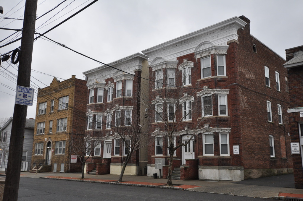

Silver Lake, New Jersey
Silver Lake is a community of 3,917 people in Essex County, New Jersey.
Why visit Silver Lake
Townapedia lists 59 museums and landmarks, 26 parks and trails, 144 places to eat and 11 attractions in and around town.
Highlights include Bridge Street Bridge, Clay Street Bridge, Branch Brook Park and Ambrose-Ward Mansion.
July is the warmest month, with average highs of 87°F; January lows average 25°F, and about 28 inches of snow fall in a normal year.
Weather in Silver Lake
Forecast from the National Weather Service. Full forecast
About Silver Lake
Silver Lake is an unincorporated community and census-designated place (CDP) in Essex County, in the U.S. state of New Jersey, that is split between Belleville (with 3,769 of the CDP's residents) and Bloomfield (474 of the total). As of the 2010 United States census, the CDP's total population was 4,243.
From the Wikipedia article Silver Lake, Essex County, New Jersey (this version), under CC BY-SA 4.0.
Things to do11

Bridge Street Bridge
Bridge · 2.6 mi
Bridge in Newark and Harrison, New Jersey
Clay Street Bridge
Bridge · 2.2 mi
Bridge in United States of America

Columbus Hall
Cinema and theater · 2.6 mi
Building in Orange, New Jersey
De Jessa Memorial Bridge
Bridge · 3.1 mi
Bridge in Nutley and Lyndhurst, New Jersey
Freeman Parkway Bridge
Bridge · 2.0 mi
Deck arch bridge in Glen Ridge, New Jersey, United States

New Jersey Institute of Technology
School · 2.7 mi
Public research university in Newark, New Jersey, USA
New Jersey Route 158
Bridge · 2.8 mi
State highway and bridge in New Jersey
Newark Drawbridge
Bridge · 2.4 mi
Railroad bridge on the Passaic River between Newark and Harrison, New Jersey, U.S.
NJIT School of Management
School · 2.7 mi
Business school in Newark, New Jersey
Route 3 Bridge
Bridge · 2.7 mi
Bridge in Secaucus and East Rutherford, New Jersey, United States
Museums and landmarks59

Branch Brook Park
Monument and historic site · National Register of Historic Places · 0.8 mi
County park of Essex County, New Jersey

Ambrose-Ward Mansion
Monument and historic site · National Register of Historic Places · 2.3 mi
Mansion in East Orange, New Jersey

Ampere
Monument and historic site · National Register of Historic Places · 1.2 mi
Railway station in East Orange, the United States of America

Bloomfield
Monument and historic site · National Register of Historic Places · 1.3 mi
Railroad station in New Jersey

Bloomfield Green Historic District
Monument and historic site · National Register of Historic Places · 1.3 mi
Historic district in Essex County, New Jersey

Brick Church
Monument and historic site · National Register of Historic Places · 2.2 mi
New Jersey Transit rail station
Carnegie Library
Monument and historic site · National Register of Historic Places · 3.1 mi
Historic building in Montclair, New Jersey, United States
Central Presbyterian Church
Monument and historic site · National Register of Historic Places · 3.2 mi
Church building in New Jersey, United States of America
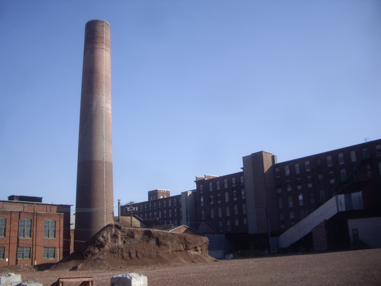
Clark Thread Company Historic District
Monument and historic site · National Register of Historic Places · 2.2 mi
Historic district in New Jersey, United States

Congregational Church
Monument and historic site · National Register of Historic Places · 2.9 mi
Church building in New Jersey, United States of America
Crane House and Museum
Monument and historic site · National Register of Historic Places · 3.0 mi
Historic house in Montclair, New Jersey


Dock Bridge
Monument and historic site · National Register of Historic Places · 3.3 mi
Vertical lift bridges in New Jersey
47 more on the map.
Parks, trails and playgrounds26

Peter Francisco Park
Park · 3.4 mi
Square in Newark, New Jersey, United States


Branch Brook Park
Park · 0.7 mi
A smaller section of Branch Brook Park
Branch Brook Place, Newark
Branch Brook Park Community Garden
Park · 0.6 mi
Small community garden open to all
14 more on the map.
Restaurants and cafes144

El Cafetal
Restaurant · Colombian Restuarant · 1.5 mi
236 Park Avenue, Newark
Su-Th 05:00-21:00; Fr-Sa 05:00-23:00
Max's Restaurant
Restaurant · Philippino · 1.2 mi
65 Belleville Avenue, Bloomfield
Mo-Fr 12:00-18:30; Sa-Su 11:00-18:30
State Street Grill
Restaurant · Diner, Korean · 1.3 mi
9 State Street, Bloomfield
Mo-Th 07:00-23:59, Fr-Sa 07:00-01:00, Su 07:00-23:59


Brisas del Mar Cevicheria
Restaurant · Seafood · 0.9 mi
350 Bloomfield Avenue, Newark
Mo-Su 05:00-21:00
Family Garden
Restaurant · Chinese · 0.9 mi
373 Bloomfield Avenue, Newark
Tu-Th 11:00-22:30; Fr-Sa 11:00-23:00; Su 12:00-22:30
132 more on the map.
Churches and places of worship57
Belleville Avenue Congregational Church
Church · National Register of Historic Places · 1.8 mi
Bethany Baptist Church
Church · National Register of Historic Places · 2.8 mi
House of Prayer Episcopal Church and Rectory
Church · National Register of Historic Places · 2.3 mi
Old First Presbyterian Church
Church · National Register of Historic Places · 3.2 mi
Queen of Angels Church
Church · National Register of Historic Places · 3.3 mi
St. James' A. M. E. Church
Church · National Register of Historic Places · 3.3 mi
St. Mark's Episcopal Church
Church · National Register of Historic Places · 3.0 mi
Stanley Theatre
Church · National Register of Historic Places · 3.4 mi
Shopping34
Gas and EV charging20
Schools, colleges and libraries79
Healthcare16
Atlantic Health Urgent Care
Clinic and pharmacy
135 Bloomfield Avenue, Bloomfield
Forest Hill Pharmacy
Clinic and pharmacy · 1.3 mi
324 Mount Prospect Avenue, Newark
MT. Prospect Pharmacy
Clinic and pharmacy · 0.9 mi
654 Mount Prospect Avenue, Newark
Map of Silver Lake
250 places. The map loads OpenStreetMap tiles when you open it.
Climate by month
Monthly table
| Month | High | Low | Rain | Snow |
|---|---|---|---|---|
| Jan | 39°F | 25°F | 3.7 in | 8.0 in |
| Feb | 42°F | 26°F | 3.3 in | 8.4 in |
| Mar | 50°F | 33°F | 4.3 in | 4.7 in |
| Apr | 62°F | 43°F | 4.1 in | 0.7 in |
| May | 72°F | 54°F | 4.4 in | 0.0 in |
| Jun | 82°F | 63°F | 4.9 in | 0.0 in |
| Jul | 87°F | 69°F | 4.8 in | 0.0 in |
| Aug | 85°F | 67°F | 4.4 in | 0.0 in |
| Sep | 78°F | 60°F | 4.3 in | 0.0 in |
| Oct | 66°F | 48°F | 4.2 in | 0.2 in |
| Nov | 54°F | 38°F | 3.6 in | 0.3 in |
| Dec | 44°F | 30°F | 4.6 in | 5.9 in |
U.S. Climate Normals 1991-2020 for Harrison (3 mi away), NOAA NCEI.
People and cost of living
American Community Survey 5-year estimates, 2020-2024, U.S. Census Bureau. Estimates have margins of error, larger for small towns.
Disaster history
Essex County has had 21 federal disaster declarations since 2000, most often for hurricanes.
- 2021-09-05: Remnants Of Hurricane Ida (Hurricane)
- 2021-09-02: Remnants Of Hurricane Ida (Hurricane)
- 2020-12-11: Tropical Storm Isaias (Hurricane)
- 2020-03-25: Covid-19 Pandemic (Biological)
- 2020-03-13: Covid-19 (Biological)
- 2018-06-08: Severe Winter Storm And Snowstorm (Severe Storm)
OpenFEMA disaster declarations summaries.
Getting there and nearby towns
Newark Liberty International Airport (EWR) is the nearest airport with scheduled flights listed in OpenStreetMap, 6 miles away.
- Ampere North 1 mi southwest, about 1 min by car
- East Orange 2 mi southwest, about 3 min by car
- Glen Ridge 2 mi northwest, about 3 min by car
- East Newark 2 mi southeast, about 4 min by car
- Harrison 3 mi southeast, about 5 min by car
- North Arlington 3 mi east, about 5 min by car
- Newark 4 mi south, about 6 min by car
- Kearny 4 mi southeast, about 6 min by car
- Brookdale 4 mi north, about 6 min by car
- Upper Montclair 4 mi north, about 7 min by car
Drive times are estimates from straight-line distance, not routes.
Local news
Headlines from INDB, the NEMICO news database.
Reviews, tips and questions
Loading what members have shared...
Sources and licences
- NCES EDGE (Public domain): public schools
- NOAA NCEI U.S. Climate Normals 1991-2020 (Public domain): climate by month
- OpenFEMA (Public domain): disaster declarations
- OpenStreetMap contributors (ODbL 1.0): places, airports, map data
- U.S. Census Bureau (Public domain): population, income, housing, education, commute
- Wikidata (CC0 1.0): elevation, founding date, time zone, website, landmarks and historic places
- Wikimedia Commons (see each image): photos
- Wikipedia (CC BY-SA 4.0): overview and history text
Photo credits
- NCS Silver Lake NB shelter jeh, Jim.henderson, Public domain
- Bound Brook Park (13971717804), Hypnotica Studios Infinite from Toms River, New Jersey, USA, CC BY 2.0
- Red Gables Montclair jeh, Jim.henderson, CC0
- Edison labs Main St Lakeside Av jeh, Jim.henderson, CC0
- MontclairNJ PineStreetHD 3, Magicpiano, CC BY-SA 4.0
- 2 Park Place, Newark, NJ, Zeete, CC BY-SA 4.0
- Montclair Congregational PM jeh, Jim.henderson, CC0
- ESSEX CLUB, NEWARK, ESSEX COUNTY, NJ, JERRYE & ROY KLOTZ, M.D., CC BY-SA 4.0
- High Court Sts castle jeh, Jim.henderson, CC0
- St Mark's Episcopal Church October 2013, Mitchazenia, CC BY-SA 3.0
- Firemens Insurance Newark jeh, Jim.henderson, Public domain
- Bloomfield Presby jeh, Jim.henderson, CC0
- ORANGE FREE PUBLIC LIBRARY, ORANGE, ESSEX COUNTY, NJ, JERRYE & ROY KLOTZ, M.D., CC BY-SA 4.0
- First Methodist Church, Montclair, New Jersey, Jrogers123, CC BY-SA 3.0
- Newark Female Charitable Society 305 Halsey, Peter Greenberg, CC BY-SA 4.0
- Newark City Hall Full View, Alexisrael, CC BY-SA 3.0
- QUEEN OF ANGELS CHURCH, NEWARK, ESSEX COUNTY, NJ, JERRYE & ROY KLOTZ, M.D., CC BY-SA 4.0
- ENCLOSURE HISTORIC DISTRICT, NUTLEY, ESSEX COUNTY NJ, JERRYE & ROY KLOTZ, M.D., CC BY-SA 4.0
- Edison Battery 177 Main St Lakeside Av jeh, Jim.henderson, CC0
- John-ballantine-house, Dmadeo, CC BY-SA 4.0
- WILLIAM CLARK HOUSE, NEWARK, ESSEX NJ, JERRYE & ROY KLOTZ, M.D., CC BY-SA 4.0
- House of Prayer CoE Newark sunny jeh, Jim.henderson, CC0
- Ahavas Sholom Newark Front, Peter Greenberg, CC BY-SA 4.0
- Indian and Puritan, Rajkiran Pericherla, CC BY-SA 3.0
- BRICK CHURCH STATION, EAST ORANGE, ESSEX COUNTY, JERRYE & ROY KLOTZ, M.D., CC BY-SA 4.0
- Ampere Station station view, Historic American Buildings Survey, Public domain
- Bloomfield Station, Tlantanu ( talk ), Public domain
- BELLEVILLE AVENUE CONGREGATIONAL CHURCH, NEWARK, ESSEX COUNTY, NJ, JERRYE & ROY KLOTZ, M.D., CC BY-SA 4.0
- BETHANY BAPTIST CHURCH, ESSEX COUNTY, NJ, JERRYE AND ROY KLOTZ, M.D., CC BY-SA 4.0
- Dock Bridge - Newark, NJ, JamesPFisherIII, CC BY 3.0
- Clark-thread-co, Dmadeo, CC BY-SA 4.0
- Broad St Sta Newark tower jeh, Jim.henderson, Public domain
- James AME High Court Sts jeh, Jim.henderson, CC0
- Griffith Building sunny jeh, Jim.henderson, CC BY-SA 4.0
- Belleville Dutch Reform Ch SE cloudy jeh, Jim.henderson, CC0
- Stone Eagles House Montclair, Jared Kofsky/PlaceNJ.com, CC BY-SA 3.0
- Newark Tabernacle Stanley jeh, Jim.henderson, Public domain
- NJ Bell Headquarters Newark (rear), Hudconja, CC BY-SA 3.0
- John Church Newark 1826 Parish jeh, Jim.henderson, CC0
- Newark-broad-street, Unknown author, CC BY 2.0


Page built October 30, 2026. Spotted a mistake? Tell us or suggest a place.