


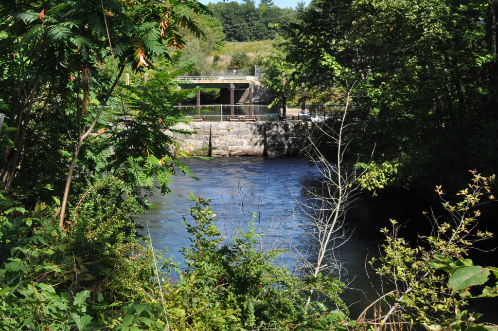

South Windham, Maine
South Windham is a community of 1,212 people in Cumberland County, Maine.
Why visit South Windham
Townapedia lists 4 museums and landmarks, 7 parks and trails, 1 place to eat and 4 attractions in and around town.
Highlights include Babb's Bridge, Crendell Hill, Cumberland and Oxford Canal and Maplewood Farm.
July is the warmest month, with average highs of 80°F; January lows average 11°F.
Weather in South Windham
Forecast from the National Weather Service. Full forecast
About South Windham
South Windham is a census-designated place (CDP) in the town of Windham in Cumberland County, Maine, United States. South Windham is included in the Lewiston-Auburn, Maine metropolitan New England City and Town Area. As of the 2020 census, South Windham had a population of 1,215. Prior to 2010, South Windham was part of the Little Falls-South Windham census-designated place.
From the Wikipedia article South Windham, Maine (this version), under CC BY-SA 4.0.
Things to do4
Babb's Bridge
Bridge · National Register of Historic Places · 2.3 mi
Place in Maine listed on National Register of Historic Places


Museums and landmarks4

Cumberland and Oxford Canal
Monument and historic site · National Register of Historic Places · 0.4 mi
Canal in Cumberland County, Maine, United States of America
Maplewood Farm
Monument and historic site · National Register of Historic Places · 2.4 mi
Human settlement in Windham, Maine, United States of America
Parson Smith House
Monument and historic site · National Register of Historic Places · 2.1 mi
Historic house on River Road in southern Windham, Maine
Parks, trails and playgrounds7


Shaw Park
Park · 1.4 mi
Shaw Park provides access to miles of Maine Mountain Division Trails which can be used for walking, horse back riding, mountain biking,...
55 Partridge Lane, Gorham
sunrise-sunset
Restaurants and cafes1

History
The Presumpscot River was an early transportation corridor to interior Maine; and provided reliable water power at Little Falls. Major William Knight was operating a sawmill at the falls in 1756. As the local forests were cleared, the sawmill was replaced by William Johnson's grist mill and a wool carding mill operated by Leonard Bacon and Lathrop Crockett. Locks were constructed around the falls to complete the Cumberland and Oxford Canal in 1832. The canal fell into disuse after the Portland and Ogdensburg Railway was completed through South Windham in 1875. Maine Central Railroad leased the railway as their Mountain Division in 1888. Availability of year-round transportation encouraged C.A. Brown and Company to build a large brick wood-paper board factory at South Windham in 1875. Androscoggin Pulp Company purchased the factory, and the industrial village of South Windham developed around the pulp mill. On April 4, 1919, the legislature passed an act creating the Reformatory for Men at South Windham. It is now the Maine Correctional Center, a minimum to medium security facility for men and women.
From the History section of South Windham, Maine on Wikipedia, under CC BY-SA 4.0.
Churches and places of worship2
Schools, colleges and libraries14
Westbrook Regional Technology Ctr
School · 5.7 mi
125 Stroudwater Street, Westbrook
Map of South Windham
32 places. The map loads OpenStreetMap tiles when you open it.
Climate by month
Monthly table
| Month | High | Low | Rain |
|---|---|---|---|
| Jan | 29°F | 11°F | 3.5 in |
| Feb | 32°F | 11°F | 3.5 in |
| Mar | 40°F | 20°F | 4.0 in |
| Apr | 53°F | 32°F | 4.4 in |
| May | 65°F | 44°F | 3.6 in |
| Jun | 75°F | 54°F | 4.5 in |
| Jul | 80°F | 60°F | 4.3 in |
| Aug | 80°F | 59°F | 3.6 in |
| Sep | 72°F | 52°F | 4.1 in |
| Oct | 58°F | 40°F | 5.4 in |
| Nov | 45°F | 30°F | 4.3 in |
| Dec | 35°F | 20°F | 4.6 in |
U.S. Climate Normals 1991-2020 for Windham 2Nw (8 mi away), NOAA NCEI.
People and cost of living
American Community Survey 5-year estimates, 2020-2024, U.S. Census Bureau. Estimates have margins of error, larger for small towns.
Disaster history
Cumberland County has had 21 federal disaster declarations since 2000, most often for severe storms.
- 2024-05-24: Severe Winter Storm (Winter Storm)
- 2024-03-20: Severe Storms And Flooding (Severe Storm)
- 2023-09-14: Hurricane Lee (Hurricane)
- 2020-04-04: Covid-19 Pandemic (Biological)
- 2020-03-13: Covid-19 (Biological)
- 2018-01-02: Severe Storm And Flooding (Severe Storm)
OpenFEMA disaster declarations summaries.
Getting there and nearby towns
Portland International Jetport (PWM) is the nearest airport with scheduled flights listed in OpenStreetMap, 9 miles away.
- Gorham 3 mi south, about 5 min by car
- Westbrook 4 mi southeast, about 7 min by car
- North Windham 6 mi north, about 10 min by car
- South Portland 10 mi southeast, about 16 min by car
- Cumberland Center 10 mi northeast, about 16 min by car
- Falmouth 10 mi east, about 16 min by car
- Falmouth Foreside 10 mi east, about 16 min by car
- Oak Hill 11 mi south, about 17 min by car
- Dunstan 12 mi south, about 19 min by car
- Portland 14 mi southeast, about 22 min by car
Drive times are estimates from straight-line distance, not routes.
Local news
Headlines from INDB, the NEMICO news database.
Reviews, tips and questions
Loading what members have shared...
Sources and licences
- NCES EDGE (Public domain): public schools
- NOAA NCEI U.S. Climate Normals 1991-2020 (Public domain): climate by month
- OpenFEMA (Public domain): disaster declarations
- OpenStreetMap contributors (ODbL 1.0): places, airports, map data
- U.S. Census Bureau (Public domain): population, income, housing, education, commute
- Wikidata (CC0 1.0): elevation, founding date, time zone, website, landmarks and historic places
- Wikimedia Commons (see each image): photos
- Wikipedia (CC BY-SA 4.0): overview and history text
Photo credits
- South Windham Community Church and Center, South Windham ME, John Phelan, CC BY-SA 4.0
- WindhamME BabbsBridge 2, Magicpiano, CC BY-SA 3.0
- WindhamME MaplewoodFarm, Magicpiano, CC BY-SA 3.0
- WindhamME ParsonSmithHouse, Magicpiano, CC BY-SA 3.0
- WindhamME CumberlandAndOxfordCanal CanalStreet, Magicpiano, CC BY-SA 3.0
- WindhamME CumberlandAndOxfordCanal CanalStreet 2, Magicpiano, CC BY-SA 3.0
Page built October 30, 2026. Spotted a mistake? Tell us or suggest a place.