


Southport, Connecticut
Southport is a community of 1,568 people in Connecticut, founded in 1639.
Why visit Southport
Townapedia lists 19 museums and landmarks, 33 parks and trails, 37 places to eat and 4 attractions in and around town.
Highlights include Fairfield University, Regina A. Quick Center for the Arts, Pine Creek Park Bridge and Bronson Windmill.
July is the warmest month, with average highs of 83°F; January lows average 24°F, and about 34 inches of snow fall in a normal year.
Weather in Southport
Forecast from the National Weather Service. Full forecast
About Southport
Southport is a census-designated place (CDP) in the town of Fairfield, Connecticut, United States. It is located along Long Island Sound between Mill River and Sasco Brook, where it borders Westport. As of the 2020 census, it had a population of 1,710. Settled in 1639, Southport center has been designated a local historic district since 1967.
From the Wikipedia article Southport, Connecticut (this version), under CC BY-SA 4.0.
Things to do4

Fairfield University
School · 3.2 mi
University located in Fairfield, Connecticut

Regina A. Quick Center for the Arts
Cinema and theater · 2.4 mi
University arts center in Fairfield, Connecticut

Museums and landmarks19

Pine Creek Park Bridge
Bridge · National Register of Historic Places · 1.4 mi
Bridge in United States of America

Bronson Windmill
Monument and historic site · National Register of Historic Places · 2.6 mi
Windmill in Connecticut, United States of America

David Ogden House
Monument and historic site · National Register of Historic Places · 1.8 mi
Historic house in Connecticut, United States

Division Street Historic District
Monument and historic site · National Register of Historic Places · 3.2 mi
Historic district in Connecticut, United States

Fairfield Historic District
Monument and historic site · National Register of Historic Places · 2.0 mi
Listed on the NRHP in Connecticut

Fairfield station
Monument and historic site · National Register of Historic Places · 1.6 mi
Railway station in Fairfield, Connecticut, United States
Greenfield Hill Historic District
Monument and historic site · National Register of Historic Places · 2.8 mi
Historic district in Connecticut, United States
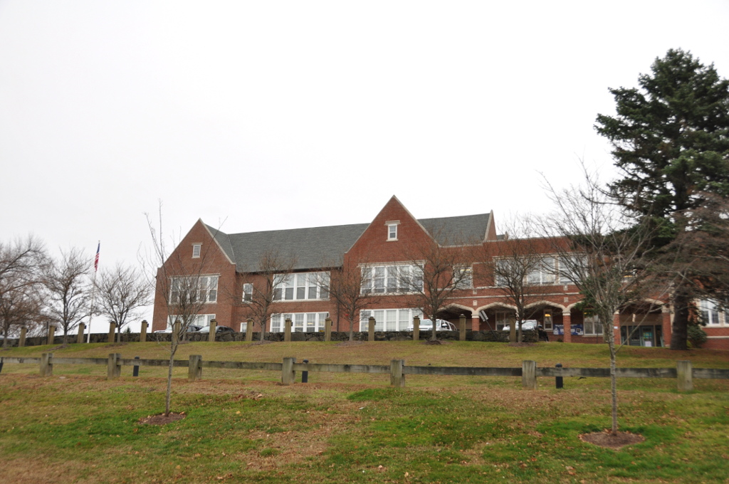
Greens Farms School
Monument and historic site · National Register of Historic Places · 2.0 mi
17 Morningside Dr. South, Westport

John Osborne House
Monument and historic site · National Register of Historic Places · 0.5 mi
Historic house in Connecticut, United States

Jonathan Sturges House
Monument and historic site · National Register of Historic Places · 1.3 mi
Historic house in Connecticut, United States

Mill Cove Historic District
Monument and historic site · National Register of Historic Places · 3.2 mi
Historic district in Connecticut, United States


Restmore
Monument and historic site · National Register of Historic Places · 1.5 mi
Historic house in Connecticut, United States
7 more on the map.
Parks, trails and playgrounds33




H. Smith Richardson Wildlife Preserve and Christmas Tree Farm
Hiking and trails · 1.1 mi
This sanctuary consists of three parcels: A 24-acre Christmas tree farm, a newly restored 14-acre field habitat, and a 36-acre evergreen...
Sasco Creek Road, Westport
21 more on the map.
Restaurants and cafes37



Hungry Pot
Restaurant · Chinese, Korean · 0.6 mi
1860 Post Road East
Mo,Su 12:00-22:30; Tu-Th off; Fr-Sa 12:00-23:00
Mama Chow
Restaurant · Noodles, Ramen, Asian Fusion
3381 Post Road, Fairfield
Tu-Th,Su 11:30-20:30, Fr-Sa 11:30-21:00, Mo closed

Fatto a Mano Bakery
Bakery · 0.7 mi
1835 Post Road East, Westport
We-Fr 08:00-15:00; Sa-Su 08:00-16:00
Kiraku Japanese Asian Grill
Restaurant · Japanese · 1.3 mi
Mo-Th 11:30-22:00; Fr 11:30-23:00; Sa 12:00-23:00; Su 12:30-22:00
Wafu
Restaurant · Asian · 0.5 mi
Mo-Th 11:30-22:00; Fr-Sa 10:30-23:00; Su 12:00-22:00
25 more on the map.
History
The indigenous village of Sasqua, inhabited by Quiripi language speakers, was located in the area. Members of that community later formed the Golden Hill Paugussett Indian Nation.
The earliest recorded event in Southport's history was "The Great Swamp Fight" or "Fairfield Swamp Fight" of July 1637 (not to be confused with the later Great Swamp Fight of King Philip's War), an episode of the Pequot War in which English colonial forces led by John Mason and Roger Ludlow vanquished a band of 80 to 100 Pequot Indians who had earlier fled from their home territory in the Mystic area and taken refuge with approximately 200 Sasqua Indians who inhabited the area that is now Fairfield. The exact location of the battle is unclear, but it is known to have been in the vicinity of Southport. In 1639, Ludlow established the town of Fairfield on the Pequot land known as Unquowa. Colonial deeds of land were signed with the Sasqua in the 1670s.
In the eighteenth century, Mill River village, a part of Fairfield, was a small hamlet of a few houses and a wharf at the mouth of Fairfield's Mill River. Farm products from the surrounding area were shipped from Mill River's small harbor to ports in New York and beyond.
From the History section of Southport, Connecticut on Wikipedia, under CC BY-SA 4.0.
Churches and places of worship5
Shopping11
Gas and EV charging3
Schools, colleges and libraries43
Healthcare6
Passport Health Fairfield Travel Clinic
Clinic and pharmacy · 1.5 mi
140 Sherman Street, Fairfield
Map of Southport
161 places. The map loads OpenStreetMap tiles when you open it.
Climate by month
Monthly table
| Month | High | Low | Rain | Snow |
|---|---|---|---|---|
| Jan | 38°F | 24°F | 3.2 in | 8.5 in |
| Feb | 40°F | 26°F | 3.1 in | 10.7 in |
| Mar | 47°F | 32°F | 4.1 in | 7.0 in |
| Apr | 58°F | 42°F | 4.2 in | 0.9 in |
| May | 68°F | 52°F | 3.6 in | 0.0 in |
| Jun | 78°F | 62°F | 3.8 in | 0.0 in |
| Jul | 83°F | 68°F | 3.3 in | 0.0 in |
| Aug | 82°F | 67°F | 4.0 in | 0.0 in |
| Sep | 75°F | 60°F | 4.0 in | 0.0 in |
| Oct | 64°F | 48°F | 3.8 in | 0.1 in |
| Nov | 54°F | 38°F | 3.1 in | 0.9 in |
| Dec | 44°F | 30°F | 4.0 in | 5.5 in |
U.S. Climate Normals 1991-2020 for Bridgeport Sikorsky Mem Ap 72504 (8 mi away), NOAA NCEI.
People and cost of living
American Community Survey 5-year estimates, 2020-2024, U.S. Census Bureau. Estimates have margins of error, larger for small towns.
Disaster history
The county has had 25 federal disaster declarations since 2000, most often for hurricanes.
- 2024-09-20: Severe Storm, Flooding, Landslides, And Mudslides (Severe Storm)
- 2024-08-21: Severe Storms, Flooding, Landslides, And Mudslides (Severe Storm)
- 2021-10-30: Remnants Of Hurricane Ida (Hurricane)
- 2021-08-22: Hurricane Henri (Hurricane)
- 2021-01-12: Tropical Storm Isaias (Hurricane)
- 2020-08-06: Tropical Storm Isaias (Hurricane)
OpenFEMA disaster declarations summaries.
Getting there and nearby towns
Igor I. Sikorsky Memorial Airport (BDR) is the nearest airport with scheduled flights listed in OpenStreetMap, 9 miles away.
- Poplar Plains 5 mi northwest, about 9 min by car
- Bridgeport 6 mi northeast, about 10 min by car
- Sacred Heart University 6 mi north, about 10 min by car
- Norwalk 7 mi southwest, about 12 min by car
- Trumbull Center 9 mi northeast, about 15 min by car
- Darien Downtown 10 mi southwest, about 17 min by car
- Milford city (balance) 13 mi northeast, about 21 min by car
- Stamford 14 mi west, about 23 min by car
- Shelton 14 mi northeast, about 23 min by car
- Fort Salonga 16 mi south, about 25 min by car
Drive times are estimates from straight-line distance, not routes.
Local news
Headlines from INDB, the NEMICO news database.
Reviews, tips and questions
Loading what members have shared...
Sources and licences
- NCES EDGE (Public domain): public schools
- NOAA NCEI U.S. Climate Normals 1991-2020 (Public domain): climate by month
- OpenFEMA (Public domain): disaster declarations
- OpenStreetMap contributors (ODbL 1.0): places, airports, map data
- U.S. Census Bureau (Public domain): population, income, housing, education, commute
- Wikidata (CC0 1.0): landmarks and historic places
- Wikimedia Commons (see each image): photos
- Wikipedia (CC BY-SA 4.0): overview and history text
Photo credits
- Southport Harbour centre, Connecticut; viewed from Sasco Beach, RGloucester, CC BY-SA 3.0
- Southport Congregational Church 2017, Jllm06, CC BY-SA 4.0
- Southport station westbound platform from westbound train, July 2019, Pi.1415926535, CC BY-SA 3.0
- Southport station eastbound platform from westbound train, July 2019, Pi.1415926535, CC BY-SA 3.0
- Southport station eastbound building from westbound train, July 2019, Pi.1415926535, CC BY-SA 3.0
- Trinity Church (P. E.), Southport, Connecticut 2017, Jllm06, CC BY-SA 4.0
- Southport station postcard, Unknown author Unknown author, Public domain
- FairfleldCT FormerEastboundSouthportRRStation, Magicpiano, CC BY-SA 4.0
- FairfieldCT WestboundSouthportRRStation2, Magicpiano, CC BY-SA 4.0
- FairfieldCT WestboundSouthportRRStation1, Magicpiano, CC BY-SA 4.0
- HABS CONN,1-SOUPO,22- (sheet 2 of 9) - Trinity Church (P. E.), 651 Pequot Road, Southport, Fairfield County, CT, Related names: Nash, Albert C, Public domain
- HABS CONN,1-SOUPO,22A- (sheet 1 of 2) - Trinity Parish Chapel (P. E.), 651 Pequot Road, Southport, Fairfield County, CT, Related names: Disbrow and Taylor, Public domain
- HABS CONN,1-SOUPO,22A- (sheet 2 of 2) - Trinity Parish Chapel (P. E.), 651 Pequot Road, Southport, Fairfield County, CT, Related names: Disbrow and Taylor, Public domain
- HABS CONN,1-SOUPO,22- (sheet 6 of 9) - Trinity Church (P. E.), 651 Pequot Road, Southport, Fairfield County, CT, Related names: Nash, Albert C, Public domain
- HABS CONN,1-SOUPO,22- (sheet 5 of 9) - Trinity Church (P. E.), 651 Pequot Road, Southport, Fairfield County, CT, Related names: Nash, Albert C, Public domain
- HABS CONN,1-SOUPO,22- (sheet 9 of 9) - Trinity Church (P. E.), 651 Pequot Road, Southport, Fairfield County, CT, Related names: Nash, Albert C, Public domain
- HABS CONN,1-SOUPO,22- (sheet 4 of 9) - Trinity Church (P. E.), 651 Pequot Road, Southport, Fairfield County, CT, Related names: Nash, Albert C, Public domain
- HABS CONN,1-SOUPO,22- (sheet 8 of 9) - Trinity Church (P. E.), 651 Pequot Road, Southport, Fairfield County, CT, Related names: Nash, Albert C, Public domain
- HABS CONN,1-SOUPO,22- (sheet 3 of 9) - Trinity Church (P. E.), 651 Pequot Road, Southport, Fairfield County, CT, Related names: Nash, Albert C, Public domain
- HABS CONN,1-SOUPO,22- (sheet 1 of 9) - Trinity Church (P. E.), 651 Pequot Road, Southport, Fairfield County, CT, Related names: Nash, Albert C, Public domain
- Pine creek park bridge, Wahrnehmer, CC BY-SA 4.0
- Jonathan Sturges House 074, Pedro Xing, CC0
- Southport Congregational Church, 1966, Jack Boucher, Public domain
- David Ogden House HABS 1938, Everett H. Keeler, Public domain
- BridgeportCT DivisionStreetHD CottageStreet, User:Magicpiano, CC BY-SA 4.0
- RESTMORE, FAIRFIELD COUNTY, CT, JERRYE & ROY KLOTZ, M.D., CC BY-SA 4.0
- Fairfield station from southbound train (2), July 2019, Pi.1415926535, CC BY-SA 3.0
- WestportCT MillCoveHD, Magicpiano, CC BY-SA 3.0
- JOHN OSBORNE HOUSE, FAIRFIELD COUNTY, CT, JERRYE & ROY KLOTZ, M.D., CC BY-SA 4.0
- Frederic Bronson Windmill, 3015 Bronson Road, Fairfield (Fairfield County, Connecticut), Jack Boucher, Public domain
- WestportCT GreenFarmsSchool, Magicpiano, CC BY-SA 3.0
- Connecticut Audubon Birdcraft Museum Exterior, Jllm06, Public domain
- Bellarmine Hall at Fairfield University, CT, Zeete, CC BY-SA 4.0
- Quick Center for the Arts, Stagophile, CC BY-SA 3.0
- Fairfield Entrance, Stagophile ( talk ), CC BY-SA 3.0
- Fairfield Museum Front Exterior, Jllm06, Public domain
- Trinity Parish Chapel, 2017, Jllm06, CC BY-SA 4.0
- Copy of Mr William Shakespear's Comedies, Histories and Tragedies, Mikael Häggström , M.D. Author info - Reusing images - Conflicts of interest: None Mikael Häggström , M.D., CC0
- Pequot Library 2017 exterior, Jllm06, CC BY-SA 4.0
- 1967 Oldsmobile Cutlass 4 d. hardtop, That Hartford Guy from Hartford, Connecticut, USA, CC BY-SA 2.0


Page built October 30, 2026. Spotted a mistake? Tell us or suggest a place.