
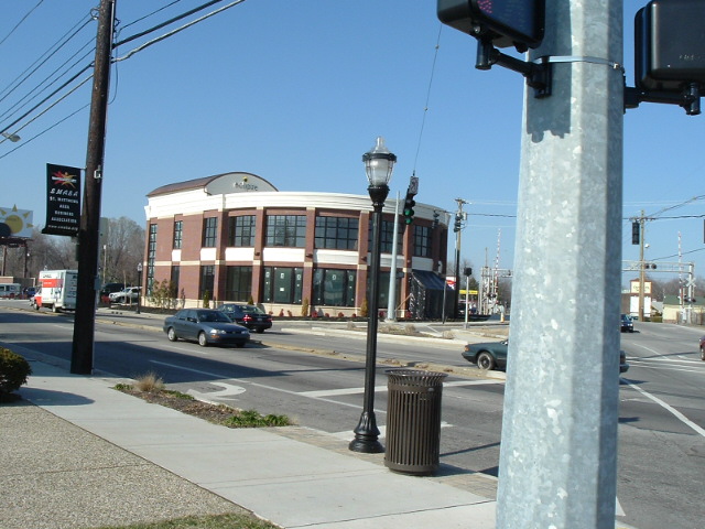


St. Matthews, Kentucky
St. Matthews is a city of 17,577 people in Jefferson County, Kentucky, founded in 1950.
Why visit St. Matthews
Townapedia lists 33 museums and landmarks, 9 parks and trails, 132 places to eat, 6 places to stay and 3 attractions in and around town.
Highlights include Cinemark Mall St. Matthews and XD;Cinemark St. Matthews, Village 8, Bellevoir-Ormsby Village and Bowman Field.
July is the warmest month, with average highs of 88°F; January lows average 27°F.
Weather in St. Matthews
Forecast from the National Weather Service. Full forecast
About St. Matthews
St. Matthews is a city in Jefferson County, Kentucky, United States. It forms part of the Louisville Metro government but is separately incorporated as a home rule-class city. As of the 2020 census, St. Matthews had a population of 17,534. It is the 23rd-largest city in the state.
From the Wikipedia article St. Matthews, Kentucky (this version), under CC BY-SA 4.0.
Things to do3

Cinemark Mall St. Matthews and XD;Cinemark St. Matthews
Cinema and theater · 0.7 mi
5000 Shelbyville Road, Louisville
Museums and landmarks33

Bellevoir-Ormsby Village
Monument and historic site · National Register of Historic Places · 3.6 mi
Historic house in Kentucky, United States
Bowman Field
Monument and historic site · National Register of Historic Places · 2.0 mi
Public airport in Louisville, Kentucky, United States
Boxhill
Monument and historic site · National Register of Historic Places · 3.8 mi
House in Glenview, Kentucky
Bray Place
Monument and historic site · National Register of Historic Places · 3.3 mi
Louisville, KY, listed on the NRHP in Kentucky
Bullock-Clifton House
Monument and historic site · National Register of Historic Places · 4.0 mi
Historic house in Kentucky, United States
Commodore Apartment Building
Monument and historic site · National Register of Historic Places · 3.6 mi
Building in Bonnycastle, Kentucky, United States
Crescent Hill
Monument and historic site · National Register of Historic Places · 3.5 mi
Human settlement in Louisville, Kentucky, United States of America


Crescent Hill Branch Library
Monument and historic site · National Register of Historic Places · 2.9 mi
Library
Crescent Hill Reservoir
Monument and historic site · National Register of Historic Places · 2.3 mi
Historic reservoir in Louisville, Kentucky, USA
Dr. John Lewis House
Monument and historic site · National Register of Historic Places · 0.8 mi
Listed on the National Register of Historic Places (NRHP) in St. Matthews, Kentucky
Farmington
Monument and historic site · National Register of Historic Places · 2.9 mi
Historic site in Louisville, Kentucky
Hikes-Hunsinger House
Monument and historic site · National Register of Historic Places · 2.9 mi
House in Louisville, United States of America
21 more on the map.
Parks, trails and playgrounds9

Seneca Park
Park · 1.9 mi
Park in Kentucky, United States of America, United States of America
06:00-23:00


Restaurants and cafes132

Buffalo Wild Wings
Restaurant · Wings · 0.5 mi
Sports bar
4600 Shelbyville Road, St Matthews
Su 11:00-24:00, Mo-Th 11:00-01:00, Fr-Sa 11:00-02:00

Baskin-Robbins
Ice cream · Ice Cream · 2.1 mi
3959 Taylorsville Road, Louisville
Mo-Th 11:00-21:30; Fr-Sa 11:00-22:00; Su 11:00-21:30

Heine Brothers'
Cafe · Coffee Shop · 1.1 mi
119 Chenoweth Lane, Louisville
Mo-Fr 06:00-21:00; Sa 06:30-21:00; Su 07:00-21:00
Heine Brothers' Coffee
Cafe · Coffee Shop
4305 Shelbyville Road, Louisville
Mo-Th 06:00-20:00; Fr 06:00-20:00; Sa 06:30-20:00; Su 07:00-20:00
Jet's Pizza
Restaurant · Pizza
101 South Hubbards Lane, Louisville
Mo-Th 10:00-22:00; Fr-Sa 10:00-23:00; Su 11:00-22:00
Taco Luchador
Restaurant · Mexican · 0.9 mi
112 Meridian Avenue, Louisville
Mo-Th 11:00-21:30; Fr 11:00-22:00; Sa 12:00-22:00; Su 12:00-21:00
The Capital Grille
Restaurant · Steak House · 1.4 mi
7600 Shelbyville Road, Louisville
Mo-Th 11:30-21:00; Fr 11:30-22:00; Sa 16:00-22:00; Su 16:00-21:00

The Cheesecake Factory
Diner · American · 0.8 mi
5000 Shelbyville Road, Louisville
Mo-Th 11:00-22:00; Fr-Sa 11:00-23:00; Su 10:00-22:00
120 more on the map.
History
Dating the arrival of American Indians to present-day Kentucky remains controversial, with estimates ranging from 40,000 to 10,000 years before the present. As with later European cultures, indigenous cultures were often divided near the falls of the Ohio River, which marked a transition zone in travel and settlement. During the late Woodland period (c. 1st century), this area was between the Ohioan Hopewell culture and the Illinois Crab Orchard culture that extended to the west. Later (c. 1200), it was the boundary between the Mississippian and Fort Ancient cultures. During the 18th century, the area was claimed by various Indian tribes, including the Shawnee from the northwest and the Iroquois to the east; based in New York and Pennsylvania, the Iroquois used the Ohio Valley as a hunting ground by right of conquest.
From the History section of St. Matthews, Kentucky on Wikipedia, under CC BY-SA 4.0.
Where to stay6
Hawthorn Suites by Wyndham Louisville East
Motel and hotel · 0.8 mi
751 Cypress Station Drive, Louisville
Hilton Garden Inn Louisville Mall of St. Matthews
Motel and hotel · 0.6 mi
400 Sherburn Lane, St Matthews
Crossland Economy Studios - Louisville - St. Matthews
Motel and hotel · 1.0 mi
1401 Browns Lane, St Matthews
Extended Stay America - Louisville - Dutchman
Motel and hotel · 1.4 mi
6101 Dutchmans Lane, St Matthews
Churches and places of worship33
Saint Francis of Assisi Complex
Church · National Register of Historic Places · 3.6 mi
Our Lady of Lourdes Catholic Church
Church · Roman Catholic · 0.7 mi
508 Breckenridge Lane, St Matthews
Saint Albert the Great Catholic Church
Church · Roman Catholic · 1.8 mi
1395 Girard Drive, Graymoor/Devondale
Beechwood Baptist Church
Church · Baptist · 0.6 mi
201 Biltmore Road, Beechwood Village
Breckenridge Chapel Free Methodist Church
Church · Methodist · 0.7 mi
239 Breckenridge Lane, St Matthews
Broadway Baptist Church
Church · Baptist · 1.7 mi
4000 Brownsboro Road, Druid Hills
Drepung Gomang Center For Engaging Compassion
Place of worship · Jehovahs Witness · 1.1 mi
411 North Hubbards Lane, St Matthews
Shopping42
Gas and EV charging10
Schools, colleges and libraries56
Healthcare12
UofL Health - Medical Center East Emergency Department
Clinic and pharmacy · 1.2 mi
3920 Dutchmans Lane, St Matthews
Map of St. Matthews
250 places. The map loads OpenStreetMap tiles when you open it.
Climate by month
Monthly table
| Month | High | Low | Rain |
|---|---|---|---|
| Jan | 43°F | 27°F | 3.3 in |
| Feb | 48°F | 30°F | 3.3 in |
| Mar | 57°F | 38°F | 4.4 in |
| Apr | 69°F | 48°F | 4.7 in |
| May | 77°F | 57°F | 5.2 in |
| Jun | 85°F | 66°F | 4.7 in |
| Jul | 88°F | 69°F | 4.6 in |
| Aug | 87°F | 68°F | 3.5 in |
| Sep | 81°F | 60°F | 3.6 in |
| Oct | 69°F | 48°F | 3.6 in |
| Nov | 57°F | 38°F | 3.4 in |
| Dec | 46°F | 31°F | 3.9 in |
U.S. Climate Normals 1991-2020 for Louisville Bowman Fld (2 mi away), NOAA NCEI.
People and cost of living
American Community Survey 5-year estimates, 2020-2024, U.S. Census Bureau. Estimates have margins of error, larger for small towns.
Disaster history
Jefferson County has had 19 federal disaster declarations since 2000, most often for severe storms.
- 2026-01-24: Severe Winter Storm (Winter Storm)
- 2025-04-24: Severe Storms, Straight-Line Winds, Tornadoes, Flooding, Landslides, And Mudslides (Severe Storm)
- 2025-04-03: Severe Storms, Straight-Line Winds, Tornadoes, And Flooding (Severe Storm)
- 2025-02-24: Severe Storms, Straight-Line Winds, Flooding, Landslides, And Mudslides (Severe Storm)
- 2025-02-16: Severe Storms, Straight-Line Winds, Flooding, And Landslides (Severe Storm)
- 2024-05-22: Severe Storms, Straight-Line Winds, Tornadoes, Landslides, And Mudslides (Severe Storm)
OpenFEMA disaster declarations summaries.
Getting there and nearby towns
Bowman Field (LOU) is the nearest airport with scheduled flights listed in OpenStreetMap, 2 miles away.
- Lyndon 3 mi east, about 5 min by car
- Jeffersontown 5 mi southeast, about 8 min by car
- Louisville/Jefferson County 6 mi south, about 9 min by car
- Jeffersonville 7 mi northwest, about 11 min by car
- Clarksville 9 mi northwest, about 14 min by car
- New Albany 11 mi northwest, about 18 min by car
- Sellersburg 13 mi northwest, about 21 min by car
- Mount Washington 15 mi south, about 24 min by car
- La Grange 17 mi northeast, about 28 min by car
- Bardstown 31 mi south, about 51 min by car
Drive times are estimates from straight-line distance, not routes.
Local news
Headlines from INDB, the NEMICO news database.
Reviews, tips and questions
Loading what members have shared...
Sources and licences
- NCES EDGE (Public domain): public schools
- NOAA NCEI U.S. Climate Normals 1991-2020 (Public domain): climate by month
- OpenFEMA (Public domain): disaster declarations
- OpenStreetMap contributors (ODbL 1.0): places, airports, map data
- U.S. Census Bureau (Public domain): population, income, housing, education, commute
- Wikidata (CC0 1.0): elevation, founding date, time zone, website, landmarks and historic places
- Wikimedia Commons (see each image): photos
- Wikipedia (CC BY-SA 4.0): overview and history text
Photo credits
- Wefaqfa, Angry Aspie ( talk ), CC BY 3.0
- Midlands, Louisville, Nyttend, Public domain
- Zachary Taylor House 1, The original uploader was Bedford at English Wikipedia ., Public domain
- Steam Engine 20, 1735 Bardstown, Nyttend, Public domain
- Willam R. Belknap School, Nyttend, Public domain
- Locust Grove, Louisville, William Gus Johnson, Public domain
- St Francis on Bardstown in Louisville, Nyttend, Public domain
- Lincliff gates, Nyttend, Public domain
- Louisville Crescent Hill Branch library, Zepfanman.com, CC BY 2.0
- Theodore Brown House Louisville KY Flickr, w.marsh (for both houses) on Flickr, CC BY 2.0
- Winchester House Louisville KY Flickr, w.marsh on Flickr, CC BY 2.0
- James Brown House Louisville KY Flickr, w.marsh (for both houses) on Flickr, CC BY 2.0
- Dr John Lewis House Flickr, w.marsh, CC BY 2.0
- Ridgeway, Louisville, Jack Boucher, Public domain
- Wright Tower (Kaden Tower), Dutchmans Lane, Bowman, Louisville, KY - 54034280678, w_lemay, CC BY-SA 2.0
- Podium, Wright Tower (Kaden Tower), Dutchmans Lane, Bowman, Louisville, KY - 54034026666, w_lemay, CC BY-SA 2.0
- Podium, Wright Tower (Kaden Tower), Dutchmans Lane, Bowman, Louisville, KY - 54034026641, w_lemay, CC BY-SA 2.0
- Wright Tower (Kaden Tower), Dutchmans Lane, Bowman, Louisville, KY - 54034280778, w_lemay, CC BY-SA 2.0
- Wright Tower (Kaden Tower), Dutchmans Lane, Bowman, Louisville, KY, w_lemay, CC BY-SA 2.0
- Wright Tower (Kaden Tower), Dutchmans Lane, Bowman, Louisville, KY - 54034280273, w_lemay, CC BY-SA 2.0
- Wright Tower (Kaden Tower), Dutchmans Lane, Bowman, Louisville, KY - 54033162362, w_lemay, CC BY-SA 2.0
- Wright Tower (Kaden Tower), Dutchmans Lane, Bowman, Louisville, KY - 54033162392, w_lemay, CC BY-SA 2.0
- Podium, Wright Tower (Kaden Tower), Dutchmans Lane, Bowman, Louisville, KY - 54033162492, w_lemay, CC BY-SA 2.0
- Podium, Wright Tower (Kaden Tower), Dutchmans Lane, Bowman, Louisville, KY - 54034026616, w_lemay, CC BY-SA 2.0
- Wright Tower (Kaden Tower), Dutchmans Lane, Bowman, Louisville, KY - 54034360529, w_lemay, CC BY-SA 2.0
- Wright Tower (Kaden Tower), Dutchmans Lane, Bowman, Louisville, KY - 54034482920, w_lemay, CC BY-SA 2.0
- Wright Tower (Kaden Tower), Dutchmans Lane, Bowman, Louisville, KY - 54033161927, w_lemay, CC BY-SA 2.0
- Wright Tower (Kaden Tower), Dutchmans Lane, Bowman, Louisville, KY - 54034360004, w_lemay, CC BY-SA 2.0
- Wright Tower (Kaden Tower), Dutchmans Lane, Bowman, Louisville, KY - 54034359854, w_lemay, CC BY-SA 2.0
- Wright Tower (Kaden Tower), Dutchmans Lane, Bowman, Louisville, KY - 54034279938, w_lemay, CC BY-SA 2.0
- Wright Tower (Kaden Tower), Dutchmans Lane, Bowman, Louisville, KY - 54034359619, w_lemay, CC BY-SA 2.0
- Wright Tower (Kaden Tower), Dutchmans Lane, Bowman, Louisville, KY - 54034359689, w_lemay, CC BY-SA 2.0
- Podium, Wright Tower (Kaden Tower), Dutchmans Lane, Bowman, Louisville, KY, w_lemay, CC BY-SA 2.0
- Walkway, Wright Tower (Kaden Tower), Dutchmans Lane, Bowman, Louisville, KY - 54034481870, w_lemay, CC BY-SA 2.0
- Wright Tower (Kaden Tower), Dutchmans Lane, Bowman, Louisville, KY - 54034360654, w_lemay, CC BY-SA 2.0
- Wright Tower (Kaden Tower), Dutchmans Lane, Bowman, Louisville, KY - 54034360709, w_lemay, CC BY-SA 2.0
- Wright Tower (Kaden Tower), Dutchmans Lane, Bowman, Louisville, KY - 54034279693, w_lemay, CC BY-SA 2.0
- Podium, Wright Tower (Kaden Tower), Dutchmans Lane, Bowman, Louisville, KY - 54034280983, w_lemay, CC BY-SA 2.0
- Podium, Wright Tower (Kaden Tower), Dutchmans Lane, Bowman, Louisville, KY - 54033163017, w_lemay, CC BY-SA 2.0
- Podium, Wright Tower (Kaden Tower), Dutchmans Lane, Bowman, Louisville, KY - 54033161407, w_lemay, CC BY-SA 2.0


Page built October 30, 2026. Spotted a mistake? Tell us or suggest a place.