


Sturbridge, Massachusetts
Sturbridge is a community of 2,443 people in Worcester County, Massachusetts.
Why visit Sturbridge
Townapedia lists 101 museums and landmarks, 13 parks and trails, 29 places to eat, 12 places to stay and 4 attractions in and around town.
Highlights include American Optical Company Historic District, Central Mills Historic District, Capen Hill Nature Sanctuary and Dresser Memorial Park.
July is the warmest month, with average highs of 81°F; January lows average 17°F, and about 52 inches of snow fall in a normal year.
Weather in Sturbridge
Forecast from the National Weather Service. Full forecast
About Sturbridge
Sturbridge is a census-designated place (CDP) in the town of Sturbridge in Worcester County, Massachusetts, United States. The population was 2,253 at the 2010 census.
From the Wikipedia article Sturbridge (CDP), Massachusetts (this version), under CC BY-SA 4.0.
Things to do4


Museums and landmarks101

American Optical Company Historic District
Monument and historic site · National Register of Historic Places · 2.2 mi
Historic district in Southbridge, Massachusetts

Central Mills Historic District
Monument and historic site · National Register of Historic Places · 1.8 mi
Historic district in Massachusetts, United States

Globe Village Fire House
Monument and historic site · National Register of Historic Places · 1.3 mi
Fire station in Southbridge, United States of America
11 West Street
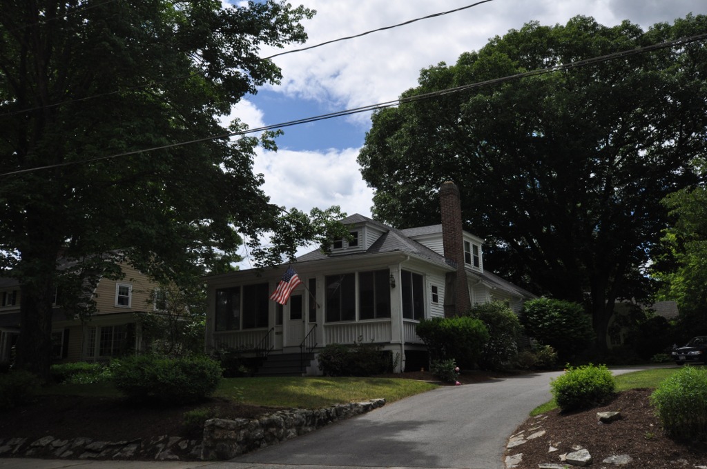
Glover Street Historic District
Monument and historic site · National Register of Historic Places · 1.6 mi
Historic district in Massachusetts, United States

Holy Trinity Episcopal Church
Monument and historic site · Episcopal · National Register of Historic Places · 1.3 mi
Church building in Massachusetts, United States
446 Hamilton Street

Southbridge station
Monument and historic site · National Register of Historic Places · 1.8 mi
Former railway station in Southbridge, Massachusetts, US
6 Larochelle Way

Sturbridge Common Historic District
Monument and historic site · National Register of Historic Places · 1.4 mi
Historic district in Massachusetts, United States

Upper Chapin Street Historic District
Monument and historic site · National Register of Historic Places · 1.9 mi
Historic district in Massachusetts, United States


Windsor Court Historic District
Monument and historic site · National Register of Historic Places · 1.9 mi
Southbridge, MA, listed on the NRHP in Massachusetts

A. Kinney House
Monument and historic site · National Register of Historic Places · 1.6 mi
House in Southbridge, Massachusetts
Academie Brochu
Monument and historic site · National Register of Historic Places · 1.5 mi
School building in Southbridge, Massachusetts
Albert H. Wheeler House
Monument and historic site · National Register of Historic Places · 1.5 mi
House in Southbridge, Massachusetts
89 more on the map.
Parks, trails and playgrounds13

Capen Hill Nature Sanctuary
Park · 3.7 mi
Nature reserve in Charlton, Massachusetts


1 more on the map.
Restaurants and cafes29

Annie's Country Kitchen
Diner · American · 0.7 mi
140 Main Street, Sturbridge
Mo-Tu 05:00-14:00; We-Fr 05:00-19:00; Sa 05:00-12:00; Su 06:00-12:00

Thai Place Sturbridge
Restaurant · Thai · 2.2 mi
Mo-We 11:30-21:00;Th-Fr 11:30-22:00;Sa 12:00-22:00;Su 12:00-21:00
Cracker Barrel
Diner · American · 1.4 mi
215 Charlton Road
06:00-22:00; Fr, Sa 06:00-23:00


17 more on the map.
Where to stay12
Churches and places of worship12
Notre Dame Catholic Church
Church · Roman Catholic · National Register of Historic Places · 1.6 mi
446 Main Street, Southbridge
Elm Street Congregational Church
Church · United Church Of Christ · 2.0 mi
61 Elm Street, Southbridge
Congregational Church
Church · National Register of Historic Places · 2.0 mi
St. George's Greek Orthodox Church
Church · National Register of Historic Places · 1.9 mi
Shopping9
Gas and EV charging9
Schools, colleges and libraries22
Bay Path Regional Vocational Technical High School
School · 5.6 mi
57 Old Muggett Hill Road, Charlton
Healthcare4
Map of Sturbridge
215 places. The map loads OpenStreetMap tiles when you open it.
Climate by month
Monthly table
| Month | High | Low | Rain | Snow |
|---|---|---|---|---|
| Jan | 35°F | 17°F | 4.0 in | 14.7 in |
| Feb | 36°F | 18°F | 3.5 in | 14.7 in |
| Mar | 45°F | 25°F | 4.6 in | 9.2 in |
| Apr | 58°F | 35°F | 4.4 in | 1.8 in |
| May | 68°F | 46°F | 3.7 in | 0.0 in |
| Jun | 77°F | 55°F | 4.4 in | 0.0 in |
| Jul | 81°F | 60°F | 4.3 in | 0.0 in |
| Aug | 79°F | 59°F | 4.4 in | 0.0 in |
| Sep | 72°F | 51°F | 4.2 in | 0.0 in |
| Oct | 59°F | 39°F | 5.0 in | 0.2 in |
| Nov | 49°F | 31°F | 4.1 in | 1.5 in |
| Dec | 39°F | 23°F | 5.1 in | 10.3 in |
U.S. Climate Normals 1991-2020 for Southbridge 3 Sw (3 mi away), NOAA NCEI.
People and cost of living
American Community Survey 5-year estimates, 2020-2024, U.S. Census Bureau. Estimates have margins of error, larger for small towns.
Disaster history
Worcester County has had 24 federal disaster declarations since 2000, most often for severe storms.
- 2024-05-15: Severe Storms And Flooding (Flood)
- 2023-09-15: Hurricane Lee (Hurricane)
- 2020-03-27: Covid-19 Pandemic (Biological)
- 2020-03-13: Covid-19 (Biological)
- 2018-07-19: Severe Winter Storm And Snowstorm (Snowstorm)
- 2015-04-13: Severe Winter Storm, Snowstorm, And Flooding (Severe Storm)
OpenFEMA disaster declarations summaries.
Getting there and nearby towns
Worcester Regional Airport (ORH) is the nearest airport with scheduled flights listed in OpenStreetMap, 15 miles away.
- Southbridge Town 3 mi southeast, about 5 min by car
- Fiskdale 3 mi northwest, about 6 min by car
- Holland 6 mi southwest, about 9 min by car
- Quinebaug 9 mi southeast, about 14 min by car
- East Brookfield 9 mi north, about 15 min by car
- Webster 10 mi east, about 16 min by car
- North Grosvenor Dale 11 mi southeast, about 18 min by car
- North Brookfield 12 mi north, about 20 min by car
- Monson Center 12 mi west, about 20 min by car
- Palmer Town 14 mi northwest, about 23 min by car
Drive times are estimates from straight-line distance, not routes.
Local news
Headlines from INDB, the NEMICO news database.
Reviews, tips and questions
Loading what members have shared...
Sources and licences
- NCES EDGE (Public domain): public schools
- NOAA NCEI U.S. Climate Normals 1991-2020 (Public domain): climate by month
- OpenFEMA (Public domain): disaster declarations
- OpenStreetMap contributors (ODbL 1.0): places, airports, map data
- U.S. Census Bureau (Public domain): population, income, housing, education, commute
- Wikidata (CC0 1.0): elevation, founding date, time zone, website, landmarks and historic places
- Wikimedia Commons (see each image): photos
- Wikipedia (CC BY-SA 4.0): overview and history text
Photo credits
- Sturbridge Town Hall - Sturbridge, Massachusetts - DSC05959, Daderot, CC0
- Shaw's (Sturbridge, Massachusetts) (50213005397), JJBers from Willimantic, Connecticut, USA, CC BY 2.0
- East Main Street, Sturbridge - postcard, Unknown author Unknown author, Public domain
- Grand Trunk Trail bench, Sturbridge MA, John Phelan, CC BY-SA 4.0
- Swamp in McKinstry Brook WMA Sturbridge 2025-03-02, Peter Cooper Jr., CC0
- Charlton–Sturbridge boundary marker on discontinued Berry Corner Road, Peter Cooper Jr., CC0
- Sturbridge Common from MA 131, April 2025, Mr. Matté (if there is an issue with this image, contact me using this image's Commons talk page , my Commons user talk page , or my English Wikipedia user talk page ; I'll know about it a lot faster), CC BY-SA 4.0
- Notre Dame Southbridge, Marcbela (Marc N. Belanger), Public domain
- Southbridge Town Hall, Marcbela (Marc N. Belanger), Public domain
- Southbridge station from the southwest, June 2021, Pi.1415926535, CC BY-SA 4.0
- Evangelical Free Church, Southbridge, MA - DSC02659, Daderot, CC0
- Central Mills Southbridge, Marcbela (Marc N. Belanger), Public domain
- SouthbridgeMA 100 GloverStreet, User:Magicpiano, CC BY-SA 4.0
- Federated Church of Sturbridge and Fiskdale, Sturbridge MA, John Phelan, CC BY-SA 3.0
- SouthbridgeMA WindsorCourt, User:Magicpiano, CC BY-SA 4.0
- Globe Village Fire House, Southbridge MA, John Phelan, CC BY-SA 3.0
- American Optical Company, Southbridge, MA - DSC02699, Daderot, CC0
- House on Chapin Street at Forest Avenue, Southbridge MA, John Phelan, CC BY-SA 3.0
- 59-63 Crystal Street, Southbridge MA, John Phelan, CC BY-SA 3.0
- Congregational Church, Southbridge MA, John Phelan, CC BY 3.0
- 386 Main Street, Southbridge MA, John Phelan, CC BY-SA 3.0
- Henry E. Durfee Farmhouse, Southbridge, MA - DSC02639, Daderot, CC0
- Comins-Wall House, Southbridge MA, John Phelan, CC BY 3.0
- H.C. Wells Double House, Southbridge MA, John Phelan, CC BY 3.0
- Napoleon LaRochelle Two-Family House, Southbridge, MA - DSC02666, Daderot, CC0
- 18 Walnut Street, Southbridge MA, John Phelan, CC BY-SA 3.0
- SouthbridgeMA DunbarVintonHouse, User:Magicpiano, CC BY-SA 4.0
- William E. Alden House, Southbridge MA, John Phelan, CC BY-SA 3.0
- Samuel C. Hartwell House, Southbridge MA, John Phelan, CC BY 3.0
- H. Morse House, Southbridge MA, John Phelan, CC BY 3.0
- SouthbridgeMA ChamberlainBordeauHouse, User:Magicpiano, CC BY-SA 4.0
- SouthbridgeMA LorenzoRStoneHouse, User:Magicpiano, CC BY-SA 4.0
- Alexis Boyer House, Southbridge MA, John Phelan, CC BY-SA 3.0
- J.M. Cheney Rental House, Southbridge MA, John Phelan, CC BY 3.0
- Mary E. Wells School 1918, Unknown author, Public domain
- Hamilton Woolen Mill Southbridge, Marcbela (Marc N. Belanger), Public domain
- SouthbridgeMA GeorgeHHartwellHouse, User:Magicpiano, CC BY-SA 4.0
- 16 High Street, Southbridge MA, John Phelan, CC BY-SA 3.0
- Smith-Lyon Farmhouse, Southbridge, MA - DSC02632, Daderot, CC0
- Beechwood, Southbridge MA, John Phelan, CC BY 3.0


Page built October 30, 2026. Spotted a mistake? Tell us or suggest a place.