


Takoma Park, Maryland
Takoma Park is a city of 17,632 people in Montgomery County, Maryland, founded in April 3, 1890.
Why visit Takoma Park
Townapedia lists 67 museums and landmarks, 70 parks and trails, 175 places to eat, 6 places to stay and 15 attractions in and around town.
Highlights include Regal Majestic 20, 16th Street Bridge, Adams Memorial and Armed Forces Retirement Home-Washington.
July is the warmest month, with average highs of 90°F; January lows average 28°F.
Weather in Takoma Park
Forecast from the National Weather Service. Full forecast
About Takoma Park
Takoma Park is a city in Montgomery County, Maryland, United States. It is a suburb of Washington, D.C., and part of the Washington metropolitan area. Founded in 1883 and incorporated in 1890, Takoma Park, informally called "Azalea City", is a Tree City USA and a nuclear-free zone. A planned commuter suburb, it is situated along the Metropolitan Branch of the historic Baltimore and Ohio Railroad, just northeast of Washington, D.C., and it shares a border and history with the adjacent Washington, D.C. neighborhood of Takoma.
From the Wikipedia article Takoma Park, Maryland (this version), under CC BY-SA 4.0.
Things to do15


16th Street Bridge
Bridge · 3.4 mi
Bridge in United States of America
AFI Silver Theatre
Cinema and theater · 1.7 mi
Movie theater in Silver Spring, Maryland, United States
Boulder Bridge
Bridge · 3.2 mi
Historic bridge in Washington, D.C., United States
Carroll Avenue Bridge
Bridge
Bridge in Takoma Park, Maryland, United States
Carter Barron Amphitheatre
Cinema and theater · 3.0 mi
Concert venue in Washington, D.C., United States of America
Clarice Smith Performing Arts Center
Cinema and theater · 2.9 mi
Theater and concert hall of the University of Maryland in College Park, Maryland, United States

School of Nursing at The Catholic University of America
School · 3.3 mi
Nursing school of Washington, D.C., U.S
Talbot Avenue bridge
Bridge · 2.7 mi
Bridge in United States of America
University of Maryland
School · 3.3 mi
Public research university in the city of College Park in Prince George's County, Maryland, USA
University of Maryland Global Campus
School · 2.5 mi
One of 11 degree-granting institutions within the University System of Maryland
3 more on the map.
Museums and landmarks67

Adams Memorial
Monument and historic site · National Register of Historic Places · 2.3 mi
Artwork by Augustus Saint-Gaudens
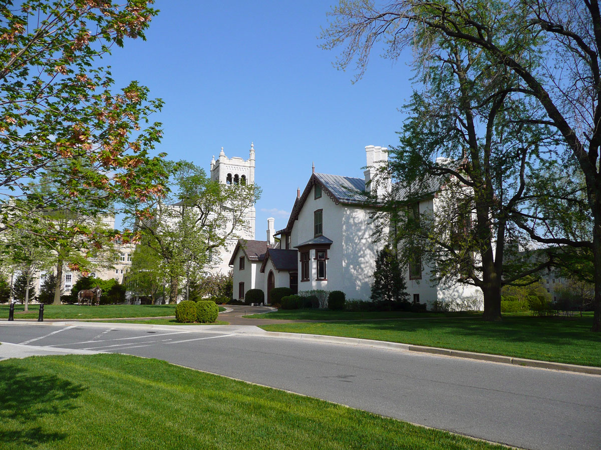
Armed Forces Retirement Home-Washington
Monument and historic site · National Register of Historic Places · 3.1 mi
United States historic place

Ash Hill
Monument and historic site · National Register of Historic Places · 2.3 mi
House in Hyattsville, Maryland, United States

Battleground National Cemetery
Monument and historic site · National Register of Historic Places · 1.5 mi
American Civil War burial ground of Union Army soldiers in Washington, D.C., US

Boulder Bridge and Ross Drive Bridge
Monument and historic site · National Register of Historic Places · 3.2 mi
Bridges in Washington, D.C.

Brooks Mansion
Monument and historic site · National Register of Historic Places · 3.3 mi
Greek Revival plantation house

Cady-Lee
Monument and historic site · National Register of Historic Places · 0.9 mi
Historic house in Washington, D.C., United States

Capital Traction Company Car Barn
Monument and historic site · National Register of Historic Places · 2.8 mi
Tram shed in Washington, D.C.

Children's Country Home
Monument and historic site · National Register of Historic Places · 3.0 mi
Hospital
College Heights Estates Historic District
Monument and historic site · National Register of Historic Places · 2.8 mi
Historic district in Maryland, United States

Coolidge Senior High School
Monument and historic site · National Register of Historic Places · 1.3 mi
Public high school in Washington, District of Columbia, United States
Davis-Warner House
Monument and historic site · National Register of Historic Places · 0.8 mi
Takoma Park, Maryland, NRHP-listed in Montgomery County
55 more on the map.
Parks, trails and playgrounds70

Acorn Park
Park · 1.6 mi
City park featuring a unique, acorn-shaped gazebo surrounded by tree-topped walkways in Silver Spring, Maryland, United States
8060 Newell Street, Silver Spring
sunrise-sunset


Long Branch-Arliss Neighborhood Park
Park · 1.5 mi
Neighborhood Park
8700 Piney Branch Road, Silver Spring
sunrise-sunset


McKeldin Mall
Park · 3.3 mi
Green space at the University of Maryland, College Park campus
58 more on the map.
Restaurants and cafes175

El Gavilan
Restaurant · Salvadoran, Tex-Mex · 1.4 mi
8805 Flower Avenue, Silver Spring
Mo-Th 11:00-22:30, Fr-Sa 11:00-24:00, Su 11:00-23:00
Firepan Korean BBQ
Restaurant · Korean · 1.6 mi
962 Wayne Avenue, Silver Spring
Fr-Sa 11:30-24:00; Su-Th 11:30-23:00

Java Nation
Cafe · Coffee Shop · 1.7 mi
1010 Wayne Ave, Silver Spring
Su-Th 09:00-21:00; Fr-Sa 09:00-22:00
Kin Da
Restaurant · Thai, Sushi · 0.7 mi
6923 Laurel Avenue, Takoma Park
Tu-Fr 11:30-15:00,17:00-20:15; Sa,Su 12:00-15:00,16:30-20:15
Ledo Pizza
Restaurant · Pizza, Pasta · 1.3 mi
7435 Georgia Avenue Northwest, Washington
Mo-Th 11:00-21:00; Fr-Sa 11:00-22:00; Su 12:00-21:00
Los Pollos Silvestres
Restaurant · Latin American · 1.3 mi
5922 Riggs Road, Hyattsville
Mo-Sa 11:00-21:00
Mid Atlantic Seafood
Restaurant · Chicken, Seafood, Soul Food · 0.8 mi
6500 New Hampshire Avenue, Takoma Park
Mo-Th 07:30-20:30; Fr-Sa 07:30-21:00; Su off
Moh Moh...Licious
Restaurant · Nepalese · 1.3 mi
7414 Geranium Street Northwest, Washington
Mo off; Tu-Su 11:00-20:00
Nile Market & Kitchen
Restaurant · Ethiopian · 1.3 mi
7815 Georgia Avenue Northwest, Washington
Mo 12:00-21:30; Tu 06:00-21:30; We-Su 12:00-21:30
163 more on the map.
Where to stay6
Churches and places of worship59
Israel Metropolitan Christian Methodist Episcopal Church
Church · 3.0 mi
Kingdom Hall of Jehovah’s Witnesses
Place of worship · Jehovahs Witness · 1.1 mi
6517 Truman Road, Hyattsville
Shopping36
Gas and EV charging28
Schools, colleges and libraries84
Juanita E. Thornton/Shepherd Park Neighborhood Library
Library · 1.3 mi
7420 Georgia Avenue Northwest, Washington
Washington Adventist University
School · Seventh Day Adventist · 0.4 mi
7600 Flower Avenue, Takoma Park
Healthcare9
1Stop Primary Urgent Care
Clinic and pharmacy · 0.9 mi
6401 New Hampshire Avenue, Hyattsville
Fresenius Kidney Care
Clinic and pharmacy · 1.0 mi
6411 Chillum Place Northwest, Washington
Walgreens
Clinic and pharmacy · 1.0 mi
1329 University Boulevard East, Takoma Park
Map of Takoma Park
250 places. The map loads OpenStreetMap tiles when you open it.
Climate by month
Monthly table
| Month | High | Low | Rain | Snow |
|---|---|---|---|---|
| Jan | 45°F | 28°F | 3.0 in | 4.7 in |
| Feb | 48°F | 30°F | 2.8 in | 2.3 in |
| Mar | 56°F | 36°F | 4.0 in | 1.4 in |
| Apr | 68°F | 46°F | 3.4 in | 0.0 in |
| May | 77°F | 57°F | 4.3 in | 0.0 in |
| Jun | 85°F | 66°F | 4.6 in | 0.0 in |
| Jul | 90°F | 71°F | 4.6 in | 0.0 in |
| Aug | 88°F | 69°F | 3.7 in | 0.0 in |
| Sep | 82°F | 62°F | 4.1 in | 0.0 in |
| Oct | 70°F | 49°F | 4.2 in | 0.0 in |
| Nov | 58°F | 39°F | 3.2 in | 0.0 in |
| Dec | 49°F | 32°F | 3.7 in | 1.3 in |
U.S. Climate Normals 1991-2020 for Natl Arboretum Dc (5 mi away), NOAA NCEI.
People and cost of living
American Community Survey 5-year estimates, 2020-2024, U.S. Census Bureau. Estimates have margins of error, larger for small towns.
Disaster history
Montgomery County has had 15 federal disaster declarations since 2000, most often for hurricanes.
- 2026-01-24: Severe Winter Storm (Winter Storm)
- 2020-03-26: Covid-19 Pandemic (Biological)
- 2020-03-13: Covid-19 (Biological)
- 2016-03-04: Severe Winter Storm And Snowstorm (Snowstorm)
- 2012-11-20: Hurricane Sandy (Hurricane)
- 2012-10-28: Hurricane Sandy (Hurricane)
OpenFEMA disaster declarations summaries.
Getting there and nearby towns
College Park Airport (CGS) is the nearest airport with scheduled flights listed in OpenStreetMap, 4 miles away.
- Langley Park 1 mi northeast, about 2 min by car
- Chillum 2 mi southeast, about 3 min by car
- Silver Spring 2 mi northwest, about 3 min by car
- Adelphi 2 mi northeast, about 4 min by car
- Hyattsville 3 mi southeast, about 5 min by car
- College Park 4 mi east, about 6 min by car
- Kemp Mill 4 mi north, about 7 min by car
- Washington 5 mi south, about 9 min by car
- East Riverdale 5 mi east, about 8 min by car
- Bethesda 6 mi west, about 10 min by car
Drive times are estimates from straight-line distance, not routes.
Local news
Headlines from INDB, the NEMICO news database.
Reviews, tips and questions
Loading what members have shared...
Sources and licences
- NCES EDGE (Public domain): public schools
- NOAA NCEI U.S. Climate Normals 1991-2020 (Public domain): climate by month
- OpenFEMA (Public domain): disaster declarations
- OpenStreetMap contributors (ODbL 1.0): places, airports, map data
- U.S. Census Bureau (Public domain): population, income, housing, education, commute
- Wikidata (CC0 1.0): elevation, founding date, time zone, website, landmarks and historic places
- Wikimedia Commons (see each image): photos
- Wikipedia (CC BY-SA 4.0): overview and history text
Photo credits
- Takoma Park downtown, Farragutful, CC BY-SA 3.0
- HMS Richards Hall - WAU, Farragutful, CC BY-SA 3.0
- Acorn Park Silver Spring, Farragutful, CC BY-SA 3.0
- Battleground Cemetery, D Monack at English Wikipedia, Public domain
- St. Paul's Church, Cliff, CC BY 2.0
- Polychrome Historic District Apr 10, Pubdog ( talk ), Public domain
- Lowell School DC, Kesasummers, Public domain
- Petworth Branch Library, Farragutful, CC BY-SA 4.0
- University Park MD Nov 08, Pubdog ( talk ), Public domain
- Mount St Sepulchre DC, Abraham Sobkowski OFM, CC BY-SA 2.5
- Hyattsville Historic District Nov 08, Pubdog ( talk ), Public domain
- Theodore Roosevelt High School, 13th St. in upper NW, Washington, D.C., Carol M. Highsmith, Public domain
- Brooks Mansion DC, Smallbones, CC0
- 1800 block of California Street, NW, AgnosticPreachersKid, CC BY-SA 3.0
- Walter Reed Army Hospital, Washington, D.C., prior to its closing in 2011, Highsmith, Carol M., 1946-, photographer, Public domain
- Ash Hill Nov 08, Pubdog ( talk ), Public domain
- Engine Co 22 DC, Farragutful, CC BY-SA 3.0
- Takoma HD, DC, Farragutful, CC BY-SA 3.0
- Hampshire Garden Apartments DC, Farragutful, CC BY-SA 3.0
- Capital Traction Company Car Barn, Farragutful, CC BY-SA 3.0
- Fort View Apartments DC, Farragutful, CC BY-SA 3.0
- US-DC-Takoma-20140319 000050 HDR v1, Brylie Christopher Oxley, CC0
- Newton Theater, AgnosticPreachersKid, CC BY-SA 3.0
- Lincoln Cottage 2009, Hal Jespersen,, Public domain
- Langley Park Mansion Sep 10, Pubdog ( talk ), Public domain
- Metro One, Pubdog, Public domain
- Rock Creek Cemetery, grave marker, AgnosticPreachersKid, CC BY-SA 3.0
- St. Gabriel Church DC 01, Farragutful, CC BY-SA 3.0
- Children's Country Home DC, Farragutful, CC BY-SA 3.0
- Park View School, ParkViewDC, CC BY-SA 3.0
- Takoma Ave HD, Farragutful, Public domain
- Cadey-Lee DC, Farragutful, CC BY-SA 3.0
- Adams-memorial-SaintGaudens, Danvera at English Wikipedia, CC BY 3.0
- Long Branch Library 5, Bohemian Baltimore, CC BY-SA 4.0
- Long Branch Local Park 01, Bohemian Baltimore, CC BY-SA 4.0
- Silver Spring Library, Farragutful, CC BY-SA 4.0
- Cannon Hall UofDel by Carol M Highsmith, Carol M. Highsmith, Public domain
- Mar Thoma Church of Greater Washington, Farragutful, CC BY-SA 3.0
- 20120421 943 Professor Elizabeth Warren (6958403644), Edward Kimmel from Takoma Park, MD, CC BY-SA 2.0
- 20120421 1307 Professor Elizabeth Warren (6958410374), Edward Kimmel from Takoma Park, MD, CC BY-SA 2.0


Page built October 30, 2026. Spotted a mistake? Tell us or suggest a place.