


Temple, Texas
Temple is a city of 89,602 people in Bell County, Texas, founded in June 29, 1881.
Why visit Temple
Townapedia lists 92 museums and landmarks, 67 parks and trails, 160 places to eat, 33 places to stay and 5 attractions in and around town.
Highlights include Grand Avenue Theaters, Cinemark, Bell County Courthouse and First Christian Church Parsonage.
August is the warmest month, with average highs of 96°F; January lows average 36°F.
Weather in Temple
Forecast from the National Weather Service. Full forecast
About Temple
Temple is a city in Bell County, Texas, United States. As of 2020, the city has a population of 82,073 according to the U.S. census. Temple lies in the region referred to as Central Texas and is a principal city in the Killeen–Temple–Fort Hood metropolitan area, which as of the 2020 Census had a population of 475,367. Located off Interstate 35, Temple is 68 miles (109 km) north of Austin, 34 miles (55 km) south of Waco and 27 miles east of Killeen.
From the Wikipedia article Temple, Texas (this version), under CC BY-SA 4.0.
Things to do5

Museums and landmarks92


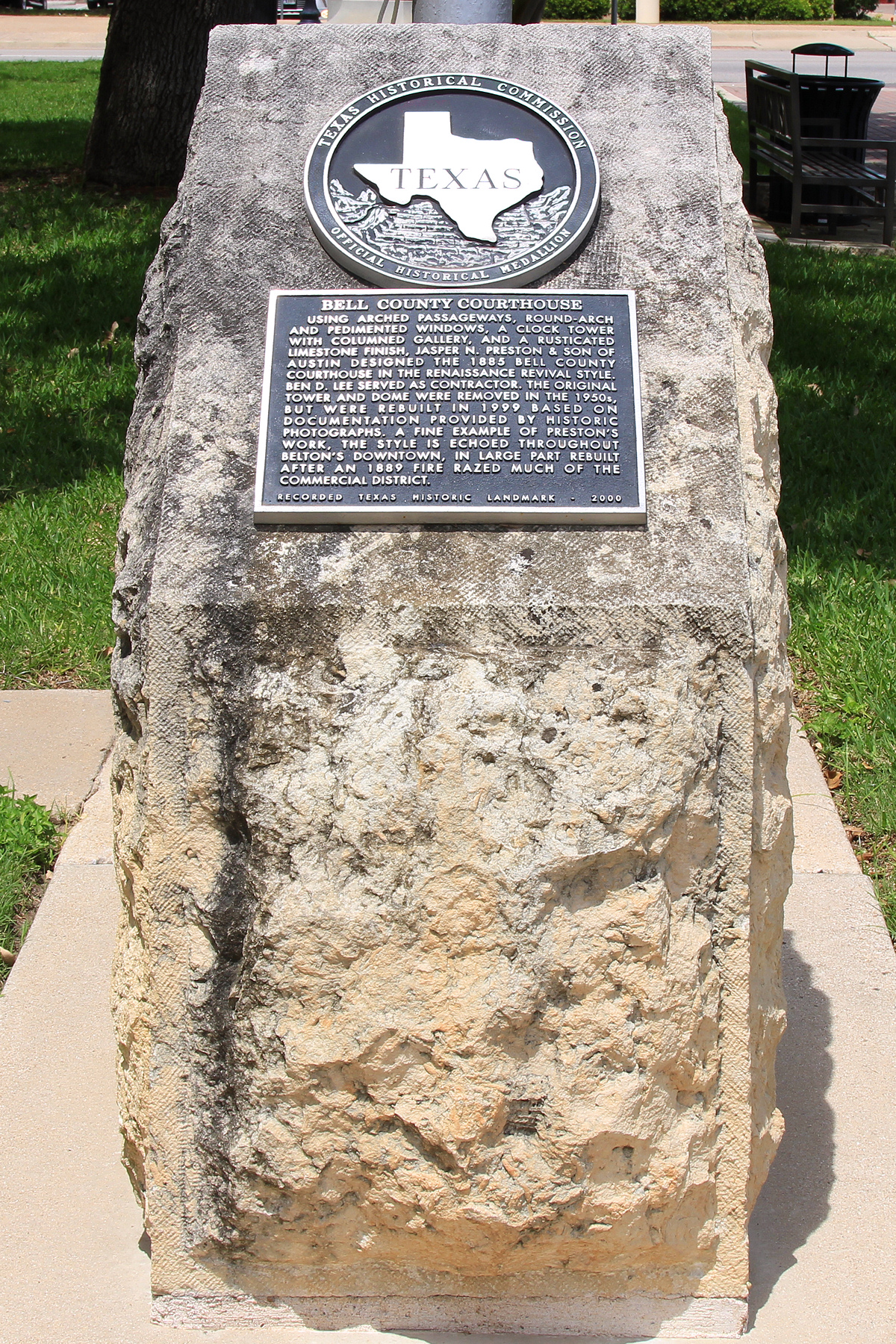
Bell County Courthouse
Monument and historic site · National Register of Historic Places · 5.6 mi
Historic place in Belton, Bell County, Texas

First Christian Church Parsonage
Monument and historic site · National Register of Historic Places · 5.1 mi
Building in Belton, Bell County, Texas
V. R. Means House
Monument and historic site · National Register of Historic Places · 4.5 mi
Building in Belton, Bell County, Texas

Temple Children's Museum
Museum · 3.0 mi
11 North 4th Street, Temple
Tu-Sa 10:00-15:00; Su 13:30-17:30
Temple Railroad and Heritage Museum
Museum · 2.6 mi
Railroad Museum in Temple, Texas
First Presbyterian Church
Monument and historic site · Presbyterian · 4.6 mi
2500 Church Street, Belton
80 more on the map.
Parks, trails and playgrounds67

Bell County Expo Center
Park · 7.5 mi
Building in Texas, United States

55 more on the map.
Restaurants and cafes160


17 South
Restaurant · Italian · 2.9 mi
17 South Main Street, Temple
Mo-Th 11:00-14:00, 17:00-21:00; Fr,Sa 11:00-14:00, 17:00-22:00

Applebee's
Diner · American · 2.2 mi
1808 Southwest H K Dodgen Loop, Temple
Mo-Th,Su 11:00-01:00, Fr-Sa 11:00-02:00
Bird Creek Brewing
Restaurant · Burger, American · 3.0 mi
8 South 4th Street, Temple
Mo 18:00-22:30; Tu-Th 11:00-21:00; Fr,Sa 11:00-23:00; Su 10:00-21:00

Black Rifle Coffee Company
Cafe · Coffee Shop · 1.8 mi
111 North General Bruce Drive, Temple
05:00-20:00
Buffalo Wild Wings
Restaurant · Wings · 2.2 mi
2202 South 31st Street, Temple
Mo-We 11:00-23:00; Th 11:00-24:00, Fr,Sa 11:00-25:00, Su 11:00-24:00
Chili's
Restaurant · Tex-Mex · 1.0 mi
3810 South General Bruce Drive, Temple
Su 10:45-22:30; Mo-Th 10:45-23:00; Fr-Sa 10:45-00:00
Cotton Patch Cafe
Diner · American · 2.7 mi
3111 South 31st Street, Temple
Mo-Th 10:45-21:30; Fr,Sa 10:45-22:00; Su 10:45-21:30
148 more on the map.
History
Temple was founded as a railroad town by the Gulf, Colorado and Santa Fe Railroad (GC&SF). The settlement began in 1880 as a GC&SF construction camp called Temple Junction. In January 1881, a post office was established, and the settlement was officially named Temple, after Bernard Moore Temple, the chief civil engineer of the GC&SF. The town was incorporated in 1882.
Also in 1882, the Missouri, Kansas and Texas Railway built through the town, and soon after, the GC&SF made Temple a division point. In its early years, Temple was a town of shacks and tents with a large number of saloons and tough characters found in the early West. Locally, it was nicknamed "Tanglefoot" because some residents found that the combination of muddy streets and liquor made walking through the town challenging.
Very shortly after the town was incorporated in 1882, two private schools were founded in the city: the Temple Academy was organized and a public school was established in 1884. In 1893, the annual Temple Stag Party began, growing out of a private Thanksgiving celebration attended by some of the town's leading men. It was held until 1923.
From the History section of Temple, Texas on Wikipedia, under CC BY-SA 4.0.
Where to stay33
Churches and places of worship70
Mount Zion United Methodist Church
Church · Methodist · National Register of Historic Places · 5.6 mi
Old St. Luke's Episcopal Church
Church · National Register of Historic Places · 5.2 mi
Shopping25
Gas and EV charging52
Schools, colleges and libraries81
Healthcare32
Baylor Scott & White Mental Health Clinic - Temple
Clinic and pharmacy · 2.6 mi
810 West Avenue U, Temple
Baylor Scott & White Clinic - Temple Westfield
Clinic and pharmacy · 2.3 mi
7556 Honeysuckle Drive, Temple
Map of Temple
250 places. The map loads OpenStreetMap tiles when you open it.
Climate by month
Monthly table
| Month | High | Low | Rain | Snow |
|---|---|---|---|---|
| Jan | 60°F | 36°F | 2.5 in | 0.0 in |
| Feb | 64°F | 39°F | 2.3 in | 0.0 in |
| Mar | 70°F | 46°F | 3.3 in | 0.0 in |
| Apr | 78°F | 54°F | 3.1 in | 0.0 in |
| May | 84°F | 63°F | 4.8 in | 0.0 in |
| Jun | 91°F | 70°F | 3.4 in | 0.0 in |
| Jul | 95°F | 72°F | 1.9 in | 0.0 in |
| Aug | 96°F | 72°F | 2.5 in | 0.0 in |
| Sep | 90°F | 66°F | 3.7 in | 0.0 in |
| Oct | 81°F | 56°F | 4.0 in | 0.0 in |
| Nov | 69°F | 46°F | 2.6 in | 0.0 in |
| Dec | 61°F | 38°F | 2.8 in | 0.0 in |
U.S. Climate Normals 1991-2020 for Stillhouse Hollow Dam (10 mi away), NOAA NCEI.
People and cost of living
American Community Survey 5-year estimates, 2020-2024, U.S. Census Bureau. Estimates have margins of error, larger for small towns.
Disaster history
Bell County has had 15 federal disaster declarations since 2000, most often for hurricanes.
- 2024-05-17: Severe Storms, Straight-Line Winds, Tornadoes, And Flooding (Flood)
- 2021-02-19: Severe Winter Storms (Severe Ice Storm)
- 2021-02-14: Severe Winter Storm (Severe Ice Storm)
- 2020-03-25: Covid-19 Pandemic (Biological)
- 2020-03-13: Covid-19 (Biological)
- 2008-09-10: Hurricane Ike (Hurricane)
OpenFEMA disaster declarations summaries.
Getting there and nearby towns
Draughon-Miller Central Texas Municipal Airport (TPL) is the nearest airport with scheduled flights listed in OpenStreetMap, 3 miles away.
- Belton 6 mi southwest, about 10 min by car
- Harker Heights 15 mi west, about 25 min by car
- Killeen 20 mi west, about 33 min by car
- Sonterra 24 mi southwest, about 38 min by car
- Hewitt 27 mi northeast, about 43 min by car
- Robinson 29 mi northeast, about 46 min by car
- Copperas Cove 31 mi west, about 50 min by car
- Gatesville 31 mi northwest, about 50 min by car
- Waco 33 mi north, about 54 min by car
- Georgetown 35 mi southwest, about 57 min by car
Drive times are estimates from straight-line distance, not routes.
Local news
Headlines from INDB, the NEMICO news database.
Reviews, tips and questions
Loading what members have shared...
Sources and licences
- NCES EDGE (Public domain): public schools
- NOAA NCEI U.S. Climate Normals 1991-2020 (Public domain): climate by month
- OpenFEMA (Public domain): disaster declarations
- OpenStreetMap contributors (ODbL 1.0): places, airports, map data
- U.S. Census Bureau (Public domain): population, income, housing, education, commute
- Wikidata (CC0 1.0): elevation, founding date, time zone, website, landmarks and historic places
- Wikimedia Commons (see each image): photos
- Wikipedia (CC BY-SA 4.0): overview and history text
Photo credits
- Downtown Temple, TX at Main Street IMG 2384, Billy Hathorn, CC BY-SA 3.0
- Belton Courthouse (1), CMBJ, CC BY-SA 2.5
- Mt zion umc belton tx south elev 2014, Larry D. Moore, CC BY 4.0
- Bell County Texas Courthouse RTHL Plaque, Larry D. Moore, CC BY 4.0
Page built October 30, 2026. Spotted a mistake? Tell us or suggest a place.