


Why visit Ban Kamala
Townapedia lists 1 museum or landmark, 8 parks and trails, 96 places to eat, 48 places to stay and 4 attractions in and around town.
Highlights include Kamala beach, หาดกมลา and Surin Beach.
Weather in Ban Kamala
Forecast from MET Norway (CC BY 4.0). Full forecast
Photos of Ban Kamala


Things to do4




Museums and landmarks1

Parks, trails and playgrounds8
หาดกมลา
Beach
Undeveloped with coral reefs on the north side and surfing in the low season.


Carnival Magic
Sports field and stadium
999 Moo 3 Kamala, Kathu District, Phuket
Sa 17:00-23:30; Mo 17:00-23:30; We 17:00-23:30; Th-Fr closed; Su...

Restaurants and cafes96
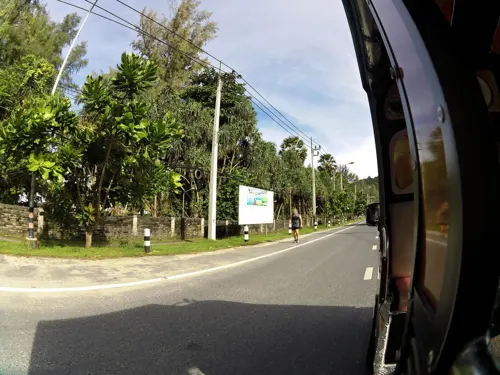
GINIS BEACH RESORT
Restaurant · Regional
Restaurant, Rooms & Apartments
MOO3 112/4 Soi Police Station, Kamala Beach
Mo-Su 08:00-23:00
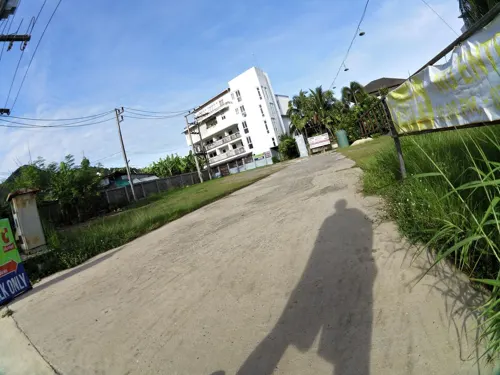
KoKosnus Kamala
Restaurant · German, Thai · 0.7 km
73/120 Pa Jak, Kamala Beach
Mo-Th, Su 11:00-23:00; Sa 17:00-23:00
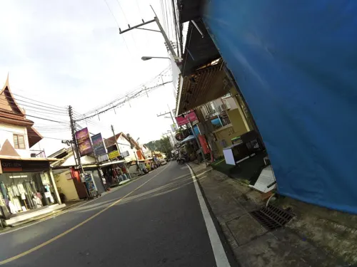
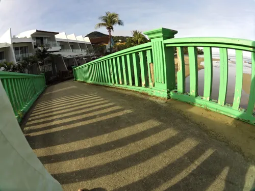
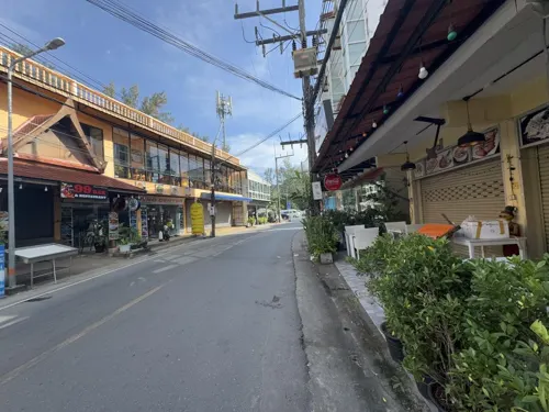
AEW Seafood
Restaurant · Thai, Seafood
Rim Hat Road
Mo-Su 08:00-24:00
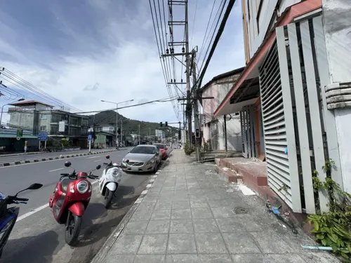
A&B Café Kamala - Coffee and more
Cafe · Coffee Shop · 0.7 km
94/134 Soi Thaweewongsub / Moo 3, Kamala Beach
Tu-Su 08:00-18:00
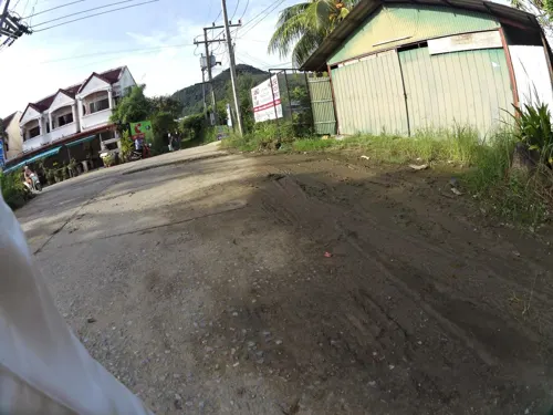

PLUM Prime Steakhouse
Restaurant · Steak House, International · 1.2 km
18/40 Layi-Nakalay Rd.. Kamala, Kathu, Phuket
18:00-23:30
Sam's indian Restaurant Kamala Phuket
Restaurant · Indian · 0.8 km
100/19 moo 3 soi 12, kamala
Mo-Su 09:00-21:00
Tiwa Seafood
Restaurant · Thai, Seafood · 0.6 km
73/183 ถนนป่าจาก
Mo-Su 10:00-24:00

84 more on the map.
Where to stay48
Churches and places of worship3
Shopping12
Schools, colleges and libraries1
Healthcare4
Map of Ban Kamala
177 places. The map loads OpenStreetMap tiles when you open it.
Getting there and nearby towns
Phuket International Airport (HKT) is the nearest airport with scheduled flights listed in OpenStreetMap, 18 km away.
- Kathu 7 km southeast, about 7 min by car
- Patong 7 km south, about 7 min by car
- Ban Karon 12 km south, about 12 min by car
- Wichit 13 km southeast, about 13 min by car
- Ban Ko Kaeo 13 km east, about 13 min by car
- Phuket 15 km southeast, about 15 min by car
- Ban Talat Nua 14 km southeast, about 14 min by car
- Ban Ratsada 14 km east, about 14 min by car
- Ban Chalong 14 km southeast, about 14 min by car
- Ban Talat Yai 15 km southeast, about 15 min by car
Drive times are estimates from straight-line distance, not routes.
Towns near Ban Kamala


Keep exploring
Local news
Headlines from INDB.
Reviews, tips and questions
Loading what members have shared...
Sources and licences
- GeoNames (CC BY 4.0): population, coordinates, regions and time zone
- Mapillary (see each image): photos
- OpenStreetMap contributors (ODbL 1.0): places, airports, map data
- Wikidata (CC0 1.0): elevation, founding date, time zone, website, landmarks and historic places
- Wikimedia Commons (see each image): photos
Photo credits
- Thaïlande 2010 248, Gossipguy, CC BY-SA 3.0
- Surin Beach, Jpatokal, CC BY-SA 4.0
- Girl and Catamaran, Kamala beach, Phuket island, Thailand XOKA9673b-NEW-S (47941398452), [email protected] from Phuket, Thailand, CC BY 2.0
- Phuket, 2015 april - panoramio (10), Roma Neus, CC BY 3.0
- Phuket, 2015 april - panoramio (11), Roma Neus, CC BY 3.0
- Буддийский мифический персонаж - panoramio, Александр Попрыгин, CC BY 3.0
- Kammala, Kathu District, Phuket, Thailand - panoramio (159), Максим Улитин, CC BY 3.0
- Phuket, 2015 april - panoramio (12), Roma Neus, CC BY 3.0
- Kammala, Kathu District, Phuket, Thailand - panoramio (172), Максим Улитин, CC BY 3.0
- Kammala, Kathu District, Phuket, Thailand - panoramio (164), Максим Улитин, CC BY 3.0
- Kammala, Kathu District, Phuket, Thailand - panoramio (160), Максим Улитин, CC BY 3.0
- Mesomorphus vitalisi Chatanay, 1917 (37562412116), Udo Schmidt from Deutschland, CC BY-SA 2.0
- Callistethus excellens (Nonfried, 1894) (32442999691), Udo Schmidt from Deutschland, CC BY-SA 2.0
- Kammala, Kathu District, Phuket, Thailand - panoramio (183), Максим Улитин, CC BY 3.0
- Kammala, Kathu District, Phuket, Thailand - panoramio (169), Максим Улитин, CC BY 3.0
- Kammala, Kathu District, Phuket, Thailand - panoramio (166), Максим Улитин, CC BY 3.0
- Kammala, Kathu District, Phuket, Thailand - panoramio (147), Максим Улитин, CC BY 3.0
- Kammala, Kathu District, Phuket, Thailand - panoramio (176), Максим Улитин, CC BY 3.0
- Kammala, Kathu District, Phuket, Thailand - panoramio (168), Максим Улитин, CC BY 3.0
- Kammala, Kathu District, Phuket, Thailand - panoramio (154), Максим Улитин, CC BY 3.0
- Kammala, Kathu District, Phuket, Thailand - panoramio (153), Максим Улитин, CC BY 3.0
- Ресторанчик - panoramio, Александр Попрыгин, CC BY 3.0
- Kammala, Kathu District, Phuket, Thailand - panoramio (175), Максим Улитин, CC BY 3.0
- Kammala, Kathu District, Phuket, Thailand - panoramio (173), Максим Улитин, CC BY 3.0
- Kammala, Kathu District, Phuket, Thailand - panoramio (171), Максим Улитин, CC BY 3.0
- Ресторанчик - panoramio (1), Александр Попрыгин, CC BY 3.0
- Магазинчик - panoramio (6), Александр Попрыгин, CC BY 3.0
- The lady walked into the frame just as I thought I'd got the perfect shot, shankar s., CC BY 2.0
- Kammala, Kathu District, Phuket, Thailand - panoramio (170), Максим Улитин, CC BY 3.0
- Kammala, Kathu District, Phuket, Thailand - panoramio (157), Максим Улитин, CC BY 3.0
- Kammala, Kathu District, Phuket, Thailand - panoramio (158), Максим Улитин, CC BY 3.0
- Kammala, Kathu District, Phuket, Thailand - panoramio (17), Максим Улитин, CC BY 3.0
- Kammala, Kathu District, Phuket, Thailand - panoramio (68), Максим Улитин, CC BY 3.0
- Kammala, Kathu District, Phuket, Thailand - panoramio (8), Максим Улитин, CC BY 3.0
- Kammala, Kathu District, Phuket, Thailand - panoramio (53), Максим Улитин, CC BY 3.0
- Kammala, Kathu District, Phuket, Thailand - panoramio (15), Максим Улитин, CC BY 3.0
- Kammala, Kathu District, Phuket, Thailand - panoramio (65), Максим Улитин, CC BY 3.0
- Kammala, Kathu District, Phuket, Thailand - panoramio (74), Максим Улитин, CC BY 3.0
- Kammala, Kathu District, Phuket, Thailand - panoramio (19), Максим Улитин, CC BY 3.0
- Kammala, Kathu District, Phuket, Thailand - panoramio (70), Максим Улитин, CC BY 3.0
- Street-level photo, skillsy, CC BY-SA 4.0
- Street-level photo, skillsy, CC BY-SA 4.0
- Street-level photo, skillsy, CC BY-SA 4.0
- Street-level photo, skillsy, CC BY-SA 4.0
- Street-level photo, jrcarlsen, CC BY-SA 4.0
- Street-level photo, skillsy, CC BY-SA 4.0
- Street-level photo, filipb, CC BY-SA 4.0
- Street-level photo, skillsy, CC BY-SA 4.0
- Street-level photo, skillsy, CC BY-SA 4.0
- Street-level photo, skillsy, CC BY-SA 4.0
- Street-level photo, filipb, CC BY-SA 4.0
- Street-level photo, skillsy, CC BY-SA 4.0
- Street-level photo, skillsy, CC BY-SA 4.0
- Street-level photo, skillsy, CC BY-SA 4.0
- Street-level photo, skillsy, CC BY-SA 4.0
- Street-level photo, skillsy, CC BY-SA 4.0
- Street-level photo, skillsy, CC BY-SA 4.0
- Street-level photo, filipb, CC BY-SA 4.0
- Street-level photo, skillsy, CC BY-SA 4.0
- Street-level photo, skillsy, CC BY-SA 4.0
- Street-level photo, skillsy, CC BY-SA 4.0
- Street-level photo, jrcarlsen, CC BY-SA 4.0
- Street-level photo, skillsy, CC BY-SA 4.0
- Street-level photo, skillsy, CC BY-SA 4.0
- Street-level photo, skillsy, CC BY-SA 4.0


Page built November 10, 2026. Spotted a mistake? Tell us or suggest a place.