


Chiang Rai, Thailand
เทศบาลนครเชียงราย
Chiang Rai is a regional capital of 78,756 people in Chiang Rai, Thailand, founded in 1262.
Why visit Chiang Rai
Townapedia lists 24 museums and landmarks, 26 parks and trails, 257 places to eat, 65 places to stay and 11 attractions in and around town.
Highlights include Pra Cave, Doi Phra Bat, Hilltribe Museum and Clock Tower.
Weather in Chiang Rai
Forecast from MET Norway (CC BY 4.0). Full forecast
About Chiang Rai
Chiang Rai (Thai: เชียงราย, pronounced [tɕʰīaŋ rāːj]; Northern Thai: ᨩ᩠ᨿᨦᩁᩣ᩠ᨿ, pronounced [tɕīaŋ hāːj]) is the northernmost major city in Thailand, with a population of approximately 70,000 people. It is located in Mueang Chiang Rai District, Chiang Rai Province. Chiang Rai was established as a capital during the reign of King Mangrai, in 1262 CE. Chiang Rai is recognized as a "Design City" by UNESCO's Creative Cities Network.
From the Wikipedia article Chiang Rai (this version), under CC BY-SA 4.0.
Travel tips from other travellers: Chiang Rai on Wikivoyage (CC BY-SA 4.0).
Photos of Chiang Rai


Things to do11





Museums and landmarks24



Oub Kham Museum
Museum · 1.9 km
ศูนย์อนุรักษ์มรดกล้ำค่าของอาณาจักรล้านนาโบราณ ประกอบด้วยเครื่องใช้ในราชสำนักล้านนา เครื่องใช้ในราชสำนักคุ้มเจ้าแพร่...
81/1 ถนนหน้าค่าย, เชียงราย
Mo-Sa 08:00-17:30
Tai Yuan Art Gallery
Museum · 1.5 km
หอศิลป์ไตยวนก่อตั้งขึ้นเมื่อปี พ.ศ. 2548 เพื่อเป็นแหล่งเรียนรู้ในด้านศิลปวัฒนธรรมภูมิปัญญาท้องถิ่นทั้งในอดีต ปัจจุบัน...
We-Su 10:00-17:30

12 more on the map.
Parks, trails and playgrounds26



14 more on the map.
Restaurants and cafes257
La Ola
Restaurant · Spanish, Italian, Mediterranean
528/8-9 13 14 ถนน บรรณปราการ, Chiang Rai
15.00-23.30
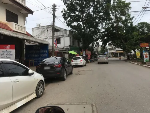
หมีเพลิน MeehPloen Cafe
Cafe · Coffee Shop, Dessert · 1.1 km
952/7 ถนนร่วมจิตถวาย, เชียงราย
Mo-Su 07:00-17:00
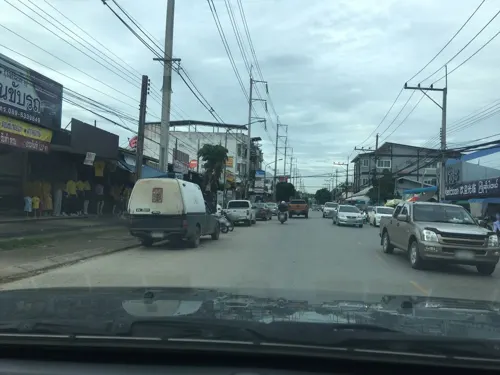



A.NA cuisine & coffee
Restaurant · Dessert, Coffee Shop, Regional, Thai · 4.5 km
51 หมู่ 6, ตำบลสันทราย
Mo-Su 08:30-22:00
Amici Pizza CEI อมีซี พิซซ่า เชียงราย
Restaurant · Pizza · 0.6 km
703/1 ถนน บรรณปราการ, เชียงราย
Mo-Su 11:30-20:30
Moom Mai
Restaurant · 2.1 km
64 Sangkhongluang Rd., Moo 16, T. Robwiang, Mueang Chiang Rai
Mo-Su 11:00-14:00, 17:00-23:00
245 more on the map.
History
The city was founded by King Mangrai in 1262 and became the capital of the Mangrai Dynasty. The word 'Chiang' means 'city' in Thai, so Chiang Rai would mean 'the City of (Mang) Rai'. Subsequently, Chiang Rai was conquered by Burma and remained under Burmese rule for several hundred years. It was not until 1786 that Chiang Rai became a Siam vassal. Siam (later Thailand) annexed the Kingdom of Chiang Mai in 1893 as a Monthon, which Chiang Rai joined later in 1910. It's not before 1933 that Chiang Rai became a full province of Thailand.
In 1432, during the reign of King Sam Fang Kaen of the Mangrai Dynasty (1402–1441), the Phra Kaeo, or Emerald Buddha, the most revered Buddha statue, was discovered in Chiang Rai when an earthquake split the chedi at Wat Phra Kaeo of Chiang Rai city. The jade figure was then seen concealed within. Another telling of the story has the "Emerald Buddha" hastily covered in mud just before marauders entered to pillage. Many years later, the clunky-looking mud Buddha was found to actually house a magnificent jade statue, perhaps by way of the earthquake mentioned above—which caused a piece of the clay to break off—revealing the jade beneath.
In 1992, the city pillar was moved from Wat Klang Wiang to Wat Phra That Doi Chom Thong, where it is known as Sadue Mueang (Thai: สะดือเมือง), the "navel" or omphalos of the city.
From the History section of Chiang Rai on Wikipedia, under CC BY-SA 4.0.
More about Chiang Rai
Geography
Chiang Rai lies on the flat alluvial plain of the Kok River, a tributary of the Mekong, between the Daen Lao Range in the north and the Phi Pan Nam Range in the south. The Kok River runs along Chiang Rai's north side, flowing eastwards out of Burma at Tha Ton (ท่าตอม) town, bending north-eastwards and joining the Mekong River about 40 kilometres (25 mi) north-east of the city. The Lao River, a tributary of the Kok, flows south of Chiang Rai.
There are four bridges spanning the Kok River within the town's boundaries, each running south–north. Most of the terrain surrounding Chiang Rai town is either flat or has moderate hills. The exception is outward in the west and north-west directions, where limestone hills are evident, some of which have vertical exposed cliffs. That is also the direction where most of the region's hill tribe people have their villages, further afield.
The city is 860 kilometres (530 mi) north of Bangkok, about 200 kilometres (120 mi) north-east of Chiang Mai, 62 kilometres (39 mi) south of Mae Sai and the Burmese border; 60 kilometres (37 mi) south-west of the town of Chiang Saen on the Mekong River across from Laos; and 90 kilometres (56 mi) north of Phayao town. The Golden Triangle, the tripoint of the Thailand, Laos and Myanmar borders, is 55 kilometres (34 mi) north-east of the city.
Education
Rajamangala University of Technology Lanna, Chiang Rai Campus
Chiang Rai International Christian School 19°57.022′N 99°49.893′E
Bansankhong (Chiangraijaroonrat) School 19°54.045′N 99°49.671′E
From the Wikipedia article Chiang Rai, under CC BY-SA 4.0.
Notable people from Chiang Rai
 Varatchaya WongteanchaiThai tennis playerPhoto: si.robi, CC BY-SA 2.0
 Chalermchai KositpipatThai artistPhoto: Thairath Online, CC BY 3.0
 Sarawut MasukfootballerPhoto: El_Loko für www.thai-fussball.com, CC BY 4.0
 Thawan DuchaneeThai painter (1939-2014)Photo: Unknown author Unknown author, Public domain
 Varunya WongteanchaiThai tennis playerPhoto: Daduschu, CC BY-SA 4.0
- Ekanit PanyaThai association football player
- Buoban PamangOlympic javelin thrower
- Chanukan KarinThai footballer
- Watsaporn WattanakoonThai model
- Watcharakorn ManowornThai association football player
- Krissadee PrakobkongThai footballer
- Wipawee Srithongvolleyball player


Born in Chiang Rai, according to Wikidata (CC0). Each name links to its Wikipedia article.
Where to stay65
Churches and places of worship43
Shopping44
THE NORTH CAMP camping item store
Shop · 0.7 km
153 153 Thanalai, Tambon Wiang, Mueang Chiang Rai District, Chiang Rai 57000
Gas and EV charging35
Schools, colleges and libraries43
Anuban Chiangrai School (San Ton Pao)
School · Mahayana · 3.3 km
478/2 หมู่ 5 ถ.พหลโยธิน ตำบลริมกก, อำเภอเมืองเชียงราย เชียงราย
Healthcare39
Map of Chiang Rai
250 places. The map loads OpenStreetMap tiles when you open it.
Getting there and nearby towns
Chiangrai International Airport (CEI) is the nearest airport with scheduled flights listed in OpenStreetMap, 7 km away.
- Mae Chan 27 km north, about 27 min by car
- Ban Ho Mae Salong 35 km northwest, about 35 min by car
- Pa Daet 48 km south, about 48 min by car
- Chiang Saen 49 km northeast, about 49 min by car
- Mae Sai 59 km north, about 59 min by car
- Mae Chai 63 km south, about 1 h by car
- Chiang Kham 65 km southeast, about 1 h by car
- Fang 65 km west, about 1 h by car
- Chiang Khong 71 km northeast, about 1 h 15 min by car
- Ban Mae Thalop 71 km west, about 1 h 15 min by car
Drive times are estimates from straight-line distance, not routes.
Keep exploring
Local news
Headlines from INDB.
Reviews, tips and questions
Loading what members have shared...
Sources and licences
- GeoNames (CC BY 4.0): population, coordinates, regions and time zone
- Mapillary (see each image): photos
- OpenStreetMap contributors (ODbL 1.0): places, airports, map data
- Wikidata (CC0 1.0): elevation, founding date, time zone, website
- Wikimedia Commons (see each image): photos
- Wikipedia (CC BY-SA 4.0): overview and history text
Photo credits
- หอนาฬิกาเชียงราย Chiang Rai Clock Tower, Chainwit., CC BY-SA 4.0
- Chiang Rai, First Church, angels, Arian Zwegers, CC BY 2.0
- WhatCat Cafe, Tanalai Rd., Chiang Rai, Thailand, Tree Lightbulb, CC0
- Chiang Rai - Thanon Bap Prakan Road - 0001, Stefan Fussan, CC BY-SA 3.0
- Chiang Rai - Clock Tower - 0001, Stefan Fussan, CC BY-SA 3.0
- Chiang Rai - Wat Klang Wiang - 0010, Stefan Fussan, CC BY-SA 3.0
- Chiang Rai Clock Tower 2018-05-23, Index Librorum Permissorum, CC0
- วัดกลางเวียง เชียงราย Chiang Rai Wat Klang Wiang (October 2021) - img 01, Chainwit., CC BY-SA 4.0
- Chiang Rai - Wat Klang Wiang - 0005, Stefan Fussan, CC BY-SA 3.0
- Chiang Rai - Wat Klang Wiang - 0007, Stefan Fussan, CC BY-SA 3.0
- Chiang Rai - Wat Klang Wiang - 0008, Stefan Fussan, CC BY-SA 3.0
- Clock tower in Chiang Rai purple, Gozitano, CC BY-SA 4.0
- Chiang Rai - Wat Klang Wiang - 0001, Stefan Fussan, CC BY-SA 3.0
- Chiang Rai - Wat Klang Wiang - 0002, Stefan Fussan, CC BY-SA 3.0
- วัดกลางเวียง เชียงราย Chiang Rai Wat Klang Wiang (October 2021) - img 03, Chainwit., CC BY-SA 4.0
- New clock tower of Chiang Rai at night, Alexey Komarov, CC BY-SA 4.0
- วัดกลางเวียง เชียงราย Chiang Rai Wat Klang Wiang (October 2021) - img 02, Chainwit., CC BY-SA 4.0
- Wiang, Mueang Chiang Rai District, Chiang Rai, Thailand - panoramio (7), mohigan, CC BY-SA 3.0
- หอนาฬิกาเก่า เชียงราย Old Chiang Rai Clock Tower 03, Chainwit., CC BY-SA 4.0
- หอนาฬิกาเก่า เชียงราย Old Chiang Rai Clock Tower 02, Chainwit., CC BY-SA 4.0
- Wiang, Mueang Chiang Rai District, Chiang Rai, Thailand - panoramio (9), mohigan, CC BY-SA 3.0
- หอนาฬิกาเก่า เชียงราย Old Chiang Rai Clock Tower 01, Chainwit., CC BY-SA 4.0
- Chiang Rai, Temple, Thailand, Vyacheslav Argenberg, CC BY 4.0
- พระธาตุดอยจอมทอง Phra Dhatu Doi Chom Thong 2, Chainwit., CC BY 4.0
- Chiang Rai-Wat Phra Kaeo-002, Ddalbiez, CC BY-SA 3.0
- Radermachera ignea-chiang rai1826, Xufanc, CC BY-SA 3.0
- Chiang Rai Mosque1, Iceway12 ( talk ) / Iceway12 at English Wikipedia, CC BY-SA 3.0
- Chiang Rai Wat Phra Singha วัดพระสิงห์ เชียงราย - ubosot & vihara kaew, Chainwit., CC BY-SA 4.0
- Chiang Rai Navel Pillar สะดือเมืองเชียงราย (2020) - img 01, Chainwit., CC BY 4.0
- Chiangrai Municipality School 6 Building 1, Nickicooo, CC BY-SA 4.0
- อุโบสถ วัดพระธาตุดอยเขาควาย (October 2021) - img 06, Chainwit., CC BY-SA 4.0
- Chiang Rai - Wat Doi Phrabat - 0011, Stefan Fussan, CC BY-SA 3.0
- Chiang Rai - Wat Chet Yot - 0002, Stefan Fussan, CC BY-SA 3.0
- Chiang Rai - Wat Doi Ngam Mueang - 0002, Stefan Fussan, CC BY-SA 3.0
- Ban Nam Lat Wang Sang - Wat Nam Lat Wang Sang - 0001, Stefan Fussan, CC BY-SA 4.0
- ChiangRai Prachanukroh Hospital, Vano111ru, CC BY-SA 4.0
- Doi Tham Phra, Vano111ru, CC BY-SA 4.0
- Wat Rong Suea Ten (Blue Temple, Chiang Rai) วัดร่องเสือเต้น (October 2021) - img 01, Chainwit., CC BY-SA 4.0
- Chiang-Rai Thailand Clock-Tower-00, CEphoto, Uwe Aranas, CC BY-SA 3.0
- Chaing Rai Wat Phra Singh วัดพระสิงห์ เชียงราย (October 2021) - img 09, Chainwit., CC BY-SA 4.0
- Chief Building of Samakkhi Witthayakhom School, YURiN, CC BY-SA 4.0
- Chiang Rai - Wat Doi Phrabat - 0002, Stefan Fussan, CC BY-SA 3.0
- Street-level photo, ozflor, CC BY-SA 4.0
- Street-level photo, kiw, CC BY-SA 4.0
- Street-level photo, kiw, CC BY-SA 4.0
- Street-level photo, toffy, CC BY-SA 4.0
- Street-level photo, jrcarlsen, CC BY-SA 4.0
- Street-level photo, ozflor, CC BY-SA 4.0
- Street-level photo, jrcarlsen, CC BY-SA 4.0
- Street-level photo, jrcarlsen, CC BY-SA 4.0
- Street-level photo, wapriz, CC BY-SA 4.0
- Street-level photo, jrcarlsen, CC BY-SA 4.0
- Street-level photo, jrcarlsen, CC BY-SA 4.0
- Street-level photo, kiw, CC BY-SA 4.0
- Street-level photo, jrcarlsen, CC BY-SA 4.0
- Street-level photo, kiw, CC BY-SA 4.0
- Street-level photo, igorzo, CC BY-SA 4.0
- Street-level photo, igorzo, CC BY-SA 4.0
- Street-level photo, igorzo, CC BY-SA 4.0
- Street-level photo, jrcarlsen, CC BY-SA 4.0


Page built November 10, 2026. Spotted a mistake? Tell us or suggest a place.