


Khon Kaen, Thailand
เทศบาลนครขอนแก่น
Khon Kaen is a regional capital of 114,459 people in Khon Kaen, Thailand.
Why visit Khon Kaen
Townapedia lists 23 museums and landmarks, 33 parks and trails, 216 places to eat, 53 places to stay and 4 attractions in and around town.
Highlights include Khon Kaen National Museum, Natural History Museum Khon Kaen University and Great Tree of Serenity Condominium.
Weather in Khon Kaen
Forecast from MET Norway (CC BY 4.0). Full forecast
About Khon Kaen
Khon Kaen (Thai: ขอนแก่น, pronounced [kʰɔ̌(ː)n kɛ̀n]) is the capital of Khon Kaen province and the fourth-largest city in Thailand. It is one of the four major cities of Isan, Northeast Thailand, also known as the "big four of Isan", the others being Udon Thani, Nakhon Ratchasima, and Ubon Ratchathani.
From the Wikipedia article Khon Kaen (this version), under CC BY-SA 4.0.
Travel tips from other travellers: Khon Kaen on Wikivoyage (CC BY-SA 4.0).
Photos of Khon Kaen


Things to do4



Museums and landmarks23

Khon Kaen National Museum
Museum · 0.6 km
Museum in Khon Kaen, Thailand
กองบังคับการสืบสวนสอบสวน ภ 4
Mi-So 09:00-19:00

Natural History Museum Khon Kaen University
Museum · 2.4 km
123 ถนน มิตรภาพ, ในเมือง
Tu-Su 09:30-19:30

Monument of Prince Songkhla Nagarind and Princess Mother
Monument and historic site · 2.4 km
11 more on the map.
Parks, trails and playgrounds33




21 more on the map.
Restaurants and cafes216
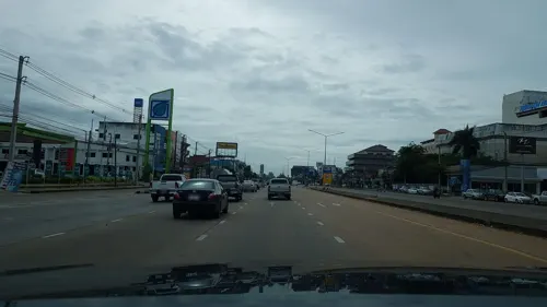
Ja Brown Laab Ped
Restaurant · Regional · 1.7 km
3 ถนนมิตรภาพ
Mo-Sa 16:30-23:00
Open in Google Maps · +66-81-5454366, +66-81-6705251, +66-85-0018491
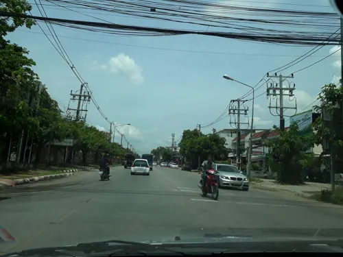
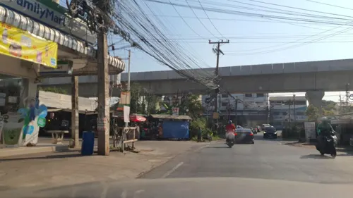
ข้าวต้มสำราญ
Restaurant · Thai, Chinese, Regional · 3.0 km
373 3-4 ม.17 ซอย หนองวัด 1, ตำบลในเมือง อ.เมือง ขอนแก่น
24/7
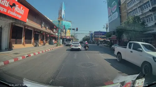
ปิ้งย่างประธานเหมา
Restaurant · Chinese, Barbecue, Bar And Grill · 1.8 km
236 ถนนหน้าเมือง, ขอนแก่น
Mo-Su 17:00-23:30



Muay Noodle Restaurant / หมวยก๋วยเตี๋ยวหมู
Restaurant · Noodle · 1.4 km
ถนนอำมาตย์, khon kaen
Mo-Su 09:00-15:00

ฟาไฉ ข้าวมันไก่สิงคโปร์ ปตท.ปกฉัตร
Restaurant · ข้าวมันไก่ · 1.1 km
7/5 ถนนมิตรภาพ, ในเมือง
ทุกวัน 09:00-19:00
204 more on the map.
More about Khon Kaen
Geography
Khon Kaen is on the Khorat Plateau, elevation 187 m, and is the center of the mid-northeastern provincial group of Thailand, according to the Thai government. Its coordinates are 16°26′N 102°50′E. The city municipality has a population of 114,459, while the Mueang Khon Kaen district, forming the city's urban area, has a population of 416,988. Khon Kaen therefore ranks as the fourth-largest city in Thailand after Bangkok, Chiang Mai and Korat.
Khon Kaen is a city in the northeastern region of Thailand. The city is bisected by Mithraphap Road, also known as the "Friendship Highway", or "Highway 2", the road linking Bangkok to the Thai-Lao Friendship Bridge. Highway 230, a modern, multi-lane by-pass enables through-traffic to avoid the city center to the west, and connects to the airport, the new main bus station (BKS3).
Arts and culture
Thailand's 2014 EU Film Festival included Khon Kaen, together with Chiang Mai and Bangkok, as host locations. A selection of six films were shown in the city, including the Spanish film The Pelayos, and the Polish film Walesa, Man of Hope.
From the Wikipedia article Khon Kaen, under CC BY-SA 4.0.
Notable people from Khon Kaen
 Nadech KugimiyaThai actorPhoto: Afropraew, CC BY-SA 4.0
 Sarayoot ChaikamdeeThai footballerPhoto: Chayanin, CC BY 3.0
 Kaoklai KaennorsingThai kickboxerPhoto: IMTheAdrenaline, CC BY-SA 3.0
- Kiatisuk SenamuangThai footballer
- Somluck Kamsingboxer
- Pimsiri SirikaewOlympic weightlifter
- Sukollawat Kanarosactor and singer
- Suban PannonThai boxer
- Korn KhunatipapisiriThai actor, model and dancer
- Arthit SunthornpitThai footballer
- Nichaphat ChatchaipholratThai actress
- Piyaphon BantaoThai footballer


Born in Khon Kaen, according to Wikidata (CC0). Each name links to its Wikipedia article.
Where to stay53
Anchan Laguna Hotel โรงแรมอัญชันลากูน่า
Motel and hotel · 5.0 km
966 robnongkinmoo bannonmuang, sila muengkhonkaen
Churches and places of worship53
Shopping58
Gas and EV charging33
Schools, colleges and libraries54
Healthcare52
Ban Ya Pharmacy (Mor Khor)
Clinic and pharmacy · 1.6 km
43/128 ถนนเสรีสัมพันธ์, ขอนแก่น
Map of Khon Kaen
250 places. The map loads OpenStreetMap tiles when you open it.
Getting there and nearby towns
Khon Kaen Airport (KKC) is the nearest airport with scheduled flights listed in OpenStreetMap, 6 km away.
- Kosum Phisai 33 km southeast, about 33 min by car
- Kranuan 39 km northeast, about 39 min by car
- Ban Phai 44 km south, about 44 min by car
- Huai Mek 46 km east, about 46 min by car
- Nong Kung Si 55 km northeast, about 55 min by car
- Non Sang 55 km northwest, about 55 min by car
- Maha Sarakham 58 km southeast, about 58 min by car
- Yang Talat 57 km east, about 57 min by car
- Kalasin 72 km east, about 1 h 15 min by car
- Kaeng Khro 72 km southwest, about 1 h 15 min by car
Drive times are estimates from straight-line distance, not routes.
Keep exploring
Local news
Headlines from INDB.
Reviews, tips and questions
Loading what members have shared...
Sources and licences
- GeoNames (CC BY 4.0): population, coordinates, regions and time zone
- Mapillary (see each image): photos
- OpenStreetMap contributors (ODbL 1.0): places, airports, map data
- Wikidata (CC0 1.0): elevation, founding date, time zone, website, landmarks and historic places
- Wikimedia Commons (see each image): photos
- Wikipedia (CC BY-SA 4.0): overview and history text
Photo credits
- Hotel in Khon Kaen, Stefan Maurer, CC BY-SA 2.0
- Khon Kaen - dual track railway under construction 16 May 2017, Petebutt, CC BY-SA 4.0
- Robert in Khon Kaen 2016, Rhilles, CC BY-SA 4.0
- Khon Kaen Wittayayon's sports day 2025-11-14, JustRandomThai, CC BY-SA 4.0
- Khon Kaen Skyline (25406353543), Rawipad C.KKU from Khon Kaen, Thailand, CC BY-SA 2.0
- Nai Mueang, Mueang Khon Kaen District, Khon Kaen 40000, Thailand - panoramio (2), mohigan, CC BY-SA 3.0
- โรงพยาบาลขอนแก่นราม, Chet Puangmala, CC BY-SA 4.0
- วัดป่าวิเวกธรรม1, วัดป่าวิเวกธรรม, CC0
- Khon Kaen National Museum, LittleT889, CC0
- Night ขอนแก่น - panoramio, NaruponOat, CC BY 3.0
- 2025 Wuling Binguo EV Pro, Chanokchon, CC BY-SA 4.0
- ถนนคนเดิน 4 - panoramio, NaruponOat, CC BY 3.0
- Lung-A, JustRandomThai, CC BY-SA 4.0
- Lung-A 2 (Uncropped), JustRandomThai, CC BY-SA 4.0
- ลุงเอกับพี่เปา (พีรดนย์ เหมยากร), JustRandomThai, CC BY-SA 4.0
- IHAVECPU meeting 1, JustRandomThai, CC BY-SA 4.0
- 2019 Mitsubishi Mirage 1.2 GLS (Rear), Chanokchon, CC BY-SA 4.0
- 2019 Mitsubishi Mirage 1.2 GLS, Chanokchon, CC BY-SA 4.0
- Agestrata orichalca orichalca (Linné, 1769) (14221885536), Udo Schmidt from Deutschland, CC BY-SA 2.0
- 2026 Zontes 368E ETC, Chanokchon, CC BY-SA 4.0
- 2026 Zontes 150X, Chanokchon, CC BY-SA 4.0
- 2026 Yamaha XMAX 300 Tech MAX, Chanokchon, CC BY-SA 4.0
- 2026 Honda Lead 125 ABS, Chanokchon, CC BY-SA 4.0
- 2026 Honda Wave 110 Special Edition (Alloy Type), Chanokchon, CC BY-SA 4.0
- 2026 Honda Scoopy Club 12, Chanokchon, CC BY-SA 4.0
- 2026 Honda Giorno+ ABS, Chanokchon, CC BY-SA 4.0
- Waterfightsongkran2026, Pinplaybloxorwiki, CC0
- 2023 Honda PCX 160 ABS, Chanokchon, CC BY-SA 4.0
- 2022 Honda MSX Grom 125 SP ABS, Chanokchon, CC BY-SA 4.0
- 2026 Honda ADV160 Roadsync Type, Chanokchon, CC BY-SA 4.0
- 2022 Honda MSX Grom 125 Standard, Chanokchon, CC BY-SA 4.0
- 2020 Honda CRF300L, Chanokchon, CC BY-SA 4.0
- 2022 Honda Click 125, Chanokchon, CC BY-SA 4.0
- DFC 2882 Crowds gather along a waterfront as rows of starburst-shaped lights and string lights illuminate the night their reflections shimmering in the water, PattayaPatrol, CC BY-SA 4.0
- DFC 2880 A smiling vendor chats with customers behind a colorful display of handmade sweets and floral arrangements at a busy night market, PattayaPatrol, CC BY-SA 4.0
- ธนวัฒน์ สวัสดิ์ผล, Thanawat.sa, CC BY-SA 4.0
- DFC 2872 A glowing outline-style light sculpture of a whimsical city skyline and dragon reflected in the calm water at night, PattayaPatrol, CC BY-SA 4.0
- DFC 2876 Crowds gather along a riverbank at night to float illuminated flower-and-candle offerings their reflections shimmering on the water during a festive lantern ceremony, PattayaPatrol, CC BY-SA 4.0
- DFC 2879 A nighttime festival scene with illuminated decorative floats reflected on a calm river as crowds sit on the grassy riverbank watching the light display, PattayaPatrol, CC BY-SA 4.0
- DFC 2475 Hot cheesy ham and pineapple pizza fresh from the oven ready to be served, PattayaPatrol, CC BY-SA 4.0
- Street-level photo, rariyaso, CC BY-SA 4.0
- Street-level photo, ThailandCambodia, CC BY-SA 4.0
- Street-level photo, mishari, CC BY-SA 4.0
- Street-level photo, jrcarlsen, CC BY-SA 4.0
- Street-level photo, theppitak, CC BY-SA 4.0
- Street-level photo, ThailandCambodia, CC BY-SA 4.0
- Street-level photo, theppitak, CC BY-SA 4.0
- Street-level photo, ozflor, CC BY-SA 4.0
- Street-level photo, ThailandCambodia, CC BY-SA 4.0
- Street-level photo, jrcarlsen, CC BY-SA 4.0
- Street-level photo, ozflor, CC BY-SA 4.0
- Street-level photo, ThailandCambodia, CC BY-SA 4.0
- Street-level photo, ThailandCambodia, CC BY-SA 4.0
- Street-level photo, theppitak, CC BY-SA 4.0
- Street-level photo, ThailandCambodia, CC BY-SA 4.0
- Street-level photo, ThailandCambodia, CC BY-SA 4.0
- Street-level photo, ozflor, CC BY-SA 4.0
- Street-level photo, mishari, CC BY-SA 4.0


Page built November 10, 2026. Spotted a mistake? Tell us or suggest a place.