


Ko Samui, Thailand
เทศบาลนครเกาะสมุย
Ko Samui is a town of 50,000 people in Surat Thani, Thailand, founded in August 30, 1956.
Why visit Ko Samui
Townapedia lists 21 museums and landmarks, 19 parks and trails, 216 places to eat, 140 places to stay and 32 attractions in and around town.
Highlights include Nathon, Hin Lat Waterfall, Samui Elephant Home and Secret Buddha Garden.
Weather in Ko Samui
Forecast from MET Norway (CC BY 4.0). Full forecast
About Ko Samui
Ko Samui or Koh Samui (Thai: เกาะสมุย, pronounced [kɔ̀ʔ sāmǔj]), often locally shortened to Samui, is an island off the east coast of Thailand. Geographically in the Chumphon Archipelago, it is part of Surat Thani Province, though as of 2012, Ko Samui was granted municipal status and thus is now locally self-governing. Ko Samui, with an area of 228.7 square kilometres (88.3 sq mi), is Thailand's second largest island after Phuket. In 2018, it was visited by 2.7 million tourists.
From the Wikipedia article Ko Samui (this version), under CC BY-SA 4.0.
Photos of Ko Samui


Things to do32



Samui Monkey Center
Zoo and aquarium · 3.1 km
Animal abuse. Do not visit!
09:00-18:00

20 more on the map.
Museums and landmarks21
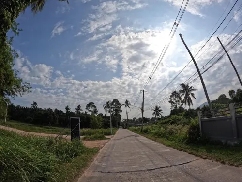


Dragon Column
Monument and historic site · 7.9 km
Thailand, Mae Nam, Ko Samui District, Surat Thani, Koh Samui
Fisherman's Village Bophut Walking Street
Monument and historic site · 10.8 km
Thanon Bo Phut
9 more on the map.
Parks, trails and playgrounds19

Secret Buddha Garden
Park · 8.7 km
Sculpture park on Samui island, Thailand

Pink Elephant Water Park
Sports field and stadium · 8.6 km
28/41 Moo 1 Mae Nam 1, Koh Samui



7 more on the map.
Restaurants and cafes216
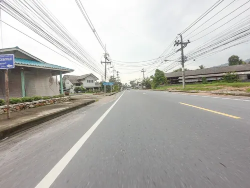
Ko Jack Coffee and Restaurant
Restaurant · Thai, Coffee Shop, Breakfast, Tea · 6.7 km
205 ม.1 ต, อ.เกาะสมุย
Mo-Fr 06:00-16:30; Sa 06:00-11:00
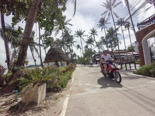
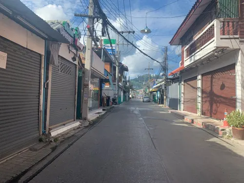
H Bistro at Hansar Samui
Restaurant · Asian, French, Thai · 10.3 km
101/28 Moo 1, Bophut
Mo-Su 06:30-22:30

A PIECE OF CAKE
Cafe · Italian, Swedish, Breakfast, Brunch, Lunch, Russian, Western, Pastry, Bakery · 11.7 km
25, 48 Chumchon Chaweng Yai Soi 3
Mo-Su 08:00 -18:00

HAPPY ELEPHANT FOOD STALL GROUP SINCE 1995
Restaurant · Thai, Western, Japanese, Italian, Healthy · 10.7 km
79 9 Thanon Bo Phut
sunrise-sunset
Magical Garden
Cafe · Coffee Shop, Ice Cream, Burger, Regional, Juice, Bistro, Sandwich, Breakfast, Western · 10.6 km
78 Thanon Laan Thong, Suratthani
Mo-Su 09:00-02:00
Orrawan's Noodles And Thai Food
Restaurant · Thai, Noodle · 7.6 km
215/3 Moo 1 Mae Nam, Koh Samui
Mo-Su 10:00-19:00
monster ccafé
Restaurant · Asian, Breakfast, Burger, Chicken, Coffee Shop, Crepe, Diner · 7.1 km
45/11 m.4
We-Mo 08:00-19:00
204 more on the map.
History
According to oral tradition, the island of Ko Samui was first settled around the 6th century CE by fishermen from the Malay Peninsula and visited by passing traders from southern China. It has also been claimed by some local historians that the island was used as a safe haven during storm seasons. However, recent archaeological evidence suggests that Ko Samui may have been inhabited significantly earlier, more than 2,000 years ago, with bronze ritual drums with etchings of birds, boats, and spirits being found in the southern hills on the island.
Beginning in the thirteenth century, Ko Samui was part of Siam's feudal system and at the time the island acted as a crucial intermediary for ongoing trade between China and India. As a result of its position in Southeast Asia, the island began receiving immigrants from many ethnic and religious groups. At the time, Ko Samui was connected to the muang system through Nakorn Si Thammarat and Thai people constituted the ethnic majority, moving the island to a more agrarian society. These individuals tended to live further inland than previous inhabitants.
Ko Samui appears on Chinese maps dating back to 1687, under the name Pulo Cornam.
Read more of the history
Beginning in the 19th century, a significant number of Chinese immigrants moved to many areas in Thailand, including Ko Samui. Most of these individuals were traders moving from Hainan, who culturally assimilated into the majority Thai society on the island. While much of these individuals' Chinese culture and identity have not been preserved, a number of Hainanese temples and communities still exist on Ko Samui. It was these immigrants who first began cotton and coconut plantations on the island, transporting them to the mainland on boats known as panuk lang si. As a result, these Thai-Chinese individuals tended to live closer to the beaches of Ko Samui, in contrast to the ethnic Thai individuals who lived further inland.
During World War II, Ko Samui was used by Japan as a base of operations in conjunction with Thailand's Navy. It is believed that, as a result of conflicts between the Allies and Japan, the area around the island contains a number of shipwrecks from the era. Locals reported a large explosion around that time, which academic Paul Chambers attributed to a Japanese tanker being bombed alongside Ko Samui on 15 June 1945.
In the 1960s, two dengue hemorrhagic fever (DHF) epidemics occurred on Ko Samui.
Until the late 20th century, Ko Samui was an isolated self-sufficient community, having little connection with the mainland of Thailand. The island was without roads until the early 1970s and the 15 kilometres (9.3 mi) journey from one side of the island to the other could involve a whole-day trek through the mountainous central jungles.
At first, tourists were primarily backpackers to whom locals provided basic accommodations. However, as Bangkok, Pattaya, and Phuket started to become major tourist destinations in the 1980s, Ko Samui began to attract significant foreign investment and travelers. The first era of development projects began at Chaweng Beach, followed by a steady outgrowth of resorts across the rest of the island. This period of economic growth was primarily the result of Thailand's Fifth
National Economic and Social Development Plan, which lasted from 1982 until 1986. In 1985, the Tourism Authority of Thailand (TAT) launched the Master Plan for Tourism Development of Ko Samui/Surat Thani.
In 1989, Samui Airport was constructed, facilitating a spike in mass tourism growth on the island during the 1990s. As a result of the increased income from tourism, Thailand's central government began reorganizing local administrative procedures on the island. Leases and joint ventures also came to replace direct land sales during this period, especially as the devaluation of the Thai baht and political instability in Indonesia led many to view Ko Samui as an affordable and relatively safe alternative destination. DHF outbreaks continued to occur on the island following the 1960 epidemics, with an incidence of nearly 500 cases per 100,000 during one outbreak in 1995, potentially impacting tourism during the period.
Economic growth has brought not only prosperity but also major changes to the island's environment and culture, including "explosive tensions" between rich and poor residents and crime linked to that or otherwise.
On 11 April 2015, a car bomb packed inside a pickup truck stolen from the southern border province of Yala, exploded in the underground car park of the Central Festival Samui shopping mall. The blast injured seven people, six Thai nationals and a 12-year-old Italian girl, who sustained minor injuries and were quickly treated and discharged. Because the vehicle originated from Yala, one of Thailand's southernmost, Muslim-majority provinces affected by the Southern Thailand insurgency, authorities initially suspected a connection to southern militant networks. Government and military officials also investigated potential links to domestic political tensions and anti-coup elements.
On 4 March 2022, Australian cricketer Shane Warne died of a heart attack at the age of 52, while on holiday in Ko Samui.
From the History section of Ko Samui on Wikipedia, under CC BY-SA 4.0.
More about Ko Samui
Geography
Ko Samui is in the Gulf of Thailand, about 35 km (22 mi) northeast of Surat Thani town (9°N, 100°E). It is the largest island in the Chumphon Archipelago, measuring about 25 kilometres (16 mi) at its widest point. To the north are the populated resort islands of Ko Pha-ngan, Ko Tao, and Ko Nang Yuan. Close to Bangrak in northeast Samui is the small uninhabited island of Ko Som, and to the northeast of Chaweng is the tiny Ko Matlang. To the south are Ko Taen and Ko Matsum, each of which have small tourist facilities. To the far west are 44 other islands which together compose Mu Ko Ang Thong National Park which is accessible by a day-trip boat tour from Ko Samui.
The central part of Ko Samui is mostly tropical jungle with tree coverage and wildlife and its largest mountain, Khao Pom, peaking at 635 m (2,083 ft). The lowland and coastal areas are connected by a 51 km (32 mi)-long road, encircling the island. Other concrete roads branch off to service other areas.
Arts and culture
Ko Samui has its own specific dialect, customs, cuisine, and observed ceremonies. A number of rituals, festivals, and other events take place across the island over the year, such as Loy Khro, where bamboo boats floated on top of immature coconuts are launched into the sea. These small boats carry hair, nail clippings, and other offerings said to cast away misfortune. The Southern Thai tradition of Gin Hor, where villagers bring together homemade food to share, continues to be celebrated in the form of temple fairs and beach gatherings. The ritual of Lah Pho Ta is held in June before village shrines as a way to honor guardian spirits with savory and sweet offerings, followed by the Manora. In addition to more traditional festivals, new celebrations have developed, such as the Samui Latin Festival and the Samui Regatta. There is a small but developing LGBTQ+ scene in Ko Samui, with the first Ko Samui Pride Celebration taking place in 2018, and the ALPHA Gay Resort and gay-owned café The Road Less Travelled (RLT) both frequented by LGBTQ+ tourists.
Education
There are a number of international schools on the island, including Windfield International School Koh Samui (WIS), the International School of Samui, Lamai International School, Oonrak Koh Samui Bilingual School, Greenacre International School, PanyaDee - The British International School of Samui (PBISS).
Suratthani Rajabhat University (SRU) opened its Koh Samui Interdisciplinary School (initially known as the International School of Tourism) in 2010, offering two bachelor's degrees in Hotel Management and Cruise Business and Thai and International Culinary Arts.
From the Wikipedia article Ko Samui, under CC BY-SA 4.0.
Where to stay140
Pinnacle Samui Resort & Spa
Motel and hotel · 7.6 km
26/19 Moo 4 Maenam Beach, Koh Samui Suratthani 84330 Thailand
Churches and places of worship17
Shopping25
Gas and EV charging7
Schools, colleges and libraries6
Healthcare14
Map of Ko Samui
250 places. The map loads OpenStreetMap tiles when you open it.
Getting there and nearby towns
Samui International Airport (USM) is the nearest airport with scheduled flights listed in OpenStreetMap, 14 km away.
- Ko Pha Ngan 27 km northeast, about 27 min by car
- Don Sak 36 km southwest, about 36 min by car
- Koh Tao 63 km north, about 1 h by car
- Surat Thani 79 km southwest, about 1 h 15 min by car
- Chaiya 83 km west, about 1 h 30 min by car
Drive times are estimates from straight-line distance, not routes.
Towns near Ko Samui


Keep exploring
Local news
Headlines from INDB.
Reviews, tips and questions
Loading what members have shared...
Sources and licences
- GeoNames (CC BY 4.0): population, coordinates, regions and time zone
- Mapillary (see each image): photos
- OpenStreetMap contributors (ODbL 1.0): places, airports, map data
- Wikidata (CC0 1.0): elevation, founding date, time zone, website, landmarks and historic places
- Wikimedia Commons (see each image): photos
- Wikipedia (CC BY-SA 4.0): overview and history text
Photo credits
- Ang Thong, Ko Samui District, Surat Thani, Thailand - panoramio, Mark Stepanov, CC BY 3.0
- Thaïlande - Ko Samui - Ang Thong (13378657915), Nicolas Vollmer from Munich [Allemagne], CC BY 2.0
- View of Ko Samui 2, Christophe95, CC BY-SA 4.0
- View of Ko Samui, Christophe95, CC BY-SA 4.0
- Secret Buddha Garden, אברהם שוורץ, CC BY-SA 4.0
- Samui 2013 May - panoramio (79), Roma Neus, CC BY 3.0
- วัดหน้าพระลาน, Vano111ru, CC BY-SA 4.0
- วัดบ่อพุทธาราม, Vano111ru, CC BY-SA 4.0
- Coast near Nathon Pier, Christophe95, CC BY-SA 4.0
- Samui 2014, february - panoramio (105), Roma Neus, CC BY 3.0
- Nathon Hafen Fischverkauf, Hajotthu, CC BY 3.0
- Nathon Hafen Fischmarkt, Hajotthu, CC BY 3.0
- Natong - panoramio, Ralf Schmidt, CC BY-SA 3.0
- Samui 2014, february - panoramio (107), Roma Neus, CC BY 3.0
- Hainan Temple Nathon, Christophe95, CC BY-SA 4.0
- Hainan Temple Nathon 2, Christophe95, CC BY-SA 4.0
- Hainan Temple Nathon 3, Christophe95, CC BY-SA 4.0
- View from Nathon Pier, Christophe95, CC BY-SA 4.0
- Nathon Hauptstraße, Hajotthu, CC BY 3.0
- Nathon Hafen Fischerboote, Hajotthu, CC BY 3.0
- Surat Thani banner, Christian Schmitt from Lohr, Deutschland, CC BY 2.0
- DSC 2793 (6434309311), Christian Schmitt from Lohr, Deutschland, CC BY 2.0
- Samui 2014, february - panoramio (106), Roma Neus, CC BY 3.0
- Samui 2014, february - panoramio (104), Roma Neus, CC BY 3.0
- KoSamuiNaThonFromJungle OwlofDoom, Unknown author, CC BY 1.0
- Samui 2014, february - panoramio (102), Roma Neus, CC BY 3.0
- Thailand cats - thajské kočky - panoramio, Thajsko, CC BY 3.0
- Samui 2014, february - panoramio (103), Roma Neus, CC BY 3.0
- Samui 2014, february - panoramio (101), Roma Neus, CC BY 3.0
- Sapphire Princess anchored in Koh Samui, Thailand (27721746634), bvi4092, CC BY 2.0
- Sapphire Princess and tender in Koh Samui, Thailand (27721993513), bvi4092, CC BY 2.0
- Medical Cannabis Clinic at Thai government hospital IMG20220107140235, Per Meistrup, CC BY-SA 4.0
- Beach, Lipa Noi, Koh Samui, Thailand - panoramio, Kim Carter, CC BY-SA 3.0
- Samui to dornsak - panoramio, Boonchai C, CC BY 3.0
- Garden in Lipa Noi - panoramio, Kim Carter, CC BY-SA 3.0
- Samui 2014, february - panoramio (74), Roma Neus, CC BY 3.0
- Koh Samui - panoramio - ferda, ferda, CC BY 3.0
- Samui 2014, february - panoramio (75), Roma Neus, CC BY 3.0
- - panoramio - Павел Бондарчук, Павел Бондарчук, CC BY 3.0
- Samui 2014, february - panoramio (76), Roma Neus, CC BY 3.0
- Street-level photo, esario, CC BY-SA 4.0
- Street-level photo, esario, CC BY-SA 4.0
- Street-level photo, lucomsky, CC BY-SA 4.0
- Street-level photo, rororo, CC BY-SA 4.0
- Street-level photo, esario, CC BY-SA 4.0
- Street-level photo, emseesee, CC BY-SA 4.0
- Street-level photo, lucomsky, CC BY-SA 4.0
- Street-level photo, esario, CC BY-SA 4.0
- Street-level photo, emseesee, CC BY-SA 4.0
- Street-level photo, lucomsky, CC BY-SA 4.0
- Street-level photo, emseesee, CC BY-SA 4.0
- Street-level photo, lucomsky, CC BY-SA 4.0


Page built November 10, 2026. Spotted a mistake? Tell us or suggest a place.