


Lampang, Thailand
เทศบาลนครลำปาง
Lampang is a regional capital of 156,139 people in Lampang, Thailand.
Why visit Lampang
Townapedia lists 17 museums and landmarks, 15 parks and trails, 150 places to eat, 39 places to stay and 2 attractions in and around town.
Highlights include Ratsadaphisek Bridge, สะพานรัษฎาภิเศก, Baan Sao Nak and Happy Life Golf Center.
Weather in Lampang
Forecast from MET Norway (CC BY 4.0). Full forecast
About Lampang
Lampang, also called Nakhon Lampang (Northern Thai: ᩃᩣᩴᨻᩣ᩠ᨦ; Thai: นครลำปาง, pronounced [náʔkʰɔːn lampaːŋ]) to differentiate from Lampang province, is the third largest city in northern Thailand and capital of Lampang province and the Mueang Lampang district. Traditional names for Lampang include Wiang Lakon and Khelang Nakhon. The city is a trading and transportation center. Lampang lies 601 km (373 mi) north of Bangkok and 101 km (63 mi) southeast of Chiang Mai.
From the Wikipedia article Lampang (this version), under CC BY-SA 4.0.
Travel tips from other travellers: Lampang on Wikivoyage (CC BY-SA 4.0).
Photos of Lampang


Things to do2


Museums and landmarks17
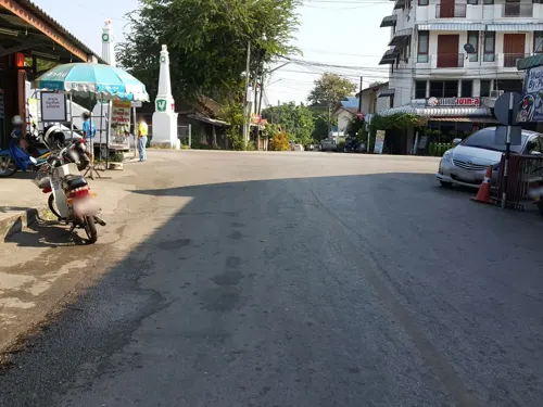

Baan Sao Nak
Museum · 1.6 km
A traditional, teak-wood Lanna-style house built on pillars in 1895, with historic furnishings.
closed

Kad Kong Ta Walking Street
Monument and historic site · 0.7 km
Bustling spot with numerous stalls of varied merchandise, dining options, baked goods & groceries. Saturday and Sunday night market
Sa-Su 16:00-22:00
5 more on the map.
Parks, trails and playgrounds15


สวนสาธารณะ สะพานดำ
Park · 3.1 km
A park with a black railway bridge and old railway equipment

3 more on the map.
Restaurants and cafes150
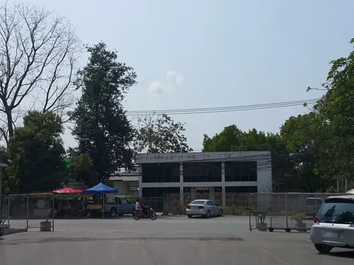
NamDern น้ำเดิน(Nam-Nam Specialist)
Restaurant · Thai, Noodle · 4.1 km
745/1 ถนนเลี่ยงเมืองลำปาง
We-Mo 09:00-18:00
Aroy One Baht
Restaurant · Thai
297 Tipchang Rd
Mo-Su 16:00-23:00
Baan Phraya Suren by Madame Musur
Bar and pub · Thai · 2.2 km
20 ถนนสุเรนทร์
Mo,We-Su 17:00-24:00
FLASH CUP
Cafe · Cake, Coffee Shop, Tea
141 ถนนปงสนุก
Mo-Su 07:30-17:30



Waengbun Dailivery
Restaurant · Diner, Thai, Coffee Shop · 1.4 km
Also has a restaurant in a nice garden by the river
106 ถนนป่าไม้
Mo-Su 11:00-20:00
หนมเส้นคุณนายนุ้ย
Restaurant · Thai, Noodle · 0.7 km
1073 ถนนจริญเมือง
Th-Tu 11:00-17:00

CheWin Coffee and Roaster
Cafe · 1.5 km
33/3 ถนสุเรนทร์
Mo-Su 08:00-16:30
138 more on the map.
History
Lampang was a major city in the Lanna kingdom. However, its historical prominence is largely overshadowed by Chiang Mai or Chiang Rai which were the traditional seats of government, and whose histories were well recorded in chronicles. Following decades of warfare with both the Ava Burmese and Ayudhya during the 17th-18th century, the region was in decline, severely depopulated, and subject to Burmese control.
In the late 18th century, the famed marksman and Lampang native Nan Thipchang assassinated the local Burmese leader in Wat Phra That Lampang Luang, and led an uprising which led to a rollback of Burmese rule over Lanna. Allied with Bangkok, the descendants of Nan Thipchang, known as Chao Ched Ton (the seven princes), became the vassal rulers of the various Lanna cities until the annexation of Lanna into Siam (Thailand) proper under King Chulalongkorn (Rama V).
Read more of the history
During the late 1800s and early 1900s, the region experienced a growth in teak logging. Lampang later became home to Louis Leonowens, who operated teak plantations around Lampang. During the Ngiao Rebellion, Lampang was attacked by 200 Shan rebels led by Phaka Mong on 3 August 1902. Prior to this, the ruler of Lampang assembled a force of 1,000 and Leonowens had organized defences around the town. They were also reinforced by 54 policemen from Chiang Mai led by Danish captain Hans Markvard Jensen. The following battle resulted in the defeat of the Shans, however Chao Bunwatwongse, Lampang's ruler, was evacuated to Chiang Mai over fears of another attack but returned to Lampang on August 7.
In 1894, the Ratsadaphisek Bridge across the Wang river was opened and became the longest bridge in Thailand at the time. However, the flow of logs down the Wang caused damage to the bridge until the current version was completed in 1917. On 1 April 1916, the first train arrived at Nakhon Lampang Railway Station, which was then the northernmost train station in Thailand.
During World War II, Lampang became an important location for Japanese operations as the main Japanese headquarters in Thailand, as well as the target of Allied bombings. In 1942, a squadron of P-40 Tomahawks belonging to the American Flying Tigers were supposed to bomb Lampang, but mistook Lamphun for Lampang and returned after seeing no troop movements in Lamphun. The Allied forces also attempted to bomb the Ratsadaphisek Bridge to disrupt Japanese operations.
From the History section of Lampang on Wikipedia, under CC BY-SA 4.0.
More about Lampang
Geography
Lampang city is in the valley of the Wang River, bordered by the Khun Tan Range on the west and the Phi Pan Nam Range on the east. The river, a major tributary of the Chao Phraya, flows through the city. The city lies mainly on the south side of Wang River, although the old parts of the city had been originally developed in the north side of it. Nowadays, downtown Lampang has grown in the southeast of the river along Bunyawat and Pahon Yothin Roads.
Economy
Besides the traditional rice paddy farming, pineapple, and sugarcane constitute major food crops in Lampang Province. The province has a large deposit of lignite in Mae Moh district, fuelling several coal-fired electricity generating plants, whose pollution has severely affected the local populations. Lampang also has a large deposit of kaolin which is widely utilized in the ceramics industry. Historically, logging was an important industry, since Lampang, together with nearby Phrae had a large stand of teak. Many elephants were employed to transport the logs to the river for transport to Bangkok, hence the founding of an "elephant school", the predecessor of the Thai Elephant Conservation Center. Much of the old growth teak stands in Lampang had been thoroughly harvested.
Arts and culture
Lampang, also called "mueang rot ma" in Thai, meaning "horse carriage city", is considered by some Thais as the last paradise in Thailand. It is about 100 km (62 mi) to the southeast of Chiang Mai. Although well-connected by rail, and four lane highways to both Bangkok and Chiang Mai, it is here that tourists can still find horse-drawn carriages in regular use for transportation. One account attributes the horse-drawn carriage to the Portuguese, via Macau, although a more likely origin is colonial Burma. Lampang was an important center of the timber industry in the early-20th century and saw an influx of migrants from British-controlled Burma. The horse-drawn carriage is one of the most memorable symbols of Lampang, as reflected in many traditional products.
Lampang has a few institutions of higher learning, such as Yonok College, and a branch of Thammasat University.
Education
Lampang has a number of educational institutions, including kindergartens, primary, secondary and vocational schools. Schools teach in the English, Thai, and Chinese languages. Lampang also has a number of universities: Lampang Rajabhat University, Rajmangala University of Technology, Nation University (formerly Yonok) and a satellite campus of Thammasat University. Lampang College of Commerce and Technology (LCCT) and Lampang International Technical College (LIT) are well known schools which teach technology.
From the Wikipedia article Lampang, under CC BY-SA 4.0.
Notable people from Lampang
 Kratae RsiamThai singer, model and boxerPhoto: THHeadline, CC BY 3.0
 Witthaya ThamwongThai archerPhoto: B20180, CC BY-SA 3.0
 Korraphat NarichanThai professional footballerPhoto: Lady.Melon, CC BY-SA 4.0
 Tevarit MajchacheepThai sports shooterPhoto: B20180, CC BY-SA 3.0
- Sahaphap WongratchThai actor and singer
- KawilaKing of the Chao-Chet-Thon dynasty
- Pierra VejjabulThai physician
- Pansa MeesathamThai footballer
- Nakarin FuplookThai footballer
- Saprang KalayanamitrThai general
- Choomphol ChaiyanitrThai sport shooter


Born in Lampang, according to Wikidata (CC0). Each name links to its Wikipedia article.
Where to stay39
Memmoth Cafe & Hostel In Lampang
Motel and hotel · Coffee Shop, Breakfast · 2.9 km
219/1-3 ถนนประสานไมตรี
Churches and places of worship77
Shopping19
Gas and EV charging19
Schools, colleges and libraries51
Healthcare22
Salaya Pharmacy
Clinic and pharmacy · 3.9 km
640/1 Moo 7 Thumbon Phrabath, Lampang
Map of Lampang
250 places. The map loads OpenStreetMap tiles when you open it.
Getting there and nearby towns
Lampang Airport (LPT) is the nearest airport with scheduled flights listed in OpenStreetMap, 3 km away.
- Mae Tha 42 km northwest, about 42 min by car
- Long 43 km southeast, about 43 min by car
- Lamphun 60 km northwest, about 1 h by car
- San Kamphaeng 64 km northwest, about 1 h by car
- Pa Sang 64 km northwest, about 1 h by car
- Den Chai 68 km southeast, about 1 h 15 min by car
- Phrae 70 km east, about 1 h 15 min by car
- San Pa Tong 73 km northwest, about 1 h 15 min by car
- Hang Dong 75 km northwest, about 1 h 15 min by car
- Chiang Mai 77 km northwest, about 1 h 15 min by car
Drive times are estimates from straight-line distance, not routes.
Keep exploring
Local news
Headlines from INDB.
Reviews, tips and questions
Loading what members have shared...
Sources and licences
- GeoNames (CC BY 4.0): population, coordinates, regions and time zone
- Mapillary (see each image): photos
- OpenStreetMap contributors (ODbL 1.0): places, airports, map data
- Wikidata (CC0 1.0): elevation, founding date, time zone, website, landmarks and historic places
- Wikimedia Commons (see each image): photos
- Wikipedia (CC BY-SA 4.0): overview and history text
Photo credits
- 10340 Lampang, YashiWong, CC BY-SA 3.0
- Wat Phra That Lampang Luang (29671184960), Thanate Tan from Bangkok, Thailand, CC BY 2.0
- Wat Phra That Lampang Luang (29850933742), Thanate Tan from Bangkok, Thailand, CC BY 2.0
- Wat Phra That Lampang Luang (29881682311), Thanate Tan from Bangkok, Thailand, CC BY 2.0
- Wat Phra That Lampang Luang (29850993492), Thanate Tan from Bangkok, Thailand, CC BY 2.0
- Wat Phra That Lampang Luang (29850985772), Thanate Tan from Bangkok, Thailand, CC BY 2.0
- Wat Phra That Lampang Luang (29881665991), Thanate Tan from Bangkok, Thailand, CC BY 2.0
- Wat Phra That Lampang Luang (29337638274), Thanate Tan from Bangkok, Thailand, CC BY 2.0
- Wat Phra That Lampang Luang (29850966922), Thanate Tan from Bangkok, Thailand, CC BY 2.0
- Wat Phra That Lampang Luang (29671191850), Thanate Tan from Bangkok, Thailand, CC BY 2.0
- Wat Phra That Lampang Luang (29964619745), Thanate Tan from Bangkok, Thailand, CC BY 2.0
- Wat Phra That Lampang Luang (29337655094), Thanate Tan from Bangkok, Thailand, CC BY 2.0
- Wat Phra That Lampang Luang (29881658471), Thanate Tan from Bangkok, Thailand, CC BY 2.0
- Wat Phra That Lampang Luang (29881651181), Thanate Tan from Bangkok, Thailand, CC BY 2.0
- Wat Phra That Lampang Luang (29881655991), Thanate Tan from Bangkok, Thailand, CC BY 2.0
- วัดพระแก้วดอนเต้าสุชาดาราม Ritthichai 01, Ritthichai Siangdee, CC BY-SA 4.0
- Wat Si Rong Mueang - Lampang - Thailand - 02 (35194408476), Adam Jones from Kelowna, BC, Canada, CC BY-SA 2.0
- Lampang Wat Pongsanuk Chedi, Hdamm, CC BY-SA 3.0
- Wang River in Amphoe Mueang Lampang, No machine-readable author provided. Oatz assumed (based on copyright claims)., Public domain
- KHA-05, Khathar, CC BY-SA 4.0
- Pagoda of Wat Pong Sanuk, KaiserO5, CC BY-SA 4.0
- Ban Sao Nak (29881585681), Thanate Tan from Bangkok, Thailand, CC BY 2.0
- Wat Chiang Rai (29850913462), Thanate Tan from Bangkok, Thailand, CC BY 2.0
- Ban Sao Nak (29930706526), Thanate Tan from Bangkok, Thailand, CC BY 2.0
- Wat Prakaewdontoa Suchadaram (29881529031), Thanate Tan from Bangkok, Thailand, CC BY 2.0
- Ban Sao Nak (29671084470), Thanate Tan from Bangkok, Thailand, CC BY 2.0
- Wat Sichum (29850804702), Thanate Tan from Bangkok, Thailand, CC BY 2.0
- Wat Pong Sanuk (29930678066), Thanate Tan from Bangkok, Thailand, CC BY 2.0
- Wat Sichum (29337492094), Thanate Tan from Bangkok, Thailand, CC BY 2.0
- Ban Sao Nak (29337538404), Thanate Tan from Bangkok, Thailand, CC BY 2.0
- Wat Chedi Sao Lang (29671137820), Thanate Tan from Bangkok, Thailand, CC BY 2.0
- Wat Lai Hin Luang (29964639345), Thanate Tan from Bangkok, Thailand, CC BY 2.0
- Ban Sao Nak (29850899532), Thanate Tan from Bangkok, Thailand, CC BY 2.0
- Wat Pong Sanuk (29930687896), Thanate Tan from Bangkok, Thailand, CC BY 2.0
- Ban Sao Nak (29338117613), Thanate Tan from Bangkok, Thailand, CC BY 2.0
- Ban Sao Nak (29881575201), Thanate Tan from Bangkok, Thailand, CC BY 2.0
- Amok Gallery (29337481414), Thanate Tan from Bangkok, Thailand, CC BY 2.0
- Wat Sichum (29337477324), Thanate Tan from Bangkok, Thailand, CC BY 2.0
- Wat Prakaewdontoa Suchadaram (29930658746), Thanate Tan from Bangkok, Thailand, CC BY 2.0
- Wat Pong Sanuk Nua (29850859932), Thanate Tan from Bangkok, Thailand, CC BY 2.0
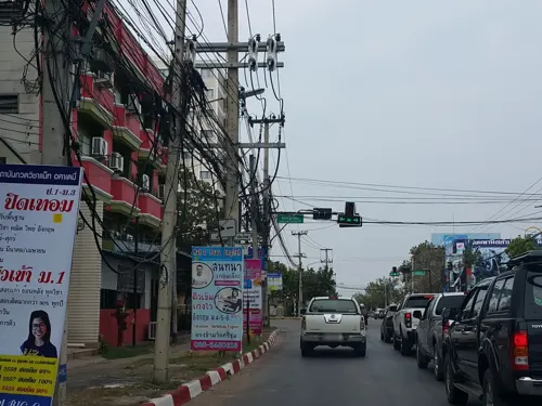
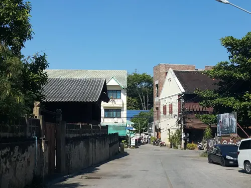
- Street-level photo, jrcarlsen, CC BY-SA 4.0
- Street-level photo, jrcarlsen, CC BY-SA 4.0
- Street-level photo, noochjaree, CC BY-SA 4.0
- Street-level photo, jrcarlsen, CC BY-SA 4.0
- Street-level photo, jrcarlsen, CC BY-SA 4.0
- Street-level photo, jrcarlsen, CC BY-SA 4.0
- Street-level photo, ekkarin, CC BY-SA 4.0
- Street-level photo, jrcarlsen, CC BY-SA 4.0
- Street-level photo, ekkarin, CC BY-SA 4.0
- Street-level photo, jrcarlsen, CC BY-SA 4.0
- Street-level photo, jrcarlsen, CC BY-SA 4.0
- Street-level photo, jrcarlsen, CC BY-SA 4.0
- Street-level photo, jrcarlsen, CC BY-SA 4.0
- Street-level photo, jrcarlsen, CC BY-SA 4.0
- Street-level photo, jrcarlsen, CC BY-SA 4.0
- Street-level photo, jrcarlsen, CC BY-SA 4.0
- Street-level photo, jrcarlsen, CC BY-SA 4.0
- Street-level photo, jrcarlsen, CC BY-SA 4.0
- Street-level photo, jrcarlsen, CC BY-SA 4.0
- Street-level photo, jrcarlsen, CC BY-SA 4.0
- Street-level photo, mishari, CC BY-SA 4.0
- Street-level photo, jrcarlsen, CC BY-SA 4.0
- Street-level photo, jrcarlsen, CC BY-SA 4.0
- Street-level photo, ekkarin, CC BY-SA 4.0


Page built November 10, 2026. Spotted a mistake? Tell us or suggest a place.