


Mae Hong Son, Thailand
เทศบาลเมืองแม่ฮ่องสอน
Mae Hong Son is a regional capital of 9,109 people in Mae Hong Son, Thailand.
Why visit Mae Hong Son
Townapedia lists 3 museums and landmarks, 1 park or trail, 29 places to eat, 30 places to stay and 2 attractions in and around town.
Weather in Mae Hong Son
Forecast from MET Norway (CC BY 4.0). Full forecast
About Mae Hong Son
Mae Hong Son (Northern Thai: ᨾᩯ᩵ᩁᩬ᩵ᨦᩈᩬᩁ; Thai: แม่ฮ่องสอน, pronounced [mɛ̂ː hɔ̂ŋ sɔ̌ːn]) is a town (thesaban mueang) in north-west Thailand, capital of Mae Hong Son Province. It is in the Shan Hills, near the border with Burma along the banks of the River Pai. As of 2018, the town had 7,066 inhabitants. The town covers the tambon Chong Kham of the Mueang Mae Hong Son district.
From the Wikipedia article Mae Hong Son (this version), under CC BY-SA 4.0.
Travel tips from other travellers: Mae Hong Son on Wikivoyage (CC BY-SA 4.0).
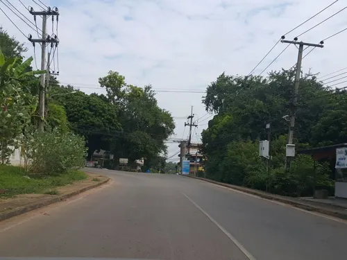
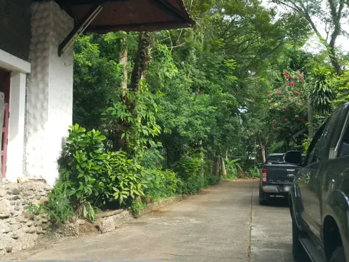
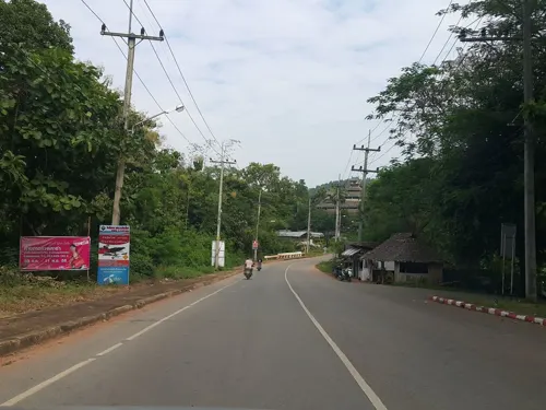
Photos of Mae Hong Son


Things to do2

Museums and landmarks3

Parks, trails and playgrounds1

Restaurants and cafes29




Salween Home Restaurant
Restaurant · 0.9 km
117/1 Moo-5
Mo, Tu, Th-Su 09:00-21:00
ร้านอาหารกระเพราถาดป้านตอง
Restaurant · Diner · 1.0 km
44/1 ถนน มรรคสันติ
17 more on the map.
History
The territory of Mae Hong Son Province was formerly part of Mawkmai State, one of the Shan States which had been founded in 1767 by Hsai Khiao, hailing from a noble family of Chiang Mai.
As a result of the Anglo-Siamese Boundary Commission of 1892-93 Mae Hong Son district was ceded to Siam, but the adjacent Möngmaü and Mehsakun trans-Salween districts— also claimed by Siam as territories located on the eastern side of the Salween River— were kept as part of British Burma.
From the History section of Mae Hong Son on Wikipedia, under CC BY-SA 4.0.
More about Mae Hong Son
Arts and culture
The town has some tourist infrastructure, including many guesthouses and several internet cafes. It also has a vegetarian restaurant near the main market.
It is a popular jumping-off point for tours to visit hill tribe villages, caves, and waterfalls in the area. There are also some hot springs nearby.
"Thung Dok Bua Tong" in Amphoe Khun Yuam, where the fields of wild sunflowers bloom and cover the hills during the month of November, is best reached from Mae Hong Son and lies some 80 km away.
From the Wikipedia article Mae Hong Son, under CC BY-SA 4.0.
Notable people from Mae Hong Son
 Rodjaraeg WattanapanitThai womanPhoto: U.S. Department of State, Public domain
- Seksan PituratThai footballer
- Sakarin Krue-OnThai artist

Born in Mae Hong Son, according to Wikidata (CC0). Each name links to its Wikipedia article.
Where to stay30
Churches and places of worship11
Shopping2
Gas and EV charging2
Schools, colleges and libraries3
Healthcare2
Map of Mae Hong Son
85 places. The map loads OpenStreetMap tiles when you open it.
Getting there and nearby towns
Mae Hong Son Airport (HGN) is the nearest airport with scheduled flights listed in OpenStreetMap, 1 km away.
- Pai 50 km east, about 50 min by car
- Wiang Nuea 51 km east, about 51 min by car
- Ban Mueang Pon 62 km south, about 1 h by car
Drive times are estimates from straight-line distance, not routes.
Keep exploring
Local news
Headlines from INDB.
Reviews, tips and questions
Loading what members have shared...
Sources and licences
- GeoNames (CC BY 4.0): population, coordinates, regions and time zone
- Mapillary (see each image): photos
- OpenStreetMap contributors (ODbL 1.0): places, airports, map data
- Wikidata (CC0 1.0): elevation, founding date, time zone, website
- Wikimedia Commons (see each image): photos
- Wikipedia (CC BY-SA 4.0): overview and history text
Photo credits
- Mae Hong Son (2007-02-473), Vyacheslav Argenberg, CC BY 2.0
- Statue of a lion in Mae Hong Son, Christophe95, CC BY-SA 4.0
- Mae Hong Son airport, VascoPlanet World Photography, CC BY 3.0
- ยามโพล้เพล้ที่วัดพระธาตุดอยกองมู, Thanes Piamnamai, CC BY-SA 3.0
- วัดหัวเวียง - panoramio, ::::=UT=::::, CC BY-SA 3.0
- วัดจองกลางL1000990, Cat2you, CC BY-SA 4.0
- วัดจองกลางL1000508, Cat2you, CC BY-SA 4.0
- Wat Kum Ko, Khunmoohan, CC BY-SA 4.0
- วัดจองกลางL1000606, Cat2you, CC BY-SA 4.0
- วัดจองกลางL1000521, Cat2you, CC BY-SA 4.0
- วัดพระนอน แม่ฮ่องสอน, KOSIN SUKHUM, CC BY-SA 4.0
- วัดจองกลางL1000477, Cat2you, CC BY-SA 4.0
- วัดจองกลางL1000457, Cat2you, CC BY-SA 4.0
- วัดจองกลางL1000505, Cat2you, CC BY-SA 4.0
- วัดจองกลางL1000488, Cat2you, CC BY-SA 4.0
- วัดจองกลางL1000617, Cat2you, CC BY-SA 4.0
- วัดจองกลางL1000520, Cat2you, CC BY-SA 4.0
- Wat Chong Klang, Manoonp, CC BY-SA 4.0
- วัดจองกลางL1000531, Cat2you, CC BY-SA 4.0
- วัดจองกลางL1000665, Cat2you, CC BY-SA 4.0
- วัดจองกลางL1000496, Cat2you, CC BY-SA 4.0
- วัดจองกลางL1000611, Cat2you, CC BY-SA 4.0
- วัดจองกลางL1000598, Cat2you, CC BY-SA 4.0
- @@@ Wat Chong Klang (1), Chaiyathat, CC BY-SA 4.0
- วัดจองกลางL1000958, Cat2you, CC BY-SA 4.0
- วัดจองกลางL1000523, Cat2you, CC BY-SA 4.0
- วัดจองกลางL1000552, Cat2you, CC BY-SA 4.0
- วัดจองกลางL1000568, Cat2you, CC BY-SA 4.0
- วัดจองกลางL1000663, Cat2you, CC BY-SA 4.0
- @@@ Wat Chong Klang (2), Chaiyathat, CC BY-SA 4.0
- วัดจองกลางL1000538, Cat2you, CC BY-SA 4.0
- วัดจองกลางL1000638, Cat2you, CC BY-SA 4.0
- วัดจองกลางL1000455, Cat2you, CC BY-SA 4.0
- วัดจองกลางL1000491, Cat2you, CC BY-SA 4.0
- วัดจองกลางL1000439, Cat2you, CC BY-SA 4.0
- วัดจองกลางL1000548, Cat2you, CC BY-SA 4.0
- วัดจองกลางL1000440, Cat2you, CC BY-SA 4.0
- วัดจองกลางL1000494, Cat2you, CC BY-SA 4.0
- วัดจองกลางL1000448, Cat2you, CC BY-SA 4.0
- วัดจองกลางL1000441, Cat2you, CC BY-SA 4.0
- Street-level photo, jrcarlsen, CC BY-SA 4.0
- Street-level photo, jrcarlsen, CC BY-SA 4.0
- Street-level photo, jrcarlsen, CC BY-SA 4.0
- Street-level photo, jrcarlsen, CC BY-SA 4.0
- Street-level photo, jrcarlsen, CC BY-SA 4.0
- Street-level photo, jrcarlsen, CC BY-SA 4.0
- Street-level photo, jrcarlsen, CC BY-SA 4.0
- Street-level photo, jrcarlsen, CC BY-SA 4.0


Page built November 10, 2026. Spotted a mistake? Tell us or suggest a place.