
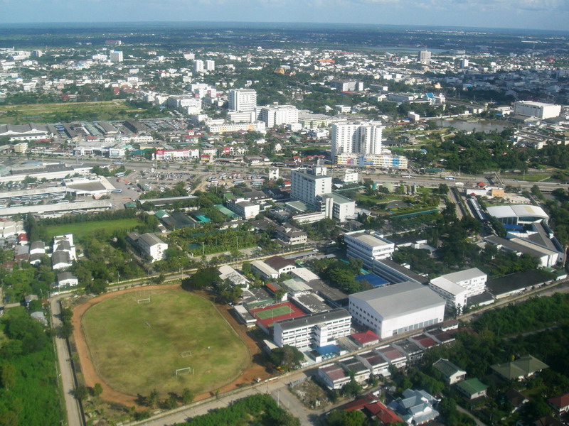


Nakhon Ratchasima, Thailand
เทศบาลนครนครราชสีมา
Nakhon Ratchasima is a regional capital of 126,391 people in Nakhon Ratchasima, Thailand, founded in 1656.
Why visit Nakhon Ratchasima
Townapedia lists 11 museums and landmarks, 16 parks and trails, 188 places to eat, 70 places to stay and 1 attraction in and around town.
Highlights include Korat Museum.
Weather in Nakhon Ratchasima
Forecast from MET Norway (CC BY 4.0). Full forecast
About Nakhon Ratchasima
Nakhon Ratchasima (Thai: นครราชสีมา, pronounced [ná(ʔ).kʰɔ̄ːn râːt.t͡ɕʰá.sǐː.māː]) is the capital of Nakhon Ratchasima province, the largest city in Northeastern Thailand and the third-largest city in Thailand. It is 250 kilometres (160 mi) northeast of Bangkok, one of the four major cities of Isan (Northeast Thailand), known as the "big four of Isan", and has a population of 466,098 people as of 2021. The city is commonly known as Korat (โคราช, pronounced [kʰōː.râːt]), a shortened form of its name.
From the Wikipedia article Nakhon Ratchasima (this version), under CC BY-SA 4.0.
Travel tips from other travellers: Nakhon Ratchasima on Wikivoyage (CC BY-SA 4.0).
Photos of Nakhon Ratchasima


Things to do1

Museums and landmarks11



Parks, trails and playgrounds16




4 more on the map.
Restaurants and cafes188
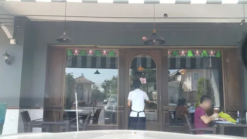
Cafe' Capu
Restaurant · German, Regional · 5.1 km
179/46 Venice Park, Nakhon Ratchasima
Mo-Su 10:00-24:00
Sukilim
Restaurant · Chinese, Japanese · 1.6 km
Sukiyaki restaurant (Chinese Style).
10:00-21:00
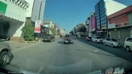
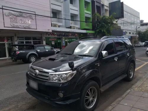


แด จัง กึม
Restaurant · Korean · 1.3 km
38/3 ถนนโยธา ตำบลในเมือง อำเภอเมืองนครราชสีมา, จังหวัดนครราชสีมา

Dadad Steakjimkajaew
Restaurant · Barbecue, Diner, Steak House, Asian, Thai, Coffee Shop, Local · 4.6 km
1119 ม5หนองจะบก ซอยสืบศิริ36 ถนนสืบศิริ
Mo-Su 10:00-22:00

Phong Phang Art & Cafe'
Cafe · Tea, Donut, Thai, Coffee Shop · 0.8 km
255/5 ถนนยมราช
Mo-Fr 09:00-18:00; Sa-Su 10:00-18:00
Shabu Monster
Restaurant · Shabu Shabu, Japanese Sukiyaki · 4.5 km
ถ.มานะศิลป์ ต.ในเมือง อ.เมือง, นครราชสีมา
Mo-Su 12:00-22:00
ก๋วยเตี๋ยวไก่บุฟเฟต์นายแมน
Restaurant · Thai · 3.3 km
186 30กันยา
Mo-Su 09:30-19.30
176 more on the map.
History
Prior to the 14th century, the area of Nakhon Ratchasima was under Khmer empire suzerainty and known in Khmer as Angkor raj, Nokor Reach Seyma, or Nokor Reach Borei, and Koreach. Phimai, to the north, was probably more important.
King Narai of Ayutthaya in the 17th century, ordered a new city built on the site to serve as a stronghold on Ayutthaya's northeastern frontier. Nakhon Ratchasima was thereafter mentioned in Siamese chronicles and legal documents as a "second-class" city of the Ayutthaya Kingdom. A royal governor ruled the city in a hereditary position.
After the final phase of the Ayutthaya kingdom ended with its complete destruction by the Burmese in 1767, a son of King Boromakot attempted to set himself up ruler in Phimai, holding sway over Korat and other eastern provinces. King Taksin of the Thonburi Kingdom (1768–1782) sent two of his generals, brothers Thong Duang and Boonma, to defeat the prince, who was executed in 1768. Thong Duang later became King Rama I of the kingdom, and Korat became his strategic stronghold on the northeastern frontier to supervise the Lao and Khmer tributary states.
Read more of the history
In 1826, Vientiane King Chao Anouvong, perceiving Siam as weakened, attacked Korat in the Laotian Rebellion against King Rama III that was to rage on for two years. Lady Mo, the wife of the deputy governor at the time, is credited with having freed the city from Anouvong's army, and has been honored with a statue in the center of downtown Korat. A full account of the war and its impact on Laos and Siam, is detailed in the book, Lady Mo and Heroism at Tung Samrit, written by Frank G Anderson. The city's old wall, east of the monument was designed and built by a French engineer who is believed to be the one who also built Naraimaharaj Palace in Lopburi. The French-based design is reflected in the moat system that surrounds the innermost portion of the city.
Nakhon Ratchasima continued to be an important political and economic center in the northeastern region under the Monthon administrative reforms of the late-19th century. In November 1900, the Royal State Railways of Siam began operation of the Nakhon Ratchasima Line from Bangkok with Korat Station as its terminus. It was officially opened on 21 December 1900 by King Chulalongkorn. The Ubon Ratchathani Line to the town of Warin opened 1 November 1922. The Thanon Chira Junction to Khon Kaen opened on 1 April 1933. Korat station was changed to Nakhon Ratchasima Railway Station in 1934.
In October 1933, after the Siamese revolution of 1932 ended the absolute monarchy, Nakhon Ratchasima became the headquarters of the Boworadet Rebellion, an abortive uprising against the new government in Bangkok.
During World War II, the troops from Nakhon Ratchasima joined the fight in Franco-Thai War, The Thai army was able to temporarily recapture some of the territory. After the war, the United States helped build Mittraphap Road from Saraburi to Nakhon Ratchasima.
In April 1981 during another attempted coup, the government, together with the royal family, took refuge in Korat.
From 1962 to 1976, during the Vietnam War, Korat Royal Thai Air Force Base hosted components of the Royal Thai Air Force, the United States Air Force, and a complement of the Royal New Zealand Air Force (RNZAF). After the US withdrawal in 1976, the Thai Air Force assumed full control. During the 1980s and early 1990s, the airfield was jointly operated as a civil airport for Nakhon Ratchasima. This ended with the opening of Nakhon Ratchasima Airport in the early 1990s.
On 13 August 1993, Thailand's worst disaster happened in the city, the collapse of the Royal Plaza Hotel, killing 137 people.
On 8 and 9 February 2020, Thailand's deadliest shooting at the time occurred in the city, when an offduty Royal Thai Army Sergeant shot 29 people dead and wounded 58 others, mostly at the local Terminal 21 mall, before being killed by responding officers.
From the History section of Nakhon Ratchasima on Wikipedia, under CC BY-SA 4.0.
More about Nakhon Ratchasima
Economy
Korat's economy has traditionally been heavily dependent on agriculture. It is known as a processing centre for Isan's production of rice, tapioca, and sugar. The Isan region accounts for half of Thailand's exports of those commodities. Together, these three agricultural commodities employ 700,000 Isan families. Korat is also one of two sites in Thailand manufacturing disk drives by Seagate Technology, employing 12,100 workers in Korat.
All three of Thailand's largest Bangkok-based department store chains have invested in expansive outlets in the city, which will provide one million square metres of retail space by late 2017.
From the Wikipedia article Nakhon Ratchasima, under CC BY-SA 4.0.
Notable people from Nakhon Ratchasima
 Somjit JongjohorboxerPhoto: 248 Event & Creation, CC BY 3.0
 Sarach YooyenThai association football playerPhoto: RuinDig/Yuki Uchida, CC BY 4.0
 Sivaruck TedsungnoenThai association football playerPhoto: BURIRAM UNITED, CC BY 3.0
 Thao SuranariThai heroPhoto: Supanut Arunoprayote, CC BY 4.0
 Pongsaklek WonjongkamThai boxer, World Boxing Council world flyweight championPhoto: 2010dynam, CC BY-SA 2.0
 Luang Por KoonBuddhist Monk from ThailandPhoto: กสิณธร ราชโอรส, CC BY-SA 4.0
 Wilavan ApinyapongThai volleyball playerPhoto: Yakov Fedorov, CC BY-SA 3.0
- Prachya PinkaewThai film director, film producer and screenwriter
- Udomporn PolsakThai weightlifter
- Teerasak PoeiphimaiThai footballer
- Anon SangsanoiThai footballer
- Rungrath PoomchantuekThai footballer


Born in Nakhon Ratchasima, according to Wikidata (CC0). Each name links to its Wikipedia article.
Where to stay70
Churches and places of worship46
Wat Bueng Saensook
Place of worship · 3.9 km
บ้านศรีสมบูรณ์ ต. โพธิ์กลาง อ. เมือง จ. นครราชสีมา
Shopping25
Gas and EV charging16
Schools, colleges and libraries27
Boromarajonani College of Nursing Nakhon Ratchasima
School · 1.6 km
177 ถนนช้างเผือก, เมืองนครราชสีมา
Healthcare19
Be Balance กายภาพบำบัดคลินิก
Hospital · 1.5 km
101/6 ถนนท้าวสุระ, เมืองนครราชสีมา
Map of Nakhon Ratchasima
250 places. The map loads OpenStreetMap tiles when you open it.
Getting there and nearby towns
Nakhon Ratchasima Airport (NAK) is the nearest airport with scheduled flights listed in OpenStreetMap, 22 km away.
- Non Thai 25 km north, about 25 min by car
- Chok Chai 28 km south, about 28 min by car
- Non Sung 29 km northeast, about 29 min by car
- Sung Noen 31 km west, about 31 min by car
- Kham Sakae Saeng 41 km north, about 41 min by car
- Amphoe Sikhiu 43 km west, about 43 min by car
- Dan Khun Thot 44 km northwest, about 44 min by car
- Phimai 51 km northeast, about 51 min by car
- Khon Buri 52 km south, about 52 min by car
- Nong Ki 57 km southeast, about 57 min by car
Drive times are estimates from straight-line distance, not routes.
Keep exploring
Local news
Headlines from INDB.
Reviews, tips and questions
Loading what members have shared...
Sources and licences
- GeoNames (CC BY 4.0): population, coordinates, regions and time zone
- Mapillary (see each image): photos
- OpenStreetMap contributors (ODbL 1.0): places, airports, map data
- Wikidata (CC0 1.0): elevation, founding date, time zone, website, landmarks and historic places
- Wikimedia Commons (see each image): photos
- Wikipedia (CC BY-SA 4.0): overview and history text
Photo credits
- NKR AERIAL, Lazydog, CC BY 3.0
- Nakhon Ratchasima Provincial Hall - January 2026, DomeMyDome, CC BY-SA 4.0
- Terminal 21, Sry85, CC BY-SA 3.0
- 2019 0210 Wat Sala Loi, Takeaway, CC BY-SA 4.0
- Terminal 21 Asok Bangkok 20202021, Chainwit., CC BY-SA 4.0
- 2019 02 Central Mall Korat exterior, Takeaway, CC BY-SA 4.0
- ประตูชุมพล โคราช, Khaun sarawut, CC BY-SA 4.0
- ประตูชุมพล -2, Yakuzakorat, CC BY-SA 4.0
- ประตูชุมพล -5, Yakuzakorat, CC BY-SA 4.0
- ประตูชุมพล -1, Yakuzakorat, CC BY-SA 4.0
- ประตูชุมพล -3, Yakuzakorat, CC BY-SA 4.0
- Thao Suranari Monument, Jingjing.pro, CC BY-SA 4.0
- KHA-02, Khathar, CC BY-SA 4.0
- ประตูชุมพล -4, Yakuzakorat, CC BY-SA 4.0
- ย่าโม โคราช, Khaun sarawut, CC BY-SA 4.0
- Clock Tower - panoramio (1), Adriaan Castermans, CC BY-SA 3.0
- Ung Heng Lee Goldsmith Tra Som - panoramio, pakong, CC BY 3.0
- 2019 02 Awesome Coffee Shop in Korat, Takeaway, CC BY-SA 4.0
- Ung Heng Lee Tra Ngeun - panoramio, pakong, CC BY 3.0
- Yellow Pumpkin drinks (Unsplash), Noom Peerapong imnoom, CC0
- ประตูชุมพล korat 09-2009 - panoramio, ::::=UT=::::, CC BY-SA 3.0
- Chumphon Gate-Korat 09-2009 - panoramio, ::::=UT=::::, CC BY-SA 3.0
- Square - panoramio (8), Adriaan Castermans, CC BY-SA 3.0
- Khorat city gate, Ahoerstemeier, CC BY-SA 3.0
- Street view - panoramio (6), Adriaan Castermans, CC BY-SA 3.0
- Ung Heng Lee Tra Pla - panoramio, pakong, CC BY 3.0
- Ung Heng Lee Goldsmith Tra Ban - panoramio, pakong, CC BY 3.0
- Ung Heng Lee Goldsmith Tra tonmai - panoramio, pakong, CC BY 3.0
- วัดพระนารายณ์ โคราช2, Noppal91, CC BY-SA 4.0
- Show 2 - panoramio, Adriaan Castermans, CC BY-SA 3.0
- Show 1 - panoramio, Adriaan Castermans, CC BY-SA 3.0
- Show 3 - panoramio, Adriaan Castermans, CC BY-SA 3.0
- 2019 Khao yam mixed, Takeaway, CC BY-SA 4.0
- 2019 02 Khao yam unmixed, Takeaway, CC BY-SA 4.0
- 2019 02 Southern Thai vegetable platter, Takeaway, CC BY-SA 4.0
- Amazing Cave - panoramio, Adriaan Castermans, CC BY-SA 3.0
- Wat Phyap 2 - panoramio, Adriaan Castermans, CC BY-SA 3.0
- Wat Phyap 1 - panoramio, Adriaan Castermans, CC BY-SA 3.0
- Old Building - panoramio (2), Adriaan Castermans, CC BY-SA 3.0
- Korat 09-2009 - panoramio, ::::=UT=::::, CC BY-SA 3.0
- Chum Phon Gate (I), This Photo was taken by Supanut Arunoprayote . Feel free to use any of my images, but please mention me as the author and may send me a message. (สามารถใช้ภาพได้อิสระ..., CC BY 4.0
- Thao Suranari Monument (I), Supanut Arunoprayote, CC BY 4.0
- 001 Bung Ta Lua Water Park - panoramio, Adriaan Castermans, CC BY-SA 3.0
- Street-level photo, ThailandCambodia, CC BY-SA 4.0
- Street-level photo, ThailandCambodia, CC BY-SA 4.0
- Street-level photo, ozflor, CC BY-SA 4.0
- Street-level photo, ozflor, CC BY-SA 4.0
- Street-level photo, jrcarlsen, CC BY-SA 4.0
- Street-level photo, ThailandCambodia, CC BY-SA 4.0
- Street-level photo, ThailandCambodia, CC BY-SA 4.0
- Street-level photo, ozflor, CC BY-SA 4.0
- Street-level photo, ThailandCambodia, CC BY-SA 4.0
- Street-level photo, jerol, CC BY-SA 4.0
- Street-level photo, ThailandCambodia, CC BY-SA 4.0
- Street-level photo, ThailandCambodia, CC BY-SA 4.0


Page built November 10, 2026. Spotted a mistake? Tell us or suggest a place.