


Nakhon Si Thammarat, Thailand
เทศบาลนครนครศรีธรรมราช
Nakhon Si Thammarat is a regional capital of 102,152 people in Nakhon Si Thammarat, Thailand, founded in September 1, 1910.
Why visit Nakhon Si Thammarat
Townapedia lists 11 museums and landmarks, 11 parks and trails, 24 places to eat, 21 places to stay and 2 attractions in and around town.
Highlights include Nakhon Si Thammarat National Museum, The National Museum of Nakhon Si Thammarat and สับปะรดสีสะพานยาว.
Weather in Nakhon Si Thammarat
Forecast from MET Norway (CC BY 4.0). Full forecast
About Nakhon Si Thammarat
Nakhon Si Thammarat (Thai: นครศรีธรรมราช, pronounced [ná(ʔ).kʰɔ̄ːn sǐː tʰām.má.râːt]; from Sanskrit: "Nagara Shrī Dharmarāja") is a city municipality (thesaban nakhon) in Mueang Nakhon Si Thammarat district, the capital of Nakhon Si Thammarat province, in the south of Thailand. It is about 610 km (380 mi) south of Bangkok, on the east coast of the Malay Peninsula. The city was the administrative centre of Southern Thailand during most of its history. Originally, a coastal city, silting moved the coastline away from the city.
From the Wikipedia article Nakhon Si Thammarat (this version), under CC BY-SA 4.0.
Travel tips from other travellers: Nakhon Si Thammarat on Wikivoyage (CC BY-SA 4.0).
Photos of Nakhon Si Thammarat


Things to do2

Museums and landmarks11

Nakhon Si Thammarat National Museum
Museum · 3.7 km
Museum in Nakhon Si Thammarat, Thailand
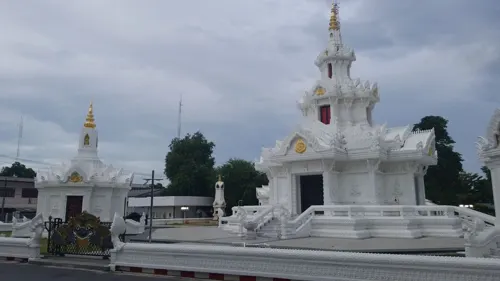

Baan Than Khun Rathawut Wicharn
Monument and historic site · 2.6 km
522 Ratchadamnoen Rd
Mo-Su 08:00-16:00

Parks, trails and playgrounds11
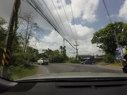

สวนศรีธรรมโศกราช
Park · 0.8 km
เดิมเป็นคุกเก่ากลางเมือง ต่อมาคุกได้ย้าไปที่ใหม่บริเวณนาพรุ บริเวณนนี้ได้ปรับปรุงใหม่ให้เป็นสวนสาธาระณะ
Restaurants and cafes24
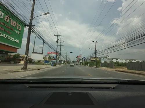
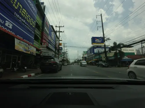
WineTasting
Brewery and winery · 0.7 km
34-35 ถนนพัฒนาการคูขวาง
Mo-Su 11:00-22:00
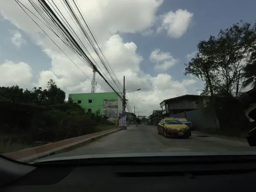
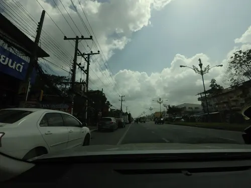



Suktawee
Restaurant · Chinese · 1.3 km
1656 Ratchadamnuen
Mo-Sa 10:30-21:00
อาหารเจ จานเจ
Restaurant · อาหารเจ/มังสวิรัติ
ึ7/14 ซ.อำนวยสุข ถนนพัฒนาการคูขวาง 24, คลัง
Mo-Fr 07:00-15:30


Yummy to my Tummy
Restaurant · Pizza, Burger, Coffee Shop, American, Sandwich, Pasta, Salad, Dessert, Western, Egional · 1.5 km
12 more on the map.
History
Nakhon Si Thammarat is one of the oldest cities in Thailand with a rich history. The earliest settlement in the vicinity of the city was Tha Rua, about ten kilometers south of the modern city, where ceramics from the Song dynasty were found dated to the twelfth century. The settlement then moved to Muang Phra Wieng, which was associated with the Tambralinga Kingdom, four kilometers to the south. An inscription was found at Wat Sema Muang that bore: The king of Srivijaya "had established a foothold on the Malay Peninsula at Ligor" by 775, where he "built various edifices, including a sanctuary dedicated to the Buddha and to the Bodhisattvas Padmapani and Vajrapani." Tambralinga, whose name means "Red Linga" (from Sanskrit tām(b)ra "copper" and lingam) and may relate to Chinese Tan Ma Ling (單馬令), was one of the polities under Mahayanist Srivijaya thalassocracy.
Read more of the history
The Chronicles of Nakorn Si Thammarat, composed in the seventeenth century, attributed the foundation of current city of Nakhon Si Thammarat to King Sri Thammasok in the thirteenth century. An inscription found at Chaiya stated that King Sri Thammasok ruled Tambralinga in 1231. King Sri Thammasok constructed Wat Phra Mahathat and introduced Singhalese Theravada Buddhism. The Nakhon Si Thammarat Kingdom held authorities over "twelve cities" that extended from Chumphon to the north and Pahang to the south. The Ramkamhaeng Stele of Sukhothai first mentioned "Nakhon Si Thammarat" in 1292, which means "The City of King Sri Thammasok" or "The City of the Virtuous king". The Nakhon Si Thammarat kingdom ended and the city perished in the fourteenth century. The ruler of Phetchaburi known as Phra Phanom Thale sent his son Phra Phanom Wang to re-establish the city and rule. Nakhon Si Thammarat then came under the influence of Central Siamese Kingdom of Ayutthaya under the mandala system.
Nakhon Si Thammarat was further incorporated into Ayutthaya, who appointed governors to the city, through centralization under King Trailokanat in the fifteenth century. Nakhon Si Thammarat served as the main seat of Siamese authority over Southern Thailand and the Malay Peninsula, becoming Muang Ek or first-level city. Nakhon Si Thammarat was known in Western sources as "Ligor". Yamada Nagamasa, the Japanese adventurer, was appointed as the governor of Ligor in 1629. In the 1680s, during the reign of King Narai, M. de Lamare the French architect renovated the city walls. After the Siamese revolution of 1688, the governor of Ligor rebelled against the new King Phetracha. King Phetracha sent troops to put down rebels in Ligor in 1692. The powers of the governors of Ligor was then curbed and Ligor was put under the authority of Samuha Kalahom the Prime Minister of Southern Siam.
After the Fall of Ayutthaya in 1767, Phra Palat Nu the vice-governor of Ligor established himself as the local warlord and ruler over Southern Thailand. King Taksin of Thonburi marched south to subjugate Phra Palat Nu or Chao Phraya Nakhon Nu in 1769. Chao Phraya Nakhon Nu was taken to Thonburi but King Taksin re-installed Nakhon Nu as a tributary ruler of Ligor in 1776. King Rama I re-established the governorship of Ligor in 1784 and it ceded to be a tributary kingdom. During the Burmese-Siamese War in 1786, the city of Ligor was sacked by the invading Burmese. During the tenure of Chao Phraya Nakhon Noi (1811–1838), known in British sources as the "Raja of Ligor", Ligor retained a relative autonomy and emerged as the political and cultural center of Southern Siam. Sir John Bowring mentioned in 1857 that the city of Ligor had a population of 12,000 people, perhaps the largest city in southern Siam before being surpassed by Surat Thani and Hatyai in modern times.
After Nakhon Noi, his son and grandson became respective governors of Nakhon Si Thammarat. During the reforms of King Chulalongkorn, the traditional governorship of Ligor was abolished and the city was incorporated into the Monthon Nakhon Si Thammarat 1896. When the monthon system was abolished in 1932, the town became a provincial capital.
From the History section of Nakhon Si Thammarat on Wikipedia, under CC BY-SA 4.0.
More about Nakhon Si Thammarat
Education
Nakhon Si Thammarat has two universities: Walailak University (the largest university in Thailand) and Nakhon Si Thammarat Rajaphat University.
While secondary schools in Nakhon Si Thammarat includes three large schools: Benjamarachutit School and Kanlayanee Si Thammarat School, both public secondary schools serving grades 7 to 12, and Sithammarat Suksa School, the largest private pre-kindergarten that serves students through grade 12.
Sithammarat Suksa School is the largest kindergarten and primary school which offers nursery-grade 6 classes on all three campuses in the city. They also offer the largest English program housed on a separate campus. Sithammart Suksa is often referred to as "Sirat" "AMC" or "EP AMC".
Several kindergarten and primary schools in the area include: Anuban Na Nakhon Utit School is a government-run school with kindergarten through grade 6. The school operates both Thai and English programmes.
From the Wikipedia article Nakhon Si Thammarat, under CC BY-SA 4.0.
Notable people from Nakhon Si Thammarat
 Surin PitsuwanThai politician (1949-2017)Photo: Government of Thailand, CC BY 2.0
 Ajcharaporn KongyotThai volleyball playerPhoto: B20180, CC BY-SA 3.0
 Piyanut Pannoyvolleyball playerPhoto: B20180, CC BY-SA 3.0
 Supharada KisskaltGerman taekwondo practitionerPhoto: Tatjana Scheidt, Inhaberin..., CC0
 Saeksan Or. KwanmuangThai Muay Thai fighter (born 1989)Photo: B20180, CC BY-SA 3.0
 Siwarut Pholhirunassociation football playerPhoto: Lady.Melon, CC BY-SA 4.0
- Witsanusak KaewruangThai footballer
- Anuwat KaewsamritThai kickboxer
- Chaiyawat Buranassociation football player
- Wanchalerm YingyongThai footballer
- Siam YappThai footballer
- Sarawut TreephanThai footballer


Born in Nakhon Si Thammarat, according to Wikidata (CC0). Each name links to its Wikipedia article.
Where to stay21
Churches and places of worship20
Shopping9
Gas and EV charging3
Schools, colleges and libraries3
Healthcare2
Map of Nakhon Si Thammarat
106 places. The map loads OpenStreetMap tiles when you open it.
Getting there and nearby towns
Nakhon Si Thammarat International Airport (NST) is the nearest airport with scheduled flights listed in OpenStreetMap, 12 km away.
- Ban Yan Yao 19 km west, about 19 min by car
- Pak Phanang 27 km east, about 27 min by car
- Ron Phibun 31 km southwest, about 31 min by car
- Thung Song 43 km southwest, about 43 min by car
- Ban Sai Khao 49 km southeast, about 49 min by car
- Chawang 51 km west, about 51 min by car
- Ban Na Saton 53 km southeast, about 53 min by car
- Hua Sai 57 km southeast, about 57 min by car
- Tham Phannara 63 km west, about 1 h by car
- Wiang Sa 70 km west, about 1 h 15 min by car
Drive times are estimates from straight-line distance, not routes.
Keep exploring
Local news
Headlines from INDB.
Reviews, tips and questions
Loading what members have shared...
Sources and licences
- GeoNames (CC BY 4.0): population, coordinates, regions and time zone
- Mapillary (see each image): photos
- OpenStreetMap contributors (ODbL 1.0): places, airports, map data
- Wikidata (CC0 1.0): elevation, founding date, time zone, website, landmarks and historic places
- Wikimedia Commons (see each image): photos
- Wikipedia (CC BY-SA 4.0): overview and history text
Photo credits
- Busy Thai street, Adam Carr at English Wikipedia, Public domain
- Nakhon Si Thammarat Lak Mueang - panoramio, Andreas Hörstemeier, CC BY-SA 3.0
- Khlang, Mueang Nakhon Si Thammarat District, Nakhon Si Thammarat 80000, Thailand - panoramio, nunt, CC BY 3.0
- Nakhon Si Thammarat - railway station ticket desks - Sep 2024, Dominic Nelson, CC BY-SA 4.0
- Nakhon Si Thammarat - railway station main platform - Sep 2024, Dominic Nelson, CC BY-SA 4.0
- Nakhon Si Thammarat - railway station platform and benches - Sep 2024, Dominic Nelson, CC BY-SA 4.0
- Nakhon Si Thammarat - railway station end of platform - Sep 2024, Dominic Nelson, CC BY-SA 4.0
- Nai Mueang, Mueang Nakhon Si Thammarat District, Nakhon Si Thammarat 80000, Thailand - panoramio, Seksan Phonsuwan, CC BY 3.0
- Wat phra mahathat woramahawihan nakhon si thammarat, KOSIN SUKHUM, CC BY-SA 4.0
- Nai Mueang, Mueang Nakhon Si Thammarat District, Nakhon Si Thammarat 80000, Thailand - panoramio (1), Seksan Phonsuwan, CC BY 3.0
- Nationalmuseum Nakhon Si Thammarat1, Media lib, CC BY-SA 3.0
- วัดพระมหาธาตุวรมหาวิหาร, Suwannee.payne, CC BY-SA 3.0
- วัดท้าวโคตร, KOSIN SUKHUM, CC BY-SA 4.0
- กำแพงเมือง (คูเมืองกำแพงเมือง), KOSIN SUKHUM, CC BY-SA 4.0
- พระเจดีย์ยักษ์และวัดพระเงินร้าง, KOSIN SUKHUM, CC BY-SA 4.0
- Phar Ngen & Je Dee Yak, Narawit07, CC BY-SA 4.0
- อนุสาวรีย์พระเจ้าศรีธรรมโศกราช, Sirinut2006, CC0
- บนท.ป.ดัดแปลง, คุณเบียร์2541, CC BY-SA 4.0
- บชท., คุณเบียร์2541, CC BY-SA 4.0
- บนท.ป.โตคิว, คุณเบียร์2541, CC BY-SA 4.0
- ANS.CTV 2020, คุณเบียร์2541, CC BY-SA 4.0
- BNS.Rapid Train 2020, คุณเบียร์2541, CC BY-SA 4.0
- หอพระสิหิงค์, KOSIN SUKHUM, CC BY-SA 4.0
- เจ้าผู้ครองนครศรีธรรมราช 1, Sirinut2006, CC0
- เจ้าผู้ครองนครศรีธรรมราช 2, Sirinut2006, CC0
- เจ้าผู้ครองนครศรีธรรมราช 3, Sirinut2006, CC0
- เจ้าผู้ครองนครศรีธรรมราช 4, Sirinut2006, CC0
- เจ้าผู้ครองนครศรีธรรมราช 5, Sirinut2006, CC0
- เจ้าผู้ครองนครศรีธรรมราช 6, Sirinut2006, CC0
- วัดพระมหาธาตุวรมหาวิหาร - panoramio, ::::=UT=::::, CC BY-SA 3.0
- วัดพระมหาธาตุวรมหาวิหาร นครศรีธรรมราช - panoramio, ::::=UT=::::, CC BY-SA 3.0
- วัฒนธรรม, Arfarn_Doloh, CC BY 3.0
- วัดพระมหาธาตุวรมหาวิหาร นครศรีธรรมราช, KOSIN SUKHUM, CC BY-SA 4.0
- WatPhraSriMahathat1, Disapong Deeprom, CC BY-SA 3.0
- WatPhraSriMahathat3, Disapong Deeprom, CC BY-SA 3.0
- Wat Pra Mahatat, Jingjing.pro, CC BY-SA 4.0
- วัดพระมหาธาตุวรมหาวิหาร, KOSIN SUKHUM, CC BY-SA 4.0
- WatPhraSriMahathat2, Disapong Deeprom, CC BY-SA 3.0
- Wat Pra Maha Tat, Jingjing.pro, CC BY-SA 4.0
- วัดพระมหาธาตุวรมหาวิหาร-1, BerryJ, CC BY-SA 4.0
- Street-level photo, mishari, CC BY-SA 4.0
- Street-level photo, mishari, CC BY-SA 4.0
- Street-level photo, mishari, CC BY-SA 4.0
- Street-level photo, mishari, CC BY-SA 4.0
- Street-level photo, mishari, CC BY-SA 4.0
- Street-level photo, mishari, CC BY-SA 4.0
- Street-level photo, mishari, CC BY-SA 4.0
- Street-level photo, mishari, CC BY-SA 4.0
- Street-level photo, mishari, CC BY-SA 4.0
- Street-level photo, mishari, CC BY-SA 4.0
- Street-level photo, simonsails, CC BY-SA 4.0
- Street-level photo, mishari, CC BY-SA 4.0


Page built November 10, 2026. Spotted a mistake? Tell us or suggest a place.