

Phatthalung, Thailand
เทศบาลเมืองพัทลุง
Phatthalung is a regional capital of 43,522 people in Phatthalung, Thailand.
Why visit Phatthalung
Townapedia lists 3 museums and landmarks, 2 parks and trails, 37 places to eat, 9 places to stay and 1 attraction in and around town.
Highlights include Khao Ok Thalu.
Weather in Phatthalung
Forecast from MET Norway (CC BY 4.0). Full forecast
About Phatthalung
Phatthalung (Thai: พัทลุง, pronounced [pʰát.tʰā.lūŋ]) is a town (thesaban mueang) in southern Thailand, capital of Phatthalung Province.
From the Wikipedia article Phatthalung (this version), under CC BY-SA 4.0.
Travel tips from other travellers: Phatthalung on Wikivoyage (CC BY-SA 4.0).
Things to do1

Museums and landmarks3

Parks, trails and playgrounds2

Restaurants and cafes37
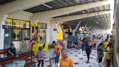


Larn Ta Chu Steak House หลานตาชูสเต็กเฮ้าส์ สาขาเมือง
Restaurant · Steak House

25 more on the map.
Notable people from Phatthalung
 Chanatip SonkhamThai taekwondo practitioner and curlerPhoto: Republic of Korea from Seoul,..., CC BY-SA 2.0
 Wichayanee PearklinThai female singerPhoto: Sry85, CC BY-SA 3.0
 Nurul SriyankemThai footballerPhoto: El_Loko für www.thai-fussball.com, CC BY 4.0
- Adul LahsohThai football player
- Teerapong Puttasukhaassociation football player
- Akkarapol Meesawatfootballer
- Chokchai ChuchaiThai footballer
- Panai KongpraphanThai footballer
- Prasert InnuiThai futsal player
- Puenkon Tor.SuratThai Muay Thai fighter
- Suriya AmatawechThai footballer
- Penake SitnumnoiThai Muay Thai fighter
Born in Phatthalung, according to Wikidata (CC0). Each name links to its Wikipedia article.
Where to stay9
Churches and places of worship4
Shopping8
Gas and EV charging2
Schools, colleges and libraries5
Healthcare6
Map of Phatthalung
77 places. The map loads OpenStreetMap tiles when you open it.
Getting there and nearby towns
Trang Airport (TST) is the nearest airport with scheduled flights listed in OpenStreetMap, 52 km away.
- Ranot 32 km northeast, about 32 min by car
- Trang 52 km west, about 52 min by car
- Ban Sai Khao 51 km north, about 51 min by car
- Huai Yot 52 km west, about 52 min by car
- Hua Sai 54 km northeast, about 54 min by car
- Ban Na Saton 59 km northeast, about 59 min by car
- Ron Phibun 67 km north, about 1 h by car
- Ban Mai 69 km southeast, about 1 h 15 min by car
- Songkhla 74 km southeast, about 1 h 15 min by car
- Hat Yai 81 km southeast, about 1 h 15 min by car
Drive times are estimates from straight-line distance, not routes.
Towns near Phatthalung


Keep exploring
Local news
Headlines from INDB.
Reviews, tips and questions
Loading what members have shared...
Sources and licences
- GeoNames (CC BY 4.0): population, coordinates, regions and time zone
- Mapillary (see each image): photos
- OpenStreetMap contributors (ODbL 1.0): places, airports, map data
- Wikidata (CC0 1.0): elevation, founding date, time zone, website
- Wikimedia Commons (see each image): photos
- Wikipedia (CC BY-SA 4.0): overview and history text
Photo credits
- Khao Ok Thalu and Phatthalung, Peter in s, CC BY-SA 3.0
- Street-level photo, simonsails, CC BY-SA 4.0
- Street-level photo, simonsails, CC BY-SA 4.0
Page built November 10, 2026. Spotted a mistake? Tell us or suggest a place.