


Roi Et, Thailand
เทศบาลเมืองร้อยเอ็ด
Roi Et is a regional capital of 39,328 people in Roi Et, Thailand, founded in February 14, 1937.
Why visit Roi Et
Townapedia lists 4 museums and landmarks, 3 parks and trails, 37 places to eat, 14 places to stay and 1 attraction in and around town.
Highlights include Muang Roi Et Municipal Aquatic Animals Center, Roi Et National Museum and Roi Et Water Park.
Weather in Roi Et
Forecast from MET Norway (CC BY 4.0). Full forecast
About Roi Et
Roi Et (Thai: ร้อยเอ็ด, pronounced [rɔ́ːj ʔèt]) is a town (thesaban mueang) in north-eastern Thailand, capital of Roi Et province. It covers the whole tambon Nai Mueang of Mueang Roi Et district. As of 2006 it had a population of 34,229. Roi Et is 514 km from Bangkok, and is served by Roi Et Airport.
From the Wikipedia article Roi Et (this version), under CC BY-SA 4.0.
Travel tips from other travellers: Roi Et on Wikivoyage (CC BY-SA 4.0).
Photos of Roi Et


Things to do1

Museums and landmarks4
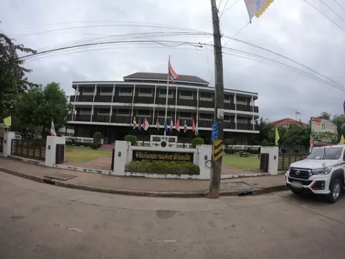

Parks, trails and playgrounds3

Roi Et Water Park
Sports field and stadium · 2.2 km
59 Tawapiban Rd
Mo-Su 10:00-18:00

Restaurants and cafes37
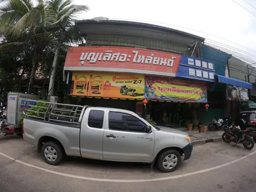




B.te cafe
Cafe · Coffee Shop · 2.1 km
28/1 ถนนคุ้มแสนสุข
Mo-Su 09:00-18:00
Double T Coffee
Cafe · Coffee Shop, Regional · 2.7 km
260 ถนนปัทมานนท์, บ้านเหล่าบักเล
Mo-Su 06:00-16:30
Red's Diner & Bar
Restaurant · Western, Burger, Dessert, Breakfast, Fish And Chips, Thai, Sandwich, Kebab · 1.1 km
7/2 Rob Muang
Tuesday-Sunday 10am - 9pm

25 more on the map.
History
Roi Et has been inhabited since the prehistory, the community was then influenced by Dvaravati around the 5th century and continued to the Angkorian period, but was abandoned following the decline of the Angkor in the 13th century. It was repopulated by Lao people led by Suthonmanee (เจ้าสุทนต์มณี) from Mueang Suwannaphum in 1775.
Roi Et City has been a major settlement for more than 300 years. In ancient times It was once called 'Saket Nakhon' and referred to as "a large city with 11 gates and 11 vassal cities", but in modern-day terms it would be classed as a middle sized market town.
From the History section of Roi Et on Wikipedia, under CC BY-SA 4.0.
Notable people from Roi Et
 Sumanya PurisaiThai footballerPhoto: EL Loko Foto, CC BY 4.0
 Ray MacDonaldThai actor (1977–2026)Photo: TrueVisionsOfficial, CC BY 3.0
 Teeraphol YoryoeiThai association football playerPhoto: El_Loko für www.thai-fussball.com, CC BY 4.0
 Tanarattha UdomchaveeThai beach volleyball playerPhoto: Mormegil, CC BY-SA 3.0
 Thanathip PaengwongThai association football playerPhoto: Alex355399, CC BY 4.0
 Nikom SomwangThai association football playerPhoto: El_Loko für www.thai-fussball.com, CC BY 4.0
 Varapatsorn RadarongThai beach volleyball playerPhoto: Petr Kadlec, CC BY-SA 3.0
- Jutatip ManeephanThai racing cyclist
- Kiadtiphon UdomThai association football player (2000-)
- Noppol PitafaiThai footballer
- Nopphon PonkamThai association football player
- Kriangkhai PimratThai footballer


Born in Roi Et, according to Wikidata (CC0). Each name links to its Wikipedia article.
Where to stay14
Churches and places of worship11
Shopping8
Gas and EV charging9
Schools, colleges and libraries13
Healthcare6
Dr.Tinnapat Kids & Teens Clinic Roi Et
Clinic and pharmacy · 1.4 km
31/18 Rattakitklaikla
Map of Roi Et
106 places. The map loads OpenStreetMap tiles when you open it.
Getting there and nearby towns
Roi Et Airport (ROI) is the nearest airport with scheduled flights listed in OpenStreetMap, 15 km away.
- Kamalasai 32 km north, about 32 min by car
- Ban Selaphum 32 km east, about 32 min by car
- Chai Wari 33 km northeast, about 33 min by car
- Wapi Pathum 38 km southwest, about 38 min by car
- Maha Sarakham 40 km west, about 40 min by car
- Waeng 44 km northeast, about 44 min by car
- Kalasin 45 km north, about 45 min by car
- Kaset Wisai 45 km south, about 45 min by car
- Yang Talat 49 km northwest, about 49 min by car
- Suwannaphum 53 km south, about 53 min by car
Drive times are estimates from straight-line distance, not routes.
Keep exploring
Local news
Headlines from INDB.
Reviews, tips and questions
Loading what members have shared...
Sources and licences
- GeoNames (CC BY 4.0): population, coordinates, regions and time zone
- Mapillary (see each image): photos
- OpenStreetMap contributors (ODbL 1.0): places, airports, map data
- Wikidata (CC0 1.0): elevation, founding date, time zone, website
- Wikimedia Commons (see each image): photos
- Wikipedia (CC BY-SA 4.0): overview and history text
Photo credits
- Roi Et City Hall, No machine-readable author provided. Oatz assumed (based on copyright claims)., Public domain
- Wat Burapha Phiram, Roi Et (I), This Photo was taken by Supanut Arunoprayote . Feel free to use any of my images, but please mention me as the author and may send me a message. (สามารถใช้ภาพได้อิสระ..., CC BY 4.0
- Mueang Roi Et - panoramio, Adriaan Castermans, CC BY-SA 3.0
- Nai Mueang, Mueang Roi Et District, Roi Et 45000, Thailand - panoramio, Fruity08, CC BY 3.0
- TS finals 1st leg - Roi Et PB United vs Dome 2 June 2024, Gunkiet, CC BY-SA 4.0
- อาคาร1ร้อยเอ็ดวิทยาลัย, Suphakon2015, CC BY-SA 4.0
- ตรา ร.ว., Bookrw, Public domain
- Roi-Et - panoramio - Seksan Phonsuwan (6), Seksan Phonsuwan, CC BY 3.0
- Roi-Et - panoramio - Seksan Phonsuwan (9), Seksan Phonsuwan, CC BY 3.0
- Roi-Et - panoramio - Seksan Phonsuwan (4), Seksan Phonsuwan, CC BY 3.0
- Roi-Et, Thailand - panoramio, Seksan Phonsuwan, CC BY 3.0
- Roi-Et - panoramio - Seksan Phonsuwan (8), Seksan Phonsuwan, CC BY 3.0
- Roi-Et - panoramio - Seksan Phonsuwan (11), Seksan Phonsuwan, CC BY 3.0
- Roi-Et - panoramio - Seksan Phonsuwan (7), Seksan Phonsuwan, CC BY 3.0
- Roi-Et - panoramio - Seksan Phonsuwan (1), Seksan Phonsuwan, CC BY 3.0
- Roi-Et - panoramio - Seksan Phonsuwan (3), Seksan Phonsuwan, CC BY 3.0
- Roi-Et - panoramio - Seksan Phonsuwan, Seksan Phonsuwan, CC BY 3.0
- Roi-Et (ร้อยเอ็ด) - panoramio, Seksan Phonsuwan, CC BY 3.0
- Roi-Et - panoramio - Seksan Phonsuwan (2), Seksan Phonsuwan, CC BY 3.0
- Roi-Et - panoramio - Seksan Phonsuwan (5), Seksan Phonsuwan, CC BY 3.0
- Roi-Et - panoramio - Seksan Phonsuwan (10), Seksan Phonsuwan, CC BY 3.0
- Roi-Et, Isaan, Thailand 50, lemoncat1, CC BY-SA 2.0
- BuengPhalanChai, FkMohr, CC BY 3.0 de
- Streetview - panoramio, Adriaan Castermans, CC BY-SA 3.0
- Phra Phrom Vajrasobhana (Srichan Punyarato), Suphakorn343, CC0
- ป้ายโรงเรียนร้อยเอ็ดวิทยาลัย - panoramio, Fruity08, CC BY 3.0
- Temple - panoramio (14), Adriaan Castermans, CC BY-SA 3.0
- Big Buddha Statue 'Luang Phaw Dto' - panoramio, Adriaan Castermans, CC BY-SA 3.0
- Knight Grand Cross (First Class) of the Order of the White Elephant, Xiengyod~commonswiki, CC BY-SA 4.0
- Knight Grand Cross (First Class) of the Most Noble Order of the Crown of Thailand, Xiengyod~commonswiki, CC BY-SA 4.0
- Chakrabrati Medal with Thai commemorative medals, Xiengyod~commonswiki, CC BY-SA 4.0
- Badge of the Order of the Crown of Thailand First Class (reverse side), Xiengyod~commonswiki, CC BY-SA 4.0
- Nong Ta Kla, FkMohr, CC BY 3.0 de
- SCP-XXXA-oc-by docphoenix-, Styletuber wiki, CC BY-SA 4.0
- Roi-Et (19 Aug 2011) - panoramio, Seksan Phonsuwan, CC BY 3.0
- Roi-Et (2009) - panoramio, Seksan Phonsuwan, CC BY 3.0
- Street-level photo, ozflor, CC BY-SA 4.0
- Street-level photo, yne, CC BY-SA 4.0
- Street-level photo, ThailandCambodia, CC BY-SA 4.0
- Street-level photo, ozflor, CC BY-SA 4.0
- Street-level photo, ozflor, CC BY-SA 4.0
- Street-level photo, ozflor, CC BY-SA 4.0
- Street-level photo, ozflor, CC BY-SA 4.0
- Street-level photo, ozflor, CC BY-SA 4.0
- Street-level photo, ozflor, CC BY-SA 4.0


Page built November 10, 2026. Spotted a mistake? Tell us or suggest a place.