


Sangkhla Buri, Thailand
อำเภอสังขละบุรี
Sangkhla Buri is a town of 10,000 people in Kanchanaburi, Thailand.
Why visit Sangkhla Buri
Townapedia lists 2 museums and landmarks, 2 parks and trails, 11 places to eat, 18 places to stay and 1 attraction in and around town.
Highlights include Uttamanusorn Bridge and Mon bridge.
Weather in Sangkhla Buri
Forecast from MET Norway (CC BY 4.0). Full forecast
About Sangkhla Buri
Sangkhla Buri (Thai: สังขละบุรี, pronounced [sǎŋ.kʰlàʔ bū.rīː], Mon: ဝင်္က,pronounced [liəŋka]) is a district (amphoe) in the northern part of Kanchanaburi province in western Thailand.
From the Wikipedia article Sangkhla Buri district (this version), under CC BY-SA 4.0.
Travel tips from other travellers: Sangkhla Buri on Wikivoyage (CC BY-SA 4.0).
Photos of Sangkhla Buri


Things to do1

Museums and landmarks2

Parks, trails and playgrounds2


Restaurants and cafes11



นั่งล้าน สะพานไม้ Sangklaburi
Restaurant · Regional, ก๋วยเตี๋ยว, ตามสั่ง, Fast Food · 1.2 km
10121 ถนนสามประสบ, หนองลู
ปิดทุกวันพุธ


History
In 1939 the district Wang Ka (วังกะ) was renamed Sangkhla Buri, which was previously the name of the minor district Thong Pha Phum. On 20 May 1941 the district was downgraded to a minor district (king amphoe) and made a subordinate of Thong Pha Phum District. It then consisted of the four tambons: Nong Lu, Prangphle, Laiwo, and Lang Phu Sa It was again upgraded to full district status on 27 July 1965.
From the History section of Sangkhla Buri district on Wikipedia, under CC BY-SA 4.0.
More about Sangkhla Buri
Geography
Sangkhla Buri is the northernmost district of Kanchanaburi province, on the border with Myanmar. Three Pagodas Pass is the border crossing station to Myanmar. Neighboring jurisdictions are (from the west clockwise) Tanintharyi Region, Mon State and Kayin State of Myanmar, Umphang district of Tak province, and Thong Pha Phum district of Kanchanaburi.
A large part of the district is covered by the Khao Laem Reservoir, an artificial lake formed by the Vajiralongkorn Dam on the Khwae Noi River. The northern part of the district is in the area of Thung Yai Naresuan Wildlife Sanctuary, which — together with the adjoining Huai Kha Khaeng Wildlife Sanctuary — constitutes the Western Forest Complex — the largest contiguous protected area in mainland Southeast Asia.
From the Wikipedia article Sangkhla Buri district, under CC BY-SA 4.0.
Where to stay18
Banthorphan Resort
Motel and hotel · 1.1 km
Banthorphan 25/3 moo.2, Nong Lu, Sangkhla Buri District, Kanchanaburi
Churches and places of worship2
Shopping1
Schools, colleges and libraries3
Healthcare1
Map of Sangkhla Buri
41 places. The map loads OpenStreetMap tiles when you open it.
Getting there and nearby towns
- Ban Huai Malai 11 km west, about 11 min by car
- Ban Hin Laem 62 km southeast, about 1 h by car
- Ban Lin Thin 76 km southeast, about 1 h 15 min by car
Drive times are estimates from straight-line distance, not routes.
Keep exploring
Local news
Headlines from INDB.
Reviews, tips and questions
Loading what members have shared...
Sources and licences
- GeoNames (CC BY 4.0): population, coordinates, regions and time zone
- Mapillary (see each image): photos
- OpenStreetMap contributors (ODbL 1.0): places, airports, map data
- Wikidata (CC0 1.0): elevation, founding date, time zone, website, landmarks and historic places
- Wikimedia Commons (see each image): photos
- Wikipedia (CC BY-SA 4.0): overview and history text
Photo credits
- Three Pagodas, Kittipong khunnen, CC BY-SA 4.0
- Nong Lu, Sangkhla Buri District, Kanchanaburi, Thailand - panoramio - Boonchai C (42), Boonchai C, CC BY 3.0
- Nong Lu, Sangkhla Buri District, Kanchanaburi, Thailand - panoramio - Boonchai C (46), Boonchai C, CC BY 3.0
- Nong Lu, Sangkhla Buri District, Kanchanaburi, Thailand - panoramio - Boonchai C (39), Boonchai C, CC BY 3.0
- Nong Lu, Sangkhla Buri District, Kanchanaburi, Thailand - panoramio - Boonchai C (40), Boonchai C, CC BY 3.0
- Nong Lu, Sangkhla Buri District, Kanchanaburi, Thailand - panoramio - Boonchai C (8), Boonchai C, CC BY 3.0
- Nong Lu, Sangkhla Buri District, Kanchanaburi, Thailand - panoramio - Boonchai C (10), Boonchai C, CC BY 3.0
- Nong Lu, Sangkhla Buri District, Kanchanaburi, Thailand - panoramio - Boonchai C (11), Boonchai C, CC BY 3.0
- Nong Lu, Sangkhla Buri District, Kanchanaburi, Thailand - panoramio - Boonchai C (9), Boonchai C, CC BY 3.0
- Nong Lu, Sangkhla Buri District, Kanchanaburi, Thailand - panoramio - Boonchai C (60), Boonchai C, CC BY 3.0
- Nong Lu, Sangkhla Buri District, Kanchanaburi, Thailand - panoramio - Boonchai C (59), Boonchai C, CC BY 3.0
- Nong Lu, Sangkhla Buri District, Kanchanaburi, Thailand - panoramio - Boonchai C (47), Boonchai C, CC BY 3.0
- Nong Lu, Sangkhla Buri District, Kanchanaburi, Thailand - panoramio - Boonchai C (48), Boonchai C, CC BY 3.0
- Nong Lu, Sangkhla Buri District, Kanchanaburi, Thailand - panoramio - Boonchai C (55), Boonchai C, CC BY 3.0
- Nong Lu, Sangkhla Buri District, Kanchanaburi, Thailand - panoramio - Boonchai C (31), Boonchai C, CC BY 3.0
- Nong Lu, Sangkhla Buri District, Kanchanaburi, Thailand - panoramio - Boonchai C (32), Boonchai C, CC BY 3.0
- Nong Lu, Sangkhla Buri District, Kanchanaburi, Thailand - panoramio - Boonchai C (36), Boonchai C, CC BY 3.0
- Nong Lu, Sangkhla Buri District, Kanchanaburi, Thailand - panoramio - Boonchai C (37), Boonchai C, CC BY 3.0
- Nong Lu, Sangkhla Buri District, Kanchanaburi, Thailand - panoramio - Boonchai C (57), Boonchai C, CC BY 3.0
- Nong Lu, Sangkhla Buri District, Kanchanaburi, Thailand - panoramio - Boonchai C (28), Boonchai C, CC BY 3.0
- Nong Lu, Sangkhla Buri District, Kanchanaburi, Thailand - panoramio - Boonchai C (29), Boonchai C, CC BY 3.0
- Nong Lu, Sangkhla Buri District, Kanchanaburi, Thailand - panoramio - Boonchai C (34), Boonchai C, CC BY 3.0
- Nong Lu, Sangkhla Buri District, Kanchanaburi, Thailand - panoramio - Boonchai C (58), Boonchai C, CC BY 3.0
- Nong Lu, Sangkhla Buri District, Kanchanaburi, Thailand - panoramio - Boonchai C (30), Boonchai C, CC BY 3.0
- Nong Lu, Sangkhla Buri District, Kanchanaburi, Thailand - panoramio - Boonchai C (27), Boonchai C, CC BY 3.0
- Nong Lu, Sangkhla Buri District, Kanchanaburi, Thailand - panoramio - Boonchai C (24), Boonchai C, CC BY 3.0
- Nong Lu, Sangkhla Buri District, Kanchanaburi, Thailand - panoramio - Boonchai C (23), Boonchai C, CC BY 3.0
- Nong Lu, Sangkhla Buri District, Kanchanaburi, Thailand - panoramio - Boonchai C (33), Boonchai C, CC BY 3.0
- Nong Lu, Sangkhla Buri District, Kanchanaburi, Thailand - panoramio - Boonchai C (15), Boonchai C, CC BY 3.0
- Bridge III, Sangkhlaburi, Thailand, mistagrrr, CC BY 2.0
- สะพานมอญ - panoramio, Bundit Sincharoen, CC BY 3.0
- Red Bridge - panoramio - Boonchai C, Boonchai C, CC BY 3.0
- Wooden brigde - panoramio, Boonchai C, CC BY 3.0
- Mon Bridge - panoramio (1), Espen Skibbuvollen, CC BY 3.0
- Walking on the Mon Bridge, Sergey, CC BY-SA 2.0
- Sangkhlaburi - panoramio, jackylim, CC BY-SA 3.0
- Mon Bridge - panoramio, Espen Skibbuvollen, CC BY 3.0
- Saphan Mon, Yoav David, CC BY-SA 3.0
- View of Sangkhaburi - panoramio (cropped), Boonchai C, CC BY 3.0
- View of Sangkhaburi - panoramio, Boonchai C, CC BY 3.0
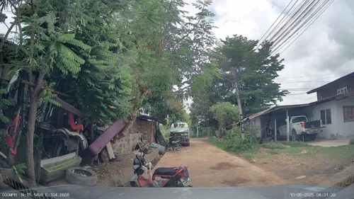
- Street-level photo, ThailandCambodia, CC BY-SA 4.0


Page built November 10, 2026. Spotted a mistake? Tell us or suggest a place.