

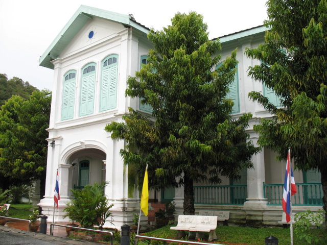
Satun, Thailand
เทศบาลเมืองสตูล
Satun is a regional capital of 34,544 people in Satun, Thailand.
Why visit Satun
Townapedia lists 2 museums and landmarks, 3 parks and trails, 11 places to eat and 19 places to stay in and around town.
Highlights include National museum Satun.
Weather in Satun
Forecast from MET Norway (CC BY 4.0). Full forecast
About Satun
Satun (Thai: สตูล, pronounced [sā.tūːn], Malay: Setul) is a town (thesaban mueang) in southern Thailand, capital of the Satun province. It covers the whole tambon Phiman of Mueang Satun. Satun lies 985 km south of Bangkok. As of 2005 it has a population of 21,498.
From the Wikipedia article Satun (this version), under CC BY-SA 4.0.
Travel tips from other travellers: Satun on Wikivoyage (CC BY-SA 4.0).
Museums and landmarks2


Parks, trails and playgrounds3

Restaurants and cafes11



Where to stay19

7 more on the map.
Notable people from Satun
 Sompong SolebThai footballerPhoto: Chayanin, CC BY 3.0
 Sakeereen TeekasomThai association football playerPhoto: Lady.Melon, CC0
- Ekkachai SumreiThai footballer
- Adisak GanuThai footballer
- Malek YawahabThai footballer
- Tanat WongsuparakThai footballer
- Adun MuensamaanThai footballer
- Seeket MadputehThai footballer
- Yayar KunathThai footballer
Born in Satun, according to Wikidata (CC0). Each name links to its Wikipedia article.
Churches and places of worship2
Shopping2
Gas and EV charging3
Schools, colleges and libraries6
Healthcare1
Map of Satun
49 places. The map loads OpenStreetMap tiles when you open it.
Getting there and nearby towns
Hat Yai International Airport (HDY) is the nearest airport with scheduled flights listed in OpenStreetMap, 50 km away.
- Sadao 39 km east, about 39 min by car
- Ta Lo Wow 45 km west, about 45 min by car
- Pante Malakar 47 km west, about 47 min by car
- Son 50 km west, about 50 min by car
- Ban Ao Makham 49 km west, about 49 min by car
- Hat Yai 62 km northeast, about 1 h by car
- Na Mom 66 km northeast, about 1 h by car
- Ban Mai 83 km northeast, about 1 h 30 min by car
- Songkhla 87 km northeast, about 1 h 30 min by car
Drive times are estimates from straight-line distance, not routes.
Towns near Satun


Keep exploring
Local news
Headlines from INDB.
Reviews, tips and questions
Loading what members have shared...
Sources and licences
- GeoNames (CC BY 4.0): population, coordinates, regions and time zone
- OpenStreetMap contributors (ODbL 1.0): places, airports, map data
- Wikidata (CC0 1.0): elevation, founding date, time zone, website
- Wikimedia Commons (see each image): photos
- Wikipedia (CC BY-SA 4.0): overview and history text
Photo credits
- River and village in Satun, furibond, CC BY-SA 2.0
- Kuden Mansion, No machine-readable author provided. Oatz assumed (based on copyright claims)., Public domain
Page built November 10, 2026. Spotted a mistake? Tell us or suggest a place.