


Si Sa Ket, Thailand
เทศบาลเมืองศรีสะเกษ
Si Sa Ket is a regional capital of 44,751 people in Si Sa Ket, Thailand.
Why visit Si Sa Ket
Townapedia lists 4 museums and landmarks, 11 parks and trails, 88 places to eat, 13 places to stay and 2 attractions in and around town.
Weather in Si Sa Ket
Forecast from MET Norway (CC BY 4.0). Full forecast
About Si Sa Ket
Sisaket (Thai: ศรีสะเกษ, RTGS: Si Sa Ket, pronounced [sǐː sàʔ kèːt]; Northern Khmer: ซีซะเกด) is a town municipality in northeast Thailand, incorporating Mueang Nuea and Mueang Tai Subdistricts and parts of Cham, Nong Khrok, Pho, Phon kha, and Ya Plong Subdistricts, all in Mueang Sisaket district, the capital of Sisaket province. As of 2017, it has a population of 40,117.
From the Wikipedia article Sisaket (this version), under CC BY-SA 4.0.
Travel tips from other travellers: Si Sa Ket on Wikivoyage (CC BY-SA 4.0).
Photos of Si Sa Ket


Things to do2

Museums and landmarks4


Parks, trails and playgrounds11



Restaurants and cafes88
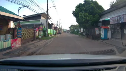
Asado ศรีสะเกษ - Kansai Yakiniku bar
Restaurant · Japanese, Yakiniku · 1.4 km
335/10 หมู่ 5 ถนนกวงเฮง
12.00-00.00
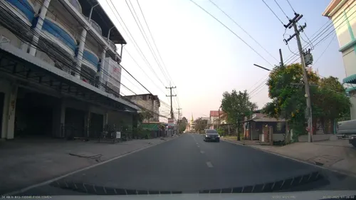


Beach Cafe Sisaket
Restaurant · นมสด, อิตาเลียนโซดา, ฮันนี่โทส, Cocktail, Beer, Bingsu, ขนมปังปิ้ง · 0.7 km
1575/3 ถนนศรีสุมังค์, เมืองใต้
Mo-Su 17:00-22:00

baanklangsoi
Restaurant · Thai, Local · 0.8 km
1325/119 ถนนราษฏร์บำรุง
10.00 - 22.00
Franks Living In The Past Restaurant
Restaurant · German · 0.9 km
Mo-Su 10:00-23:00
ก๋วยเตี๋ยวเรือเข้าท่า สาขา 1 (ต้นตำรับ)
Restaurant · Noodle, Thai · 1.3 km
08:00-16:00

76 more on the map.
History
The municipality was created by a royal decree that took effect on 29 November 1936 and was then named Khu Khan after the province. The municipality covered the subdistricts of Mueang Nuea and Mueang Tai, with the area of 3.26 km2.
On 6 March 1939, the municipality was renamed Sisaket, following the renaming of the province the year before.
On 12 March 1987, the municipality was extended to parts of Cham, Nong Khrok, Pho, Phon kha, and Ya Plong Subdistricts, with the total area of 36.66 km2.
From the History section of Sisaket on Wikipedia, under CC BY-SA 4.0.
Notable people from Si Sa Ket
 Supachok SarachatThai association football playerPhoto: ブルキン, CC BY-SA 4.0
 Chompon BuangamThai footballerPhoto: El_Loko für www.thai-fussball.com, CC BY 4.0
- Suphanat Mueantaassociation football player
- Orathai SrimaneeThai association football player
- Wuttichai TathongThai footballer
- Saringkan Promsupaassociation football player
- Sasirawan InthachotThai Paralympic athlete
- Pralong SawandeeThai footballer
- Nattaphon KrobyooThai association football player
- Theerachai NgamcharoenThai footballer
- Ekkapan JandakornThai footballer
- Chainarong TathongThai footballer


Born in Si Sa Ket, according to Wikidata (CC0). Each name links to its Wikipedia article.
Where to stay13
Churches and places of worship19
Shopping21
Gas and EV charging14
Schools, colleges and libraries35
Healthcare15
Map of Si Sa Ket
222 places. The map loads OpenStreetMap tiles when you open it.
Getting there and nearby towns
Ubon Ratchathani International Airport (UBP) is the nearest airport with scheduled flights listed in OpenStreetMap, 60 km away.
- Ban I Lam 19 km northwest, about 19 min by car
- Phrai Bueng 41 km south, about 41 min by car
- Ubon Ratchathani 57 km east, about 57 min by car
- Warin Chamrap 58 km east, about 58 min by car
- Kantharalak 63 km southeast, about 1 h by car
- Ban Yang Sak Krapho Lum 63 km northeast, about 1 h by car
- Yasothon 78 km north, about 1 h 15 min by car
- Suwannaphum 78 km northwest, about 1 h 15 min by car
- Det Udom 84 km east, about 1 h 30 min by car
- Amnat Charoen 89 km north, about 1 h 30 min by car
Drive times are estimates from straight-line distance, not routes.
Keep exploring
Local news
Headlines from INDB.
Reviews, tips and questions
Loading what members have shared...
Sources and licences
- GeoNames (CC BY 4.0): population, coordinates, regions and time zone
- Mapillary (see each image): photos
- OpenStreetMap contributors (ODbL 1.0): places, airports, map data
- Wikidata (CC0 1.0): elevation, founding date, time zone, website
- Wikimedia Commons (see each image): photos
- Wikipedia (CC BY-SA 4.0): overview and history text
Photo credits
- SI SA KET CIRCLE - panoramio, Sujeong, CC BY 3.0
- Naga Sculpture Si Sa Ket railway station - panoramio, Sujeong, CC BY 3.0
- Mueang Tai, Mueang Si Sa Ket District, Si Sa Ket 33000, Thailand - panoramio, กิตติ เลขะกุล, CC BY 3.0
- Mueang Tai, Mueang Si Sa Ket District, Si Sa Ket 33000, Thailand - panoramio (1), กิตติ เลขะกุล, CC BY 3.0
- Ya Plong, Mueang Si Sa Ket District, Si Sa Ket 33000, Thailand - panoramio, กิตติ เลขะกุล, CC BY 3.0
- อุโบสถวัดมหาพุทธาราม, Thirathibodi, CC BY-SA 4.0
- Sisaket railway station 2024, Reversemos.sapanaht, CC BY-SA 4.0
- Sisaket Trainstation (MGK08072), Markus G. Klötzer, CC BY-SA 4.0
- Sisaket railway station - panoramio, Sujeong, CC BY 3.0
- Sisaket waste centre (MGK171209-113252), Markus G. Klötzer, CC BY-SA 4.0
- Sisaket waste centre (MGK171209-113304), Markus G. Klötzer, CC BY-SA 4.0
- Baby Waterbuffalo (MGK09197), Markus G. Klötzer, CC BY-SA 4.0
- Huai Haet (MGK21209), Markus G. Klötzer, CC BY-SA 4.0
- Huai Haet (MGK21208), Markus G. Klötzer, CC BY-SA 4.0
- Huai Haet (MGK21231), Markus G. Klötzer, CC BY-SA 4.0
- Huai Haet Bridge (MGK21158), Markus G. Klötzer, CC BY-SA 4.0
- Huai Haet - Railway Bridge (MGK21161), Markus G. Klötzer, CC BY-SA 4.0
- Huai Haet (MGK21156), Markus G. Klötzer, CC BY-SA 4.0
- Ban Non Kong (MGK21170), Markus G. Klötzer, CC BY-SA 4.0
- Huai Haet - Railway Bridge (MGK21172), Markus G. Klötzer, CC BY-SA 4.0
- Huai Haet - Mai Bridge to open B.E. 2561 (2018) (MGK21174), Markus G. Klötzer, CC BY-SA 4.0
- Huai Haet - Mai Bridge to open B.E. 2561 (2018) (MGK21176), Markus G. Klötzer, CC BY-SA 4.0
- Huai Haet (MGK20655), Markus G. Klötzer, CC BY-SA 4.0
- Huai Haet (MGK20649), Markus G. Klötzer, CC BY-SA 4.0
- Huai Haet (MGK20652), Markus G. Klötzer, CC BY-SA 4.0
- Huai Haet (MGK20659), Markus G. Klötzer, CC BY-SA 4.0
- Huai San (MGK20664), Markus G. Klötzer, CC BY-SA 4.0
- Huai San (MGK20665), Markus G. Klötzer, CC BY-SA 4.0
- Huai San (MGK20669), Markus G. Klötzer, CC BY-SA 4.0
- Huai San (MGK20667), Markus G. Klötzer, CC BY-SA 4.0
- Street-level photo, ThailandCambodia, CC BY-SA 4.0
- Street-level photo, ThailandCambodia, CC BY-SA 4.0


Page built November 10, 2026. Spotted a mistake? Tell us or suggest a place.