


Surin, Thailand
เทศบาลเมืองสุรินทร์
Surin is a regional capital of 46,673 people in Surin, Thailand.
Why visit Surin
Townapedia lists 4 museums and landmarks, 4 parks and trails, 22 places to eat and 21 places to stay in and around town.
Weather in Surin
Forecast from MET Norway (CC BY 4.0). Full forecast
About Surin
Surin (Thai: สุรินทร์, pronounced [sù.rīn]; Northern Khmer: ซเร็น, pronounced [sren]) is a town in Thailand, capital of Surin province, 431 km east-northeast of Bangkok. It is the site of the annual Surin Elephant Round-up. As of 2019, Surin has an estimated population of 39,179.
From the Wikipedia article Surin, Thailand (this version), under CC BY-SA 4.0.
Travel tips from other travellers: Surin on Wikivoyage (CC BY-SA 4.0).
Photos of Surin


Museums and landmarks4
Phraya Surin Phakdi Si Narong Changwang (Pum) Monument
Monument and historic site · 0.6 km

Parks, trails and playgrounds4


Restaurants and cafes22
Farang Connection
Restaurant · International · 0.8 km
Pleasant spot for expats, tourists and a few locals to hang out. Open courtyard (under cover), Internet. Advice around town.
257/11 Jitbumrung Rd, Muang Surin
08:00-22:00
Garden House
Cafe · Coffee Shop, Dessert · 1.9 km
ขอเชิญมาสัมผัสบรรยากาศสวน🍀🌳🪴☘️ มีทั้งบอนไซที่มีอายุหลายสิบปี 🪴 ไม้ใบต่างๆ🍀☘️ แวะชิมกาแฟคุณภาพ รสชาติเยี่ยม
7P65VGG6+F5, 223/1 หมู่ 6 ซอยคุ้มไตรคาม, นอกเมือง
Mo-Fr 07:30-17:00
Oasis Restaurant
Restaurant · 0.8 km
Western/Thai restaurant in a small town. Serves farlang and thai food. Caters to the local expat movie. Norwegian.
12:00-20:00

Malila ( มะลิลา )
Cafe · Beer Shop · 0.8 km
65 ถ.ศิริรัฐ ต.ในเมือง อ.เมือง, สุรินทร์

at Prae
Restaurant · Thai · 2.5 km
210 หมู่ที่ 14 ต.นอกเมือง อ.เมืองสุรินทร์, สุรินทร์
10 more on the map.
Where to stay21



โรงแรมโซริน บูทีค (Sorin boutique hotel)
Motel and hotel · 1.1 km
22/88 ถนนเทศบาล 3, ในเมือง
Surin Majestic Hotel
Motel and hotel · 1.0 km
Open in Google Maps · +66 44 713 980; +66 44 713 981; +66 44 713 982; +66 44 713 983
9 more on the map.
History
The earliest settlers in this region were hunter-gatherers. The Neolithic, with the introduction of agriculture, dates from 2,500 to 1,500 years BCE. The Bronze Age dates from 1,500–500 BCE and the Iron Age from 500 BCE to 500 CE. It is in the Iron Age that the first evidence of human settlement emerges in the province, with approximately sixty known Iron Age sites.
The earliest known historical period is the Dvaravati. This was an Indian-based culture that diffused through the north-east region of what is now Thailand. Evidence of this culture is found in the Surin region, dating from the 7th to the 11th centuries CE. It was in this period that Buddhism became the dominant religion of the region.
Following the Dvaravati period, the powerful Khmer Empire expanded its influence throughout what is now the southern Isan region of Thailand. This period covers the 7th to 13th centuries CE. Surin was an important part of the ancient Khmer empire. Temple ruins and a substantial ethnic Khmer minority remain part of Surin. Khmer stone inscriptions date from c. 600 CE. Over the next several centuries, a growing number of Khmer sites were constructed in the province, most notably Prasat Sikhoraphum. These sites would have formed part of the network of Khmer infrastructure centred on Prasat Phanom Rung.
Read more of the history
With the collapse of the Khmer Empire in the 13th century, Surin province faded from history. It was in the 18th century that it re-emerges. At this time, a Kuay local leader named Chiangpum became the royally appointed ruler of the region. According to legend, he presented a rare white elephant to Chao Phaya Chakri, future King Rama I. In gratitude, Chiangpum was awarded the royal title Luang Surin Phakdi and appointed the village headman. When Rama I became the Thai monarch, he appointed Luang Surin Phakdi as the province's governor. In 1763, the village was moved to the location of the modern city of Surin, and was upgraded to a city with the name Muang Prathai Saman. There is a local legend that this move was due to better water supplies at the new site. The original location of the town was at Muang Thi, approximately 15 kilometres (9.3 mi) to the east of the modern city. In 1786, the city's name was changed to Surin in honor of its governor.
The province slowly grew in population; there was a continual influx of people from surrounding areas, principally Cambodia (part of what is now western Cambodia was ruled by Bangkok at this time). Surin was largely self-sufficient, and somewhat isolated. This changed with the advent of the railroad in 1922. Chinese and Indian merchants settled, and its manufacturing increased.
From the History section of Surin, Thailand on Wikipedia, under CC BY-SA 4.0.
More about Surin
Geography
In the north of the province is the valley of the Mun river, a tributary of the Mekong. To the south of the province is the Dongrek mountain chain, which also forms the boundary to Cambodia. The central and northern parts of the province are undulating flood plains.
From the Wikipedia article Surin, Thailand, under CC BY-SA 4.0.
Notable people from Surin
 Puripol BoonsonThai sprinterPhoto: Chensiyuan, CC BY-SA 4.0
 Kanjana SungngoenThai footballerPhoto: B20180, CC BY-SA 4.0
 Siroch ChatthongThai professional footballerPhoto: El Loko Foto, CC BY 4.0
 Attachai FairtexMuay Thai boxerPhoto: Martial arts central, CC BY-SA 4.0
- Tony JaaThai stunt actor
- Panida KhamsriOlympic weightlifter
- Sukanya ChomchuendeeThai pole vaulter
- Jonathan KhemdeeThai-Danish professional footballer
- Chenrop SamphaodiThai association football player
- Wirat WangchanThai footballer
- Boonmee BoonrodThai footballer
- Yotsapon TeangdarThai footballer


Born in Surin, according to Wikidata (CC0). Each name links to its Wikipedia article.
Churches and places of worship14
Shopping6
โรงพิมพ์รุ่งธนเกียรติออฟเซ็ท
Grocery · 1.0 km
253 , 253/1 ถนนเทศบาล 3, ในเมืองสุรินทร์
Gas and EV charging3
Schools, colleges and libraries6
Healthcare2
Map of Surin
82 places. The map loads OpenStreetMap tiles when you open it.
Getting there and nearby towns
Surin Airport (PXR) is the nearest airport with scheduled flights listed in OpenStreetMap, 2 km away.
- Buri Ram 44 km west, about 44 min by car
- Prakhon Chai 50 km southwest, about 50 min by car
- Satuek 51 km northwest, about 51 min by car
- Phayakkhaphum Phisai 78 km northwest, about 1 h 15 min by car
- Nang Rong 80 km west, about 1 h 15 min by car
- Ban I Lam 81 km northeast, about 1 h 15 min by car
- Kaset Wisai 87 km north, about 1 h 30 min by car
- Suwannaphum 87 km north, about 1 h 30 min by car
Drive times are estimates from straight-line distance, not routes.
Keep exploring
Local news
Headlines from INDB.
Reviews, tips and questions
Loading what members have shared...
Sources and licences
- GeoNames (CC BY 4.0): population, coordinates, regions and time zone
- Mapillary (see each image): photos
- OpenStreetMap contributors (ODbL 1.0): places, airports, map data
- Wikidata (CC0 1.0): elevation, founding date, time zone, website
- Wikimedia Commons (see each image): photos
- Wikipedia (CC BY-SA 4.0): overview and history text
Photo credits
- Monument of Phaya Surin Phakdi Si Narong Changwang - Surin, JJ Harrison ( https://www.jjharrison.com.au/ ), CC BY 3.0
- Wat Burapharam - Surin, JJ Harrison ( https://www.jjharrison.com.au/ ), CC BY 3.0
- Wat Burapharam Detail - Surin, JJ Harrison ( https://www.jjharrison.com.au/ ), CC BY 3.0
- Wat Jumpholsutthawas and ancient moat, Surin, Thailand, Reversemos.sapanaht, CC BY-SA 4.0
- ใจกลางเมืองสุรินทร์ - Surin Downtown, Reversemos.sapanaht, CC BY 4.0
- Nai Mueang, Mueang Surin District, Surin 32000, Thailand - panoramio, Mozhar, CC BY-SA 3.0
- Nai Mueang, Mueang Surin District, Surin 32000, Thailand - panoramio (2), Mozhar, CC BY-SA 3.0
- Nai Mueang, Mueang Surin District, Surin 32000, Thailand - panoramio (1), Mozhar, CC BY-SA 3.0
- Surin Province - panoramio, มะเดื่อ แสลงหลวง, CC BY 3.0
- Surin City Pillar Shrine Detail - Surin, JJ Harrison ( https://www.jjharrison.com.au/ ), CC BY 3.0
- Surin City Pillar Shrine - Surin, JJ Harrison ( https://www.jjharrison.com.au/ ), CC BY 3.0
- สุรินทร์พลาซ่า Surin Plaza, Reversemos.sapanaht, CC BY 4.0
- Surin cinema - panoramio, osmach, CC BY 3.0
- Surin railway station (Jan’24), Reversemos.sapanaht, CC BY-SA 4.0
- Thanasan road and elephants roundabout, Surin, Reversemos.sapanaht, CC BY-SA 4.0
- Special Express no.21 (Sprinter) at Surin Station - img 03, Reversemos.sapanaht, CC BY-SA 4.0
- Asia Elephant, Natha Wang, CC BY 3.0
- Raod no 226 ผ่านหน้าศาลากลางจังหวัด - panoramio, มะเดื่อ แสลงหลวง, CC BY 3.0
- ศาลากลางจังหวัดสุรินทร์ - panoramio, มะเดื่อ แสลงหลวง, CC BY 3.0
- ศาลจังหวัด - panoramio, มะเดื่อ แสลงหลวง, CC BY 3.0
- ศาลากลางจังหวัดสุรินทร์ - panoramio (1), มะเดื่อ แสลงหลวง, CC BY 3.0
- Facelifted Chevrolet Colorado 2017, Poramin, CC BY-SA 4.0
- ศาลหลักเมืองสุรินทร์ - panoramio (1), มะเดื่อ แสลงหลวง, CC BY 3.0
- พระอุโบสถ วัดกลาง (จังหวัดสุรินทร์) 2011 - panoramio 55355670, มะเดื่อ แสลงหลวง, CC BY 3.0
- ศาลหลักเมืองสุรินทร์ - panoramio (4), มะเดื่อ แสลงหลวง, CC BY 3.0
- ศาลหลักเมืองสุรินทร์ - panoramio, มะเดื่อ แสลงหลวง, CC BY 3.0
- ศาลหลักเมืองสุรินทร์ - panoramio (2), มะเดื่อ แสลงหลวง, CC BY 3.0
- ศาลหลักเมืองสุรินทร์ - panoramio (3), มะเดื่อ แสลงหลวง, CC BY 3.0
- Surawittayakarn School - โรงเรียนสุรวิทยาคาร, Reversemos.sapanaht, CC BY 4.0
- วงเวียนน้ำพุ - panoramio, มะเดื่อ แสลงหลวง, CC BY 3.0
- หอนาฬิกา - panoramio, มะเดื่อ แสลงหลวง, CC BY 3.0
- หอนาฬิกา - panoramio (1), มะเดื่อ แสลงหลวง, CC BY 3.0
- ตลาดสด - panoramio, มะเดื่อ แสลงหลวง, CC BY 3.0
- Ford Ranger Raptor 01, Poramin, CC BY-SA 4.0
- สถานีรถไฟสุรินทร์ - panoramio (2), มะเดื่อ แสลงหลวง, CC BY 3.0
- สถานีรถไฟสุรินทร์ - panoramio (1), มะเดื่อ แสลงหลวง, CC BY 3.0
- สถานีรถไฟสุรินทร์ - panoramio, มะเดื่อ แสลงหลวง, CC BY 3.0
- Elephants in diapers, SCA Svenska Cellulosa Aktiebolaget from Stockholm, Sweden, CC BY 2.0
- สถานีรถไฟสุรินทร์ - panoramio (3), มะเดื่อ แสลงหลวง, CC BY 3.0
- สถานีรถไฟสุรินทร์ - panoramio (4), มะเดื่อ แสลงหลวง, CC BY 3.0
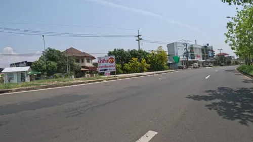
- Street-level photo, ThailandCambodia, CC BY-SA 4.0
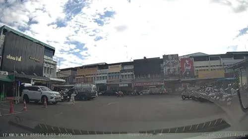
- Street-level photo, ThailandCambodia, CC BY-SA 4.0
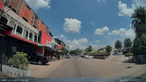
- Street-level photo, ThailandCambodia, CC BY-SA 4.0
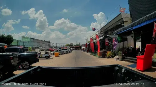
- Street-level photo, ThailandCambodia, CC BY-SA 4.0
- Street-level photo, ThailandCambodia, CC BY-SA 4.0
- Street-level photo, ThailandCambodia, CC BY-SA 4.0
- Street-level photo, ThailandCambodia, CC BY-SA 4.0
- Street-level photo, ThailandCambodia, CC BY-SA 4.0
- Street-level photo, ThailandCambodia, CC BY-SA 4.0
- Street-level photo, ThailandCambodia, CC BY-SA 4.0
- Street-level photo, ThailandCambodia, CC BY-SA 4.0
- Street-level photo, ThailandCambodia, CC BY-SA 4.0
- Street-level photo, ThailandCambodia, CC BY-SA 4.0
- Street-level photo, ThailandCambodia, CC BY-SA 4.0
- Street-level photo, ThailandCambodia, CC BY-SA 4.0
- Street-level photo, ThailandCambodia, CC BY-SA 4.0
- Street-level photo, ThailandCambodia, CC BY-SA 4.0
- Street-level photo, ThailandCambodia, CC BY-SA 4.0


Page built November 10, 2026. Spotted a mistake? Tell us or suggest a place.