


Taling Chan, Thailand
เขตตลิ่งชัน
Taling Chan is a city of 105,299 people in Bangkok, Thailand.
Why visit Taling Chan
Townapedia lists 134 museums and landmarks, 39 parks and trails, 177 places to eat, 43 places to stay and 43 attractions in and around town.
Highlights include National Theatre, Chamai Maru Chet Bridge, Bank of Thailand Museum and Grand Palace.
Weather in Taling Chan
Forecast from MET Norway (CC BY 4.0). Full forecast
About Taling Chan
Taling Chan (Thai: ตลิ่งชัน, pronounced [tā.lìŋ tɕʰān]) is one of the 50 districts (khet) of Bangkok, Thailand. Its neighbours, clockwise from the north, are Bang Kruai district of Nonthaburi province and Bang Phlat, Bangkok Noi, Bangkok Yai, Phasi Charoen, Bang Khae, and Thawi Watthana Districts of Bangkok.
From the Wikipedia article Taling Chan district (this version), under CC BY-SA 4.0.
Photos of Taling Chan


Things to do43

National Theatre
Cinema and theater · 4.3 km
Theatre in Bangkok, Thailand



Chaloem Wan Chat bridge
Bridge · 5.3 km
Bridge and road intersection in Bangkok, Thailand
Chaturaphak Rangsarit Bridge
Bridge · 6.8 km
Bridge in Bangkok, Thailand
31 more on the map.
Museums and landmarks134


Grand Palace
Monument and historic site · 4.9 km
Official residence of the King of Thailand since 1782
Mo-Su 08:30-15:30

Queen Sirikit Museum of Textiles
Museum · 4.6 km
History museum, Textile museum in Grand Palace, Bangkok
Mo-Su 09:00-16:30

Bangkok National Museum
Museum · 4.3 km
Museum in Bangkok, Thailand
We-Su 09:00-16:00; PH off

Chakri Maha Prasat Hall
Monument and historic site · 4.8 km
Https://photos.app.goo.gl/PinGerfAWkiRhCps5
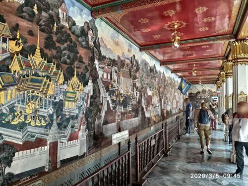
Pavilion of Regalia, Royal Decorations and Coins
Museum · 4.8 km
Museum in Bangkok, Thailand

Phra Sumen Fort
Monument and historic site · 4.5 km
ถนนพระอาทิตย์
Mo-Su 08:00-23:00

Silpakorn University Art Gallery
Museum · 4.6 km
Art gallery and museum in Bangkok, Thailand

Siriraj Medical Museum
Museum · 3.8 km
Medical museum in Bangkok, Thailand

14 October 1973 Memorial
Monument and historic site · 5.1 km
Memorial in Thailand


Baan Kao Lao Rueng Museum
Museum · 6.9 km
History museum in Bangkok, Thailand
122 more on the map.
Parks, trails and playgrounds39


Chao Phraya Sky Park
Park · 6.2 km
Elevated park in Bangkok, Thailand


Princess Mother Memorial Park
Park · 6.5 km
Park in Bangkok, Thailand



27 more on the map.
Restaurants and cafes177
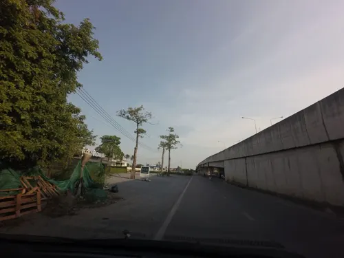
Tuu Gub Kao
Restaurant · Thai, Fusion · 4.0 km
Thai modern food
54 Phutthamonthon Sai 1
Tu-Su 11:30-20:30
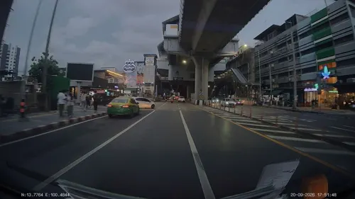
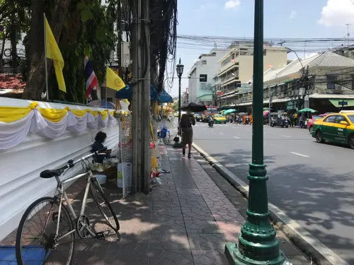



500 Cafe
Cafe · Coffee Shop, Cafe, ิbakery, Cocktail · 2.4 km
500 Cafe by FORFUN Bangkok, Thailand
500 ซอยแซมมี่
Fr-Sa 13:00-00:00




165 more on the map.
History
Taling Chan is an old district, dating back to the time when Thonburi was a separate province; now, Thonburi has merged into Bangkok. In 1998, part of the district was split off to form the new Thawi Watthana district. Historically, much of the area was used as orchards and kitchen gardens, many of which remain today; it has been called "Bangkok's Kitchen."
About 1,000 years ago, the landscape of Taling Chan is believed to have been part of the Chao Phraya river delta, consisting of muddy mangrove forests with no evidence of human settlement.
Two areas of Taling Chan, Bang Ramat and Bang Chueak Nang, were mentioned in the Kamsuan Samut of the Ayutthaya period; they are regarded as among Bangkok's oldest zones.
During World War II, a southern railway line running through the district was one of the targets of Allied bombing.
Taling Chan covers a rectangular area and is intersected by many waterways. It is an agricultural area, which makes access by road difficult. Today, many roads pass through the district, such as Kanchanaphisek, Borommaratchachonnani, Ratchaphruek, Phutthamonthon Sai 1, and Phran Nok-Phutthamonthon Sai 4; however, the most convenient route is still by water. Taling Chan is served by both BMTA and affiliated buses, but only on a few lines. There was no electricity in the area until 1972.
From the History section of Taling Chan district on Wikipedia, under CC BY-SA 4.0.
Where to stay43
Churches and places of worship47
Wat Iam Woranut
Place of worship · Thai Mahanikaya · 4.9 km
178 ถนนสามเสน
Wat Amarinthraram Worawihan
Place of worship · Thai Mahanikaya · 3.5 km
ถนนอรุณอมรินทร์
Wat Buranasiri Mattayaram
Place of worship · Thai Thammayut · 4.9 km
5 ถนนอัษฎางค์
Wat Nak Klang Worawihan
Place of worship · Thai Mahanikaya · 4.6 km
อิสรภาพ 42, บางกอกใหญ่
Wat Rakhang Kositaram Woramahawihan
Place of worship · Thai Mahanikaya · 4.1 km
250 ซอยอรุณอมรินทร์ 18
Wat Kho Non Bang Si Thong
Place of worship · Thai Mahanikaya · 5.0 km
Shopping77
Gas and EV charging18
Schools, colleges and libraries48
Thammasat University Tha Phra Chan
School · 4.3 km
2 ถนนพระจันทร์, แขวงพระบรมมหาราชวัง เขตพระนคร กรุงเทพมหานคร
King Mongkut's University of Technology North Bangkok
School · 8.0 km
Healthcare20
Map of Taling Chan
250 places. The map loads OpenStreetMap tiles when you open it.
Getting there and nearby towns
Don Mueang International Airport (DMK) is the nearest airport with scheduled flights listed in OpenStreetMap, 22 km away.
- Ban Khlong Chak Phra 1 km southwest, about 1 min by car
- Bangkok Noi 3 km southeast, about 3 min by car
- Ban Khlong Bang Ramat 3 km southwest, about 3 min by car
- Ban Bang Bamru 3 km east, about 3 min by car
- Bang Kruai 4 km northeast, about 4 min by car
- Bangkok 5 km southeast, about 5 min by car
- Phra Nakhon 5 km east, about 5 min by car
- Bang Phlat 6 km east, about 6 min by car
- Ban Khlong Bang Phrom 5 km southwest, about 5 min by car
- Thon Buri 7 km southeast, about 7 min by car
Drive times are estimates from straight-line distance, not routes.
Keep exploring
Local news
Headlines from INDB.
Reviews, tips and questions
Loading what members have shared...
Sources and licences
- GeoNames (CC BY 4.0): population, coordinates, regions and time zone
- Mapillary (see each image): photos
- OpenStreetMap contributors (ODbL 1.0): places, airports, map data
- Wikidata (CC0 1.0): elevation, founding date, time zone, website, landmarks and historic places
- Wikimedia Commons (see each image): photos
- Wikipedia (CC BY-SA 4.0): overview and history text
Photo credits
- New Southern Bus Terminal (Sai Tai Mai) - in 2009, Sry85, CC BY-SA 3.0
- Khlong Chak Phra, Taling Chan, Bangkok, Thailand - panoramio (13), mohigan, CC BY-SA 3.0
- Taling Chan district office, Ahoerstemeier, CC BY-SA 3.0
- Khlong Chak Phra, Taling Chan, Bangkok, Thailand - panoramio (11), mohigan, CC BY-SA 3.0
- Khlong Chak Phra, Taling Chan, Bangkok, Thailand - panoramio (12), mohigan, CC BY-SA 3.0
- Khlong Chak Phra, Taling Chan, Bangkok, Thailand - panoramio (6), mohigan, CC BY-SA 3.0
- Khlong Chak Phra, Taling Chan, Bangkok, Thailand - panoramio (15), joinai, CC BY 3.0
- Khlong Chak Phra, Taling Chan, Bangkok, Thailand - panoramio (7), mohigan, CC BY-SA 3.0
- Khlong Chak Phra, Taling Chan, Bangkok, Thailand - panoramio (10), mohigan, CC BY-SA 3.0
- Khlong Chak Phra, Taling Chan, Bangkok, Thailand - panoramio (14), joinai, CC BY 3.0
- Khlong Chak Phra, Taling Chan, Bangkok, Thailand - panoramio (3), mohigan, CC BY-SA 3.0
- Khlong Chak Phra, Taling Chan, Bangkok, Thailand - panoramio (2), mohigan, CC BY-SA 3.0
- Khlong Chak Phra, Taling Chan, Bangkok, Thailand - panoramio (5), mohigan, CC BY-SA 3.0
- Khlong Chak Phra, Taling Chan, Bangkok, Thailand - panoramio (9), mohigan, CC BY-SA 3.0
- Khlong Chak Phra, Taling Chan, Bangkok, Thailand - panoramio (4), mohigan, CC BY-SA 3.0
- Khlong Chak Phra, Taling Chan, Bangkok, Thailand - panoramio (8), mohigan, CC BY-SA 3.0
- Khlong Chak Phra, Taling Chan, Bangkok, Thailand - panoramio, mohigan, CC BY-SA 3.0
- Khlong Chak Phra, Taling Chan, Bangkok, Thailand - panoramio (1), mohigan, CC BY-SA 3.0
- โรงละครแห่งชาติ April2021 Thailand National Theatre Bangkok 01, Chainwit., CC BY-SA 4.0
- BKK Saphan Chamai Maruchet, Hdamm, CC BY-SA 3.0
- สะพานช้างโรงสี Saphan Chang Rong Si Bridge (October 2021) - img 01, Chainwit., CC BY-SA 4.0
- สะพานเจริญราษฎร์ 32, Dharmadana, CC BY-SA 4.0
- Charoenpadana bridge, Sry85, CC BY-SA 4.0
- สะพานเจริญรัช 31, BerryJ, CC BY-SA 3.0
- Dusit Zoo bear statue, Ahoerstemeier, CC BY-SA 3.0
- Krung Thong Bridge 05499, dsin_travel, CC BY 2.0
- พิพิธภัณท์เหรียญ, Bntofficial, CC BY-SA 4.0
- 0005574-พระบรมมหาราชวังและวัดพระศรีรัตนราศดาราม, Preecha.MJ, CC BY-SA 4.0
- Queen Sirikit Museum of Textiles 2, Vano111ru, CC BY-SA 4.0
- Bangkok National Museum, This Photo was taken by Supanut Arunoprayote . Feel free to use any of my images, but please mention me as the author and may send me a message. (สามารถใช้ภาพได้อิสระ..., CC BY 4.0
- Bkksilpakorn0306a, Hdamm, CC BY-SA 3.0
- The Forensic Science Museum in Bangkok, Bobby from London, L'Angleterre, CC BY 2.0
- อนุสรณ์สถาน 14 ตุลา ถ่ายเมื่อกันยายน 2563 14 October 1973 Memorial 02, Chainwit., CC BY-SA 4.0
- Baan Kudichin Museum (2026) 01, Medelam, CC BY-SA 4.0
- A gate of King Rama IX Memorial Park 20221016 165652, Xiengyod~commonswiki, CC BY-SA 4.0
- NarongchaiV 1018-02-0008, Narongchaiv, CC BY-SA 3.0
- Bangkok Suan Romaninart Park IMG 6834, Bjoertvedt, CC BY-SA 4.0
- น้ำพุพานโลหะ สวนสราญรมย์ Bronze Fountain of Saransom Park, Chainwit., CC BY-SA 4.0
- Wat Karawah (cropped), Supanut Arunoprayote, CC BY 4.0
- Conception Church, Bangkok, Supanut Arunoprayote, CC BY-SA 4.0
- Tampak Depan Gereja Santa Cruz Kudi Chin (2026) 02, Medelam, CC BY-SA 4.0
- Bkkwangthaphra0603e, Hdamm, CC BY-SA 3.0
- สวนหลวงพระราม 8 ๘, Phoebus 28, CC BY-SA 4.0
- Bangkokphrasumenfort03, Fotograf / Photographer: Heinrich Damm ( User:Hdamm , Hdamm at de.wikipedia.org ), CC BY 2.0
- Sanam Luang Bangkok, Adbar, CC BY-SA 3.0
- วัดพระศรีรัตนศาสดาราม วัดพระแก้ว กรุงเทพมหานคร - Wat Phra Kaew, Temple of Emerald Buddha, Bangkok, Thailand, Basile Morin, CC BY-SA 4.0
- Dome Building TU, This Photo was taken by Supanut Arunoprayote . Feel free to use any of my images, but please mention me as the author and may send me a message. (สามารถใช้ภาพได้อิสระ..., CC BY 4.0
- วัดระฆังโฆสิตารามวรมหาวิหาร เขตบางกอกน้อย กรุงเทพมหานคร (24), กสิณธร ราชโอรส, CC BY-SA 4.0
- Siriraj Hospital, Wonton2ton, Public domain
- Taweethapisek School view from building 1, Earthpanot, CC BY-SA 3.0
- Phra Sumen Fort Bangkok - Day, Supanut Arunoprayote, CC BY-SA 4.0
- วัดบุรณศิริมาตยาราม198, CKasa, CC BY-SA 3.0
- Bot of Wat Amarin, Bangkok Noi - panoramio, Andreas Hörstemeier, CC BY-SA 3.0
- Grand Palace Bangkok, Thailand, Andy Marchand, CC BY-SA 3.0
- วัดนาคกลาง 01, Anusorn sanaphanthu, CC BY-SA 3.0
- Chinorot Witthayalai School entrance, Ahoerstemeier, CC BY-SA 4.0
- วัดนายโรง เขตบางกอกน้อย กรุงเทพมหานคร (3), กสิณธร ราชโอรส, CC BY-SA 4.0
- Wat Amon Thayikaram Ahoerstemeier 6, User:Ahoerstemeier, CC BY 4.0
- วัดเอี่ยมวรนุช เขตพระนคร กรุงเทพมหานคร (17), กสิณธร ราชโอรส, CC BY-SA 4.0
- สะพานหัน 2564 Saphan Han (October 2021) - img 01, Chainwit., CC BY-SA 4.0
- Bangkok 2014 PD 087, Bin im Garten, CC BY 3.0
- Chao Phraya Sky Park เจ้าพระยาสกายปาร์ค สวนลอยฟ้าเจ้าพระยา (October 2021) - img 19, Chainwit., CC BY-SA 4.0
- Kiakkai Bridge - 2026 08 21 - 01, Anna Frodesiak, CC0
- Bodindecha (Sing Singhaseni) Nonthaburi School Emblem, Cocoman1456, CC0
- Siriraj Piyamaharajkarun Hospital, Thanapas.som, CC BY-SA 4.0
- วิทยาลัยพณิชยการธนบุรี, Dharmadana, CC BY-SA 4.0
- Street-level photo, mishari, CC BY-SA 4.0
- Street-level photo, ThailandCambodia, CC BY-SA 4.0
- Street-level photo, naaao5228, CC BY-SA 4.0
- Street-level photo, ThailandCambodia, CC BY-SA 4.0
- Street-level photo, poramet, CC BY-SA 4.0
- Street-level photo, naaao5228, CC BY-SA 4.0
- Street-level photo, ozflor, CC BY-SA 4.0
- Street-level photo, naaao5228, CC BY-SA 4.0
- Street-level photo, geocruizer, CC BY-SA 4.0
- Street-level photo, geocruizer, CC BY-SA 4.0
- Street-level photo, geocruizer, CC BY-SA 4.0
- Street-level photo, km2bp, CC BY-SA 4.0
- Street-level photo, naaao5228, CC BY-SA 4.0


Page built November 10, 2026. Spotted a mistake? Tell us or suggest a place.