


Udon Thani, Thailand
เทศบาลนครอุดรธานี
Udon Thani is a regional capital of 130,531 people in Udon Thani, Thailand.
Why visit Udon Thani
Townapedia lists 9 museums and landmarks, 12 parks and trails, 152 places to eat, 71 places to stay and 1 attraction in and around town.
Highlights include Taxi Ca Dech, YoYoland Udon and Udon Thani Rajabhat University Stadium.
Weather in Udon Thani
Forecast from MET Norway (CC BY 4.0). Full forecast
About Udon Thani
Udon Thani (Thai: อุดรธานี, pronounced [ʔù.dɔ̄ːn tʰāː.nīː]) is a city in Isan (Northeast Thailand), the capital of Udon Thani province and the sixth largest city in Thailand. The city municipality (thesaban nakhon / city proper) had a population of 130,531 people as of 2019, while Udon Thani's urban area, Mueang Udon Thani, has a population of approximately 400,000.
From the Wikipedia article Udon Thani (this version), under CC BY-SA 4.0.
Travel tips from other travellers: Udon Thani on Wikivoyage (CC BY-SA 4.0).
Photos of Udon Thani


Things to do1

Museums and landmarks9

Taxi Ca Dech
Monument and historic site · 6.0 km
168/24 หมู่ 4 ซอยท้าวจันทร์
Mo-Su 06:00-18:00

Parks, trails and playgrounds12

YoYoland Udon
Sports field and stadium · 1.9 km
ถนนประจักษ์ศิลปาคม
Mo-Su 10:00-21:00


Restaurants and cafes152
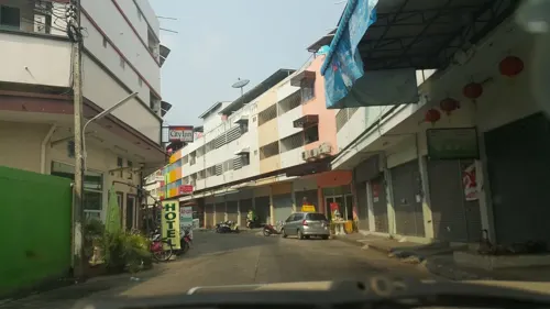
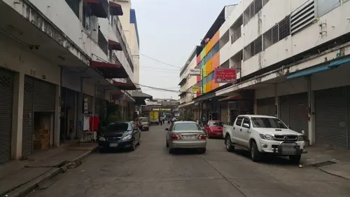
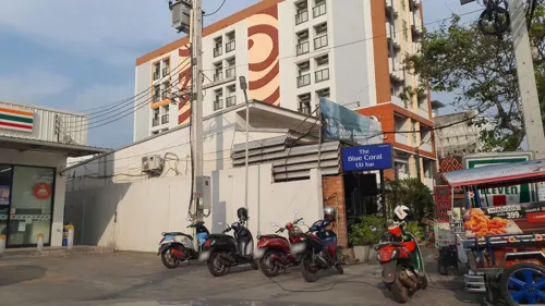
Aussie Pub and steakhouse
Bar and pub · Steak House, Burger, American, Chicken, Sausage, Barbecue, Coffee Shop · 2.1 km
ถนนประจักษ์ศิลปาคม
Mo-Su 16:00-24:00
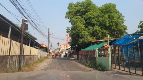
MaMite Cafe
Cafe · Coffee Shop, Pancake · 3.4 km
486
Mo-Su 11:00-23:00
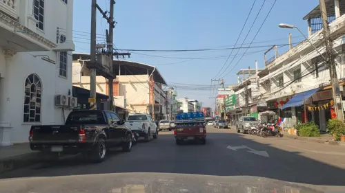
Phaisach Tana
Restaurant · Thai, Lao · 1.1 km
Siri Saddhā Rd.
06:00-15:00
Open in Google Maps · +66902351423;+66625562494;+66985949516;+66982496459
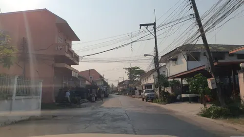
สนทนาคาเฟ่
Cafe · Coffee Shop, Burger, Pizza, Juice · 1.3 km
4/4 อุดรดุษฎี ซอย9, บ้านเลื่อม
Mo-Fr 07:00-15:00
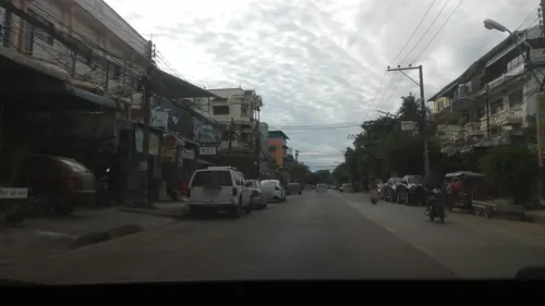
Godfather Coffee III
Cafe · Coffee Shop · 1.2 km
103/37 ถนนโพนพิสัย
Mo-Su 08:00-18:00
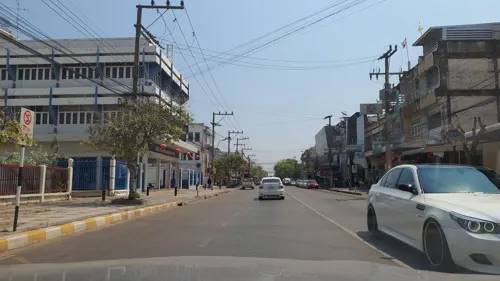


Grey Cabin
Restaurant · 1.4 km
28/5 Srisuk
Mo-Tu 08:30-21:00; We 09:00-21:00; Fr 08:30-21:00; Sa-Su 08:00-21:00

BACK YARD Udonthani
Restaurant · Thai, Asian, International · 0.8 km
224/145 อุดรดุษฎี ซอย4, หมากแข้ง
Mo-Su 17:00-24:00

140 more on the map.
History
The city's economy was boosted by the proximity to Udorn Royal Thai Air Force Base during the Vietnam War and retains reminders of that time in the form of bars, coffee shops, and hotels. "Udon sort of became like Pattaya when the GIs arrived," said a local architect. "Restaurants serving Western cuisine, hotels and nightclubs sprouted up everywhere to meet their needs. It was an extremely busy city back then."
The BBC has reported that Udon Thani's Royal Air Force Base was the site of a CIA black site, known to insiders as "Detention Site Green", used to interrogate Abu Zubaydah, Saudi-born Palestinian, believed to be one of Osama bin Laden's top lieutenants. In December 2014 the United States Senate Select Committee on Intelligence (SSCI) published an executive summary of a secret 6,000-page report on CIA techniques. The report alleges that at least eight Thai senior officials knew of the secret site. The site was closed in December 2002.
Earlier reports alleged that a Voice of America relay station in a rural area of Udon Thani Province, Ban Dung District, was the CIA black site.
From the History section of Udon Thani on Wikipedia, under CC BY-SA 4.0.
More about Udon Thani
Economy
Asia Pacific Potash Corporation (APPC), a wholly owned subsidiary of Italian-Thai Development PLC, owns the concession to the Udon North and Udon South potash mines and plans to develop them.
Potash deposits in northeast Thailand are believed to contain the world's third-largest—after Canada and Russia—unexploited potash reserves. Potash is one of the main components of agricultural fertilizer.
From the Wikipedia article Udon Thani, under CC BY-SA 4.0.
Notable people from Udon Thani
 Sapsiree Taerattanachaibadminton playerPhoto: Sapsiree, CC BY-SA 4.0
 Chayut Triyachartbadminton playerPhoto: Daniel from Glasgow, United Kingdom, CC BY 2.0
 Korawit NamwisetThai footballerPhoto: ClassVelt55, CC BY-SA 4.0
- Sudaporn SeesondeeThai boxer
- Praphas CharusathienThai military officer, politician (1912-1997)
- Parinya ChuaimaroengThai athletics competitor
- Kovid FoythongThai footballer
- Panuwat FailaiThai footballer
- Ittipol PoolsapThai footballer
- Kiatjarern RuangparnThai footballer
- Pongtep MulaleeThai association football player
- Rachanon KanyathongThai association football player


Born in Udon Thani, according to Wikidata (CC0). Each name links to its Wikipedia article.
Where to stay71
Churches and places of worship19
วัดอินทราวาส
Place of worship · 2.9 km
61 บ้านเก่าน้อย ถนนมิตรภาพ, ตำบลหนองบัว อำเภอเมือง จังหวัดอุดรธานี
Shopping19
Gas and EV charging27
Schools, colleges and libraries33
Healthcare15
Map of Udon Thani
250 places. The map loads OpenStreetMap tiles when you open it.
Getting there and nearby towns
Udon Thani International Airport (UTH) is the nearest airport with scheduled flights listed in OpenStreetMap, 3 km away.
- Kut Chap 23 km west, about 23 min by car
- Nong Wua So 36 km southwest, about 36 min by car
- Ban Phan Don 36 km southeast, about 36 min by car
- Nong Bua Lamphu 44 km southwest, about 44 min by car
- Ban Nong Wua So 49 km east, about 49 min by car
- Nong Khai 52 km north, about 52 min by car
- Tha Bo 53 km northwest, about 53 min by car
- Ban Dung 59 km northeast, about 59 min by car
- Na Klang 64 km west, about 1 h by car
- Si Chiang Mai 64 km north, about 1 h by car
Drive times are estimates from straight-line distance, not routes.
Keep exploring
Local news
Headlines from INDB.
Reviews, tips and questions
Loading what members have shared...
Sources and licences
- GeoNames (CC BY 4.0): population, coordinates, regions and time zone
- Mapillary (see each image): photos
- OpenStreetMap contributors (ODbL 1.0): places, airports, map data
- Wikidata (CC0 1.0): elevation, founding date, time zone, website
- Wikimedia Commons (see each image): photos
- Wikipedia (CC BY-SA 4.0): overview and history text
Photo credits
- Aerial view of Udon Thani City, KhunWasut, CC BY 3.0
- Udon Thani - Wat Matchimawat - 0006, Stefan Fussan, CC BY-SA 3.0
- Udon Thani - Wat Pothisompon - 0010, Stefan Fussan, CC BY-SA 3.0
- Udon Thani - Pavilion - 0001, Stefan Fussan, CC BY-SA 3.0
- Udon Thani - Chinese Shrine - 0004, Stefan Fussan, CC BY-SA 3.0
- Udon Thani - Chinese Shrine - 0005, Stefan Fussan, CC BY-SA 3.0
- Udon Thani - Chinese Shrine - 0006, Stefan Fussan, CC BY-SA 3.0
- Udon Thani - The City Pillar Shrine - 0002, Stefan Fussan, CC BY-SA 3.0
- Scarabé rhinocéros siamois (Xylotrupes socrates siamensis) Udon Thani TH 22.10.25, C.Farquet, CC0
- Udon Thani - Spirit House - 0001, Stefan Fussan, CC BY-SA 3.0
- Udon Thani - Nong Prachak Lake - Panorama 0001, Stefan Fussan, CC BY-SA 3.0
- Udon Thani - Wat Matchimawat - 0001, Stefan Fussan, CC BY-SA 3.0
- Udon Thani - Wat Matchimawat - 0004, Stefan Fussan, CC BY-SA 3.0
- Udon Thani - Nong Prachak Lake - 0021, Stefan Fussan, CC BY-SA 3.0
- Mak Khaeng, Mueang Udon Thani District, Udon Thani 41000, Thailand - panoramio (2), katsunori.n, CC BY 3.0
- Mak Khaeng, Mueang Udon Thani District, Udon Thani 41000, Thailand - panoramio, katsunori.n, CC BY 3.0
- Mak Khaeng, Mueang Udon Thani District, Udon Thani 41000, Thailand - panoramio (1), katsunori.n, CC BY 3.0
- Udon Thani - Wat Pothisompon - 0001, Stefan Fussan, CC BY-SA 3.0
- Statue and relics of Man Bhuridatta, Wat Bodhisombhorn, Udon Thani, Xiengyod~commonswiki, CC BY-SA 4.0
- Statue and relics of Sao Kantasila, Wat Bodhisombhorn, Udon Thani, Xiengyod~commonswiki, CC BY-SA 4.0
- Statues of Chum bandula, Wat Bodhisombhorn, Udon Thani, Xiengyod~commonswiki, CC BY-SA 4.0
- Statues of Chansi Candadipa, Wat Bodhisombhorn, Udon Thani, Xiengyod~commonswiki, CC BY-SA 4.0
- A wax statue of Chum Bandula, Wat Bodhisombhorn, Udon Thani 02, Xiengyod~commonswiki, CC BY-SA 4.0
- A wax statue of Chum Bandula, Wat Bodhisombhorn, Udon Thani 01, Xiengyod~commonswiki, CC BY-SA 4.0
- A wax statue of Chansi Candadipa, Wat Bodhisombhorn, Udon Thani 01, Xiengyod~commonswiki, CC BY-SA 4.0
- Mak Khaeng, Mueang Udon Thani District, Udon Thani 41000, Thailand - panoramio (3), katsunori.n, CC BY 3.0
- Udon Thani - Wat Pothisompon - 0002, Stefan Fussan, CC BY-SA 3.0
- Udon Thani - Wat Pothisompon - 0008, Stefan Fussan, CC BY-SA 3.0
- Udon Thani - Wat Pothisompon - 0012, Stefan Fussan, CC BY-SA 3.0
- Udon Thani - Wat Pothisompon - 0007, Stefan Fussan, CC BY-SA 3.0
- Udon Thani - Wat Pothisompon - 0005, Stefan Fussan, CC BY-SA 3.0
- ANIVLOG THAILAND E200, C.Farquet, CC0
- ศาลหลักเมืองจังหวัดอุดรธานี , Udonthani City Pillar Shine - panoramio, ::::=UT=::::, CC BY-SA 3.0
- Nong Prajak Park Pano - panoramio, gewien, CC BY-SA 3.0
- อาคารพิพิธภัณฑ์เมืองอุดรธานี , Udonthani City Museum Building - panoramio, ::::=UT=::::, CC BY-SA 3.0
- โรงเรียนอุดรคริสเตียนวิทยา, JustRandomThai, CC BY-SA 4.0
- พิพิธภัณฑ์เมืองอุดรธานี 01, อภิชิต พีรทิตยา, CC BY-SA 4.0
- พิพิธภัณฑ์เมืองอุดรธานี 02, อภิชิต พีรทิตยา, CC BY-SA 4.0
- พิพิธภัณฑ์เมืองอุดรธานี 03, อภิชิต พีรทิตยา, CC BY-SA 4.0
- Phra Parama Dhatu Dhamma Cetiya, Wat Bodhisombhorn, Interior 01, Xiengyod~commonswiki, CC BY-SA 4.0
- Street-level photo, jrcarlsen, CC BY-SA 4.0
- Street-level photo, jrcarlsen, CC BY-SA 4.0
- Street-level photo, jrcarlsen, CC BY-SA 4.0
- Street-level photo, ozflor, CC BY-SA 4.0
- Street-level photo, jrcarlsen, CC BY-SA 4.0
- Street-level photo, jrcarlsen, CC BY-SA 4.0
- Street-level photo, jrcarlsen, CC BY-SA 4.0
- Street-level photo, jrcarlsen, CC BY-SA 4.0
- Street-level photo, rariyaso, CC BY-SA 4.0
- Street-level photo, jrcarlsen, CC BY-SA 4.0
- Street-level photo, rariyaso, CC BY-SA 4.0
- Street-level photo, jrcarlsen, CC BY-SA 4.0
- Street-level photo, jrcarlsen, CC BY-SA 4.0
- Street-level photo, jrcarlsen, CC BY-SA 4.0
- Street-level photo, ozflor, CC BY-SA 4.0
- Street-level photo, jrcarlsen, CC BY-SA 4.0
- Street-level photo, rariyaso, CC BY-SA 4.0
- Street-level photo, jrcarlsen, CC BY-SA 4.0
- Street-level photo, rariyaso, CC BY-SA 4.0
- Street-level photo, jrcarlsen, CC BY-SA 4.0
- Street-level photo, rariyaso, CC BY-SA 4.0
- Street-level photo, jrcarlsen, CC BY-SA 4.0
- Street-level photo, jrcarlsen, CC BY-SA 4.0


Page built November 10, 2026. Spotted a mistake? Tell us or suggest a place.