


Bolvadin, Turkey
Bolvadin is a town of 55,870 people in Afyonkarahisar Province, Turkey.
Why visit Bolvadin
Townapedia lists 11 museums and landmarks, 3 parks and trails, 4 places to eat, 8 places to stay and 2 attractions in and around town.
Highlights include Paşa Dağı and Çay Han.
Weather in Bolvadin
Forecast from MET Norway (CC BY 4.0). Full forecast
About Bolvadin
Bolvadin (Ancient Greek: Πολύβοτον/Πολύβοτος and Latin: Polybotum/Polybotus) is a city of Afyonkarahisar Province in Turkey. It is the seat of Bolvadin District. Bolvadin district has a total population of 45,468 according to the 2024 census. It has an altitude of 1,016 m.
From the Wikipedia article Bolvadin (this version), under CC BY-SA 4.0.
Things to do2

Museums and landmarks11


Parks, trails and playgrounds3

Restaurants and cafes4





History
The city was founded in very early times. It was part of Phrygia. In the Roman era it was known as Polybotum and a castle was built here. It then passed into the hands of the Seljuk Turks and then the Ottoman Empire, known as a strategic bridge in the mountains.
From 1867 until 1922, Bolvadin was part of the Hüdavendigâr vilayet of the Ottoman Empire. Bolvadin was occupied by Greek troops during the Turkish War of Independence, until September 1922.
From the History section of Bolvadin on Wikipedia, under CC BY-SA 4.0.
Where to stay8
Grand Bozkurt Butik Otel
Motel and hotel · 13.4 km
Çay yolu 4. km Turkuaz petrol, Çay
Churches and places of worship8
Shopping4
Gas and EV charging19
Schools, colleges and libraries45
Healthcare22
Map of Bolvadin
126 places. The map loads OpenStreetMap tiles when you open it.
Getting there and nearby towns
17’nci Hava ve Füze Savunma Üs Komutanlığı (AFY) is the nearest airport with scheduled flights listed in OpenStreetMap, 39 km away.
- Dipevler 5 km northeast, about 5 min by car
- Karayokuş 10 km northeast, about 10 min by car
- Çay 13 km south, about 13 min by car
- Derekarabağ 12 km east, about 12 min by car
- Eber 14 km southeast, about 14 min by car
- Büyükkarabağ 19 km northeast, about 19 min by car
- Kemerkaya 20 km north, about 20 min by car
- Emirdağ 35 km north, about 35 min by car
- Afyonkarahisar 44 km west, about 44 min by car
- Sandıklı 73 km west, about 1 h 15 min by car
Drive times are estimates from straight-line distance, not routes.
Local news
Headlines from INDB.
Reviews, tips and questions
Loading what members have shared...
Sources and licences
- GeoNames (CC BY 4.0): population, coordinates, regions and time zone
- Mapillary (see each image): photos
- OpenStreetMap contributors (ODbL 1.0): places, airports, map data
- Wikidata (CC0 1.0): elevation, founding date, time zone, website
- Wikimedia Commons (see each image): photos
- Wikipedia (CC BY-SA 4.0): overview and history text
Photo credits
- Kırık Minare, Abdurrahmançetin, CC BY-SA 4.0
- Avşar Emaye - Bolvadin - panoramio, alperyilmaz_tr, CC BY-SA 3.0
- Çay; Taş Han von 1278, Portal, Christian1311, CC BY-SA 4.0
- Hasır Dokumacılığı, Turpcan, CC BY-SA 4.0
- ISS043-E-200667 - View of Earth, Earth Science and Remote Sensing Unit , Lyndon B. Johnson Space Center, Public domain
- ISS043-E-200665 - View of Earth, Earth Science and Remote Sensing Unit , Lyndon B. Johnson Space Center, Public domain
- ISS016-E-37790 - View of Earth, Earth Science and Remote Sensing Unit , Lyndon B. Johnson Space Center, Public domain
- ISS043-E-200666 - View of Earth, Earth Science and Remote Sensing Unit , Lyndon B. Johnson Space Center, Public domain
- ISS016-E-37789 - View of Earth, Earth Science and Remote Sensing Unit , Lyndon B. Johnson Space Center, Public domain
- ISS053-E-118191 - View of Earth, Earth Science and Remote Sensing Unit , Lyndon B. Johnson Space Center, Public domain
- ISS053-E-118192 - View of Earth, Earth Science and Remote Sensing Unit , Lyndon B. Johnson Space Center, Public domain
- ISS053-E-119105 - View of Earth, Earth Science and Remote Sensing Unit , Lyndon B. Johnson Space Center, Public domain
- ISS053-E-119104 - View of Earth, Earth Science and Remote Sensing Unit , Lyndon B. Johnson Space Center, Public domain
- Kırkgöz köprü, Abdurrahmançetin, CC BY-SA 4.0
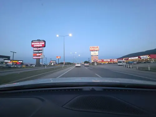
- Street-level photo, mehmetsayin, CC BY-SA 4.0
- Street-level photo, mehmetsayin, CC BY-SA 4.0
- Street-level photo, mehmetsayin, CC BY-SA 4.0
- Street-level photo, mehmetsayin, CC BY-SA 4.0
- Street-level photo, mehmetsayin, CC BY-SA 4.0
- Street-level photo, worms, CC BY-SA 4.0
- Street-level photo, mehmetsayin, CC BY-SA 4.0
- Street-level photo, worms, CC BY-SA 4.0
- Street-level photo, mehmetsayin, CC BY-SA 4.0
- Street-level photo, mehmetsayin, CC BY-SA 4.0
- Street-level photo, mehmetsayin, CC BY-SA 4.0
- Street-level photo, worms, CC BY-SA 4.0
- Street-level photo, worms, CC BY-SA 4.0
- Street-level photo, worms, CC BY-SA 4.0
- Street-level photo, worms, CC BY-SA 4.0


Page built November 8, 2026. Spotted a mistake? Tell us or suggest a place.