




Why visit Cizre
Townapedia lists 15 museums and landmarks, 3 parks and trails, 6 places to eat, 2 places to stay and 4 attractions in and around town.
Highlights include Ain Diwar Bridge, Cizre Bridge, Bezabde and Pinaka, Corduene.
Weather in Cizre
Forecast from MET Norway (CC BY 4.0). Full forecast
About Cizre
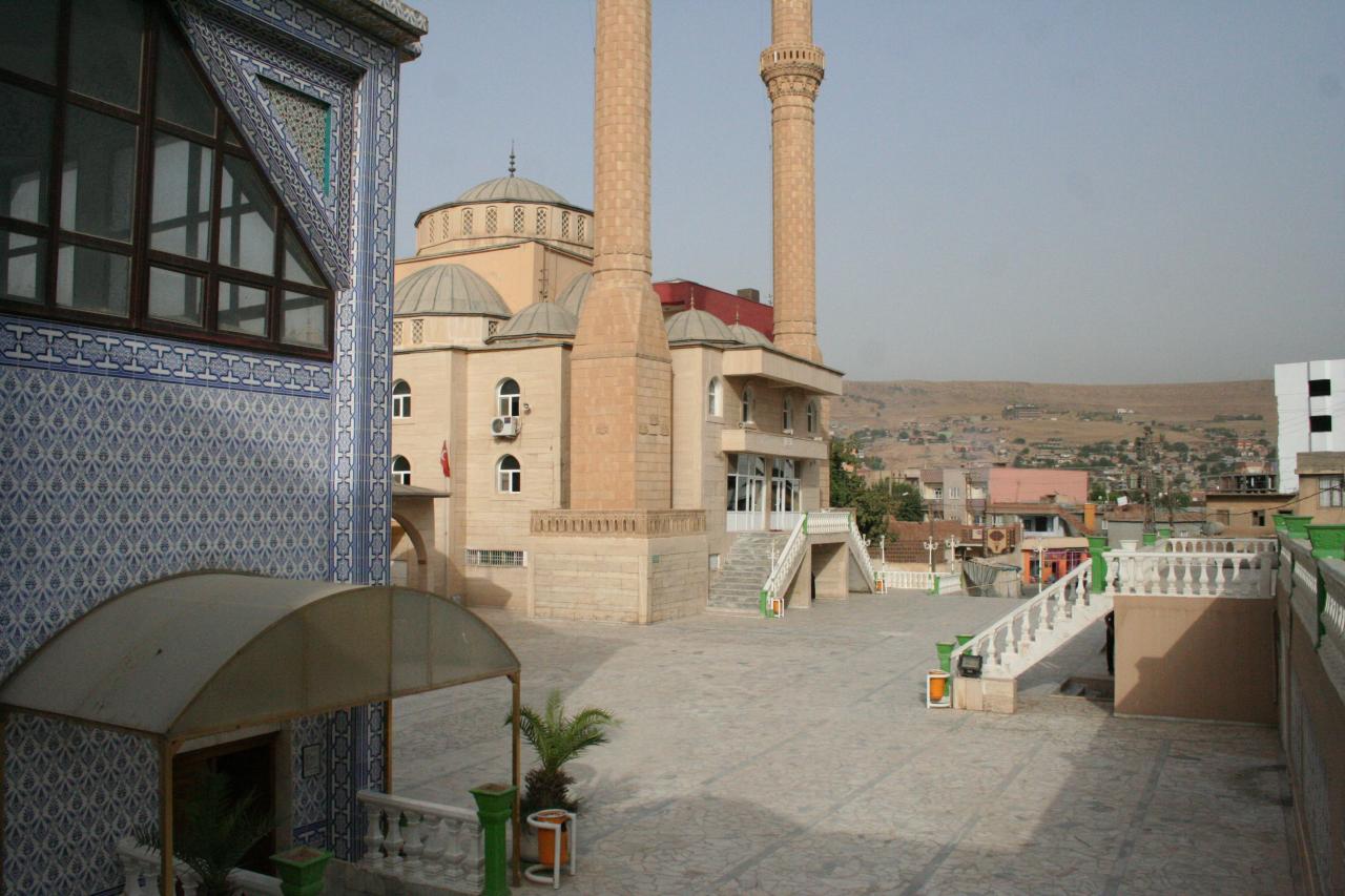
Cizre (Turkish: [ˈdʒizɾe]) is a city in the Cizre District of Şırnak Province in Turkey. It is located on the river Tigris by the Syria–Turkey border and close to the Iraq–Turkey border. Cizre is in the historical region of Upper Mesopotamia and the cultural region of Turkish Kurdistan. The city had a population of 130,916 in 2021.
From the Wikipedia article Cizre (this version), under CC BY-SA 4.0.
Things to do4



Museums and landmarks15

Bezabde
Monument and historic site · 13.2 km
Roman fortress in modern Turkey

Pinaka, Corduene
Monument and historic site · 13.0 km
Place in Şırnak, Turkey

Kırmızı Medrese
Monument and historic site · 0.6 km
Şen Caddesi, Şırnak
Noah's Mausoleum (Cizre, Turkey)
Monument and historic site · 0.8 km


3 more on the map.
Parks, trails and playgrounds3


Restaurants and cafes6

Diyar 21 Kirevem Sofra Salonu
Restaurant · 1.7 km
Devlet Hastanesi Karşısı, Cizre/Şırnak

Where to stay2
Churches and places of worship30
Atbaşı Köyü Camii
Place of worship · Sunni · 13.6 km
8 Atbaşı Küme Evleri, Şırnak
Hasan Basri Camii
Place of worship · Sunni · 0.9 km
66 Şerafettin Elçi Caddesi, Şırnak
Shopping10
Gas and EV charging5
Schools, colleges and libraries24
Metin Bostancıoğlu İmam Hatip Ortaokulu
School · 0.9 km
31 Akaydın Caddesi, Şırnak
Healthcare40
Fadıl Eczanesi
Clinic and pharmacy · 1.8 km
Devlet Hastanesi Karşısı, Cizre/Şırnak
Cizre Eczanesi
Clinic and pharmacy · 1.8 km
Devlet Hastanesi Karşısı, Cizre/Şırnak
Dicle Eczanesi
Clinic and pharmacy · 1.7 km
Devlet Hastanesi Karşısı, Cizre/Şırnak
Map of Cizre
139 places. The map loads OpenStreetMap tiles when you open it.
Getting there and nearby towns
Şırnak Şerafettin Elçi Airport (NKT) is the nearest airport with scheduled flights listed in OpenStreetMap, 12 km away.
- Yeşilyurt 5 km southwest, about 5 min by car
- Sulak 6 km southwest, about 6 min by car
- Bozalan 7 km east, about 7 min by car
- Kasrik 8 km north, about 8 min by car
- Düzova 9 km west, about 9 min by car
- Cibri 10 km southwest, about 10 min by car
- Dicle 11 km southwest, about 11 min by car
- Katran 11 km southwest, about 11 min by car
- Silopi 26 km east, about 26 min by car
- Siirt 70 km north, about 1 h 15 min by car
Drive times are estimates from straight-line distance, not routes.
Local news
Headlines from INDB.
Reviews, tips and questions
Loading what members have shared...
Sources and licences
- GeoNames (CC BY 4.0): population, coordinates, regions and time zone
- OpenStreetMap contributors (ODbL 1.0): places, airports, map data
- Wikidata (CC0 1.0): elevation, founding date, time zone, website, landmarks and historic places
- Wikimedia Commons (see each image): photos
- Wikipedia (CC BY-SA 4.0): overview and history text
Photo credits
- Cizre-July2012-01, Rehman Abubakr, CC BY-SA 4.0
- Ain Diwar 1, Zoeperkoe, CC BY-SA 4.0
- Noah-Mausoleum-Cizre-Turkey-August-2009-7, Joaoleitao ( talk ). Original uploader was Joaoleitao at en.wikipedia, CC BY-SA 3.0
- Gora Mem û Zîn, Gomada, CC BY-SA 3.0
- Medreseya Sor Cizîra Botan 2009 2, MikaelF, CC BY-SA 3.0
- Kela Cizîrê 2009, Unknown author, Public domain
- Mizgefta Mezin a Cizîra Botan 2009 2, MikaelF, CC BY-SA 3.0
- Pinaca Castle Corduene 1, Gertrude Bell, Public domain
- Mem u Zin türbesi, KediÇobanı, CC BY-SA 4.0
- Mizgefta Mezin a Cizîra Botan 2009 3, MikaelF, CC BY-SA 3.0
- Abdaliye Medresesi, KediÇobanı, CC BY-SA 4.0


Page built November 8, 2026. Spotted a mistake? Tell us or suggest a place.