


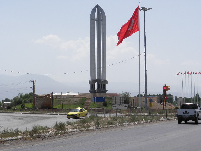


Why visit Enginalan
Townapedia lists 1 museum or landmark in and around town.
Highlights include Iğdır Genocide Memorial and Museum.
Weather in Enginalan
Forecast from MET Norway (CC BY 4.0). Full forecast
About Enginalan
Enginalan (Kurdish: Pilûr, Armenian: Բլուր, romanized: Blur), is a village in the Iğdır District of Iğdır Province, Turkey. Its population is 2,482 (2022). The village is populated by Azerbaijanis and Kurds.
From the Wikipedia article Enginalan, Iğdır (this version), under CC BY-SA 4.0.
Museums and landmarks1
Iğdır Genocide Memorial and Museum
Museum · 4.9 km
Museum in Iğdır District
History
From the records of 1901 and 1928, we know the village was once called Blur in Armenian, which means mound.
Enginalan was an Armenian inhabited settlement prior to the Armenian-Turkish war in 1920, with a population of 2,244 in 1908.
From the History section of Enginalan, Iğdır on Wikipedia, under CC BY-SA 4.0.
Map of Enginalan
1 places. The map loads OpenStreetMap tiles when you open it.
Getting there and nearby towns
Iğdır Airport (IGD) is the nearest airport with scheduled flights listed in OpenStreetMap, 13 km away.
- Panik 3 km northeast, about 3 min by car
- Obaköy 3 km west, about 3 min by car
- Iğdır 4 km south, about 4 min by car
- Yüzbaşılar 4 km north, about 4 min by car
- Melekli 6 km east, about 6 min by car
- Yaycı 6 km west, about 6 min by car
- Çakırtaş 7 km northeast, about 7 min by car
- Tacirli 7 km northeast, about 7 min by car
- Hoşhaber 8 km southwest, about 8 min by car
- Ağrı 89 km west, about 1 h 30 min by car
Drive times are estimates from straight-line distance, not routes.
Local news
Headlines from INDB.
Reviews, tips and questions
Loading what members have shared...
Sources and licences
- GeoNames (CC BY 4.0): population, coordinates, regions and time zone
- OpenStreetMap contributors (ODbL 1.0): places, airports, map data
- Wikidata (CC0 1.0): elevation, founding date, time zone, website, landmarks and historic places
- Wikimedia Commons (see each image): photos
- Wikipedia (CC BY-SA 4.0): overview and history text
Photo credits
- IĞDIR PULUR ENGİNALAN KÖYÜ - panoramio, yeşilgüzelığdır, CC BY 3.0
- SoykırımAnıtMüze5, Sabri76, Public domain
- IĞDIR' DA HAYVANCILIK - panoramio, yeşilgüzelığdır, CC BY 3.0
- Hakveyis toprak kanal - panoramio, carsigdir, CC BY-SA 3.0
- Hakveyis mahallesi şeftali bağı - panoramio, carsigdir, CC BY-SA 3.0
- Kayısı kurutma hakveyis köyü - panoramio, carsigdir, CC BY-SA 3.0
Page built November 8, 2026. Spotted a mistake? Tell us or suggest a place.