
Hilvan, Turkey
Hilvan is a town of 16,990 people in Şanlıurfa, Turkey, founded in June 26, 1926.
Why visit Hilvan
Townapedia lists 4 museums and landmarks, 1 place to eat and 3 attractions in and around town.
Highlights include Büyüktülük Tepe, Fik Tepe and Tille Höyük.
Weather in Hilvan
Forecast from MET Norway (CC BY 4.0). Full forecast
About Hilvan
Hilvan (Kurdish: Curnê Reş, Ottoman Turkish: قره جورون, romanized: Karacurun) is a municipality and district of Şanlıurfa Province, Turkey. Its area is 1,111 km2, and its population is 42,218 (2022). It is 55 km north from the city of Şanlıurfa.
From the Wikipedia article Hilvan (this version), under CC BY-SA 4.0.
Travel tips from other travellers: Hilvan on Wikivoyage (CC BY-SA 4.0).
Things to do3

Museums and landmarks4

Tille Höyük
Monument and historic site · 17.5 km
Archeological site in Turkey
Restaurants and cafes1
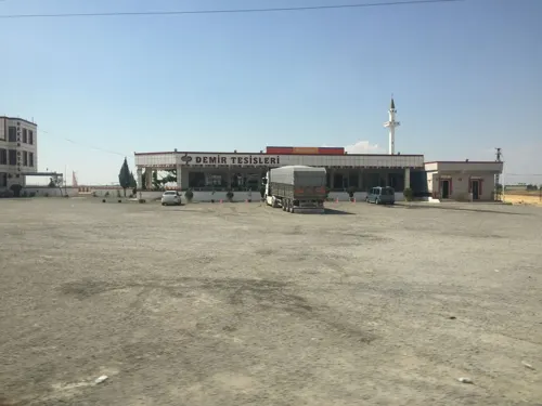
Churches and places of worship6

Shopping2
Gas and EV charging10
Schools, colleges and libraries5
Healthcare14
Map of Hilvan
45 places. The map loads OpenStreetMap tiles when you open it.
Getting there and nearby towns
Şanlıurfa Airport (GNY) is the nearest airport with scheduled flights listed in OpenStreetMap, 16 km away.
- Geldibuldu 17 km northwest, about 17 min by car
- İkizce 25 km northwest, about 25 min by car
- Menzil 27 km northwest, about 27 min by car
- Yapraklı 30 km northwest, about 30 min by car
- Güzelsu 33 km north, about 33 min by car
- Siverek 37 km northeast, about 37 min by car
- Kâhta 37 km northwest, about 37 min by car
- Şanlıurfa 49 km south, about 49 min by car
- Adıyaman 63 km west, about 1 h by car
- Çermik 75 km northeast, about 1 h 15 min by car
Drive times are estimates from straight-line distance, not routes.
Local news
Headlines from INDB.
Reviews, tips and questions
Loading what members have shared...
Sources and licences
- GeoNames (CC BY 4.0): population, coordinates, regions and time zone
- Mapillary (see each image): photos
- OpenStreetMap contributors (ODbL 1.0): places, airports, map data
- Wikidata (CC0 1.0): elevation, founding date, time zone, website, landmarks and historic places
- Wikipedia (CC BY-SA 4.0): overview and history text
Photo credits
- Street-level photo, sessiznotalar, CC BY-SA 4.0
- Street-level photo, sessiznotalar, CC BY-SA 4.0
- Street-level photo, sessiznotalar, CC BY-SA 4.0
- Street-level photo, sessiznotalar, CC BY-SA 4.0
- Street-level photo, sessiznotalar, CC BY-SA 4.0
- Street-level photo, sessiznotalar, CC BY-SA 4.0
- Street-level photo, sessiznotalar, CC BY-SA 4.0
- Street-level photo, sessiznotalar, CC BY-SA 4.0
- Street-level photo, sessiznotalar, CC BY-SA 4.0
- Street-level photo, sessiznotalar, CC BY-SA 4.0
- Street-level photo, sessiznotalar, CC BY-SA 4.0
- Street-level photo, sessiznotalar, CC BY-SA 4.0
Page built November 8, 2026. Spotted a mistake? Tell us or suggest a place.