


Why visit İskenderun
Townapedia lists 5 museums and landmarks, 15 parks and trails, 37 places to eat, 4 places to stay and 4 attractions in and around town.
Highlights include Çobandede Tepesi, Deniz Müzesi, Myriandrus and İskenderun Millet Parkı.
Weather in İskenderun
Forecast from MET Norway (CC BY 4.0). Full forecast
About İskenderun
İskenderun (Arabic: إسكندرونة), historically known as Alexandretta (Greek: Αλεξανδρέττα, lit. 'little Alexandria') and Scanderoon, is a municipality and district of Hatay Province, Turkey. Its area is 247 km2, and its population is 251,682 (2022). It is on the Mediterranean coast. Located on an alluvial plain, the city was heavily damaged by powerful earthquakes in February 2023 and subsequent aftershocks, floods and fires.
From the Wikipedia article İskenderun (this version), under CC BY-SA 4.0.
Travel tips from other travellers: İskenderun on Wikivoyage (CC BY-SA 4.0).
Things to do4

Museums and landmarks5


Myriandrus
Monument and historic site · 6.1 km
Ancient Phoenician port city
Parks, trails and playgrounds15



3 more on the map.
Restaurants and cafes37

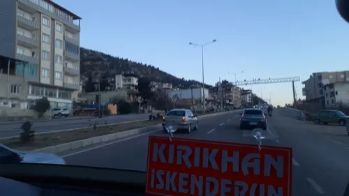



Tarihi Han Ciğercisi
Restaurant · Turkish · 5.5 km
250/3 Uğur Mumcu Caddesi, Hatay
24/7
Artukbey Kahve Karaağaç
Cafe · Coffee Shop · 3.2 km
38 10 Nisan, Hatay

25 more on the map.
Where to stay4
Churches and places of worship83
Katolik Kilisesi
Church · Catholic · 0.6 km
7 Mithatpaşa Caddesi, Hatay
Hacı Ahmet Karatoyuk Camii
Place of worship · Sunni · 1.7 km
İbrahim Karaoğlanoğlu Caddesi, Pınarbaşı Mah.
Bekbele Mahallesi Merkez Camii
Place of worship · 5.9 km
Mimar Sinan Caddesi, Hatay
Shopping37
Gas and EV charging11
Schools, colleges and libraries51
Healthcare165
Özel iskenderun diyaliz merkezi
Clinic and pharmacy · 2.6 km
no 100 İbrahim Karaoğlanoğlu Caddesi
Map of İskenderun
250 places. The map loads OpenStreetMap tiles when you open it.
Getting there and nearby towns
Hatay Airport (HTY) is the nearest airport with scheduled flights listed in OpenStreetMap, 27 km away.
- Denizciler 7 km northeast, about 7 min by car
- Çırtıman 7 km south, about 7 min by car
- Sarıseki 10 km north, about 10 min by car
- Atik 10 km southeast, about 10 min by car
- Belen 11 km south, about 11 min by car
- Karayılan 14 km north, about 14 min by car
- Kırıkhan 19 km southeast, about 19 min by car
- Serinyol 25 km south, about 25 min by car
- Samandağ 59 km south, about 59 min by car
- Adana 88 km northwest, about 1 h 30 min by car
Drive times are estimates from straight-line distance, not routes.
Local news
Headlines from INDB.
Reviews, tips and questions
Loading what members have shared...
Sources and licences
- GeoNames (CC BY 4.0): population, coordinates, regions and time zone
- Mapillary (see each image): photos
- OpenStreetMap contributors (ODbL 1.0): places, airports, map data
- Wikidata (CC0 1.0): elevation, founding date, time zone, website, landmarks and historic places
- Wikimedia Commons (see each image): photos
- Wikipedia (CC BY-SA 4.0): overview and history text
Photo credits
- City View of Iskenderun Turkey - panoramio, Chanilim714, CC BY-SA 3.0
- Iskenderun Roman Catholic church 6687, Dosseman, CC BY-SA 4.0
- İstiklal Makzume Anadolu Lisesi, Gorkem80, CC BY-SA 4.0
- Street-level photo, hderinoz, CC BY-SA 4.0
- Street-level photo, ahmettsafaa, CC BY-SA 4.0
- Street-level photo, kunduzh, CC BY-SA 4.0
- Street-level photo, hderinoz, CC BY-SA 4.0
- Street-level photo, ahmettsafaa, CC BY-SA 4.0
- Street-level photo, ahmettsafaa, CC BY-SA 4.0
- Street-level photo, burcudemir, CC BY-SA 4.0
Page built November 8, 2026. Spotted a mistake? Tell us or suggest a place.