
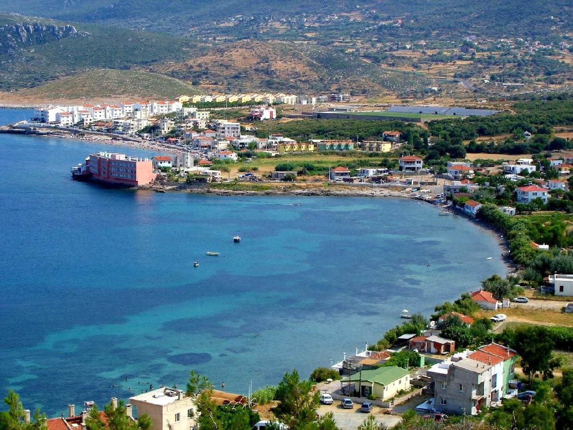


Karaburun, Turkey
Karaburun (ilçe merkezi)
Karaburun is a town of 3,312 people in İzmir Province, Turkey.
Why visit Karaburun
Townapedia lists 4 museums and landmarks, 4 parks and trails, 10 places to eat, 10 places to stay and 6 attractions in and around town.
Highlights include Cybeleia and Helos.
Weather in Karaburun
Forecast from MET Norway (CC BY 4.0). Full forecast
About Karaburun
Karaburun is a municipality and district of İzmir Province, in western Turkey. Its area is 421 km2, and its population is 12,200 (2022). The district area roughly corresponds to the peninsula of the same name (Karaburun Peninsula) which spears north of the tourism resorts of neighboring Çeşme and its dependencies and west of the city of İzmir. In fact, the district area is one of the westernmost points of Anatolia.
From the Wikipedia article Karaburun (this version), under CC BY-SA 4.0.
Things to do6


Museums and landmarks4

Cybeleia
Monument and historic site · 13.6 km
Ancient city of Ionia, in modern-day Turkey
Helos
Monument and historic site · 14.7 km
Ancient city of Ionia, in modern-day Turkey
Siduse
Monument and historic site · 2.6 km
Greek colony in ancient Ionia
Parks, trails and playgrounds4

Restaurants and cafes10

Yalı Restoran
Restaurant · Meze, Fish, Kalamar, Karides, Ara Sıcak · 1.2 km
2100. Sokak, izmir
09:00-23:00

Zeytin Cafe
Restaurant · 1.3 km
13 İskele mh Fehim Aytekin Cd, Karaburun / İzmir

History
The oldest name known for the region was Mimas, in reference to the son of Gaia who was one of the Giants slain by Hephaistos during the war between Gods and Giants in Greek mythology. Homer mentions the "windy Mimas" mountain (present-day Bozdağ) in his Odyssey. The Mimas mountain is also associated with Iris, Leto and Narcissus. In Ionian through to Byzantine times, the region also carried the names Stelar or Stylarius, Caleberno by the Genoese and Ahırlı during the Ottoman era. There are different possibilities for the name Karaburun. One that is mentioned in the municipality web site is that it would be a modified form of Caleberno. Another possibility may have to do with the very translation of the Turkish name, which means "black cape", a fitting description especially for sailors who approach Karaburun Peninsula from open sea.
The region is rich in history although its only sizeable urban center from ancient Greek, Byzantine through to Ottoman times was in Erythrai. Today the village of Ildırı stands in the ancient town's location and the village is in Çeşme. Traces of smaller settlements can also be traced back to the Bronze Age.
Karaburun is the most recently constituted district of İzmir, although the town of Karaburun was made into a municipality already in 1902. From 1867 until 1922, Karaburun was part of Aidin Vilayet.
From the History section of Karaburun on Wikipedia, under CC BY-SA 4.0.
Where to stay10
North Wind Hotels Karaburun
Motel and hotel · Regional, Coffee Shop, Sandwich, Chicken · 14.4 km
No:1 Palmiye Sokağı, İzmir
Churches and places of worship5
Shopping1
Gas and EV charging1
Schools, colleges and libraries2
Healthcare2
Map of Karaburun
45 places. The map loads OpenStreetMap tiles when you open it.
Getting there and nearby towns
Çiğli 2. Ana Jet Üssü (IGL) is the nearest airport with scheduled flights listed in OpenStreetMap, 46 km away.
- Mordoğan 17 km southeast, about 17 min by car
- Foça 22 km east, about 22 min by car
- Çeşme 39 km southwest, about 39 min by car
- Urla 41 km southeast, about 41 min by car
- Aliağa 44 km northeast, about 44 min by car
- Menemen 49 km east, about 49 min by car
- Karşıyaka 56 km east, about 56 min by car
- Konak 58 km southeast, about 58 min by car
- İzmir 60 km southeast, about 1 h by car
- Karabağlar 61 km southeast, about 1 h by car
Drive times are estimates from straight-line distance, not routes.
Local news
Headlines from INDB.
Reviews, tips and questions
Loading what members have shared...
Sources and licences
- GeoNames (CC BY 4.0): population, coordinates, regions and time zone
- OpenStreetMap contributors (ODbL 1.0): places, airports, map data
- Wikidata (CC0 1.0): elevation, founding date, time zone, website, landmarks and historic places
- Wikimedia Commons (see each image): photos
- Wikipedia (CC BY-SA 4.0): overview and history text
Photo credits
- Faik Sarikaya Karaburun Bodrum Koyu, Faik Sarıkaya, Attribution
- Karaburun, İzmir, Turkey - panoramio (1), Bir_Ege_Hikayesi ©, CC BY 3.0
- Karaburun, İzmir, Turkey - panoramio (2), Bir_Ege_Hikayesi ©, CC BY 3.0
- Karaburun, İzmir, Turkey - panoramio, Bir_Ege_Hikayesi ©, CC BY 3.0
- İskele, 35960 Karaburun-İzmir, Turkey - panoramio, Bir_Ege_Hikayesi ©, CC BY 3.0
- Karaburun, İzmir, Turkey - panoramio (9), Bir_Ege_Hikayesi ©, CC BY 3.0
- Karaburun, İzmir, Turkey - panoramio (7), Bir_Ege_Hikayesi ©, CC BY 3.0
- Karaburun, İzmir, Turkey - panoramio (8), Bir_Ege_Hikayesi ©, CC BY 3.0
- Karaburun, İzmir, Turkey - panoramio (5), Bir_Ege_Hikayesi ©, CC BY 3.0
- Karaburun, İzmir, Turkey - panoramio (4), Bir_Ege_Hikayesi ©, CC BY 3.0
- Karaburun, İzmir, Turkey - panoramio (11), Bir_Ege_Hikayesi ©, CC BY 3.0
- Karaburun, İzmir, Turkey - panoramio (3), Bir_Ege_Hikayesi ©, CC BY 3.0
- Karaburun, İzmir, Turkey - panoramio (6), Bir_Ege_Hikayesi ©, CC BY 3.0
- Karaburun, İzmir, Turkey - panoramio (10), Bir_Ege_Hikayesi ©, CC BY 3.0
- 35960 Saip-Karaburun-İzmir, Turkey - panoramio (1), Bir_Ege_Hikayesi ©, CC BY 3.0
- Karaburun, İzmir, Turkey - panoramio (12), Bir_Ege_Hikayesi ©, CC BY 3.0
- Merkez, 35970 Karaburun-İzmir, Turkey - panoramio, Bir_Ege_Hikayesi ©, CC BY 3.0
- 35960 Saip-Karaburun-İzmir, Turkey - panoramio (2), Bir_Ege_Hikayesi ©, CC BY 3.0
- 35960 Saip-Karaburun-İzmir, Turkey - panoramio, Bir_Ege_Hikayesi ©, CC BY 3.0
- 35960 Ambarseki-Karaburun-İzmir, Turkey - panoramio (2), Bir_Ege_Hikayesi ©, CC BY 3.0
- Merkez, 35970 Karaburun-İzmir, Turkey - panoramio (1), Bir_Ege_Hikayesi ©, CC BY 3.0
- 35960 Ambarseki-Karaburun-İzmir, Turkey - panoramio (1), Bir_Ege_Hikayesi ©, CC BY 3.0
- 35960 Ambarseki-Karaburun-İzmir, Turkey - panoramio (4), Bir_Ege_Hikayesi ©, CC BY 3.0
- Karaburun Bay, Jackmaldow, CC BY-SA 4.0
- 35960 Ambarseki-Karaburun-İzmir, Turkey - panoramio (5), Bir_Ege_Hikayesi ©, CC BY 3.0
- 35960 Ambarseki-Karaburun-İzmir, Turkey - panoramio (3), Bir_Ege_Hikayesi ©, CC BY 3.0
- 35960 Bozköy-Karaburun-İzmir, Turkey - panoramio (1), Bir_Ege_Hikayesi ©, CC BY 3.0
- 35960 Bozköy-Karaburun-İzmir, Turkey - panoramio, Bir_Ege_Hikayesi ©, CC BY 3.0
- 35960 Ambarseki-Karaburun-İzmir, Turkey - panoramio, Bir_Ege_Hikayesi ©, CC BY 3.0
- 35960 Bozköy-Karaburun-İzmir, Turkey - panoramio (2), Bir_Ege_Hikayesi ©, CC BY 3.0
- 35960 Tepeboz-Karaburun-İzmir, Turkey - panoramio, Bir_Ege_Hikayesi ©, CC BY 3.0
- 35960 Tepeboz-Karaburun-İzmir, Turkey - panoramio (2), Bir_Ege_Hikayesi ©, CC BY 3.0
- 35960 Tepeboz-Karaburun-İzmir, Turkey - panoramio (1), Bir_Ege_Hikayesi ©, CC BY 3.0
- 35960 Hasseki-Karaburun-İzmir, Turkey - panoramio (11), Bir_Ege_Hikayesi ©, CC BY 3.0
- 35960 Hasseki-Karaburun-İzmir, Turkey - panoramio (1), Bir_Ege_Hikayesi ©, CC BY 3.0
- 35960 Hasseki-Karaburun-İzmir, Turkey - panoramio (3), Bir_Ege_Hikayesi ©, CC BY 3.0
- 35960 Hasseki-Karaburun-İzmir, Turkey - panoramio, Bir_Ege_Hikayesi ©, CC BY 3.0
- 35960 Hasseki-Karaburun-İzmir, Turkey - panoramio (5), Bir_Ege_Hikayesi ©, CC BY 3.0
- 35960 Hasseki-Karaburun-İzmir, Turkey - panoramio (4), Bir_Ege_Hikayesi ©, CC BY 3.0
- Eudolus quadriguttatus (Herbst, 1783) Syn.- Aphodius (Phalocronotus) quadriguttatus Herbst, 1783 (37221701495), Udo Schmidt from Deutschland, CC BY-SA 2.0


Page built November 8, 2026. Spotted a mistake? Tell us or suggest a place.