


Why visit Menemen
Townapedia lists 25 museums and landmarks, 33 parks and trails, 154 places to eat, 3 places to stay and 6 attractions in and around town.
Highlights include Menemen Gediz Bridge, İzmir Opera House, Atatürk, His Mother and Women's Rights Monument and Bostanlı Open-air Archaeological Museum.
Weather in Menemen
Forecast from MET Norway (CC BY 4.0). Full forecast
About Menemen
Menemen (Turkish: [meˈnemæn]) is a municipality and district of İzmir Province, Turkey. Its area is 573 km2, and its population is 200,904 (2022). The district extends on a fertile plain formed by the alluvial soil carried by the Gediz River. Adjacent districts are, from east to west; Aliağa and Foça to the north and Bornova, Karşıyaka and Çiğli to the south.
From the Wikipedia article Menemen (this version), under CC BY-SA 4.0.
Things to do6




Pika peak viewpoint
Scenic view · 11.9 km
360 degrees view from the top of Pika cliff
Museums and landmarks25

Atatürk, His Mother and Women's Rights Monument
Monument and historic site · 17.6 km
Monument in İzmir, western Turkey

Bostanlı Open-air Archaeological Museum
Museum · 17.1 km
Museum in Karşıyaka District
Heraclea (Lydia)
Monument and historic site · 7.8 km
Ancient city of Lydia in modern-day Turkey

Larissa
Monument and historic site · 7.4 km
Ancient city of Aeolis in modern-day Turkey
Melampagos
Monument and historic site · 9.2 km
Ancient city of Aeolis in modern-day Turkey
Mormonda
Monument and historic site · 14.4 km
Ancient city of Ionia, in modern-day Turkey

Neonteichos
Monument and historic site · 6.1 km
Ancient city of Aeolis in modern-day Turkey
Sillyos
Monument and historic site · 11.8 km
Ancient city of Ionia, in modern-day Turkey
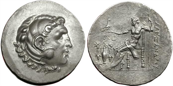
Temnos
Monument and historic site · 13.2 km
Greek polis in Ancient Aeolis
13 more on the map.
Parks, trails and playgrounds33

İzmir Wildlife Park
Park · 15.9 km
Zoological garden in İzmir, western Turkey

21 more on the map.
Restaurants and cafes154
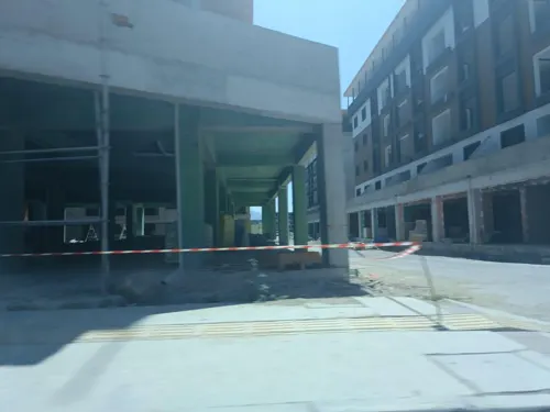
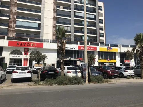

Gül Kardeşler Pide Kebap Çorba
Restaurant · Turkish, Soup, Pide, Kebab · 10.9 km
8788/1. Sokak, İzmir
10:00-00.00

Loose
Cafe · Coffee Shop, Sandwich · 10.9 km
8788/1. Sokak, İzmir
24/7
Cafe Di Smirne
Cafe · Pizza, Coffee Shop, Burger · 9.3 km
Kaynaklar Caddesi
Mo-Su 10:00-02:00


142 more on the map.
History
A late Bronze Age settlement in Panaztepe with a number of tholos tombs indicates an apparent Mycenaean influence. The first nucleus of Menemen was formed on the left bank of the River Gediz in the immediate vicinity of today's Yahşelli village. This settlement dates back to 1000 B.C. and is on the natural fluvial frontier between Ionia and Aeolia of antiquity. It is believed that the settlement was moved from its former place to today's Asarlık village between 263 and 241 B.C. and later to its actual place during the Turkish principalities era in Anatolia (13th-14th centuries).
The city was founded by Greek settlers and the region was first under Greek political influence and later came under the rule of Phrygian Kingdom. The region was taken over by the Lydians and their rule lasted between 676 and 546 B.C. until the commencement of the Persian rule in the western Anatolia after the defeat suffered by the Lydians in the face of the famous Persian King Cyrus.
As the Persian Empire collapsed after a series of definitive defeats against the Macedonians, the region became a part of Alexander's Empire. After Alexander's death in 323 B.C. Menemen and its environs had been ruled by the Pergamon Kingdom.
From the History section of Menemen on Wikipedia, under CC BY-SA 4.0.
Where to stay3
Churches and places of worship50
Shopping92
Gas and EV charging22
Schools, colleges and libraries78
Özel İzmir Atatürk Organize Sanayi Bölgesi Nedim Uysal Mesleki ve Teknik Anadolu Lisesi
School · 11.5 km
13 10038. Sokak
Healthcare104
Bakırçay Üniversitesi Çiğli Bölge Eğitim ve Araştırma Hastanesi
Hospital · 12.1 km
15 Nolu Katip Çelebi Üniversitesi Balatçık Kampüsü Eğitim Aile Sağlığı Merkezi
Clinic and pharmacy · 10.9 km
Map of Menemen
250 places. The map loads OpenStreetMap tiles when you open it.
Getting there and nearby towns
Çiğli 2. Ana Jet Üssü (IGL) is the nearest airport with scheduled flights listed in OpenStreetMap, 11 km away.
- Karşıyaka 17 km south, about 17 min by car
- Bornova 21 km southeast, about 21 min by car
- İzmir 22 km south, about 22 min by car
- Konak 23 km south, about 23 min by car
- Karabağlar 26 km south, about 26 min by car
- Manisa 31 km east, about 31 min by car
- Urla 41 km southwest, about 41 min by car
- Seferihisar 50 km southwest, about 50 min by car
- Torbalı 53 km southeast, about 53 min by car
- Turgutlu 56 km east, about 56 min by car
Drive times are estimates from straight-line distance, not routes.
Local news
Headlines from INDB.
Reviews, tips and questions
Loading what members have shared...
Sources and licences
- GeoNames (CC BY 4.0): population, coordinates, regions and time zone
- Mapillary (see each image): photos
- OpenStreetMap contributors (ODbL 1.0): places, airports, map data
- Wikidata (CC0 1.0): elevation, founding date, time zone, website, landmarks and historic places
- Wikimedia Commons (see each image): photos
- Wikipedia (CC BY-SA 4.0): overview and history text
Photo credits
- Menemen, İzmir, Turkey, Ahmet Gürsakal, CC BY-SA 3.0
- Izmir Atatürk Cd. Menemen Belediyesi Şehir Parkı in Menemen 6398, Dosseman, CC BY-SA 4.0
- Izmir Atatürk Cd. Menemen Belediyesi Şehir Parkı in Menemen 6399, Dosseman, CC BY-SA 4.0
- Izmir Atatürk Cd. Yeni Camii in Menemen 6397, Dosseman, CC BY-SA 4.0
- Izmir Atatürk Cd. Yeni Camii in Menemen 6396, Dosseman, CC BY-SA 4.0
- Izmir Atatürk Cd. in Menemen 6394, Dosseman, CC BY-SA 4.0
- Menemen su testileri (22481046067), Luigi Guarino from Bonn, Germany, CC BY 2.0
- Menemen İstasyonu, Alikam1896, CC BY-SA 4.0
- Otoyol 33 in Belen, Menemen, BSRF, CC BY-SA 4.0
- Bridge crossing Otoyol 33 in Yanıkköy, Menemen 01, BSRF, CC BY-SA 4.0
- Bridge crossing Otoyol 33 in Yanıkköy, Menemen 02, BSRF, CC BY-SA 4.0
- Menemen Gediz Bridge, B'Tian P. Dorsam, CC BY-SA 4.0
- Rosa Faruggıa Heykeli, Ozlmktv, CC BY-SA 4.0
- İzmir Natural Life Park p1, VikiPicture, CC BY-SA 3.0
- İzmir Bakırçay University 02, BSRF, CC BY-SA 4.0
- Neonteikhos Antik Kenti, Ferit BAYCUMAN, CC BY-SA 4.0
- View GulfofIzmir from MountYamanlar, Mr. Vehbi Moğol, CC BY-SA 3.0
- Alexander the great temnos tetradrachm, Ancientcointraders, CC BY-SA 4.0
- Izmir atatürk eğitim ve araştırma hastanesi - panoramio, ümit tomar, CC BY 3.0
- MountYamanlar IzmirTurkey EUnluBlogspot, Mr. E. Unlu, CC BY 3.0
- İzmir Katip Çelebi Üniversitesi Giriş ve Çıkış Kapısı, Samizambak, CC BY-SA 4.0
- Larissa 2026-10-11 12.44.36 1793784615, Ferit BAYCUMAN, CC BY-SA 4.0
- Volkan Sevin Sigorta - panoramio, Gunesnet, CC BY 3.0
- Kubilay Statue, December 2021, BSRF, CC BY-SA 4.0
- ISS065-E-59869 - View of Earth, Earth Science and Remote Sensing Unit , Lyndon B. Johnson Space Center, Public domain
- ISS007-E-12983 - View of Turkey, Earth Science and Remote Sensing Unit , Lyndon B. Johnson Space Center, Public domain
- ISS067-E-204065 - View of Earth, Earth Science and Remote Sensing Unit , Lyndon B. Johnson Space Center, Public domain
- Tomar Farm - panoramio, ümit tomar, CC BY 3.0
- Tomar çiftliğinden Ege ÜN.Araş.çiftligine doğru - panoramio, ümit tomar, CC BY 3.0
- Tomar Çiftliği - panoramio, ümit tomar, CC BY 3.0
- Tomar çiftliginden kent 2 - panoramio, ümit tomar, CC BY 3.0
- Egekent 2 railway station 01, BSRF, CC BY-SA 4.0
- Egekent 2 railway station 02, BSRF, CC BY-SA 4.0
- ISS065-E-59868 - View of Earth, Earth Science and Remote Sensing Unit , Lyndon B. Johnson Space Center, Public domain
- Bizim arsız - panoramio, alikizgingunes, CC BY 3.0
- Buruncuk Toll Plaza 01, BSRF, CC BY-SA 4.0
- Buruncuk Toll Plaza 02, BSRF, CC BY-SA 4.0
- Ulukent railway station 03, BSRF, CC BY-SA 4.0
- Ulukent railway station 02, BSRF, CC BY-SA 4.0
- Ulukent railway station 01, BSRF, CC BY-SA 4.0
- Street-level photo, ktahyam-Mapping, CC BY-SA 4.0
- Street-level photo, yaserbaranaycin, CC BY-SA 4.0
- Street-level photo, Hpelin, CC BY-SA 4.0
- Street-level photo, unen, CC BY-SA 4.0
- Street-level photo, hilalla, CC BY-SA 4.0
- Street-level photo, unen, CC BY-SA 4.0
- Street-level photo, ktahyam-Mapping, CC BY-SA 4.0
- Street-level photo, ktahyam-Mapping, CC BY-SA 4.0
- Street-level photo, boracasli, CC BY-SA 4.0
- Street-level photo, hilalla, CC BY-SA 4.0
- Street-level photo, ktahyam-Mapping, CC BY-SA 4.0
- Street-level photo, ktahyam-Mapping, CC BY-SA 4.0
- Street-level photo, ktahyam-Mapping, CC BY-SA 4.0
- Street-level photo, hilalla, CC BY-SA 4.0


Page built November 8, 2026. Spotted a mistake? Tell us or suggest a place.