
Why visit Karayılan
Townapedia lists 1 museum or landmark, 1 park or trail and 1 place to stay in and around town.
Weather in Karayılan
Forecast from MET Norway (CC BY 4.0). Full forecast
About Karayılan
Karayılan (literally "black snake") is a neighbourhood of the municipality and district of İskenderun, Hatay Province, Turkey. Its population is 9,074 (2022). Before the 2013 reorganisation, it was a town (belde).
From the Wikipedia article Karayılan, Hatay (this version), under CC BY-SA 4.0.
Museums and landmarks1

Parks, trails and playgrounds1

Where to stay1

Churches and places of worship5

History
The name of the town refers to a 17th-century Turkmen family. In 1691 the Ottoman government tried to settle the nomads. The nomads struggled to continue their traditional lifestyle. Although the government punished them by exiling to Rakka Eyalet (now in Syria) they were able to return. But at the end of continuous struggles, towards the end of the 18th century, three families gave up and agreed to settle where they were assigned to. It was designated as a town on November 29, 1989. In 1990, Karayılan was declared a seat of township.
From the History section of Karayılan, Hatay on Wikipedia, under CC BY-SA 4.0.
Schools, colleges and libraries1
Healthcare2
Map of Karayılan
11 places. The map loads OpenStreetMap tiles when you open it.
Getting there and nearby towns
Hatay Airport (HTY) is the nearest airport with scheduled flights listed in OpenStreetMap, 40 km away.
- İskenderun 14 km south, about 14 min by car
- Dörtyol 14 km north, about 14 min by car
- Belen 25 km south, about 25 min by car
- Kırıkhan 27 km southeast, about 27 min by car
- Yumurtalık 38 km west, about 38 min by car
- Osmaniye 41 km north, about 41 min by car
- Ceyhan 49 km northwest, about 49 min by car
- Antakya 56 km south, about 56 min by car
- Hıdırbey 56 km south, about 56 min by car
- Samandağ 73 km south, about 1 h 15 min by car
Drive times are estimates from straight-line distance, not routes.
Local news
Headlines from INDB.
Reviews, tips and questions
Loading what members have shared...
Sources and licences
- GeoNames (CC BY 4.0): population, coordinates, regions and time zone
- Mapillary (see each image): photos
- OpenStreetMap contributors (ODbL 1.0): places, airports, map data
- Wikidata (CC0 1.0): elevation, founding date, time zone, website
- Wikipedia (CC BY-SA 4.0): overview and history text
Photo credits
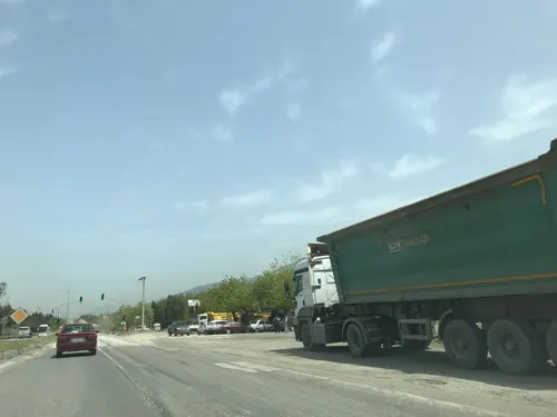
- Street-level photo, hderinoz, CC BY-SA 4.0
Page built November 8, 2026. Spotted a mistake? Tell us or suggest a place.