


Why visit Kemalpaşa
Townapedia lists 8 places to eat and 2 places to stay in and around town.
Weather in Kemalpaşa
Forecast from MET Norway (CC BY 4.0). Full forecast
About Kemalpaşa
Kemalpaşa, also known originally as Noghedi or Makriyali, is a town on the Black Sea coast in Artvin Province, Turkey. It is the seat of Kemalpaşa District. Its population is 5,715 (2021). It is 15 kilometres (9.3 mi) east of Hopa and 5 kilometres (3.1 mi) west of the Sarp border check point to Georgia.
From the Wikipedia article Kemalpaşa, Artvin (this version), under CC BY-SA 4.0.
Restaurants and cafes8



Where to stay2
Churches and places of worship4

Makriali Church
Church · 0.6 km
Former orthodox church in Kemalpaşa, Artvin Province, Turkey

Shopping7


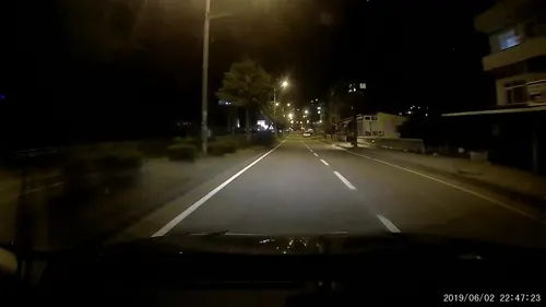


Gas and EV charging1
Healthcare5
Map of Kemalpaşa
27 places. The map loads OpenStreetMap tiles when you open it.
Getting there and nearby towns
Rize-Artvin Airport (RZV) is the nearest airport with scheduled flights listed in OpenStreetMap, 66 km away.
- Koprucu 3 km southeast, about 3 min by car
- Hopa 14 km southwest, about 14 min by car
- Düzköy 14 km southeast, about 14 min by car
- Demirciler 15 km southeast, about 15 min by car
- Borçka 18 km southeast, about 18 min by car
- Arhavi 24 km southwest, about 24 min by car
- Artvin 42 km southeast, about 42 min by car
- Seyitler 41 km southeast, about 41 min by car
- Ardeşen 56 km southwest, about 56 min by car
- Şavşat 74 km east, about 1 h 15 min by car
Drive times are estimates from straight-line distance, not routes.
Local news
Headlines from INDB.
Reviews, tips and questions
Loading what members have shared...
Sources and licences
- GeoNames (CC BY 4.0): population, coordinates, regions and time zone
- Mapillary (see each image): photos
- OpenStreetMap contributors (ODbL 1.0): places, airports, map data
- Wikidata (CC0 1.0): elevation, founding date, time zone, website, landmarks and historic places
- Wikimedia Commons (see each image): photos
- Wikipedia (CC BY-SA 4.0): overview and history text
Photo credits
- Kemalpasa, Jaba1977, Attribution
- Kemalpaşa artvin 8 2011, Özgür Esen ( Surdurulebiliryasam ), CC BY-SA 4.0
- Kemalpaşa artvin 13 2011, Özgür Esen ( Surdurulebiliryasam ), CC BY-SA 4.0
- Kemalpaşa artvin 2 2011, Özgür Esen ( Surdurulebiliryasam ), CC BY-SA 4.0
- Kemalpaşa artvin 16 2011, Özgür Esen ( Surdurulebiliryasam ), CC BY-SA 4.0
- Kemalpaşa artvin 11 2011, Özgür Esen ( Surdurulebiliryasam ), CC BY-SA 4.0
- Kemalpaşa artvin 12 2011, Özgür Esen ( Surdurulebiliryasam ), CC BY-SA 4.0
- Kemalpaşa artvin 6 2011, Özgür Esen ( Surdurulebiliryasam ), CC BY-SA 4.0
- Kemalpaşa artvin 9 2011, Özgür Esen ( Surdurulebiliryasam ), CC BY-SA 4.0
- Kemalpaşa artvin 15 2011, Özgür Esen ( Surdurulebiliryasam ), CC BY-SA 4.0
- Kemalpaşa artvin 10 2011, Özgür Esen ( Surdurulebiliryasam ), CC BY-SA 4.0
- Kemalpaşa artvin 4 2011, Özgür Esen ( Surdurulebiliryasam ), CC BY-SA 4.0
- Kemalpaşa artvin 1 2011, Özgür Esen ( Surdurulebiliryasam ), CC BY-SA 4.0
- Kemalpaşa artvin 14 2011, Özgür Esen ( Surdurulebiliryasam ), CC BY-SA 4.0
- Kemalpaşa artvin 5 2011, Özgür Esen ( Surdurulebiliryasam ), CC BY-SA 4.0
- Kemalpaşa artvin 3 2011, Özgür Esen ( Surdurulebiliryasam ), CC BY-SA 4.0
- Kemalpaşa artvin 7 2011, Özgür Esen ( Surdurulebiliryasam ), CC BY-SA 4.0
- KEMALPAŞA-HOPA 2010 - panoramio, nurettingülay(from T…, CC BY-SA 3.0
- Kemalpaşa fountain, Robot8A, CC BY-SA 4.0
- Kemalpaşa Sahil - panoramio, Gürsoy Tokgöz, CC BY 3.0
- Kemalpaşa, Artvin, Kolhisli, CC BY 4.0
- Makriali St. George Georgian Church, Hopa dist., Lazistan - მაკრიალის წმ. გიორგი, ოხვამე, Abkhazian1, CC BY-SA 4.0
- Artvin’de restorant, Kayra, CC BY 4.0
- Sunset in Artvin, Kurmanbek, CC BY-SA 4.0
- SARP-HOPA 2010 - panoramio (2), nurettingülay(from T…, CC BY-SA 3.0
- Street-level photo, healixx, CC BY-SA 4.0
- Street-level photo, healixx, CC BY-SA 4.0
- Street-level photo, healixx, CC BY-SA 4.0
- Street-level photo, healixx, CC BY-SA 4.0
- Street-level photo, healixx, CC BY-SA 4.0
- Street-level photo, shoorick, CC BY-SA 4.0
- Street-level photo, shoorick, CC BY-SA 4.0
- Street-level photo, shoorick, CC BY-SA 4.0
- Street-level photo, shoorick, CC BY-SA 4.0
- Street-level photo, healixx, CC BY-SA 4.0


Page built November 8, 2026. Spotted a mistake? Tell us or suggest a place.