


Why visit Lapseki
Townapedia lists 21 museums and landmarks, 11 parks and trails, 13 places to eat, 13 places to stay and 18 attractions in and around town.
Highlights include 1915 Çanakkale Bridge, Gelibolu Feneri, Abarnias and Aegospotami.
Weather in Lapseki
Forecast from MET Norway (CC BY 4.0). Full forecast
About Lapseki
Lapseki (from Greek: Λάμψακος, Lampsakos) is a town in Çanakkale Province, Turkey. It is the seat of Lapseki District. Its population is 14,984 (2021). The mayor is Atilla Öztürk (iYi).
From the Wikipedia article Lapseki (this version), under CC BY-SA 4.0.
Things to do18

1915 Çanakkale Bridge
Bridge · 4.2 km
Road suspension bridge in Turkey



6 more on the map.
Museums and landmarks21

Abarnias
Monument and historic site · 5.6 km
Ancient city of Troas in modern-day Turkey

Ide
Monument and historic site · 17.8 km
Ancient city of Thrace in modern-day Turkey
Kressa
Monument and historic site · 5.1 km
Ancient city of Thrace in modern-day Turkey
Krithotai
Monument and historic site · 7.5 km
Ancient city of Thrace in modern-day Turkey

Lampsacus
Monument and historic site
Ancient city of Troas in modern-day Turkey
Pactya
Monument and historic site · 17.6 km
City located in ancient Thrace
Paesus
Monument and historic site · 10.6 km
Ancient city of Troas, in modern-day Turkey
Percote
Monument and historic site · 11.3 km
Ancient city of Troas in modern-day Turkey

9 more on the map.
Parks, trails and playgrounds11





Restaurants and cafes13

Valide Sultan 2
Restaurant · Turkish · 7.0 km
2/B Zübeyde Hanım Caddesi, Çanakkale
06:00-00:00

Kahve Dünyası
Cafe · Coffee Shop, Sandwich, Ice Cream, Cake, Pasta · 9.0 km
Mo-Su 10:00-20:00
Valide Sultan
Restaurant · Turkish · 7.0 km
16 Atatürk Caddesi, Çanakkale


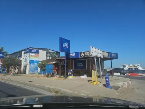
Burger King
Fast food · Burger · 8.4 km
Malkara - Çanakkale Otoyolu, Çanakkale
10:00-22:00


1 more on the map.
History
The town was founded by Greek colonists from Phocaea in the 6th century BC, one of 4 settlements along the Dardanelles at that time. Soon afterwards it became a competitor of Miletus, controlling the trade routes in the Dardanelles. The modern Turkish name derives from the original Greek name.
Ancient Greek legend says that while the city was under the rule of King Mandron and named Pityussa, the king, who defended the colonists from Phocaea from the attacks of the local people, minted coins for the first time in its history in the name of his daughter Lampsace and later the city was given this name by the colonists to express their indebtedness to him. In this way, the name Lampsakos, then Lapseki, was passed down to the present day.
The city was under the Byzantines for a long period before being passed into Ottoman hands after its conquest by Süleyman Pasha in 1356. Occupied at the end of World War I, the town was freed from the British and French forces on 25 September 1922, toward the end of the War of Independence. In the district are the graves of 15,000 soldiers who
The city was the port Yirmisekiz Mehmed Çelebi took off from in his embassy mission to France.
From the History section of Lapseki on Wikipedia, under CC BY-SA 4.0.
Where to stay13
Churches and places of worship15
Shopping14
Gas and EV charging14
Schools, colleges and libraries19
Healthcare27
Map of Lapseki
165 places. The map loads OpenStreetMap tiles when you open it.
Getting there and nearby towns
Çanakkale Airport (CKZ) is the nearest airport with scheduled flights listed in OpenStreetMap, 32 km away.
- Gelibolu 7 km north, about 7 min by car
- Bolayır 20 km north, about 20 min by car
- Işıklar 27 km southwest, about 27 min by car
- Karacaören 28 km southwest, about 28 min by car
- Çanakkale 31 km southwest, about 31 min by car
- Eceabat 33 km southwest, about 33 min by car
- Ezine 69 km southwest, about 1 h 15 min by car
- Altınoluk 85 km south, about 1 h 30 min by car
- Gönen 86 km east, about 1 h 30 min by car
- Edremit 88 km south, about 1 h 30 min by car
Drive times are estimates from straight-line distance, not routes.
Local news
Headlines from INDB.
Reviews, tips and questions
Loading what members have shared...
Sources and licences
- GeoNames (CC BY 4.0): population, coordinates, regions and time zone
- Mapillary (see each image): photos
- OpenStreetMap contributors (ODbL 1.0): places, airports, map data
- Wikidata (CC0 1.0): elevation, founding date, time zone, website, landmarks and historic places
- Wikimedia Commons (see each image): photos
- Wikipedia (CC BY-SA 4.0): overview and history text
Photo credits
- Lapseki havadan, ibrahim Kıroğlu, CC BY-SA 4.0
- Lapseki İskelesi, İbrahim Kıroğlu, CC BY-SA 4.0
- Lapseki Gelibolu Feribot - panoramio, Aziz Akbiyik, CC BY-SA 3.0
- Lapseki Gelibolu Feribot - panoramio (1), Aziz Akbiyik, CC BY-SA 3.0
- Lapseki iskele - panoramio, Aziz Akbiyik, CC BY-SA 3.0
- Lapseki iskele - panoramio (1), Aziz Akbiyik, CC BY-SA 3.0
- Lapseki ラープセキ - panoramio, ykeiko, CC BY-SA 3.0
- Lapseki - panoramio, Aziz Akbiyik, CC BY-SA 3.0
- Lapseki Kar, İbrahim Kıroğlu, CC BY-SA 4.0
- Gelibolu Lapseki Feribotu - panoramio (1), Aziz Akbiyik, CC BY-SA 3.0
- Gelibolu Lapseki Feribotu - panoramio (2), Aziz Akbiyik, CC BY-SA 3.0
- Dalyan Mahallesinden Lapseki, İbrahim Kıroğlu, CC BY-SA 4.0
- 1915 Çanakkale Bridge2, Glabb, CC BY-SA 3.0
- Gallipoli War Museum, Kızıldeniz, CC BY-SA 4.0
- Stater Zeus Lampsacus CdM, Unknown author, Public domain
- Fener gelibolu - panoramio, nevzat demir, CC BY-SA 3.0
- Gelibolu mevlevihanesi 03, Satirdan kahraman, CC BY-SA 4.0
- Gelibolu Hallâc-ı Mansûr Türbesi dışarıdan, YeditepePsychologyStudent, CC BY 4.0
- Gelibolu Mevlevihanesi önden görünümü, YeditepePsychologyStudent, CC BY 4.0
- 1915 Çanakkale Bridge at night view, Maurice Flesier, CC BY-SA 4.0
- Magic Black Sea, Nadezda, CC BY 4.0
- Çanakkale Köprüsü 01.11.2025, Kuzey ege Bayraktar, CC0
- Çanakkale köprüsü panoramio 29.08.2024, Kuzey ege Bayraktar, CC0
- 1915 Çanakkale Bridge at night, Maurice Flesier, CC BY-SA 4.0
- 1915 Çanakkale Bridge 20220327 (4), Zafer, CC BY-SA 4.0
- 1915 Çanakkale Bridge 20220327 (5), Zafer, CC BY-SA 4.0
- 1915 Çanakkale Bridge 20220327 (7), Zafer, CC BY-SA 4.0
- 1915 Çanakkale Bridge 20220327 (cropped), Zafer, Public domain
- 1915 Çanakkale Bridge 20220327 (2), Zafer, CC BY-SA 4.0
- 1915 Çanakkale Bridge 20220327 (6), Zafer, CC BY-SA 4.0
- 1915 Çanakkale Bridge 20220327, Zafer, Public domain
- 1915 Çanakkale Bridge 20220327 (1), Zafer, CC BY-SA 4.0
- 1915 Çanakkale Bridge 20220327 (3), Zafer, CC BY-SA 4.0
- Istanbul to Izmir FTT banner 1915 Canakkale Bridge, Zafer, Public domain
- 1915 Çanakkale Bridge 20220327 (8), Zafer, CC BY-SA 4.0
- 1915 Çanakkale Bridge 20220327 (9), Zafer, CC BY-SA 4.0
- 1915 Çanakkale Bridge 20220327 (11), Zafer, CC BY-SA 4.0
- 1915 Çanakkale Bridge 20220327 (12), Zafer, CC BY-SA 4.0
- 1915 Çanakkale Bridge 20220327 (14), Zafer, CC BY-SA 4.0
- 1915 Çanakkale Bridge 20220327 (13), Zafer, CC BY-SA 4.0
- Street-level photo, Zafer, CC BY-SA 4.0
- Street-level photo, doriel, CC BY-SA 4.0
- Street-level photo, Zafer, CC BY-SA 4.0
- Street-level photo, observer17, CC BY-SA 4.0
- Street-level photo, observer17, CC BY-SA 4.0
- Street-level photo, observer17, CC BY-SA 4.0


Page built November 8, 2026. Spotted a mistake? Tell us or suggest a place.