


Pozantı, Turkey
Pozantı is a town of 10,517 people in Adana, Turkey, founded in June 1, 1954.
Why visit Pozantı
Townapedia lists 5 museums and landmarks, 4 parks and trails, 10 places to eat, 7 places to stay and 4 attractions in and around town.
Highlights include Şekerpınarı Bridge, Akdağ, Padyandus and Anasha Castle.
Weather in Pozantı
Forecast from MET Norway (CC BY 4.0). Full forecast
About Pozantı
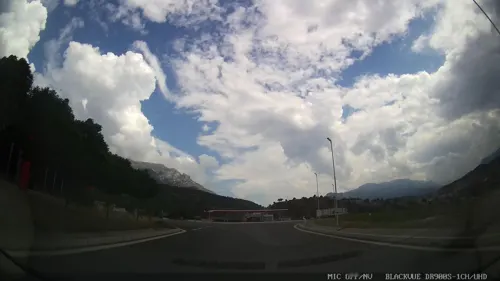
Pozantı (Greek: Πενδοσις, romanized: Pendhòsis, formerly Arabic: الْبَدَندُون, romanized: el-Bedendûn) is a municipality and district of Adana Province, Turkey. Its area is 899 km2, and its population is 19,852 (2022). The town is in the highlands of Çukurova, and is a major gateway to the Mediterranean coasts. Pozantı stands in the foothills, at the bottom of one of the few passes through the mountains.
From the Wikipedia article Pozantı (this version), under CC BY-SA 4.0.
Travel tips from other travellers: Pozantı on Wikivoyage (CC BY-SA 4.0).
Things to do4

Şekerpınarı Bridge
Bridge · 4.9 km
Bridge in Adana, southern Turkey
Akköprü, Adana

Museums and landmarks5

Padyandus
Monument and historic site
Ancient city of Cappadocia in modern-day Turkey
Parks, trails and playgrounds4


Mersin Tarsus Hopur Topaşır Yaban Hayatı Geliştirme Sahası
Hiking and trails · 14.3 km
Restaurants and cafes10

Belemedik Restaurant
Restaurant · Kebab · 10.0 km
Belemedil Tabiat Parkı, Adana
Akçatekir Yaşam Park Restaurant
Restaurant · Kebap, Pirzola, Kahvaltı, Çay, Kahve · 12.1 km



History
Pozantı has had a number of names. In antiquity it was Pendonsis or Pendosis, to the Arabs El Bedendum, and finally Bozantı and Pozantı in Turkish.
Standing at the entrance to a pass across the Taurus Mountains, Pendonsis was strategically important, as the gateway between the high plain of Anatolia and the low plain of Cilicia or Çukurova and the Middle East beyond. Pozantı has passed through the hands of Hittites, Persians, Alexander the Great, Rome and Byzantium. Muslim forces moved through the area in the period of the Abbasids, followed by the Turks after the Battle of Manzikert in 1071. During the Crusades, control of the pass was returned to the Byzantines, then the Armenian Kingdom of Cilicia and the Mamluks, before finally being brought under Ottoman control by Selim I in 1517.
Pozantı is windy and bleak, and for most of its history was a fort and a road-house, but more people began to live in the area permanently when a railway was built in 1917. However, passing trade on the road is still a major driver of the local economy.
Pozantı was briefly occupied by French forces at the end of World War I.
From the History section of Pozantı on Wikipedia, under CC BY-SA 4.0.
Where to stay7
Churches and places of worship26
Shopping2
Gas and EV charging6
Schools, colleges and libraries3
Healthcare7
Map of Pozantı
74 places. The map loads OpenStreetMap tiles when you open it.
Getting there and nearby towns
Adana Şakirpaşa Havalimanı (ADA) is the nearest airport with scheduled flights listed in OpenStreetMap, 61 km away.
- Gökbez 2 km northeast, about 2 min by car
- Akçatekir 8 km southwest, about 8 min by car
- Aşçıbekirli 24 km north, about 24 min by car
- İnköy 25 km southwest, about 25 min by car
- Karaisalı 25 km southeast, about 25 min by car
- Hasangazi 25 km northwest, about 25 min by car
- Tarsus 57 km south, about 57 min by car
- Adana 63 km southeast, about 1 h by car
- Mersin 72 km south, about 1 h 15 min by car
- Ereğli 73 km west, about 1 h 15 min by car
Drive times are estimates from straight-line distance, not routes.
Local news
Headlines from INDB.
Reviews, tips and questions
Loading what members have shared...
Sources and licences
- GeoNames (CC BY 4.0): population, coordinates, regions and time zone
- Mapillary (see each image): photos
- OpenStreetMap contributors (ODbL 1.0): places, airports, map data
- Wikidata (CC0 1.0): elevation, founding date, time zone, website, landmarks and historic places
- Wikimedia Commons (see each image): photos
- Wikipedia (CC BY-SA 4.0): overview and history text
Photo credits
- Pozantı01, Ingeborg Simon, CC BY-SA 3.0
- Pozantı Ak Köprü, old stone bridge restored in various periods, Cappadocia, Turkey (37552274866), Carole Raddato from FRANKFURT, Germany, CC BY-SA 2.0
- 2.Belemedik Nature Park, MehmetNasuh1949, CC BY-SA 4.0
- 6.Belemedik Nature Park, MehmetNasuh1949, CC BY-SA 4.0
- 5.Belemedik Nature Park, MehmetNasuh1949, CC BY-SA 4.0
- 4.Belemedik Nature Park, MehmetNasuh1949, CC BY-SA 4.0
- 3.Belemedik Nature Park, MehmetNasuh1949, CC BY-SA 4.0
- 7.Belemedik Nature Park, MehmetNasuh1949, CC BY-SA 4.0
- Crossover car in Belemedik 01, Zeynel Cebeci, CC BY-SA 4.0
- Crossover car in Belemedik 02, Zeynel Cebeci, CC BY-SA 4.0
- 8.Belemedik Nature Park, MehmetNasuh1949, CC BY-SA 4.0
- 10.Belemedik Nature Park, MehmetNasuh1949, CC BY-SA 4.0
- 9.Belemedik Nature Park, MehmetNasuh1949, CC BY-SA 4.0
- Airplane shot, Sara shae bl, CC BY-SA 4.0
- Rock formation, Belemedik 04, Zeynel Cebeci, CC BY-SA 4.0
- 21.Belemedik Nature Park, MehmetNasuh1949, CC BY-SA 4.0
- 22.Belemedik Nature Park, MehmetNasuh1949, CC BY-SA 4.0
- Kızılçam ağacı, Belemedik 04, Zeynel Cebeci, CC BY-SA 4.0
- Kızılçam ağacı, Belemedik 02, Zeynel Cebeci, CC BY-SA 4.0
- Çakıt River in Belemedik 04, Zeynel Cebeci, CC BY-SA 4.0
- Çakıt River in Belemedik 01, Zeynel Cebeci, CC BY-SA 4.0
- Çakıt River in Belemedik 03, Zeynel Cebeci, CC BY-SA 4.0
- Belemedik'te Doğu Çınarları 02, Zeynel Cebeci, CC BY-SA 4.0
- Kızılçam ağacı, Belemedik 03, Zeynel Cebeci, CC BY-SA 4.0
- Pinus brutia - Turkish pine tree 02, Zeynel Cebeci, CC BY-SA 4.0
- Belemedik'te Doğu Çınarları 05, Zeynel Cebeci, CC BY-SA 4.0
- Pinus brutia - Turkish pine tree 03, Zeynel Cebeci, CC BY-SA 4.0
- Çakıt River in Belemedik 02, Zeynel Cebeci, CC BY-SA 4.0
- Belemedik'te Doğu Çınarları 06, Zeynel Cebeci, CC BY-SA 4.0
- Kızılçam ağacı, Belemedik 05, Zeynel Cebeci, CC BY-SA 4.0
- Belemedik'te Doğu Çınarları 07, Zeynel Cebeci, CC BY-SA 4.0
- Belemedik'te Doğu Çınarları 03, Zeynel Cebeci, CC BY-SA 4.0
- Belemedik'te Doğu Çınarları 01, Zeynel Cebeci, CC BY-SA 4.0
- Belemedik'te Doğu Çınarları 04, Zeynel Cebeci, CC BY-SA 4.0
- Pinus brutia - Turkish pine tree 01, Zeynel Cebeci, CC BY-SA 4.0
- Kızılçam ağacı, Belemedik 01, Zeynel Cebeci, CC BY-SA 4.0
- 23.Belemedik Nature Park, MehmetNasuh1949, CC BY-SA 4.0
- ISS067-E-51353 - View of Earth, Earth Science and Remote Sensing Unit , Lyndon B. Johnson Space Center, Public domain
- ISS018-E-13390 - View of Earth, Earth Science and Remote Sensing Unit , Lyndon B. Johnson Space Center, Public domain
- Pinus brutia, Findikli 2, Vince Smith from London, United Kingdom, CC BY-SA 2.0
- Street-level photo, asturksever, CC BY-SA 4.0


Page built November 8, 2026. Spotted a mistake? Tell us or suggest a place.