


Serik, Turkey
Serik (ilçe)
Serik is a town of 36,925 people in Antalya, Turkey, founded in June 26, 1926.
Why visit Serik
Townapedia lists 32 museums and landmarks, 30 parks and trails, 156 places to eat, 76 places to stay and 11 attractions in and around town.
Highlights include Eurymedon Bridge, Zeytintaşı Cave, Sillyon and Aqueduct.
Weather in Serik
Forecast from MET Norway (CC BY 4.0). Full forecast
Things to do11


Zeytintaşı Cave
Monument and historic site · 14.4 km
Show cave in Serik, Antalya, Turkey


Museums and landmarks32



Kynosarion
Monument and historic site · 6.1 km
Ancient city of Pamphylia, in modern-day Turkey



20 more on the map.
Parks, trails and playgrounds30

Aspendos
Hiking and trails · 6.3 km
Ancient Greco-Roman city in Antalya province of Turkey


Garden of Tolerance
Park · 9.9 km
The Garden of Tolerance is a square that holds a church, a mosque and a synagogue.





18 more on the map.
Restaurants and cafes156




144 more on the map.
Where to stay76
Churches and places of worship58
Shopping44
Gas and EV charging37
SHARZ Taşağıl Petrol
EV charging · 13.3 km
Hocalar, 07550 Manavgat/Antalya, MANAVGAT
Schools, colleges and libraries13
Healthcare91
KARADAYI ECZANESİ
Clinic and pharmacy · 4.2 km
29/B Gönüller Küme Evleri, Antalya
Map of Serik
250 places. The map loads OpenStreetMap tiles when you open it.
Getting there and nearby towns
Antalya Airport (AYT) is the nearest airport with scheduled flights listed in OpenStreetMap, 27 km away.
- Gedik 2 km west, about 2 min by car
- Cumalı 3 km west, about 3 min by car
- Belkıs 4 km east, about 4 min by car
- Eminciler 4 km southwest, about 4 min by car
- Urundu 5 km north, about 5 min by car
- Belek 7 km southwest, about 7 min by car
- Aspendos 6 km northeast, about 6 min by car
- Muratpaşa 30 km west, about 30 min by car
- Antalya 36 km west, about 36 min by car
- Alanya 90 km southeast, about 1 h 30 min by car
Drive times are estimates from straight-line distance, not routes.
Local news
Headlines from INDB.
Reviews, tips and questions
Loading what members have shared...
Sources and licences
- GeoNames (CC BY 4.0): population, coordinates, regions and time zone
- Mapillary (see each image): photos
- OpenStreetMap contributors (ODbL 1.0): places, airports, map data
- Wikidata (CC0 1.0): elevation, founding date, time zone, website, landmarks and historic places
- Wikimedia Commons (see each image): photos
Photo credits
- Serik, Turkey - City Center next to Dolmusstop, Babbsack, CC BY-SA 3.0
- Eurymedon Bridge, Aspendos, Turkey. Pic 01, Adam Franco, CC BY-SA 2.0
- ZeytintasiMagaraGirisi, Vincent Vega, CC BY-SA 4.0
- SillyonAkropolis, Klaus-Peter Simon, CC BY 3.0
- Aspendos Amphitheatre, Saffron Blaze, CC BY-SA 3.0
- Aspendos teatro romano - panoramio, Nicola Feola, CC BY 3.0
- Aqueduct of Aspendos 01, Bernard Gagnon, CC BY-SA 3.0
- Hlavní třída - panoramio (8), 1089hruskapetr, CC BY 3.0
- Mizející stará zástavba - panoramio, 1089hruskapetr, CC BY 3.0
- Tržiště pod širým nebem - panoramio, 1089hruskapetr, CC BY 3.0
- Na tržišti - panoramio, 1089hruskapetr, CC BY 3.0
- BAYAROĞLU DEMİR - panoramio, BAYAROĞLU DEMİRÇELİK, CC BY 3.0
- ISS046-E-40417 - View of Earth, Earth Science and Remote Sensing Unit , Lyndon B. Johnson Space Center, Public domain
- ISS046-E-40416 - View of Earth, Earth Science and Remote Sensing Unit , Lyndon B. Johnson Space Center, Public domain
- ISS009-E-16091 - View of Turkey, Earth Science and Remote Sensing Unit , Lyndon B. Johnson Space Center, Public domain
- Aqvadukt nedaleko Aspendos - panoramio, 1089hruskapetr, CC BY 3.0
- Aspendos Gladiator Arena 4564, Dosseman, CC BY-SA 4.0
- 20180111 AntalyaHwy 5071 (25223687457), Ray Swi-hymn from Sijhih-Taipei, Taiwan, CC BY-SA 2.0
- Datei-Seljuk (Eurymedon) Bridge near Aspendos Turkey-1, KaHe, Public domain
- Seljuk (Eurymedon) Bridge near Aspendos Turkey-3, KaHe, Public domain
- Seljuk (Eurymedon) Bridge near Aspendos Turkey-2, KaHe, Public domain
- Aspendos Eurymedon-Bridge-T 20241001 093808, Rigorius, CC BY-SA 4.0
- Opravený římský most 2 - panoramio, 1089hruskapetr, CC BY 3.0
- Aspendos Eurymedon Bridge 7317, Dosseman, CC BY-SA 4.0
- Aspendos Eurymedon Bridge 7324, Dosseman, CC BY-SA 4.0
- Perge Stadium in 2012 7316, Dosseman, CC BY-SA 4.0
- Aspendos Eurymedon Bridge 7318, Dosseman, CC BY-SA 4.0
- Seljuk (Eurymedon) Bridge near Aspendos Turkey, stones of old roman water pipe, KaHe, Public domain
- Eurymedon Bridge (Aspendos) 2018-09-20 12-45-42 ILCE-6500 DSC08766 DxO (32183834808), Miguel Discart, CC BY-SA 2.0
- The Roman Eurymedon Bridge, reconstructed in the 13th century (12908874965), Graeme Churchard from Bristol (51.473110 -2.625987), UK, CC BY 2.0
- Aspendos Eurymedon Bridge 4587, Dosseman, CC BY-SA 4.0
- Aspendos Eurymedon Bridge 4567, Dosseman, CC BY-SA 4.0
- Aspendos Eurymedon Bridge 4574, Dosseman, CC BY-SA 4.0
- Aspendos Eurymedon Bridge 4575, Dosseman, CC BY-SA 4.0
- Aspendos Köprüsü, Canercangul, CC BY-SA 4.0
- Aspendos Eurymedon Bridge 4573, Dosseman, CC BY-SA 4.0
- Aspendos Eurymedon Bridge 4566, Dosseman, CC BY-SA 4.0
- Aspendos Eurymedon Bridge 4569, Dosseman, CC BY-SA 4.0
- Aspendos Eurymedon Bridge 7319, Dosseman, CC BY-SA 4.0
- Aspendos Eurymedon-Bridge 20241001 094223, Rigorius, CC BY-SA 4.0
- Sillyon lone tower in 2015 5388, Dosseman, CC BY-SA 4.0
- Aspendos Basilica and Agora panorama, Dosseman, CC BY-SA 4.0
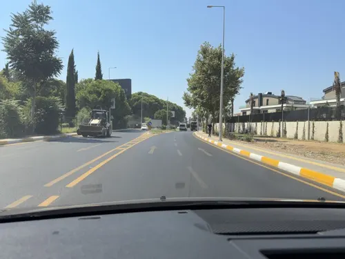
- Street-level photo, wasd42, CC BY-SA 4.0
- Street-level photo, wasd42, CC BY-SA 4.0
- Street-level photo, Yurikson, CC BY-SA 4.0
- Street-level photo, Guria, CC BY-SA 4.0
- Street-level photo, norbertschuster, CC BY-SA 4.0


Page built November 8, 2026. Spotted a mistake? Tell us or suggest a place.