


Sinop, Turkey
Sinop (il merkezi)
Sinop is a regional capital of 34,834 people in Sinop, Turkey.
Why visit Sinop
Townapedia lists 20 museums and landmarks, 9 parks and trails, 9 places to eat, 4 places to stay and 1 attraction in and around town.
Highlights include Sinop Fortress Prison and Alâeddin Sinop Mosque.
Weather in Sinop
Forecast from MET Norway (CC BY 4.0). Full forecast
About Sinop
Sinop is a city on the isthmus of İnce Burun (İnceburun, Cape Ince) and on the Boztepe Peninsula, near Cape Sinope (Sinop Burnu, Boztepe Cape, Boztepe Burnu) which is situated on the northernmost edge of the Turkish side of the Black Sea coast, in the ancient region of Paphlagonia, in modern-day northern Turkey. It is the seat of Sinop Province and Sinop District. Its population is 57,404 (2022).
From the Wikipedia article Sinop, Turkey (this version), under CC BY-SA 4.0.
Travel tips from other travellers: Sinop on Wikivoyage (CC BY-SA 4.0).
Things to do1

Museums and landmarks20


Alâeddin Sinop Mosque
Monument and historic site · 1.2 km
Mosque in Turkey

Balatlar Church
Monument and historic site
Byzantine church in northern Turkey



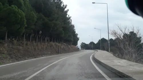

8 more on the map.
Parks, trails and playgrounds9
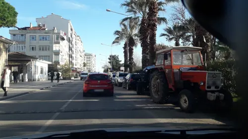

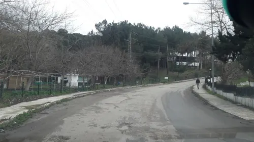

Restaurants and cafes9




History
Over a period of approximately 2,500 years, Sinope has at various times been settled by Colchians and then the Greeks (in the late 7th, late 5th, and 4th–3rd centuries BC) and by Turkic people beginning in the 13th century. In the 19th and 20th centuries it was also settled by the muhacir who immigrated from the Balkans and Caucasus.
The Greek colony of Sinope (Greek: Σινώπη, romanized: Sinṓpē) was founded by Ionians from the city of Miletus. Sinope issued its own coinage, founded colonies, and gave its name to a red earth pigment called sinopia, which was mined in Cappadocia for use throughout the ancient world. Some scholars have dated the earliest Greek colonization of Sinope to the 7th c. BC, while others have proposed an earlier date in the 8th c. While literary evidence exists supporting earlier settlement, archaeological evidence has been found of Greek settlement around the Black Sea region beginning in the late 7th century.
From the History section of Sinop, Turkey on Wikipedia, under CC BY-SA 4.0.
Where to stay4
Churches and places of worship8
Shopping4
Gas and EV charging2
Schools, colleges and libraries19
Healthcare14
Map of Sinop
90 places. The map loads OpenStreetMap tiles when you open it.
Getting there and nearby towns
Sinop Airport (NOP) is the nearest airport with scheduled flights listed in OpenStreetMap, 7 km away.
- Gerze 25 km south, about 25 min by car
- Erfelek 26 km southwest, about 26 min by car
- Ayancık 49 km west, about 49 min by car
- Yakakent 53 km southeast, about 53 min by car
- Durağan 69 km south, about 1 h 15 min by car
- Türkeli 69 km west, about 1 h 15 min by car
- Boyabat 70 km southwest, about 1 h 15 min by car
- Hanönü 73 km southwest, about 1 h 15 min by car
- Çatalzeytin 79 km west, about 1 h 15 min by car
- Bafra 80 km southeast, about 1 h 15 min by car
Drive times are estimates from straight-line distance, not routes.
Local news
Headlines from INDB.
Reviews, tips and questions
Loading what members have shared...
Sources and licences
- GeoNames (CC BY 4.0): population, coordinates, regions and time zone
- Mapillary (see each image): photos
- OpenStreetMap contributors (ODbL 1.0): places, airports, map data
- Wikidata (CC0 1.0): elevation, founding date, time zone, website, landmarks and historic places
- Wikimedia Commons (see each image): photos
- Wikipedia (CC BY-SA 4.0): overview and history text
Photo credits
- Sinop Overview 2009, Bjørn Christian Tørrissen, CC BY-SA 3.0
- Sinop Museum entrance, Robot8A, CC BY-SA 4.0
- SINOP SEHIR MEZARLIGI. CUKURBAG - panoramio, Kayhan ERTUGRUL, CC BY-SA 3.0
- Sinop ,Harbour & Castle - panoramio, Haluk Comertel, CC BY 3.0
- TABAK's.SINOP - panoramio, Kayhan ERTUGRUL, CC BY-SA 3.0
- SINOP OGRETMEN EVI - panoramio, Kayhan ERTUGRUL, CC BY-SA 3.0
- Sinop Gazi Cd 30 december 2009 - panoramio, Gerwin Pennings, CC BY 3.0
- Hamsilos koyu, Sinop, EsraKaliber, CC BY-SA 4.0
- SINOP YELKEN KULUBU - panoramio, Kayhan ERTUGRUL, CC BY-SA 3.0
- Sinop Feb 2020 00 01 51 493000, Robot8A, CC BY-SA 4.0
- UGUR MUMCU,Sinop Valiliği sitesinden - panoramio, Kayhan ERTUGRUL, CC BY-SA 3.0
- SINOP.SAAT KULESI - panoramio, Kayhan ERTUGRUL, CC BY-SA 3.0
- Sinop Feb 2020 00 01 30 604000, Robot8A, CC BY-SA 4.0
- SINOP HUKUMET KONAGI - panoramio, Kayhan ERTUGRUL, CC BY-SA 3.0
- SINOP.ADALET SARAYI - panoramio, Kayhan ERTUGRUL, CC BY-SA 3.0
- Sinop eastern bastion in 2005 9226, Dosseman, CC BY-SA 4.0
- Sinop eastern bastion in 2005 9220, Dosseman, CC BY-SA 4.0
- Sinop eastern bastion in 2005 9213, Dosseman, CC BY-SA 4.0
- Sinop eastern bastion in 2005 9214, Dosseman, CC BY-SA 4.0
- Sinop eastern bastion in 2005 9242, Dosseman, CC BY-SA 4.0
- Sinop eastern bastion in 2005 9221, Dosseman, CC BY-SA 4.0
- Sinop eastern bastion in 2005 9224, Dosseman, CC BY-SA 4.0
- Sinop eastern bastion in 2005 9219, Dosseman, CC BY-SA 4.0
- Sinop eastern bastion in 2005 9218, Dosseman, CC BY-SA 4.0
- Sinop eastern bastion in 2005 9225, Dosseman, CC BY-SA 4.0
- Sinop eastern bastion in 2005 9216, Dosseman, CC BY-SA 4.0
- Sinop eastern bastion in 2005 9229, Dosseman, CC BY-SA 4.0
- Sinop eastern bastion in 2005 9215, Dosseman, CC BY-SA 4.0
- Sinop eastern bastion in 2005 9241, Dosseman, CC BY-SA 4.0
- Sinop eastern bastion in 2005 9227, Dosseman, CC BY-SA 4.0
- Sinop eastern bastion in 2005 9232, Dosseman, CC BY-SA 4.0
- Sinop eastern bastion in 2005 9223, Dosseman, CC BY-SA 4.0
- Sinop eastern bastion in 2005 9217, Dosseman, CC BY-SA 4.0
- Sinop eastern bastion in 2005 9231, Dosseman, CC BY-SA 4.0
- Sinop eastern bastion in 2005 9230, Dosseman, CC BY-SA 4.0
- Sinop Tarihi Cezaevi 1, Basak, CC BY-SA 4.0
- Alaattin Keykubat Camii 1214, Acar54, CC BY-SA 4.0
- Balatlarchurch, Sait Can Kutsal, CC BY-SA 4.0
- Pervane Medresesi, Basak, CC BY-SA 4.0
- Sinop-Castle, Ertly, CC BY-SA 4.0
- SINOP ETNOGRAFYA MUZESI - panoramio, Kayhan ERTUGRUL, CC BY-SA 3.0
- Street-level photo, 12volt, CC BY-SA 4.0
- Street-level photo, 12volt, CC BY-SA 4.0
- Street-level photo, 12volt, CC BY-SA 4.0
- Street-level photo, 12volt, CC BY-SA 4.0
- Street-level photo, 12volt, CC BY-SA 4.0
- Street-level photo, 12volt, CC BY-SA 4.0
- Street-level photo, 12volt, CC BY-SA 4.0
- Street-level photo, 12volt, CC BY-SA 4.0
- Street-level photo, 12volt, CC BY-SA 4.0
- Street-level photo, 12volt, CC BY-SA 4.0
- Street-level photo, 12volt, CC BY-SA 4.0
- Street-level photo, 12volt, CC BY-SA 4.0
- Street-level photo, 12volt, CC BY-SA 4.0
- Street-level photo, 12volt, CC BY-SA 4.0
- Street-level photo, 12volt, CC BY-SA 4.0
- Street-level photo, 12volt, CC BY-SA 4.0
- Street-level photo, 12volt, CC BY-SA 4.0
- Street-level photo, 12volt, CC BY-SA 4.0
- Street-level photo, 12volt, CC BY-SA 4.0
- Street-level photo, 12volt, CC BY-SA 4.0
- Street-level photo, 348601, CC BY-SA 4.0
- Street-level photo, 12volt, CC BY-SA 4.0
- Street-level photo, 12volt, CC BY-SA 4.0
- Street-level photo, 12volt, CC BY-SA 4.0


Page built November 8, 2026. Spotted a mistake? Tell us or suggest a place.