


Why visit Tufanbeyli
Townapedia lists 10 museums and landmarks, 1 park or trail and 128 attractions in and around town.
Highlights include Bey Dağı, Karakoyun Dağı, Cabassus and Comana.
Weather in Tufanbeyli
Forecast from MET Norway (CC BY 4.0). Full forecast
About Tufanbeyli
Tufanbeyli is municipality and district of Adana Province, Turkey. Its area is 851 km2, and its population is 16,400 (2022). It is 196 km north-east of the city of Adana, on an uneven, sloping plateau high in the Tahtalı range of the Taurus Mountains. It has been bounded economically to Kayseri, 178 km far.
From the Wikipedia article Tufanbeyli (this version), under CC BY-SA 4.0.
Things to do128

116 more on the map.
Museums and landmarks10

Cabassus
Monument and historic site · 16.5 km
Town of ancient Cataonia
Comana
Monument and historic site · 12.1 km
Ancient city of Cappadocia, in modern-day Turkey
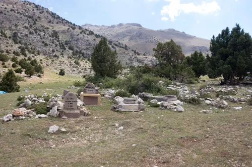
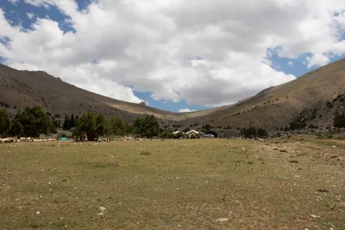
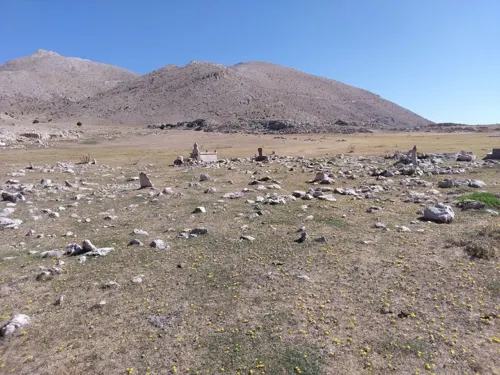
Aydınlı Aşiretlerinden Ali Oğlu Mehmet Avcı
Monument and historic site · 13.3 km
1934 - 1962
Parks, trails and playgrounds1
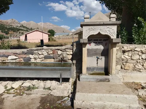


Churches and places of worship18

6 more on the map.
History
During the Bronze Age, the area was part of the kingdom of Kizzuwatna. In classical antiquity, the region of Tufanbeyli was in the southwestern corner of Cappadocia (while the parts of the Adana region south of Tufanbeyli were in Cilicia). The city of Comana was situated near Şarköy, some kilometers north of Tufanbeyli.
The area is now settled by descendants of Turks from the Caucasus and the Avşar (Afshar tribe; the former having come to Anatolia as a result of the Russian influx into the Caucasus in the 18th and 19th centuries. The latter being one of the group of Turkish migrants from Asia that have preserved their clan identity in Anatolia. The Avşar played a key role in the Turkish conquest of the Çukurova region and remained a local authority right up until the 19th century, especially in mountain strongholds like Tufanbeyli. Its former names were Höketçe before 1923 and Mağara between 1923 and 1967. It became a district in 1958 by separating from Saimbeyli.
From the History section of Tufanbeyli on Wikipedia, under CC BY-SA 4.0.
Gas and EV charging1
Schools, colleges and libraries6
Healthcare7
Map of Tufanbeyli
171 places. The map loads OpenStreetMap tiles when you open it.
Getting there and nearby towns
Kayseri Erkilet International Airport (ASR) is the nearest airport with scheduled flights listed in OpenStreetMap, 85 km away.
- Doğanlı 8 km west, about 8 min by car
- Yamanlı 9 km south, about 9 min by car
- Yeşilova 12 km south, about 12 min by car
- Çatalçam 15 km southwest, about 15 min by car
- Doğanbeyli 16 km southwest, about 16 min by car
- Develi 65 km west, about 1 h by car
- Talas 75 km northwest, about 1 h 15 min by car
- Hacılar 79 km northwest, about 1 h 15 min by car
- Kayseri 83 km northwest, about 1 h 30 min by car
- Elbistan 86 km east, about 1 h 30 min by car
Drive times are estimates from straight-line distance, not routes.
Local news
Headlines from INDB.
Reviews, tips and questions
Loading what members have shared...
Sources and licences
- GeoNames (CC BY 4.0): population, coordinates, regions and time zone
- Mapillary (see each image): photos
- OpenStreetMap contributors (ODbL 1.0): places, airports, map data
- Wikidata (CC0 1.0): elevation, founding date, time zone, website, landmarks and historic places
- Wikimedia Commons (see each image): photos
- Wikipedia (CC BY-SA 4.0): overview and history text
Photo credits
- Ortaköy ve Pekmezli, Tufanbeyli 2016 02-1, Zeynel Cebeci, CC BY-SA 4.0
- Tufanbeyli Atatürk Yibo Pansiyon - panoramio, [email protected], CC BY 3.0
- Cumhuriyet, 01640 Tufanbeyli-Adana, Turkey - panoramio, [email protected], CC BY 3.0
- ISS031-E-45902 - View of Earth, Earth Science and Remote Sensing Unit , Lyndon B. Johnson Space Center, Public domain
- ISS056-E-3465 - View of Earth, Earth Science and Remote Sensing Unit, NASA Johnson Space Center, Public domain
- ISS056-E-3467 - View of Earth, Earth Science and Remote Sensing Unit, NASA Johnson Space Center, Public domain
- ISS031-E-45903 - View of Earth, Earth Science and Remote Sensing Unit , Lyndon B. Johnson Space Center, Public domain
- ISS056-E-3466 - View of Earth, Earth Science and Remote Sensing Unit, NASA Johnson Space Center, Public domain
- ISS056-E-3464 - View of Earth, Earth Science and Remote Sensing Unit, NASA Johnson Space Center, Public domain
- ISS006-E-17269 - View of Turkey, Earth Science and Remote Sensing Unit , Lyndon B. Johnson Space Center, Public domain
- ISS053-E-168601 - View of Earth, Earth Science and Remote Sensing Unit , Lyndon B. Johnson Space Center, Public domain
- ISS065-E-210919 - View of Earth, Earth Science and Remote Sensing Unit , Lyndon B. Johnson Space Center, Public domain
- ISS065-E-210922 - View of Earth, Earth Science and Remote Sensing Unit , Lyndon B. Johnson Space Center, Public domain
- ISS065-E-208208 - View of Earth, Earth Science and Remote Sensing Unit , Lyndon B. Johnson Space Center, Public domain
- ISS065-E-210918 - View of Earth, Earth Science and Remote Sensing Unit , Lyndon B. Johnson Space Center, Public domain
- ISS022-E-87413 - View of Earth, Earth Science and Remote Sensing Unit , Lyndon B. Johnson Space Center, Public domain
- ISS065-E-210923 - View of Earth, Earth Science and Remote Sensing Unit , Lyndon B. Johnson Space Center, Public domain
- ISS065-E-210920 - View of Earth, Earth Science and Remote Sensing Unit , Lyndon B. Johnson Space Center, Public domain
- ISS065-E-210921 - View of Earth, Earth Science and Remote Sensing Unit , Lyndon B. Johnson Space Center, Public domain
- ISS065-E-208209 - View of Earth, Earth Science and Remote Sensing Unit , Lyndon B. Johnson Space Center, Public domain
- ISS053-E-127122 - View of Turkey, Earth Science and Remote Sensing Unit , Lyndon B. Johnson Space Center, Public domain
- ISS053-E-127123 - View of Turkey, Earth Science and Remote Sensing Unit , Lyndon B. Johnson Space Center, Public domain
- ISS053-E-127121 - View of Turkey, Earth Science and Remote Sensing Unit , Lyndon B. Johnson Space Center, Public domain
- Turkey-1764 (2216659726), Dennis G. Jarvis, CC BY-SA 2.0
- Turkey-1779 (2216661476) (2), Dennis G. Jarvis, CC BY-SA 2.0
- Turkey-1725 (2215853387) (2), Dennis G. Jarvis, CC BY-SA 2.0
- Turkey-1770 (2216660384), Dennis G. Jarvis, CC BY-SA 2.0
- Turkey-1765 (2215866091), Dennis G. Jarvis, CC BY-SA 2.0
- Turkey-1772 (2215866809), Dennis G. Jarvis, CC BY-SA 2.0
- Turkey-1780 (2216661568) (2), Dennis G. Jarvis, CC BY-SA 2.0
- Turkey-1796 (2216663076), Dennis G. Jarvis, CC BY-SA 2.0
- Turkey-1766 (2215866179) (2), Dennis G. Jarvis, CC BY-SA 2.0
- Turkey-1813 (2216665006), Dennis G. Jarvis, CC BY-SA 2.0
- Turkey-1768 (2215866397) (2), Dennis G. Jarvis, CC BY-SA 2.0
- Turkey-1808 (2215870681) (2), Dennis G. Jarvis, CC BY-SA 2.0
- Turkey-1770 (2216660384) (2), Dennis G. Jarvis, CC BY-SA 2.0
- Turkey-1782 (2215868053), Dennis G. Jarvis, CC BY-SA 2.0
- Turkey-1776 (2216661210) (2), Dennis G. Jarvis, CC BY-SA 2.0
- Turkey-1814 (2216665100) (2), Dennis G. Jarvis, CC BY-SA 2.0
- Turkey-1814 (2216665100), Dennis G. Jarvis, CC BY-SA 2.0
- Street-level photo, turankaya74, CC BY-SA 4.0
- Street-level photo, turankaya74, CC BY-SA 4.0
- Street-level photo, turankaya74, CC BY-SA 4.0
- Street-level photo, turankaya74, CC BY-SA 4.0


Page built November 8, 2026. Spotted a mistake? Tell us or suggest a place.